The etymology of the name "Effra" has been much disputed. There is no evidence that it was applied to the stream before the late 18th century, and early 19th century gazetteers gave it no name.[1] A map of 1744 refers to it as the "Shore",[2] and it was also referred to as "Brixton Creek"[3] and "the Wash". Unlikely suggestions for the name's origin include Ruskin's, that it was "shortened from [the Latin word] Effrena",[4] that it was from a Celtic root "yfrid", or that it derived from Anglo-Saxon "efer", "bank",[5] perhaps via "heah efre" ("high bank") recorded in a charter of 693 for a spot on the bank of the Thames.[4]
A more recent suggestion is that the name is a corruption of the place-name "Heathrow", the name of a manor which once covered some 70 acres south of present day Coldharbour Lane and east of present day Effra Road.[6] By the 1790s the land making up the Manor of Heathrow was known as Effra Farm.[6] There is evidence that the name was first applied to the stream at Brixton, perhaps taken from the name of the farm, and was only later extended to the rest of its course.[1] A 2016 book by the Lambeth borough archivist supports this view, suggesting that other etymologies are a product of 19th century antiquarianism.
History
Before the 19th century
'Effra'
---------→Dulwich/Effra basin
Excerpt from Hering's Sewerage in Europe map of 1882. The Norwood Ridge sits around the Effra Branch sewer, diverting east. The route of the replaced stream is two lateral sewers, partly for local lateral sewage, but otherwise for taking storm combined sewerage from the Effra Branch and Southern High and Low Level sewers to the Tideway.
The drainage basin of the stream covered around 20 square kilometres (8 sq miles) of present-day inner south London. Historically the Effra was fed partly by a line of springs that emerged at between 80 and 100 metres above sea level along the 5km ridge of the Great North Wood, where a layer of gravels overlies the impermeable London Clay.[7] There were also springs at a lower level in Dulwich; the various tributaries met near Brixton before flowing to the Thames.[7]
The lowest part of the river was diverted as early as the 13th century, after the monks of Bermondsey Priory made an agreement with neighbouring landowners to end flooding problems.[2] Before that time the river's course ran either into Walworth Marsh, which after draining became Walworth Common, or into the Earl's Sluice to reach the Thames.[2] The lower, northern part of the river appeared in Ogilby's Britannia of 1675 as the "New River".[1]
While the upper, southern parts of the river were rural, they became increasingly suburbanised as the 19th century went on. The art critic John Ruskin, who grew up at Herne Hill close to one of the Effra's tributaries, described "the good I got out of the tadpole-haunted ditch in Croxted Lane",[8] and made an early sketch of a bridge over it.
Until about 1850 Brixton Road, where it ran along the course of the stream, was known as the "Washway",[1] and the stream itself was often called the "Wash". By that time the Effra was heavily polluted with domestic waste, due to increasing development along its course, and by 1821 it was classed as an open sewer downstream of North Brixton.[9] It still often flooded in heavy rain, and residents of Brixton Road and South Lambeth repeatedly complained of their houses being inundated.[9] In 1847 the commissioners of the Surrey and East Kent Sewers, under the direction of surveyor Joseph Gwilt, carried out works "arching over" (culverting) the Effra[10] as far upstream as Herne Hill.
Post-industrial revolution
When the London sewerage system was constructed during the mid-19th century, its designer Sir Joseph Bazalgette incorporated flows from the River Effra into the southern division of the system. The Effra Branch Sewer, about 3 miles in length and costing some £19,400 to construct,[11] received much of the Effra's surface water and ran from the Norwood area into the Southern High Level Sewer at Croxted Lane. The Southern High Level itself ran from Herne Hill eastwards under Peckham and New Cross to Deptford.[12] Here it joined the Southern Low Level Sewer, which picked up remaining effluent from the old depression converted to sewer at Vauxhall and passed under Kennington and Burgess Park to Deptford; the two branches merging to form the Southern Outfall Sewer that runs underneath Greenwich and Woolwich to Crossness.[13]
As the area was increasingly urbanised, the remaining parts of the Effra's upper course were incorporated into the surface water drainage system, although some parts remained open and marked on Ordnance Survey maps until the later 19th century. The main course of the Effra remained as a sewer and culverts beneath Brixton Road, south London, and seen through a drainage grate in the crypts under St. Luke's Church, West Norwood, south London.
Course
The Upper Norwood Recreation Ground, source of the main tributary of the Effra.
The river was fed by several tributaries which met above Brixton. The main branch of the Effra rises near Harold Road in Upper Norwood Recreation Ground, and flows through West Norwood. Where Norwood High Street merges at the fountain with the A215 to form Norwood Road, it was joined by a small tributary from Knights Hill ward.[12]
A second branch rose south of Gipsy Hill and ran into West Dulwich via Croxted Road, after flowing from near the Westow House inn,[n 1] Westow Hill. Beyond the Paxton pub opposite the end of Gipsy Hill its culvert captures water from Hamilton Road, forms the back garden line of Croxted Road and joins the other tributary at the South Circular Road, where it now forms the sewers of Croxted Road, Dulwich Road, Dalberg Road, Effra Road, Electric Lane, and Brixton Road.[13]
East along the watershed, springs rose in Dulwich Wood, flowing through Belair Park and beneath North Dulwich to Herne Hill. Still further to the east a tributary called the Ambrook rose from springs in Sydenham Hill Wood and Peckarmans Wood, flowing to Herne Hill through present-day Dulwich Park, where its heavily landscaped channel is visible.[14] The longest and easternmost tributary ran from Eliot Bank and Horniman Park in Forest Hill down to Herne Hill. Rocque's map of 1746 called these confluences around Herne Hill railway station "Island Green".[12] Most of these tributaries are no longer visible above ground: an exception is the Ambrook, which still flows seasonally in Sydenham Hill Wood.[14]
The Effra flowed generally NNW until it reached its lower course, north of Brixton. At this point it turned northeast and then east, running through the grounds of Bermondsey Priory. It fed Lambeth and possibly Walworth Marshes, and may have joined the Earl's Sluice, which entered the Thames at Deptford Wharf. After diversion in the 13th century, it ran directly west from Kennington to join the Thames at Vauxhall.[15]
Folklore
Boundary marker for Camberwell Parish on the course of the Effra at Gipsy Hill, where the watercourse was rediscovered in the 1920s.
A local story tells of a coffin found floating down the Thames in Victorian times, which was traced back to West Norwood Cemetery.[n 2] Cemetery staff were puzzled to find that the plot the coffin had come from was undisturbed. Further investigation revealed that the ground beneath the grave had subsided, and the entire coffin had fallen into the underground Effra river, floating downstream to Vauxhall and entering the Thames.[13] The song “Down in the Effra” by British folk band The Effras was written about this account.[16]
Flooding
This section needs expansion. You can help by adding to it. (January 2010)
Although little more than a stream in the south, until 1935 the culverted watercourse flooded during heavy rains every decade or so; an inscription on a white stone tablet high up the side of a building in Elder Road, West Norwood reads: "FLOOD LEVEL 17th July 1890".[12]
After a three-hour-long storm on Sunday 14 June 1914 the sewer overflowed again and flooded houses along its path from Elder Road to Chestnut Road, and locals were forced to evacuate their homes for several days. Further floods in the 1920s prompted works to enlarge the sewer. This was sufficient until a small part of the local area was flooded again during a powerful downpour on 20 July 2007.[12]
The Unearthing the Effra Campaign
In 1992 a project by the London arts group Platform sparked a local campaign to dig up the river. The Unearthing the Effra project was based around a mock Effra Redevelopment Agency, which included a public office. The project gained publicity in local newspapers and radio stations before the journalists noticed that the group had scattered, the whole thing being a stunt carried out in the name of art.[12]
↑ A public house at the south-west corner of Crystal Palace
↑ Under which goes the first-mentioned high source of the Effra in the south of the illustration at the Walbrook River website from the book N. Barton's Lost Rivers
References
1 2 3 4 Bonner, A. "Surrey Place-names" in Surrey Archaeological Collections v XXXVII, pp.126-7
Tulse Hill is a district in the London Borough of Lambeth in South London that sits on Brockwell Park. It is approximately five miles from Charing Cross and is bordered by Brixton, Dulwich, Herne Hill, Streatham and West Norwood.
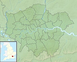
Lambeth is a London borough in South London, England, which forms part of Inner London. Its name was recorded in 1062 as Lambehitha and in 1255 as Lambeth. The geographical centre of London is at Frazier Street near Lambeth North tube station, though nearby Charing Cross on the other side of the Thames in the City of Westminster is traditionally considered the centre of London.
Herne Hill is a district in south London, approximately four miles from Charing Cross and bordered by Brixton, Camberwell, Dulwich, and Tulse Hill. It sits to the north and east of Brockwell Park and straddles the boundary between the boroughs of Lambeth and Southwark. There is a road of the same name in the area, as well as a railway station.
The River Tyburn was a stream in London, England. Its main successor sewers emulate its main courses, but it resembled the Colne in its county of Middlesex in that it had many distributaries. It ran from South Hampstead, through Marylebone, Mayfair, St James's parish/district and Green Park to meet the tidal Thames at four sites, grouped into pairs. These pairs were near Whitehall Stairs, and by Thorney Street, between Millbank Tower and Thames House. Its much smaller cousin, the Tyburn Brook, was a tributary of the Westbourne and the next Thames tributary.
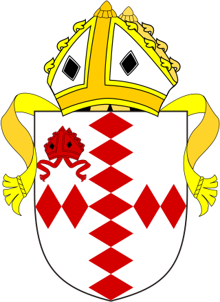
The Diocese of Southwark is one of the 42 dioceses of the Church of England, part of the worldwide Anglican Communion. The diocese forms part of the Province of Canterbury in England. It was created on 1 May 1905 from part of the ancient Diocese of Rochester that was served by a suffragan bishop of Southwark (1891–1905). Before 1877 most of the area was part of the Diocese of Winchester, some being part of the Diocese of London.
The Walbrook is a subterranean river in London. It gives its name to the Walbrook City ward and to a nearby street. It played an important role in the Roman settlement of Londinium.
Dulwich and West Norwood is a constituency in South London created in 1997. It has been represented by Helen Hayes of Labour since her election in 2015.
The region of Greater London, including the City of London, is divided into 75 parliamentary constituencies which are sub-classified as borough constituencies, affecting the type of electoral officer and level of expenses permitted. Since the general election of July 2024, 59 are represented by Labour MPs, 9 by Conservative MPs, 6 by Liberal Democrat MPs, and 1 by an independent MP.
The London Borough of Croydon has over 120 parks and open spaces within its boundaries, ranging from the 200 acre (80ha) Selsdon Wood Nature Reserve to many recreation grounds and sports fields scattered throughout the Borough. Croydon covers an area of 86.52 km2, the 256th largest district in England. Croydon's physical features consist of many hills and rivers that are spread out across the borough and into the North Downs, Surrey and the rest of South London. Some of the open spaces in Croydon form part of the well-known London LOOP walks where the first section was opened on 3 May 1996 with a ceremony on Farthing Downs in Coulsdon. As a borough in Outer London it also contains some open countryside in the form of country parks. Croydon Council is associated with several other boroughs who are taking part in the Downlands Countryside Management Project. These boroughs are Sutton; and by Surrey County Council; the City of London Corporation; the Surrey districts of Reigate and Banstead and Tandridge; and the Countryside Agency. An additional partner is Natural Britain.
London Buses route 3 is a Transport for London contracted bus route in London, England. Running between Crystal Palace and Victoria bus stations, it is operated by Transport UK London Bus.
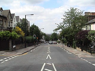
Gipsy Hill in south London is a hilly and leafy neighbourhood spanning the southern parts of the London Boroughs of Lambeth and Southwark characterised for its stunning views of the City of London and Dulwich.
West Dulwich is a neighbourhood in South London on the southern boundary of Brockwell Park, which straddles the London Borough of Lambeth and the London Borough of Southwark. Croxted Road and South Croxted Road mark the boundary between Southwark to the east and Lambeth to the west. The suburb of West Dulwich dates back to the 17th century when the often flooded land known as Dulwich Common was acquired and drained by Edward Alleyn's estate.
The Norwood Ridge is a 10-square-mile (26 km2) rectangular upland which occupies the geographical centre of south London, centred 5 miles (8 km) south of London Bridge. Beneath its topsoil it is a ridge of London Clay that is capped on all sides with remaining natural gravel deposits mixed with some sandy soil, which in the South Thames basin is a material known as the Claygate Beds.
Lambeth was a constituency 1832—1885 loosely equivalent in area to the later administrative units: the London Borough of Lambeth and the south-west and centre of the London Borough of Southwark. It returned two members of parliament (MPs) to the House of Commons of the UK Parliament by the bloc vote version of the first-past-the-post system.
Sydenham Hill forms part of a longer ridge and is an affluent locality in southeast London. It is also the name of a road which runs along the northeastern part of the ridge, demarcating the London Boroughs of Southwark, Bromley, and Lewisham. Its highest part is the apex of the Boroughs of Southwark and Lewisham and the 15th-highest peak in London, at 367 feet (112 m).
The A215 is an A road in south London, starting at Elephant and Castle and finishing around Shirley. It runs through the London Boroughs of Lambeth, Southwark and Croydon.
The Great North Wood was a natural oak woodland that started three miles (4.8 km) south-east of central London and scaled the Norwood Ridge. At its full extent, the wood's boundaries stretched almost as far as Croydon and as far north as Camberwell. It had occasional landownings as large clearings, well-established by the Middle Ages such as the hamlets of Penge and Dulwich.
The Falconbrook was a stream that rose in Balham and Tooting, draining much of those parishes then the south and west of the larger district of Battersea including Clapham Junction to enter the London reaches of the Thames. Before doing so, it briefly formed the border of Wandsworth Town, reflected in the SW11/SW18 boundary today.
Sydenham Hill Wood is a ten-hectare wood on the northern slopes of the Norwood Ridge in the London Borough of Southwark. It is designated as a Local Nature Reserve and Site of Metropolitan Importance for Nature Conservation. With the adjacent Dulwich Wood, Sydenham Hill Wood is the largest extant tract of the ancient Great North Wood. The two woods are formed from coppices known as Lapsewood, Old Ambrook Hill Wood and Peckarmans Wood after the relocation of The Crystal Palace in 1854 and the creation of the high level line in 1865.
This page is based on this Wikipedia article Text is available under the CC BY-SA 4.0 license; additional terms may apply. Images, videos and audio are available under their respective licenses.