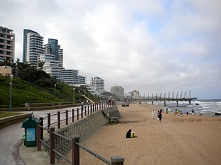
Durban is the third-most populous city in South Africa after Johannesburg and Cape Town, and the largest city in KwaZulu-Natal. Durban forms part of the eThekwini Metropolitan Municipality, which includes neighbouring towns and has a population of about 4 million, making the combined municipality one of the largest cities on the Indian Ocean coast of the African continent. Durban was also one of the host cities of the 2010 FIFA World Cup.

Randburg is an area located in the Gauteng province of South Africa. Formerly a separate municipality, its administration devolved to the newly created City of Johannesburg Metropolitan Municipality, along with neighbouring Sandton and Roodepoort, in the late 1990s. During the transitional period of 1996–2000, Randburg was part of the Northern Metropolitan Local Council (MLC).
Hillcrest is a town in the KwaZulu-Natal province of South Africa that forms part of the eThekwini Metropolitan Municipality and is situated approximately 32 km north-west of Durban and 53 km south-east of Pietermaritzburg.
Isipingo is a town situated 19 kilometres (12 mi) south of Durban in KwaZulu-Natal, South Africa and currently forms part of eThekwini Metropolitan Municipality. The town is named after the Siphingo River, which in turn is thought to be named for the intertwining cat-thorn shrubs (Scutia myrtina) present in the area, or the river's winding course.
Hilton is a small town that lies between Howick and Pietemaritzburg in the province of KwaZulu-Natal, South Africa. In 1872 the Reverend William Orde Newnham opened Hilton College on a large estate 7.8km north of the town, which is now one of South Africa's leading private schools.
Pinetown is a city that forms part of the eThekwini Metropolitan Municipality, based just inland from Durban in KwaZulu-Natal, South Africa. The town is situated 16 km north-west of Durban and 64 km south-east of Pietermaritzburg.
Westville is an area in KwaZulu-Natal, South Africa, and is just west and 10 km inland from the Durban CBD. It was a formerly independent municipality however it became part of the eThekwini Metropolitan Municipality in 2002.

Verulam is a town 24 kilometres north of Durban in KwaZulu-Natal, South Africa and forms part of the eThekwini Metropolitan Municipality, governing the Greater Durban metropolitan area.

Umlazi is a township in KwaZulu-Natal, South Africa, located south-west of Durban. Organisationally and administratively it forms part of the eThekwini Metropolitan Municipality and its South Municipal Planning Region.

Canning Vale is a southern suburb of Perth, 22 km (13.7 mi) from the central business district. Its local government areas are the City of Canning and the City of Gosnells.
Chatsworth is a large township in KwaZulu-Natal, South Africa established in the 1950s to segregate the Indian population and create a buffer between the white suburbs of Durban to the north and the black townships of Durban to the south. Located in the Southern Durban basin and roughly bordered by the Umhlatuzana River in the North and Umlaas River in the south, the suburb is made up mainly of Indian/Asian and Black African people.

Hinduism is practised throughout South Africa, but primarily in KwaZulu-Natal. Approximately 1.1% of the South African population professed to be Hindu, according to the 2011 census. This is down from the 1.4% based on the 1996 census. The 2016 General Household Survey measured a further decline to 0.9%.

Mira-Bhayandar is a city and municipal corporation in Thane district in the state of Maharashtra, India located in the northern part of Salsette Island before the Vasai Creek, and shares a border with North Mumbai. Mira-Bhayandar is administered by Mira-Bhayandar Municipal Corporation (MBMC), with a population at the 2011 Census of 809,378. Mira-Bhayandar is a part of Mumbai Metropolitan Region (MMR).

uMhlanga, alternatively rendered Umhlanga, is a residential, commercial and resort town north of Durban on the coast of KwaZulu-Natal, South Africa. It is part of the eThekwini Metropolitan Municipality, which was created in 2000 and includes the greater Durban area. The name means "place of reeds" in the Zulu language, and the correct pronunciation of "hl" in uMhlanga is similar to the Welsh "ll".

Indian South Africans are South Africans who descend from indentured labourers and free migrants who arrived from British India during the late 1800s and early 1900s. The majority live in and around the city of Durban, making it one of the largest ethnically Indian-populated cities outside of India.

Rosebank is one of the Southern Suburbs of Cape Town, South Africa, located between the suburbs of Mowbray and Rondebosch.
La Lucia is a wealthy suburb located in uMhlanga, north of Durban, in the KwaZulu-Natal province of South Africa. It was named after Lucia Michel. She and her husband Albert Michel founded the sugar cane farm La Lucia.

Morningside is an affluent suburb of Durban, KwaZulu-Natal, South Africa.

Stamford Hill is a suburb of Durban, KwaZulu-Natal, South Africa. It is administered by the eThekwini Metropolitan Municipality and its postal code is 4001.
Athlone Park is a small coastal suburb located between Durban and Amanzimtoti in KwaZulu-Natal, South Africa and forms part the eThekwini Metropolitan Municipality as a Southern Suburb.


