
Lonavala is a hill station town and a Municipal Council in the Pune district, Maharashtra, India. It is about 64 km west of Pune and 96 km to the east of Mumbai. It is known for its production of the hard candy chikki and is also a major stop on the railway line connecting Mumbai and Pune. From the Pune suburbs, local trains are available from Pune Junction. Both the Mumbai-Pune Expressway as well as the Mumbai-Bengaluru highway pass through Lonavala.
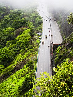
Khandala is a hill station in the Western Ghats in the state of Maharashtra, India, about 3 kilometres (1.9 mi) from Lonavala, 12 kilometres from Khopoli and 33.4 kilometres (20.8 mi) from Karjat.
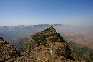
Harishchandra Fort is a hill fort in the Ahmednagar district of India. Its history is linked with that of Malshej Ghat, kothale village and it has played a major role in guarding and controlling the surrounding region.
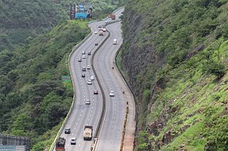
The Mumbai–Pune Expressway is India's first 6-lane wide concrete, access-controlled tolled expressway. It spans a distance of 94.5 km connecting Mumbai, the capital of Maharashtra state and the financial capital of India, with Pune, the cultural and educational capital of Maharashtra. The expressway, which was fully operationalized in 2002, introduced new levels of speed and safety in automobile transportation to Indian roads. It is one of India's busiest roads.
Kamshet is located in Pune district in the state of Maharashtra, India, 110 km from Mumbai City, and 45 km from Pune in Pune district. It is 16 km from the twin hill stations of Khandala and Lonavala and is accessible by road and rail from Mumbai and Pune. Kamshet is home to small villages that are built in the traditional style - with mud, thatch and reeds.
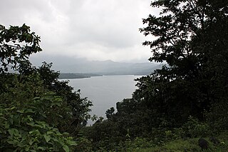
Bhandardara is a holiday resort village near Igatpuri, in the western ghats of India. The village is located in the Akole tehsil, Ahmednagar district of the state of Maharashtra, about 185 kilometers (115 mi) from Mumbai and 155 kilometers (96 mi) from Ahmednagar.
Mulher is a village in the Nashik district of Maharashtra, India.
Kusgaon Budruk is a census town in Pune district in the Indian state of Maharashtra.
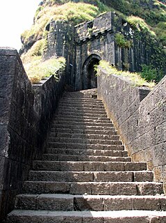
Lohagad is one of the many hill forts of Maharashtra state in India. Situated close to the hill station Lonavala and 52 km (32 mi) northwest of Pune, Lohagad rises to an elevation of 1,033 m (3,389 ft) above sea level. The fort is connected to the neighboring Visapur fort by a small range. The fort was under the Maratha empire for the majority of the time, with a short period of 5 years under the Mughal empire.
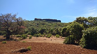
Kamalgad, also called Bhelanja or Kattalgad is a square hill fort in Wai Taluka in Maharashtra, India.

Korigad is a hill fort located about 20 km (12 mi) south of Lonavla in Pune district, Maharashtra, India. Its date of construction is not known but likely predates 1500. It is about 923 m above sea level. The planned township of Aamby Valley is built over the fort's southern and eastern foothills. The closest village is Peth Shahpur, about 1 km (0.62 mi) north of the fort.

Shrivardhan Fort is one of the two hill forts that constitute the Rajmachi fortification, the other being Manaranjan Fort. It is located in Rajmachi village which 8.5 km from Lonavala in the Sahyadris mountain range. At 900 m(3000 feet) above sea level it was the taller of the two peaks and was named after Shrivardhan Ganpatrao Patwardhan. Other than a rampart there is no visible construction. It was probably used at a watchtower for the Sahyadri region. There are two water tanks at the top of the hill but one of them has an iron pillar in it.
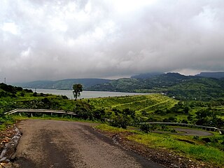
Pavananagar is a village near Pavana Dam in Maharashtra, India. It is about 45 km via Paud and 65 km via Kamshet from Pune. There are roads to Pavananagar from Pune & Lonavala. Lonavala to Pavana Dam is 20 km; 40 minutes journey from Lonavala.
- Lonavala → Bhangarwadi → Kusgaon → Aundhgaon → Dudhivarekhind → Prati Pandharpur → Pavana Dam
- Pune → Pirangut → Paud → Kolvan → Pavana Dam → Pavananagar.
- Pune → Nigdi → Kamshet → Bedsa → Pavananagar.

Pune Suburban Railway, also known as Pune Local, is a suburban rail system connecting Pune to its suburbs and neighboring villages in Pune District, Maharashtra. It is operated by Central Railway (CR), part of Indian Railways. The system operates on two routes, Pune Junction–Lonavala and its part Pune Junction–Talegaon. 18 trains operate on Pune Junction–Lonavala route and 5 trains operate on Pune Junction–Talegaon route. Also, DEMU trains operate on Pune Junction–Daund–Baramati route.

Lonavala railway station is a railway station in Lonavala, a hill station in the state of Maharashtra in India. Lonavala station is the origin of Lonavala–Pune Suburban Trains. 17 suburban trains operate on the Pune–Lonavala route. Lonavla is also a halt for Mumbai–Pune Express and Mail trains. The Karjat–Pune passenger train also has a halt at Lonavala. Trains traveling on the Kalyan–Pune route also halt at Lonavala. This station leads access to Lonavala town and nearby areas like Karla Caves, Bhaja Caves, Lohagad, Visapur Fort, Bhushi Dam and Bhor Ghat. Khandala hill station is just 8 kilometres (5.0 mi) from Lonavla.

Kataldhar is a waterfall near Lonavala in Pune district in the Indian state of Maharashtra. This waterfall is not so famous because reaching the valley is somewhat difficult and requires basic trekking experience. Water is not available there for the whole year, but a good amount of water falls during the monsoon season.
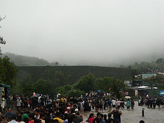
The Bhushi Dam is a masonry dam on the Indrayani River in Lonavala, Maharashtra, India. In 2014, the Indian Railways announced plans to develop Bhushi Dam as a tourist resort with participation from the private sector.
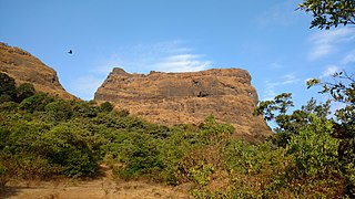
Ghangad is a fort situated near 30km from Lonavla-Khandala and 100 km from Pune in Maharashtra state, India.This fort is an important fort in the Pune district. The fort restoration is done by the Shivaji Trail group with the help of local villagers. The fort is at least 300 years old. Restoration work took place in 2011-12.
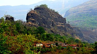
Mrugagad fort is a hill fort in Sudhagad taluka of Raigad district, Maharashtra, India. At a height of 1750 ft, the fort lies near Bheliv village, and is made of stone. The fort is very small in size and is in a form of spur radiating from the Western ghats. The fort is very close to the Lonavala, Khandala and Khopoli.
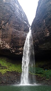
Devkund Waterfall is a waterfall located near Bhira, in Raigad district, Maharastra, India. It is a 'plunge' waterfall pouring massive amounts of water on the rocky surface underneath. It is a popular spot for one day picnics.


