
The East River is a saltwater tidal estuary or strait in New York City. The waterway, which is not a river despite its name, connects Upper New York Bay on its south end to Long Island Sound on its north end. It separates Long Island, with the boroughs of Brooklyn and Queens, from Manhattan Island, and from the Bronx on the North American mainland.

Long Island City (LIC) is a neighborhood within the New York City borough of Queens. It is bordered by Astoria to the north; the East River to the west; Sunnyside to the east; and Newtown Creek, which separates Queens from Greenpoint, Brooklyn, to the south. Its name refers to its location on the western tip of Long Island.

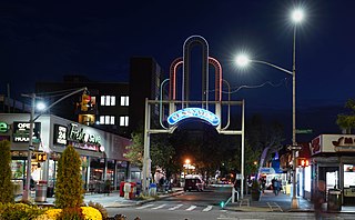
Corona is a neighborhood in the borough of Queens in New York City. It borders Flushing and Flushing Meadows–Corona Park to the east, Jackson Heights to the west, Forest Hills and Rego Park to the south, Elmhurst to the southwest, and East Elmhurst to the north. Corona's main thoroughfares include Corona Avenue, Roosevelt Avenue, Northern Boulevard, Junction Boulevard, and 108th Street.

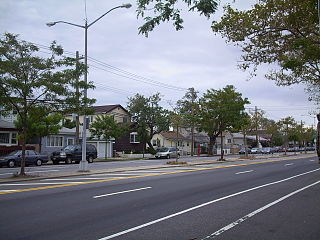
Hollis is a residential middle-class neighborhood within the southeastern section of the New York City borough of Queens. While a predominantly African-American community, there are small minorities of Hispanics and South Asians residing in the area. Boundaries are considered to be 181st Street to the west, Hillside Avenue to the north, Francis Lewis Boulevard to the east, and Murdock Avenue to the south. Hollis is located between Jamaica to the west and Queens Village to the east.

Queens Village is a mostly residential middle class neighborhood in the eastern part of the New York City borough of Queens. It is bound by Hollis to the west, Cambria Heights to the south, Bellerose, Queens and Elmont, Nassau County to the east, and Oakland Gardens to the north.

Douglaston–Little Neck is a neighborhood in the northeastern part of the New York City borough of Queens. The community is located on the North Shore of Long Island, bordered to the east by the region of Great Neck in Nassau County, to the south by Glen Oaks and the North Shore Towers, and to the west by Bayside.
Broad Channel is a neighborhood in the southern portion of the New York City borough of Queens. It occupies the southern portion of Rulers Bar Hassock, the only inhabited island in Jamaica Bay.

Maspeth is a residential and commercial community in the borough of Queens in New York City. It was founded in the early 17th century by Dutch and English settlers. Neighborhoods sharing borders with Maspeth are Woodside to the north; Sunnyside to the northwest; Greenpoint, Brooklyn to the west; East Williamsburg, Brooklyn to the southwest; Fresh Pond and Ridgewood to the south; and Middle Village and Elmhurst to the east.
Belle Harbor is a small residential neighborhood in the New York City borough of Queens, located on the western half of the Rockaway Peninsula, the southernmost area of the borough. Belle Harbor commonly refers to the area from Beach 126th to Beach 141st Streets.

Richmond Hill is a commercial and residential neighborhood located in the southeastern section of the New York City borough of Queens. The area borders Kew Gardens and Forest Park to the north, Jamaica and South Jamaica to the east, South Ozone Park to the south, and Woodhaven and Ozone Park to the west. The neighborhood is split between Queens Community Board 9 and 10.
Sunnyside is a neighborhood in the western portion of the New York City borough of Queens. It shares borders with Hunters Point and Long Island City to the west, Astoria to the north, Woodside to the east and Maspeth to the south. It contains the Sunnyside Gardens Historic District, one of the first planned communities in the United States.
The Queens Community Board 1 is a local advisory group in New York City, encompassing the neighborhoods of Astoria, Long Island City, Queensbridge, Ditmars, Ravenswood, Steinway, Garden Bay, and Woodside, in the Borough of Queens. It also includes Rikers Island, the citywide correctional complex, which is within the Borough of the Bronx but connected by its only bridge to Astoria. The Board's district is delimited by the East River on both west and north, by the Brooklyn–Queens Expressway on the east, and by Northern Boulevard, the Long Island Rail Road and Bridge Plaza North on the south.

East Elmhurst is a residential neighborhood in the northwest section of the New York City borough of Queens. It is bounded to the south by Jackson Heights and Corona, to the north and east by Bowery Bay, and to the west by Woodside and Ditmars Steinway. The area also includes LaGuardia Airport, located on the shore of Flushing Bay, LaGuardia Landing Lights Fields, and Astoria Heights.

Travers Park is a 2-acre (8,100 m2) community park and playground in Jackson Heights, Queens, New York City. It is located between 77th and 78th Streets, on the north side of 34th Avenue. More than half of the park is occupied by an asphalt play area, with basketball and tennis courts. A children's playground with leaf-and-vine shaped spray shower occupies about one third of the park. There are also restroom facilities, handball courts, a dog run, picnic tables, a bicycle rack, benches, tables, and a lawn. In 2012, a segment of adjacent 78th Street was transformed into a permanent Street Plaza; the sports area of a nearby school was also bought by New York City and added to the park.

Bay Terrace is a neighborhood in the northeastern section of the New York City borough of Queens. It is often considered part of the larger area of Bayside. Bay Terrace overlooks the East River and the approaches to the Throgs Neck Bridge from the Clearview Expressway and Cross Island Parkway. It is bounded on the west by the Clearview Expressway, on the south by 26th and 28th Avenues, to the east by the Little Neck Bay, and to the north by the East River.

Glen Oaks is the easternmost neighborhood of the New York City borough of Queens. The neighborhood is part of Queens Community Board 13 and borders Nassau County to the east.

The East River Greenway is an approximately 9.44-mile-long (15.19 km) foreshoreway for walking or cycling on the east side of the island of Manhattan on the East River. It is part of the Manhattan Waterfront Greenway. The largest portions are operated by the New York City Department of Parks and Recreation. It is separated from motor traffic, and many sections also separate pedestrians from cyclists. The greenway is parallel to the Franklin D. Roosevelt East River Drive for a majority of its length.

Anable Basin is a 500-foot-long (150 m) artificial inlet of the East River located in the Long Island City neighborhood of Queens, New York City. It was carved in 1868 to serve the large concentrations of industrial firms in the neighborhood.
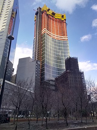
Sven is a residential building located at 29-59 Northern Boulevard in the Long Island City neighborhood of Queens, New York City. At 762 feet (232 m) tall, Sven is the third-tallest building in Queens behind Skyline Tower and The Orchard, as well as one of the tallest buildings in New York City outside of Manhattan.

Queens West is a district and redevelopment project along the East River in Long Island City, Queens, New York City. The project, located on Hunter's Point south of the Anable Basin, is a joint project sponsored by the Port Authority of New York & New Jersey (PANYNJ) and the Empire State Development Corporation (ESD). The Queens West Development Corporation (QWDC), a subsidiary of ESD, was established in 1992 to facilitate implementation of the approved development plan.


