
Yosemite Valley is a glacial valley in Yosemite National Park in the western Sierra Nevada mountains of Central California, United States. The valley is about 7.5 mi (12.1 km) long and 3,000–3,500 ft (910–1,070 m) deep, surrounded by high granite summits such as Half Dome and El Capitan, and densely forested with pines. The valley is drained by the Merced River, and a multitude of streams and waterfalls flow into it, including Tenaya, Illilouette, Yosemite and Bridalveil Creeks. Yosemite Falls is the highest waterfall in North America and is a big attraction, especially in the spring, when the water flow is at its peak. The valley is renowned for its natural environment and is regarded as the centerpiece of Yosemite National Park.

Great Basin National Park is an American national park located in White Pine County in east-central Nevada, near the Utah border, established in 1986. The park is most commonly entered by way of Nevada State Route 488, which is connected to U.S. Routes 6 and 50 by Nevada State Route 487 via the small town of Baker, the closest settlement.
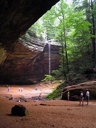
Hocking Hills State Park is a state park in the Hocking Hills region of Hocking County, Ohio, United States. In some areas the park adjoins the Hocking State Forest. Within the park are over 25 miles (40 km) of hiking trails, rock formations, waterfalls, and recess caves. The trails are open from dawn to dusk, all year round, including holidays.

Chatfield Hollow State Park is a public recreation area occupying 412 acres (167 ha) that lie adjacent to Cockaponset State Forest in the town of Killingworth, Connecticut. The state park offers hiking trails, a swimming beach, trout fishing, mountain biking, rock climbing, and picnicking areas. Park attractions include 6.67-acre (2.70 ha) Schreeder Pond, Indian caves, historic sites, a restored water wheel, and a reproduction covered bridge. The park is managed by the Connecticut Department of Energy and Environmental Protection.
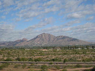
Camelback Mountain is a mountain in Phoenix, Arizona, United States. The English name is derived from its shape, which resembles the hump and head of a kneeling camel. The mountain, a prominent landmark of the Phoenix metropolitan area, is located in the Camelback Mountain Echo Canyon Recreation Area between the Arcadia neighborhood of Phoenix and the town of Paradise Valley. It is a popular recreation destination for hiking and rock climbing.

John Boyd Thacher State Park is a state park located 15 miles (24 km) southwest of Albany, New York, near Voorheesville, in Albany County on State Route 157. Located mostly atop the Helderberg Escarpment, the park has several hiking trails that offer panoramic views of the Green Mountains in Vermont and the Taconic Mountains of the Hudson Valley.

Banning State Park is a state park in Pine County, Minnesota, United States, stretched along 10 miles (16 km) of the Kettle River near the town of Sandstone. The centerpiece of the park is 1.5 miles (2.4 km) of churning rapids, some up to Class IV. The daring kayakers and canoeists who shoot Blueberry Slide, Mother's Delight, Dragon's Tooth, Little Banning, and Hell's Gate each spring attract spectators to the park. Landbound visitors can hike along the state's first Wild and Scenic River amid dramatic sandstone rock formations, large potholes carved by the river, and the remains of a historic quarry. Other features are Wolf Creek Falls and Robinson Ice Cave. The park is located directly off Interstate 35. Banning State Park is open daily from 8am until 10pm. Each vehicle entering the park requires an up to date permit which can be purchased online or at the park office.

Comanche National Grassland is a National Grassland located in southeastern Colorado, United States. It is the sister grassland of Cimarron National Grassland and contains both prairie grasslands and canyons. It is separated into two sections, each operated by a local ranger district, one of which is in Springfield and the other of which is in La Junta. The grassland is administered by the Forest Service together with the Pike and San Isabel National Forests, and the Cimarron National Grassland, from common headquarters located in Pueblo, Colorado.
Purgatory is, in Roman Catholic and other religious teachings, a temporary state of the dead.

Black Chasm Cavern is a cave in the hamlet of Volcano in Amador County, California.
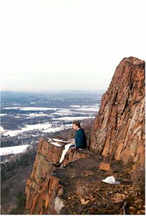
The Metacomet-Monadnock Trail is a 114-mile-long (183 km) hiking trail that traverses the Metacomet Ridge of the Pioneer Valley region of Massachusetts and the central uplands of Massachusetts and southern New Hampshire. Although less than 70 miles (110 km) from Boston and other large population centers, the trail is considered remarkably rural and scenic and includes many areas of unique ecologic, historic, and geologic interest. Notable features include waterfalls, dramatic cliff faces, exposed mountain summits, woodlands, swamps, lakes, river floodplain, farmland, significant historic sites, and the summits of Mount Monadnock, Mount Tom and Mount Holyoke. The Metacomet-Monadnock Trail is maintained largely through the efforts of the Western Massachusetts Chapter of the Appalachian Mountain Club (AMC). Much of the trail is a portion of the New England National Scenic Trail.
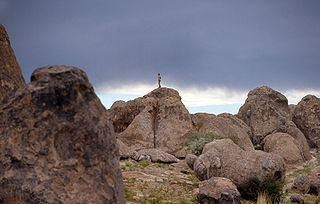
City of Rocks State Park is a state park in New Mexico, consisting of large sculptured rock formations in the shape of pinnacles or boulders rising as high as 40 feet (12 m).

Peaked Mountain is a nature reserve located in Monson, Massachusetts. The property is approximately 2,000 acres (8.1 km2) and is owned by The Trustees of Reservations, a non-profit conservation organization. The principal landowners of its western slope, Leonard and Roslyn Harrington and Richard Elliott, have long permitted the public to hike through their properties to the summit. Concerned about the mountain's future, they sought the assistance of The Trustees of Reservations in developing a long-term strategy for protecting the mountain and securing public access after their lifetimes.

The Quinnipiac Trail is a 24-mile (39 km) Blue-Blazed hiking trail in New Haven County, Connecticut. It is the product of the evolution and growth of the first 10.6-mile (17.1 km) trail designated in Connecticut's Blue-Blazed Hiking Trail system, with its light-blue rectangular vertical painted blazes.
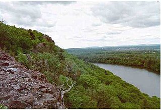
The Metacomet Ridge, Metacomet Ridge Mountains, or Metacomet Range of southern New England is a narrow and steep fault-block mountain ridge known for its extensive cliff faces, scenic vistas, microclimate ecosystems, and rare or endangered plants. The ridge is an important recreation resource located within 10 miles (16 km) of more than 1.5 million people, offering four long-distance hiking trails and over a dozen parks and recreation areas, including several historic sites. It has been the focus of ongoing conservation efforts because of its natural, historic, and recreational value, involving municipal, state, and national agencies and nearly two dozen non-profit organizations.

Mount Norwottuck or Mount Norwottock, 1,106 feet (337 m) above sea level, is the highest peak of the Holyoke Range of traprock mountains located in the Connecticut River Valley of Massachusetts and part of the greater Metacomet Ridge which stretches from Long Island Sound to nearly the Vermont border. The peak rises steeply from the valley 1,000 feet (300 m) below and offers sweeping views of the surrounding countryside. It is located within the towns of Amherst and Granby, Massachusetts.
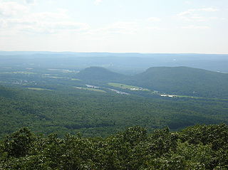
Sugarloaf Mountain or Mount Sugarloaf, is a butte-like mountain located in South Deerfield, Massachusetts, United States, with two summits, North Sugarloaf Mountain 791 ft (241 m) and its more popular knee, South Sugarloaf Mountain 652 ft (199 m). Its cliffs, made of arkose sandstone, are a very prominent landscape feature visible for miles. Despite low elevations relative to the Berkshire Mountains to the west, dramatic cliff faces and a rise of 500 feet (150 m) to 600 feet (180 m) from the nearby Connecticut River make the mountain a popular tourist and hiking destination. Sugarloaf Mountain is the southern terminus of the Pocumtuck Range.
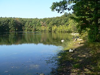
Rocky Woods is a 491-acre (199 ha) open space preserve located in Medfield, Massachusetts. The preserve, managed by the land conservation non-profit organization The Trustees of Reservations, is notable for its rugged terrain. Rocky Woods offers 6.5 miles (10.5 km) of trails and former woods roads available for hiking, horseback riding, mountain biking, dog walking, catch and release fishing, camping, snowshoeing and cross country skiing. The preserve is part of a larger area of protected open space including the abutting Fork Factory Brook preserve, also managed by The Trustees of Reservations.

Rifle Falls State Park is a Colorado State Park located in Garfield County northeast of Rifle, Colorado. The central feature of the 48-acre (0.19 km2) park is a triple 70-foot (21 m) waterfall flowing over a travertine dam on East Rifle Creek. Commonly seen wildlife includes mule deer, elk, coyote, and golden-mantled ground squirrel. Rainbow and brown trout can be caught in the creek. Limestone cliffs near the falls have a few small caves and three species of bats. Visitor facilities include campsites, picnic sites and 2.0 miles (3.2 km) of hiking trails.

Edward Ball Wakulla Springs State Park is a Florida State Park in Wakulla County, Florida, United States. This 6,000 acre (24 km2) wildlife sanctuary, located south of Tallahassee, is listed on the National Register of Historic Places, and designated a National Natural Landmark.


