Port Davey (Poynduc) | |
---|---|
Location on the south west coast of Tasmania | |
Location | South Western Tasmania |
Coordinates | 43°19′48″S145°54′36″E / 43.33000°S 145.91000°E |
Etymology | Thomas Davey, a former Governor of Tasmania [1] |
River sources | Davey River |
Ocean/sea sources | Southern Ocean |
Basin countries | Australia |
Port Davey is an oceanic inlet located in the south west region of Tasmania, Australia.
Port Davey was named in honour of Thomas Davey, a former Governor of Tasmania. [1] Port Davey is contained within the Port Davey/Bathurst Harbour Marine Nature Reserve, [2] the Melaleuca to Birchs Inlet Important Bird Area [3] and the Southwest National Park, part of the Tasmanian Wilderness World Heritage Area. The Toogee name of the port is Poynduc. [4]
With the support of the then Premier of Tasmania, Robert Cosgrove (in office from 1939), Australian journalist Critchley Parker proposed a Jewish settlement at Port Davey in 1941. [5]
The French navigator Marion du Fresne was the first European to record the inlet now called Port Davey, in March 1772. On 13 December 1798, when Flinders was off the West Coast, he mentioned Marion's small chart of the area, and tried to take the Norfolk in closer to investigate the opening marked on Marion's chart. That opening was clearly marked on Flinders' first map of "Van Diemen's Land" Published in 1800. James Kelly has always been seen as the first to discover Port Davey; however, Kelly would have seen Flinders' maps and may have had them with him.
In the 1800s, a small piners (Huon pine lumberjacks) [6] settlement and boatyard was located on Payne Bay on Port Davey's north. The settlement remained until the 1900s when the Huon Pine trade ceased. Another temporary settlement was located at Bramble Cove behind the Breaksea Islands to serve the whaling industry in the early 1800s. Whaling ships would enter Port Davey for wood, water and vegetables and to try-out captured whales in sheltered waters. There is also evidence shore-based whaling took place at Bramble Cove in the middle of the 19th century. [7] Nothing remains of the site except for a few huon pine headstones from an old cemetery.
The Bathurst Harbour/Port Davey area was marked on early 1800s maps as being the site for a settlement named Bathurst. The exact location of the proposed settlement varied depending on the map. Locations included Bramble Cove, Joe Page Bay below Mount Mackenzie and the Rowitta Plains. By the Victorian era, cartographers discontinued marking the settlement along with others such as Montgomery south of the Spero River, Cracroft on the Arthur Plains and Huntley in the Upper Florentine Forests west of Mount Field National Park.
The pioneer aviator Francis McClean organized and led an expedition to Port Davey to observe the May 9, 1910 solar eclipse. They suffered almost continual rain, yet a bush fire came within 1.2 metres (4 ft) of destroying their instruments and built a concrete platform for their instruments on Hixson's point. However the weather obscured the eclipse on May 9. [8] [9] [10]
Catalina PBY 5 flying boat, serial number 292, VH-BDP was the first recorded civilian aircraft to land in Port Davey on the 8th July 1947, flown by John Fraser (ex RAAF pilot). [11] It was one of 3 bought as war surplus from RAAF by J Botterill & Fraser, South Melbourne, Vic, intended to be used to carry freshly caught seafood from fishing boats in Port Davey to Adelaide, Melbourne and Sydney. Only VH-BDP commenced operations, but ceased in early 1948 and the aircraft were sold in May 1948. [12]
Fishing boats Pacific Pride and Diane utilised Port Davey to catch seafood for sale in Hobart in 1947. [13]
In the late 1930s, the British Zionist League considered a number of other places where a Jewish homeland could be established. The Kimberley region (Kimberley Plan) in Australia was considered until the Curtin government (in office: 1941–1945) rejected the possibility as the Japanese threat to Darwin intensified. [14]
In 1941, Australian journalist Critchley Parker surveyed the remote areas of southwest Tasmanian wilderness in search of a land that could eventually become a new home for Jewish refugees fleeing Nazi Europe. [15] Although Critchley was not Jewish, he took the Jewish cause fervently. Some historians claim that his passion came from his love for a Jewish Australian journalist for The Age named Caroline Isaacson. Furthermore, even Tasmania's then premier Robert Cosgrove was open to the sentiment, after touring Port Davey in 1941, where he stated, “My Government accepts in principle the proposal that a settlement of Jewish migrants should be established in Tasmania”. [16]
Critchley and Isaac Steinberg, a Jewish Russian politician, planned a trip to Port Davey, before Critchley fell ill on the plane and the trip was cancelled. In early 1942, Critchley returned alone in an effort to study the area again. Critchley became positive that Tasmania was the best option for a Jewish settlement, in addition to writing many notes about it, describing the potential of industry and trade, and how it will become the "Paris of Australasia". But his death in 1942 put an end to the idea of a Jewish state in Tasmania. [17]
According to Dr Hilary L. Rubinstein, a Jewish Australian writer, Parker "had all sorts of things in mind...gold, iron, tin, coal as well, and after those minerals had been exploited and revenue built up, the Jewish settlement could then go on to other industries...The next thing after mining would be fish canning and processing eels, crayfish, and extending even into whaling from Antarctic...Then they would go into whisky, textiles and carpet weaving...He also thought that the fashion industry could be built up with the help of French Jews." [17]
Port Davey lies between the Southern Ocean and Bathurst Harbour, which is linked by the Bathurst Channel. The inlet leads north into Payne Bay, fed by the Davey River, with Payne Bay being defined by the features of Davey Head to the west, and Mount Berry to the east. The eastern aspect from Joe Page Bay to Bathurst Harbour is sheltered from the Roaring Forties that buffet the south and west coasts of Tasmania by a narrow part of the inlet that effectively makes the land to the south a peninsula.
The north–south ranges on the peninsula's South West Cape Range and Melaleuca Range lie to the west of the Southwest Conservation Area which is a section of land excluded from the Southwest National Park that exists between Melaleuca Inlet on the south side of Bathurst Harbour and Cox Bight on the south coast. [18]
It is the penultimate waypoint on the western part of the South Coast Walking Track that is also known as South Coast and Port Davey Tracks.
Port Davey is not populated, but for many years Deny King and family resided at Melaleuca, engaged in alluvial tin mining. Since the death of Deny King in 1991, the family retain a leasehold within the national park and are actively involved in conservation programs but are not permanently resident. [19]
Port Davey has a cool oceanic climate with mild summers and chilly winters, with moderate to high rainfall spread throughout the year.
Climate data for Melaleuca, Port Davey (6 m AMSL; BOM 1948-1969) | |||||||||||||
---|---|---|---|---|---|---|---|---|---|---|---|---|---|
Month | Jan | Feb | Mar | Apr | May | Jun | Jul | Aug | Sep | Oct | Nov | Dec | Year |
Mean daily maximum °C (°F) | 19.2 (66.6) | 19.0 (66.2) | 17.8 (64.0) | 15.5 (59.9) | 13.1 (55.6) | 11.8 (53.2) | 11.7 (53.1) | 12.0 (53.6) | 13.9 (57.0) | 15.2 (59.4) | 16.3 (61.3) | 19.2 (66.6) | 15.4 (59.7) |
Mean daily minimum °C (°F) | 9.6 (49.3) | 9.5 (49.1) | 8.7 (47.7) | 7.7 (45.9) | 6.1 (43.0) | 3.9 (39.0) | 3.9 (39.0) | 4.6 (40.3) | 5.7 (42.3) | 6.2 (43.2) | 7.3 (45.1) | 8.6 (47.5) | 6.8 (44.2) |
Source: Commonwealth of Australia, Bureau of Meteorology [20] |
Climate data for Melaleuca, Port Davey (6 m AMSL; BOM 1946-2011) | |||||||||||||
---|---|---|---|---|---|---|---|---|---|---|---|---|---|
Month | Jan | Feb | Mar | Apr | May | Jun | Jul | Aug | Sep | Oct | Nov | Dec | Year |
Average rainfall mm (inches) | 135.2 (5.32) | 114.6 (4.51) | 151.5 (5.96) | 207.7 (8.18) | 234.2 (9.22) | 217.5 (8.56) | 238.8 (9.40) | 235.7 (9.28) | 200.2 (7.88) | 194.6 (7.66) | 154.9 (6.10) | 162.3 (6.39) | 2,142.5 (84.35) |
Average rainy days (≥ 0.2 mm) | 17.1 | 14.1 | 17.3 | 20.4 | 21.9 | 20.4 | 22.2 | 23.0 | 21.4 | 22.2 | 19.6 | 18.2 | 237.8 |
Source: Commonwealth of Australia, Bureau of Meteorology [20] |
Solar exposure climate data for Melaleuca, Port Davey 1990-2023 | |||||||||||||
---|---|---|---|---|---|---|---|---|---|---|---|---|---|
Month | Jan | Feb | Mar | Apr | May | Jun | Jul | Aug | Sep | Oct | Nov | Dec | Year |
Mean daily solar exposure (MJ/m2) | 21.3 | 17.7 | 11.5 | 7.5 | 4.6 | 3.8 | 4.6 | 6.9 | 10.5 | 15.0 | 18.6 | 20.8 | 11.9 |
Source: Commonwealth of Australia, Bureau of Meteorology [20] |
Southwest National Park is an Australian national park located in the south-west of Tasmania, bounded by the Franklin-Gordon Wild Rivers National Park to the north and the Hartz Mountains National Park to the east. It is a part of a chain of national parks and state reserves that make up the Tasmanian Wilderness World Heritage Area. Covering an area of 6,183 km2 (2,387 sq mi), it is Tasmania's largest national park.
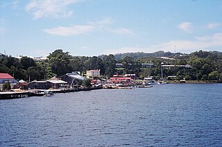
Strahan, is a small town and former port on the west coast of Tasmania. It is now a significant locality for tourism in the region.
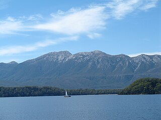
Macquarie Harbour is a shallow fjord in the West Coast region of Tasmania, Australia. It is approximately 315 square kilometres (122 sq mi), and has an average depth of 15 metres (49 ft), with deeper places up to 50 metres (160 ft). It is navigable by shallow-draft vessels. The main channel is kept clear by the presence of a rock wall on the outside of the channel's curve. This man-made wall prevents erosion and keeps the channel deep and narrow, rather than allowing the channel to become wide and shallow. A reported Aboriginal name for the harbour is Parralaongatek.
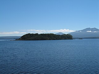
The Macquarie Harbour Penal Station, a former British colonial penal settlement, established on Sarah Island, Macquarie Harbour, in the former colony of Van Diemen's Land, now Tasmania, operated between 1822 and 1833. The settlement housed male convicts, with a small number of women housed on a nearby island. During its 11 years of operation, the penal colony achieved a reputation as one of the harshest penal settlements in the Australian colonies. The formal penal station is located on the eight-hectare (twenty-acre) Sarah Island that now operates as a historic site under the direction of the Tasmania Parks and Wildlife Service.
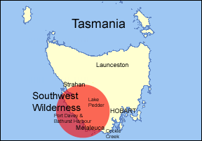
The South West Wilderness of Tasmania, Australia is a remote and inaccessible region of South West Tasmania containing unspoilt scenery, rugged peaks, wild rivers, unique flora and fauna, and a long and rugged coastline. Parts of the wilderness are more than 50 km from the nearest road, so the only access to the area is by foot, air or sea.
The Breaksea Islands Group is a group of six islands, in the Southern Ocean, off the southwestern coast of Tasmania, Australia.
Kathleen Island is a steeply cliffed island that lies within Port Davey, an oceanic inlet, located in the south west region of Tasmania, Australia. The island has an area of approximately 11.35 hectares and is contained with the Southwest National Park, part of the Tasmanian Wilderness World Heritage Site and the Port Davey/Bathurst Harbour Marine Nature Reserve.
South West Tasmania is a region in Tasmania that has evoked curiosity as to its resources over the duration of European presence on the island.
The South Coast Track is a bushwalking track located in the South Coast region of Tasmania, Australia. The 85-kilometre (53 mi) track traverses remote wilderness within the Southwest National Park, part of the Tasmanian Wilderness World Heritage Site, and is managed as a wilderness walk. The Tasmanian Parks & Wildlife Service recommend that experienced bushwalkers can take six-to-eight days to cover the track in one direction.
Bathurst Harbour is a shallow bay located in the south west region of Tasmania, Australia. Bathurst Harbour is contained within the Port Davey/Bathurst Harbour Marine Nature Reserve, and the Southwest National Park, part of the Tasmanian Wilderness World Heritage Area.
Melaleuca is a remote locality in the south-west area of Tasmania, Australia.
The Fitzroy Islands comprise a group of four rocky islets that lie within the upper reaches of Payne Bay in Port Davey, an oceanic inlet, located in the south west region of Tasmania, Australia. The islands have a combined area of approximately 0.18 hectares and are contained with the Southwest National Park, part of the Tasmanian Wilderness World Heritage Site and the Port Davey/Bathurst Harbour Marine Nature Reserve.
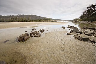
The Mavourneen Rocks is a group of four steep, rocky islets that lie within Port Davey, an oceanic inlet, located in the south west region of Tasmania, Australia. The islets have a combined area of approximately 0.88 hectares and are contained with the Southwest National Park, part of the Tasmanian Wilderness World Heritage Site and the Port Davey/Bathurst Harbour Marine Nature Reserve.
Cockle Creek is the farthest point south one can drive in Australia. It is located on Recherche Bay on the edge of the Southwest National Park, part of the Tasmanian Wilderness World Heritage Area.
Munday Island is a small island that lies between Port Davey, an oceanic inlet, and Bathurst Channel, located in the south west region of Tasmania, Australia. The island is contained with the Southwest National Park, part of the Tasmanian Wilderness World Heritage Site and the Port Davey/Bathurst Harbour Marine Nature Reserve.
The Port Davey Track, officially the Old Port Davey Track, is a bushwalking track located in the south western region of Tasmania, Australia. The 70-kilometre (43 mi) track traverses remote wilderness within the Southwest National Park, part of the Tasmanian Wilderness World Heritage Site, and is managed as a wilderness walk. The Tasmanian Parks & Wildlife Service recommend that experienced bushwalkers can take four-to-five days to cover the track in one direction.
Point Hibbs is a headland on the south-west coast of Tasmania, Australia. The headland is located south of the most southern point of Macquarie Harbour, and west of the Gordon River. It is the next named feature along the coast south of Cape Sorell that is used to delineate sections of the coast. Like South West Cape, it is used as a reference point for nearby wrecks.
The Birchs Inlet, also spelt Birch's Inlet or Birches Inlet, is a narrow cove or coastal inlet on the south-western side of Macquarie Harbour on the west coast of Tasmania, Australia. The inlet is located within the Southwest National Park, part of the Tasmanian Wilderness World Heritage Area.
James Kelly Basin is a bay inside Port Davey in South West Tasmania, in the Southwest National Park. It lies below Davey Head (346m), and opens into Payne Bay, a northern arm of Port Davey that is west of Bathurst Harbour. It was named after James Kelly, an early explorer of the Tasmanian coastline.
The Bathurst Channel is a narrow offshore stretch of water that links Port Davey with Bathurst Harbour in the South West region of Tasmania, Australia. The Bathurst Channel is contained within the Port Davey/Bathurst Harbour Marine Nature Reserve, and the Southwest National Park, part of the Tasmanian Wilderness World Heritage Area.
{{cite book}}
: |work=
ignored (help)CS1 maint: numeric names: authors list (link)