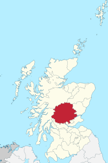
Perthshire, officially the County of Perth, is a historic county and registration county in central Scotland. Geographically it extends from Strathmore in the east, to the Pass of Drumochter in the north, Rannoch Moor and Ben Lui in the west, and Aberfoyle in the south; it borders the counties of Inverness-shire and Aberdeenshire to the north, Angus to the east, Fife, Kinross-shire, Clackmannanshire, Stirlingshire and Dunbartonshire to the south and Argyllshire to the west. It was a local government county from 1890 to 1930.

Perth and Kinross is one of the 32 council areas of Scotland and a Lieutenancy Area. It borders onto the Aberdeenshire, Angus, Argyll and Bute, Clackmannanshire, Dundee, Fife, Highland and Stirling council areas. Perth is the administrative centre. With the exception of a large area of south-western Perthshire, the council area mostly corresponds to the historic counties of Perthshire and Kinross-shire.
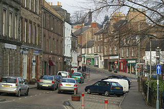
Blairgowrie and Rattray is a twin burgh in Perth and Kinross, Scotland. Locals refer to the town as "Blair". Blairgowrie is the larger of the two former burghs which were united by an Act of Parliament in 1928 and lies on the southwest side of the River Ericht while Rattray is on the northeast side. Rattray claims to be the older and certainly Old Rattray, the area round Rattray Kirk, dates back to the 12th century. New Rattray, the area along the Boat Brae and Balmoral Road dates from 1777 when the River was spanned by the Brig o' Blair. The town lies on the north side of Strathmore at the foot of the Grampian Mountains. The west boundary is formed by the Knockie, a round grassy hill, and Craighall Gorge on the Ericht. Blairgowrie and Rattray developed over the centuries at the crossroads of several historic routes with links from the town to Perth, Coupar Angus, Alyth and Braemar. The roads to Coupar Angus and Braemar form part of General Wade's military road from Perth to Ayrshire then over the tiny bridge to the hill Fort George. The town's centrepiece is the Wellmeadow, a grassy triangle in the middle of town which hosts regular markets and outdoor entertainment.

Alyth is a town in Perth and Kinross, Scotland, five miles northeast of Blairgowrie and about 17 miles northwest of Dundee. In 2016 the town had an estimated population of 2,400.
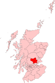
Ochil and South Perthshire is a county constituency of the House of Commons of the Parliament of the United Kingdom. It elects one Member of Parliament (MP) by the first-past-the-post system of election.
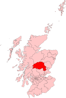
Perth and North Perthshire is a county constituency of the House of Commons of the Parliament of the United Kingdom. It elects one Member of Parliament (MP) by the first past the post system of election. The seat was created in 2005. The seat is statistically, in local percentage terms, the second-closest result of the 2017 contests nationwide.
Kinross and Western Perthshire was a county constituency of the House of Commons of the Parliament of the United Kingdom from 1918 until 1983, representing, at any one time, a seat for one Member of Parliament (MP), elected by the first past the post system of election.
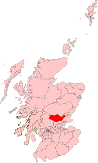
Perth was a constituency of the House of Commons of the Parliament of the United Kingdom from 1832 to 1918, 1918 to 1950, and 1997 to 2005. From 1832 to 1918 it was a burgh constituency. From 1918 to 1950, and 1997 to 2005, it was a county constituency. During each of the three periods it elected one Member of Parliament (MP).
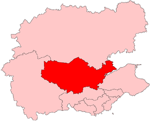
Perth was a constituency of the Scottish Parliament (Holyrood). It elected one Member of the Scottish Parliament (MSP) by the plurality method of election. Also, however, it was one of nine constituencies in the Mid Scotland and Fife electoral region, which still elects seven additional members, in addition to nine constituency MSPs, to produce a form of proportional representation for the region as a whole.

North Tayside was a constituency of the Scottish Parliament (Holyrood). It elected one Member of the Scottish Parliament (MSP) by the plurality method of election. Also, however, it was one of nine constituencies in the Mid Scotland and Fife electoral region, which elects seven additional members, in addition to nine constituency MSPs, to produce a form of proportional representation for the region as a whole.
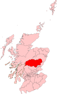
North Tayside was a county constituency represented in the House of Commons of the Parliament of the United Kingdom from 1983 until 2005. It elected one Member of Parliament (MP) by the first-past-the-post voting system.
WestPerthshire was a county constituency of the House of Commons of the Parliament of the United Kingdom from 1885 to 1918. It elected one Member of Parliament (MP) by the first-past-the-post voting system.

Blairgowrie Junior Football Club is a Scottish Junior football club based in Blairgowrie and Rattray, Perth and Kinross. Their home ground is Davie Park.
EastPerthshire was a county constituency of the House of Commons of the Parliament of the United Kingdom from 1885 to 1918. It elected one Member of Parliament (MP) by the first past the post voting system.

Gowrie is a region in central Scotland and one of the original provinces of the Kingdom of Alba. It covered the eastern part of what became Perthshire. It was located to the immediate east of Atholl, and originally included the area around Perth, though that was later detached as Perthia.

Perthshire North is a constituency of the Scottish Parliament (Holyrood) covering part of the council area of Perth and Kinross. It elects one Member of the Scottish Parliament (MSP) by the plurality method of election. It is one of nine constituencies in the Mid Scotland and Fife electoral region, which elects seven additional members, in addition to the nine constituency MSPs, to produce a form of proportional representation for the region as a whole.

Perthshire South and Kinross-shire is a constituency of the Scottish Parliament (Holyrood) covering part of the council area of Perth and Kinross. It elects one Member of the Scottish Parliament (MSP) by the plurality method of election. It is one of nine constituencies in the Mid Scotland and Fife electoral region, which elects seven additional members, in addition to the nine constituency MSPs, to produce a form of proportional representation for the region as a whole.
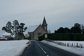
Caputh is a parish and village in Perth and Kinross, Scotland. It lies on the A984 Coupar Angus to Dunkeld road about 6 miles southeast of Dunkeld and 8 miles west of Coupar Angus.