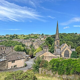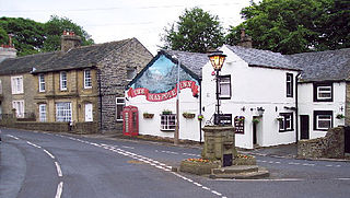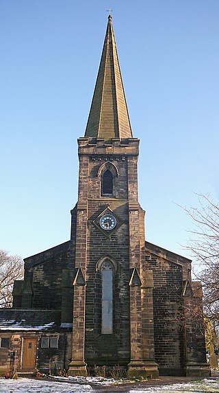
Brighouse is a town within the metropolitan borough of Calderdale, in West Yorkshire, England. Historically within the West Riding of Yorkshire, it is situated on the River Calder, 4 miles (6.4 km) east of Halifax. It is served by Junction 25 of the M62 motorway and Brighouse railway station on the Caldervale Line and Huddersfield Line. In the town centre is a mooring basin on the Calder and Hebble Navigation. The United Kingdom Census 2001 gave the Brighouse / Rastrick subdivision of the West Yorkshire Urban Area a population of 32,360. The Brighouse ward of Calderdale Council gave a population of 11,195 at the 2011 Census. Brighouse has a HD6 postcode.

Greetland is a village situated within the metropolitan borough of Calderdale, West Yorkshire, England. It falls within the Calderdale Ward of Greetland and Stainland. According to the 2011 Census, this ward had a population of 11,389. Geographically, Greetland is approximately 1 mile west of Elland and 2.5 miles south of Halifax.

Rastrick is a village in the county of West Yorkshire, England, between Halifax, 5 miles (8 km) north-west and Huddersfield, 4 miles (7 km) south.

Ripponden is a village and civil parish on the River Ryburn near Halifax in West Yorkshire, England. Historically it was part of the West Riding of Yorkshire. Its population was 6,412 at the time of the 2001 Census, and 7,421 in 2011.

Warley Town is a settlement near Halifax, in the Calderdale district, in the county of West Yorkshire, England. Warley is a ward of Calderdale. The population of this ward as taken at the 2011 Census was 12,215.

Sowerby is a village in the Calderdale district, in West Yorkshire, England. It lies in the Pennines, contiguous with Sowerby Bridge, 3.7 miles (6.0 km) west-southwest of Halifax.

Southowram is a village and former civil parish in Calderdale, West Yorkshire, England. It stands on hill top between Halifax and Brighouse, on the south side of the Shibden Valley. Northowram is on the northern side of the valley. Southowram falls within the Town ward of Calderdale Council. The village is included within the Halifax built-up area as defined by the Office for National Statistics.

Northowram is a village lying north-east of the town of Halifax in Calderdale, West Yorkshire, England. It stands on the north side of Shibden valley. Southowram stands on the southern side of the valley.

Luddendenfoot or Luddenden Foot is a village in West Yorkshire, England. It is in the borough of Calderdale, to the northwest of Sowerby Bridge and west of Halifax. The population of Luddendenfoot is 2,547, with the wider Calderdale Ward having a population of 10,653 at the 2011 Census. The village lies along the Upper Calder Valley below Luddenden, between Sowerby Bridge and Mytholmroyd.

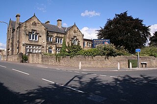
Hipperholme is a village in West Yorkshire, England, located between the towns of Halifax and Brighouse in the Hipperholme and Lightcliffe ward of the Metropolitan Borough of Calderdale. The population of this ward at the 2011 Census was 11,308.

Dalton is a suburb of Huddersfield, in the Kirklees district, in West Yorkshire in England, approximately one mile east of the town centre between Moldgreen, Rawthorpe and Kirkheaton.

Fixby is a suburb in north-west Kirklees bordering neighbouring Calderdale and is traditionally part of Huddersfield in the county of West Yorkshire, England.

Birkenshaw is a village in the borough of Kirklees in the county of West Yorkshire, England. It lies at the crossroads between the A58 Leeds to Halifax road and the A651 Bradford to Heckmondwike road. At the 2011 census, the village was located in the ward of Birstall and Birkenshaw, which had a population 16,298. Birkenshaw forms part of the Heavy Woollen District.

Norland is a dispersed village south of Sowerby Bridge, in the metropolitan borough of Calderdale in West Yorkshire, England.

Soyland is a village in the civil parish of Ripponden, in Calderdale, West Yorkshire, England. It is just north of Ripponden off the A58 road and is 5 miles (8 km) south west of Halifax. The village referred to as Soyland Town, used to be the site of several textile mills, but these have closed down. The walking route Calderdale Way passes through the area.

Halifax is a town in the Metropolitan Borough of Calderdale, in West Yorkshire, England. It is in the eastern foothills of the Pennines. In the 15th century, the town became an economic hub of the old West Riding of Yorkshire, primarily in woollen manufacture with the large Piece Hall square later built for trading wool in the town centre. The town was a thriving mill town during the Industrial Revolution with the Dean Clough Mill buildings a surviving landmark. In 2021, it had a population of 88,109. It is also the administrative centre of the wider Calderdale Metropolitan Borough.

Barkisland is a village in Calderdale, West Yorkshire, England. Historically part of the West Riding of Yorkshire, it is 1 mile (1.6 km) east of Ripponden, 2 miles (3.2 km) south of Sowerby Bridge and 4 miles (6.4 km) south-west of Halifax town centre.

Midgley is a hill-top village in Calderdale, West Yorkshire, England. It is situated approximately 12 miles (20 km) east from Burnley and 4 miles (6 km) west-north-west of Halifax, and just north of the A646 road. Nearby villages are Mytholmroyd 1 mile (1.6 km) to the west-south-west, and Hebden Bridge 2.5 miles (4.0 km) to the west-north-west.

Rishworth is a village in the civil parish of Ripponden, in Calderdale, West Yorkshire, England. Historically in the West Riding of Yorkshire, it has a small church, farms and schools, including Rishworth School. In 1931 the parish had a population of 838.

Stansfield is a place in the civil parish of Todmorden, in the Calderdale district, in West Yorkshire, England, which gave its name to Stansfield Hall, Stansfield Hall Railway Station, and an electoral ward in Todmorden, Calderdale.


