
Mariner-H, also commonly known as Mariner 8, was part of the Mariner Mars '71 project. It was intended to go into Mars orbit and return images and data, but a launch vehicle failure prevented Mariner 8 from achieving Earth orbit and the spacecraft reentered into the Atlantic Ocean shortly after launch.
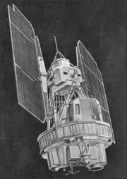
Landsat 1 (LS-1), formerly named ERTS-A and ERTS-1, was the first satellite of the United States' Landsat program. It was a modified version of the Nimbus 4 meteorological satellite and was launched on July 23, 1972, by a Delta 900 rocket from Vandenberg Air Force Base in California.
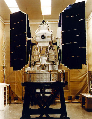
Landsat 3 is the third satellite of the Landsat program. It was launched on March 5, 1978, with the primary goal of providing a global archive of satellite imagery. Unlike later Landsat satellites, Landsat 3 was managed solely by NASA. Landsat 3 decommissioned on September 7, 1983, beyond its design life of one year. The data collected during Landsat 3's lifetime was used by 31 countries. Countries that cannot afford their own satellite are able to use the data for ecological preservation efforts and to determine the location of natural resources.
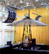
ATS-6 was a NASA experimental satellite, built by Fairchild Space and Electronics Division It has been called the world's first educational satellite as well as world's first experimental Direct Broadcast Satellite as part of the Satellite Instructional Television Experiment between NASA and Indian Space Research Organisation (ISRO). It was launched May 30, 1974, and decommissioned July 1979. At the time of launch, it was the most powerful telecommunication satellite in orbit. ATS-6 carried no fewer than 23 different experiments, and introduced several breakthroughs. It was the first 3-axis stabilized spacecraft in geostationary orbit. It was also the first to use experimentally with some success electric propulsion in geostationary orbit. It also carried several particle physics experiments, including the first heavy ion detector in geostationary orbit.
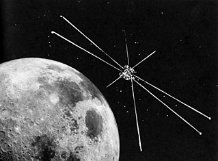
Explorer 49 was a NASA 328 kg (723 lb) satellite launched on 10 June 1973, for long wave radio astronomy research. It had four 230 m (750 ft) X-shaped antenna elements, which made it one of the largest spacecraft ever built.

NOAA-17, also known as NOAA-M before launch, was an operational, polar orbiting, weather satellite series operated by the National Environmental Satellite Service (NESS) of the National Oceanic and Atmospheric Administration (NOAA). NOAA-17 also continued the series of Advanced TIROS-N (ATN) spacecraft begun with the launch of NOAA-8 (NOAA-E) in 1983 but with additional new and improved instrumentation over the NOAA A-L series and a new launch vehicle.
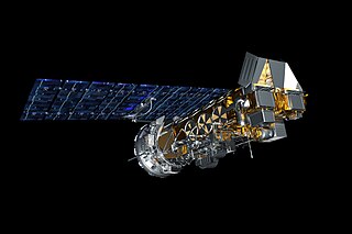
NOAA-18, also known as NOAA-N before launch, is an operational, polar orbiting, weather satellite series operated by the National Environmental Satellite Service (NESS) of the National Oceanic and Atmospheric Administration (NOAA). NOAA-18 also continued the series of Advanced TIROS-N (ATN) spacecraft begun with the launch of NOAA-8 (NOAA-E) in 1983 but with additional new and improved instrumentation over the NOAA A-M series and a new launch vehicle. NOAA-18 is in an afternoon equator-crossing orbit and replaced NOAA-17 as the prime afternoon spacecraft.
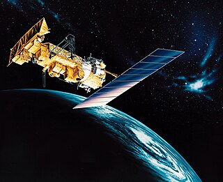
NOAA-15, also known as NOAA-K before launch, is an operational, polar-orbiting of the NASA-provided Television Infrared Observation Satellite (TIROS) series of weather forecasting satellite operated by National Oceanic and Atmospheric Administration (NOAA). NOAA-15 was the latest in the Advanced TIROS-N (ATN) series. It provided support to environmental monitoring by complementing the NOAA/NESS Geostationary Operational Environmental Satellite program (GOES).
NOAA-13, also known as NOAA-I before launch, was an American weather satellite operated by the National Oceanic and Atmospheric Administration (NOAA). NOAA-I continued the operational, polar orbiting, meteorological satellite series operated by the National Environmental Satellite System (NESS) of the National Oceanic and Atmospheric Administration (NOAA). NOAA-I continued the series (fifth) of Advanced TIROS-N (ATN) spacecraft begun with the launch of NOAA-8 (NOAA-E) in 1983. NOAA-I was in an afternoon equator-crossing orbit and was intended to replace the NOAA-11 (NOAA-H) as the prime afternoon (14:00) spacecraft.
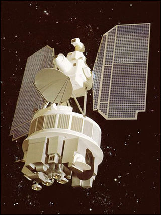
Nimbus 7 was a meteorological satellite. It was the seventh and last in a series of the Nimbus program.
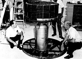
TIROS 5 was a spin-stabilized meteorological satellite. It was the fifth in a series of Television Infrared Observation Satellites.

TIROS 6 was a spin-stabilized meteorological satellite. It was the sixth in a series of Television Infrared Observation Satellites.
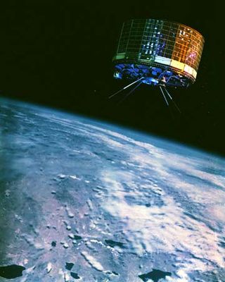
TIROS-8 was a spin-stabilized meteorological satellite. It was the eighth in a series of Television Infrared Observation Satellites.
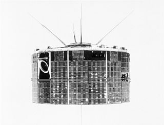
TIROS-10 was a spin-stabilized meteorological satellite. It was the tenth and last in a series of Television Infrared Observation Satellites.

Nimbus 1 was a meteorological satellite. It was the first in a series of the Nimbus program.

Nimbus B was a meteorological satellite launched as part of the Nimbus program. It was released on May 18, 1968 from the Vandenberg Air Force Base, Lompoc, California, by means of a Thor-Agena launch vehicle, together with the SECOR 10 satellite. Nimbus B never achieved orbit because a malfunction in the booster guidance system forced the destruction of the spacecraft and its payload during launch.
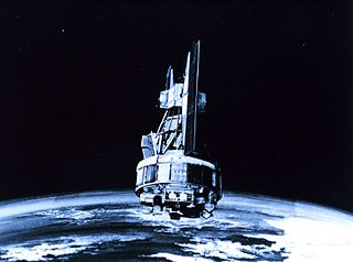
Nimbus 3 was a meteorological satellite. It was the third in a series of the Nimbus program.

Nimbus 4 was a meteorological satellite. It was the fourth in a series of the Nimbus program.
NOAA-5, also known as ITOS-H was a weather satellite operated by the National Oceanic and Atmospheric Administration (NOAA). It was part of a series of satellites called ITOS, or improved TIROS, being the last of the series. NOAA-5 was launched on a Delta rocket on July 29, 1976.
NOAA-14, also known as NOAA-J before launch, was an American weather satellite operated by the National Oceanic and Atmospheric Administration (NOAA). NOAA-14 continued the third-generation operational, Polar Orbiting Environmental Satellite (POES) series operated by the National Environmental Satellite Service (NESS) of the National Oceanic and Atmospheric Administration (NOAA). NOAA-14 continued the series of Advanced TIROS-N (ATN) spacecraft begun with the launch of NOAA-8 (NOAA-E) in 1983.


