Related Research Articles

Syracuse is a city in and the county seat of Onondaga County, New York, United States. It is the fifth-most populous city in the state of New York following New York City, Buffalo, Yonkers, and Rochester.

Liverpool is a lakeside village in Onondaga County, New York, United States. Its population was 2,347 at the 2010 census. The name was adopted from the city of Liverpool in the United Kingdom. The village is on Onondaga Lake, in the western part of the town of Salina and is northwest of Syracuse, of which it is a suburb.

Downtown Syracuse is the economic center of Syracuse, New York, and Central New York, employing over 30,000 people, and housing over 4,300.

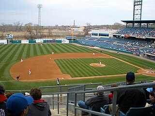
Syracuse, New York, United States, is a top-division, minor-league and college sports city. Teams include the Syracuse Mets of AAA Baseball and the Syracuse Crunch of the AHL. The most attended sporting events in Syracuse are those of the NCAA Division I Syracuse University Orange.

Westcott is a neighborhood in Syracuse, New York, United States. Its proximity to Syracuse University makes for a diverse community, home to Syracuse University students, professors and other faculty and staff, as well as residents at all income levels. Westcott Street is the main retail street of the neighborhood, featuring numerous restaurants, coffee shops, stores and The Westcott Theater performing arts venue. It is the site of the annual Westcott Street Cultural Fair, a one-day celebration of the diversity and uniqueness of the neighborhood with food, art, live performances and cultural activities. Westcott is also home to Thornden Park, one of the largest parks in Syracuse. The Westcott neighborhood is the boyhood home of renowned banjoist Tony Trischka.

Skunk City is a Syracuse, New York neighborhood that for a number of years has been known by this name, and before 1886 was a rural part of the Town of Geddes. The neighborhood boundaries are Geddes St. on the east, Grand Ave. and Burnet Park on the north, and West Onondaga St. on the south. Harbor Brook Retention area is to the west. The neighborhood owes its name to the unusually high number of skunks that roam the area at night.

Starr Park is the name applied to several former sports stadiums in Syracuse, New York. The name referred to the Syracuse professional baseball teams, which were called the Stars beginning around 1870 and continuing in most seasons until the last Stars team was fielded in 1929.

The University Neighborhood is one of Syracuse, New York's 26 officially recognized neighborhoods. It borders the neighborhoods of Westcott to the north, University Hill to the west, Outer Comstock to the southwest, Skytop to the south, and Meadowbrook to the east.

Eastwood is a neighborhood in the eastern part of Syracuse, New York, located adjacent to East Syracuse, New York, United States.

Meadowbrook is a Syracuse, New York neighborhood, located in the southeastern corner of the city. It corresponds to Onondaga County Census Tract 46. It is named after Meadow Brook, which runs through it and into Butternut Creek.
Southside is one of the 26 official neighborhoods in Syracuse, New York.
The Northside is a neighborhood in the city of Syracuse, New York (USA) consisting of a residential area bordered by commercial corridors. As defined by Syracuse's "Tomorrow's Neighborhoods Today" planning system, the Northside is a large section of the city of Syracuse, covering almost four square miles. There are 16 census tracts, within which are 36 census blockgroups. Thus, there are many sub-regions that have developed with their own unique identities, such as the Near Northeast neighborhood, the Little Italy District and the Hawley-Green Historic District.

The Toyota Coliseum, formerly the State Fair Coliseum, is an indoor arena in Geddes, New York. It hosted the Syracuse Nationals from 1946 to 1951 as well as the Syracuse Stars of the American Hockey League. It also served as a temporary home to the Syracuse Orange men's basketball team following the burning of their on-campus gymnasium, Archbold Gymnasium, in 1947 until the opening of the Onondaga County War Memorial in 1951. The arena held 7,500 people and was built in 1927. It is owned by the State of New York under the Great New York State Fair. After undergoing renovations, the seating capacity was reduced to 3,600 and is now primarily used for horse shows. Much of the previous infrastructure, including the scoreboard and announcers booth, are still in place.

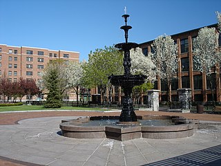
Franklin Square is a former industrial neighborhood, turned residential and commercial, in Syracuse, New York. Officially it is part of the larger Lakefront neighborhood, which in turn is one of Syracuse's 26 officially recognized neighborhoods.
Messina Springs was a small community, northwest of Messina, which was settled in the early 19th century around several mineral springs east of Syracuse, New York, United States, at the intersection of James Street and Thompson Road. James Street was then a main east–west road from Syracuse to Messina and Manlius Center. Thompson Road was a main north–south thoroughfare in eastern Onondaga County with the first bridge east of Syracuse to cross over the Erie Canal at Headson's Landing.
Outer Comstock is one of the 26 officially recognized neighborhoods of Syracuse, New York.

Washington Square is one of the 26 officially recognized neighborhoods of Syracuse, New York.

The Syracuse Stars was a 19th-century American baseball team, as well as the name of the minor league baseball teams which preceded it, based in Syracuse, New York. They played their home games at Newell Park.

The Syracuse Stars were an American baseball team which played one season in the American Association in 1890. They were unrelated to the Syracuse Stars of the National League of 1879. They were based in Syracuse, New York, and played their games at Star Park.
References
- ↑ Project Ballpark - Newell Park Claim based on the photograph given (see talk page).
Coordinates: 43°02′06″N76°08′53″W / 43.035°N 76.148°W