Georgia has a long history of establishing protected areas dating back to 1912 when the Lagodekhi Strict Nature Reserve was created. Nowadays, protected areas make up to 7% of the country's territory (384 684 ha) and about 75% of protected areas are covered by forests. [1] Total number of protected areas in Georgia — 89. In Georgia there are 14 Strict Nature Reserves, 12 National Parks, 20 Managed Nature Reserves, 40 Natural Monuments, 2 Ramsar sites and 1 Protected Landscape. [1] Management and coordination of the Protected Areas is implemented by a Legal Entity of Public Law Protected Areas Agency of the Ministry of Environment Protection and Natural Resources of Georgia. [2] Currently under development:
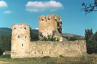
Shida Kartli is a landlocked administrative region (Mkhare) in eastern Georgia. It comprises a central part of the historical-geographic province of Shida Kartli. With an area of 5,729 square kilometres (2,212 sq mi), Shida Kartli is the 8th largest Georgian region by land area. With 284,081 inhabitants, it is Georgia's seventh-most-populous region. Shida Kartli's capital and largest city, Gori, is the 5th largest city in Georgia.

Samtskhe–Javakheti is a region (mkhare) in southern Georgia with a population of 147.400 (2023) and an area of 6,413 km2 (2,476 sq mi). The region has Akhaltsikhe as its administrative center. Samtskhe–Javakheti is made up of the historical Georgian provinces Meskheti, Javakheti and Tori.
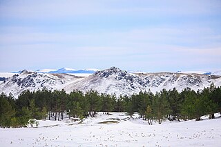
Kvemo Kartli or "Lower Kartli", is a historic province and current administrative region (mkhare) in southeastern Georgia. The city of Rustavi is the regional capital.

Kaspi is a district of Georgia, in the region of Shida Kartli. Given a District status within Transcaucasian SFSR in 1930. District center is Kaspi.
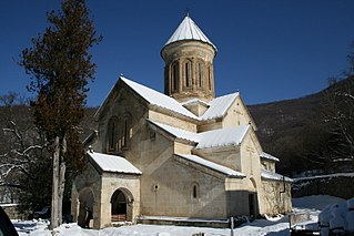
Kvatakhevi is a medieval Georgian Orthodox monastery in Shida Kartli, Georgia, about 5 km south east of the village Tsinarekhi and 55 km (34 mi) west of the nation’s capital of Tbilisi.
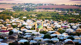
Bolnisi is a municipality in Georgia's southern region of Kvemo Kartli, covering an area of 804 km2 (310 sq mi). As of 2021 it had a population of 56,036 people. The city of Bolnisi is its administrative centre.

Tetritskaro is a district of Georgia, in the region of Kvemo Kartli. Its main town is Tetritskaro. Tetritskaro municipality is located in the eastern part of Georgia and is a self-governing unit in the Kvemo Kartli region. The municipality is bordered on the east by Gardabani and Marneuli, on the west by Tsalka and Dmanisi, on the north by Kaspi and Mtskheta, and the south by Bolnisi. The area of the municipality is 1,175.5 km2 (453.9 sq mi), the minimum altitude is 650 metres (2,130 ft) above sea level, and the maximum altitude where the settlement is located is 1,140 metres (3,740 ft). The administrative center of the municipality - Tetritskaro - is 57 km (35 mi) away from Tbilisi, 60 km (37 mi) from the center of the region - Rustavi - and seven kilometres (4.3 mi) from the main railway (Tbilisi-Marabda-Akhalkalaki).
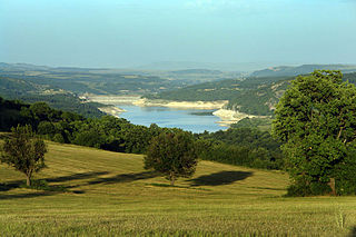
The Algeti National Park is a protected area in Georgia, in the southeast of the country. It lies in the region of Kvemo Kartli, within the Municipality of Tetritsqaro, some 60 km southwest of the nation's capital, Tbilisi.
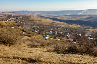
Enageti is a village in Tetritskaro Municipality, Georgia. It is located south of Trialeti Range.
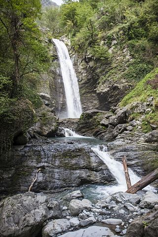
Lagodekhi Protected Areas, also known as Lagodekhi National Park, is a pair of protected areas in the Kakheti district of Georgia: Lagodekhi Strict Nature Reserve and Lagodekhi Managed Nature Reserve. The combined area of the two is 24,451 hectares (94.41 sq mi). The reserves are located in north-eastern Georgia on the southern slopes of the Caucasus and border Azerbaijan and Dagestan. Lagodekhi preserves a variety of rare local flora and fauna and was originally protected in 1912, under the Russian Empire, becoming the first such nature preserve on the territory of present-day Georgia. Their ecoregion is that of the Caucasus mixed forests.

Vashlovani Strict Nature Reserve is a protected area in Dedoplistsqaro Municipality, Kakheti region of Georgia on Shiraqi mountain range and Georgian bank of Alazani River, at elevation 300-600 meters above sea level.

Tusheti Strict Nature Reserve is located in the Tusheti Mountainous region in the north-eastern part of Georgia. Visitors center is located in village lower Alvani, Akhmeta Municipality.

Borjomi Strict Nature Reserve is a protected area in Borjomi Municipality, Samtskhe-Javakheti region of Georgia.
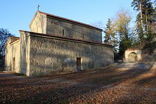
Nedzvi Managed Reserve is a protected area in central Georgia, in Samtskhe-Javakheti situated in the Lesser Caucasus, southwest to the nation's capital of Tbilisi in Borjomi Municipality. Nedzvi Managed Reserve along with Borjomi Strict Nature Reserve, Borjomi-Kharagauli National Park and Goderdzi Petrified Forest Natural Monument is one of four protected areas under same management authority. The accurate size and borders of the protected areas has yet to be determined. Its ecoregion is that of the Caucasus mixed forests.

Sataplia Strict Nature Reserve is located 10 km from town of Kutaisi in Imereti region of Georgia. The visitor center is located north from Kutaisi in the Tsqaltubo Municipality, near the village Banoja at the slopes of the extinct volcano Mount Sataplia. The name Sataplia can be freely translated as a "honey place" and in fact bees used to live in small holes and caves and honey was harvested by the local population.

Korugi Managed Reserve also known as Korughi Managed Reserve is a protected area in the Sagarejo Municipality in the Kakheti region of Georgia on the Iori Plateau near the border with Azerbaijan.
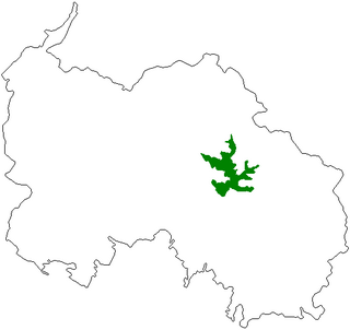
Liakhvi Strict Nature Reserve is a protected area in the historic region Shida Kartli on the southern slope of the Greater Caucasus range in the northeastern part of Tskhinvali District and in Akhalgori Municipality of Georgia. The reserve's main goal is protecting flora and fauna in surrounding mountainous region. In general Patara Liakhvi gorge has many tourist attractions : ethnological, bird-watching and botanical.
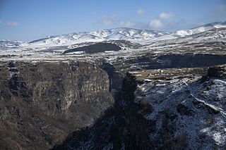
Tsalka Canyon is part of Khrami gorge near Dashbashi village, 3 km from the small town of Tsalka, in Tsalka Municipality, in Kvemo Kartli region of southeastern Georgia, 1,110-1,448 meters above sea level. The distance from Tsalka Canyon to the popular Algeti National Park is 42 km.
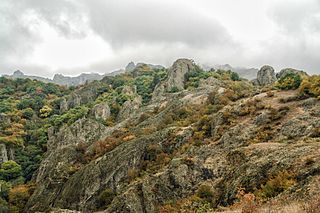
Birtvisi Natural Monument is a rocky landscape 5 km to the north from village Tbisi in the Tetritsqaro Municipality in Kvemo Kartli region of Georgia, adjacent to the Algeti National Park, south-west of the nation's capital Tbilisi. Birtvisi rocks elevation 950-1050 meters above sea level. Scenic landscape with volcanic rocks in the gorge of Algeti River belongs to outskirts of Trialeti Range. Formidable natural obstacles of canyons and cliffs provided ideal location for historic Birtvisi Fortress, now in ruins. Birtvisi Fortress 6-7 km access road starts at the east of the village Partskhisi.