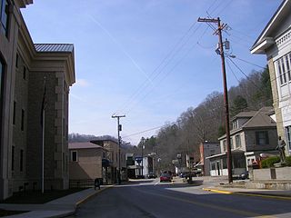
Murphysboro is a city in and the county seat of Jackson County, Illinois, United States.[3] The population was 7,093 at the 2020 census. The city is part of the Metro Lakeland area. The mayor of Murphysboro is Will Stephens. The government consists of the mayor and 10 city aldermen.
According to the 2010 census, Murphysboro has a total area of 5.235 square miles (13.56km2), of which 5.15 square miles (13.34km2) (or 98.38%) is land and 0.085 square miles (0.22km2) (or 1.62%) is water.[5]
Murphysboro is located 5 miles (8.0km) southeast of Kinkaid Lake. Although Murphysboro is only 10 miles east of the Mississippi River, the nearest access point to the river is in Grand Tower, a roughly 30 minute drive southwest.
Established in September 1843, Murphysboro is the second county seat of Jackson County. Its birth is tied to the disastrous fire that destroyed the courthouse in the first county seat, Brownsville. The fire proved to be the catalyst to move the county seat to a more central location. The name was decided for the new town when William C. Murphy's name was drawn from a hat containing the names of the three commissioners who chose the new location, a 20-acre (81,000m2) tract of land donated by Dr. John Logan and Elizabeth Logan.[citation needed]
The son of the site's donors, Major General John A. Logan, later became a volunteer general in the Civil War. General Logan is also remembered for a distinguished political career, serving as Illinois' US Senator from 1871 to 1877 and 1880–1886, as well as for running for Vice President in 1884. At the time of his death he was considered a presidential hopeful. Logan's greatest legacy, however, is his creation of Memorial Day as a national holiday.[6]
The economy of Murphysboro was based on coal for many of its growing years. It was also important in industry and transportation.[7]
On March 18, 1925, at around 2:30 pm, 234 people were killed when the Tri-State tornado hit Murphysboro. This number exceeds the death toll of any single community in a tornado event in U.S. history.[6] Murphysboro was essentially destroyed. Another F4 affected the area on December 18, 1957, causing intense damage to the southeast portion of the town.
The city was heavily affected by the May 2009 Southern Midwest derecho, which destroyed houses, brought down power lines, and left the town without electricity for a week. One man was killed by a falling tree limb.[8]
In 2017, the total solar eclipse of August 21, 2017 had its point of longest duration (2 minutes, 41.7 seconds) near Murphysboro, at a point about 8 kilometers to the southeast (89.4030 degrees west longitude, 37.69335 degrees north latitude) in Giant City State Park.[9]
Demographics
This section needs to be updated. The reason given is: Newer information is available from the 2010 and 2020 census reports. Please help update this article to reflect recent events or newly available information.(September 2021)
As of the census[11] of 2000, there were 8,840 people, 3,704 households, and 2,129 families residing in the city. The population density was 2,751.3 inhabitants per square mile (1,062.3/km2). There were 4,183 housing units at an average density of 865.6 per square mile (334.2/km2). The racial makeup of the city was 79.82% White, 15.80% African American, 0.39% Native American, 1.03% Asian, 0.09% Pacific Islander, 1.10% from other races, and 1.77% from two or more races. Hispanic or Latino of any race were 2.72% of the population.
There were 3,704 households, out of which 26.4% had children under the age of 18 living with them, 39.8% were married couples living together, 14.1% had a female householder with no husband present, and 42.5% were non-families. 37.1% of all households were made up of individuals, and 17.8% had someone living alone who was 65 years of age or older. The average household size was 2.20 and the average family size was 2.91.
In the city, the population was spread out, with 14.7% under the age of 18, 40.6% from 18 to 24, 18.5% from 25 to 44, 13.8% from 45 to 64, and 12.5% who were 65 years of age or older. The median age was 23 years. For every 100 females, there were 104.7 males. For every 100 females age 18 and over, there were 103.5 males.
The median income for a household in the city was $25,551, and the median income for a family was $34,987. Males had a median income of $28,216 versus $20,011 for females. The per capita income for the city was $13,527. About 15.8% of families and 21.3% of the population were below the poverty line, including 31.4% of those under age 18 and 10.9% of those age 65 or over.
In recent years, business and tourism organizations have been at the front of renewing interest in the town as a center of historical and cultural tourism.
Murphysboro's General John A. Logan Museum, the Murphysboro Tourism Bureau, the Chamber of Commerce, and Friends of Murphysboro have been working together to restore interest in the maintenance of architectural treasures such as the Band Shell in Riverside Park, an example of the type of large-scale project of the Works Progress Administration; the Robert W. Hamilton House, a nearly intact example of 19th-century Carpenter Gothic architecture; and the Liberty Theater, once a $1-movie house now converted into a center for regional film festivals, nostalgia nights, and concerts.
The Logan Museum Neighborhood has been the site of a project designed to convert some of the neighborhood's homes into exhibit and gallery spaces. The Neighborhood currently consists of the Sheyley House, the Hughes House, the Horsfield Printshop, and the Bullar House. The Bullar House contains the museum's main offices and exhibit spaces. The Sheyley House is the headquarters of the Murphysboro Tourism Commission and host to an exhibit detailing the town's history. The Hughes House is dedicated gallery space available to local artists. The Horsfield Printshop is the only building of the four not open to the general public. It houses a seamstress shop that produces replica clothing for local schools and the General John A. Logan Museum.
Festivals
Murphysboro is home of the Apple Festival, always the second weekend after Labor Day.
Murphysboro also hosts the Murphysboro Riverside Blues Festival each year in September at the Historic Riverside park band shell.
Murphysboro hosts the Big Muddy Brewfest every October. It draws 100+ breweries and 2000+ visitors each fall.[12]
The Oak Street Art Fair[13] is held in the Logan Historic Arts Neighborhood[14] of Murphysboro each April.
The Big Muddy Monster festival occurs in June with attractions around the city. The festival first started in June 2023.
Michael J. Bost (born 1960), member of the U.S. House of Representatives
R. G. Crisenberry (1882–1965), Illinois state legislator, educator, and businessman
Gary M. Geiger (1937-1996), major league baseball player
Theo Germaine (born 1992), actor; childhood resident of Murphysboro[16]
Joseph B. Gill (1862-1942), politician and journalist, editor of the Murphysboro Independent, 1886–1893; lieutenant governor of Illinois, 1893–1897
Rudolph Zerses Gill (1866-1951), architect of public and municipal buildings designed in the Romanesque Revival style and in the Classical Revival and Modern styles, throughout Illinois, Missouri, and Tennessee
Otis F. Glenn (1879-1959), attorney and politician, twice Jackson County State's Attorney, 1906–1908, 1916–20, Illinois State Senate, 1920–24; U.S. Senate, 1928–33
Jeff Keener (born 1959), major league baseball player
John A. Logan (1826-1886), politician and soldier, Civil War corps commander, temporary commander of the Army of the Tennessee during the Battle of Atlanta, U.S. senator, unsuccessful Republican nominee for vice president, 1884
Robert H. Mohlenbrock (born 1931) botanist, university professor, author, co-founder of Illinois Native Plant Society
Murphysboro was showcased in the TLC program BBQ Pitmasters episode 2.
Related Research Articles
Jackson County is a county located in the U.S. state of Illinois with a population of 52,974 at the 2020 census, the county is located 98 miles southeast of St. Louis. Its county seat is Murphysboro, and its most populous city is Carbondale, home to the main campus of Southern Illinois University. The county was incorporated on January 10, 1816, and named for Andrew Jackson. The community of Brownsville served as the fledgling county's first seat.
Carbondale is a city in Jackson County, Illinois, United States, within the Southern Illinois region informally known as "Little Egypt". As of the 2020 census, the city had a population of 25,083, making it the most populous city in Southern Illinois outside the Metro East region of Greater St. Louis.
North City is a village in Franklin County, Illinois, United States. As of the 2020 census, the population was 509. North City is also known as "Coello". The current mayor is Curtis Overton.
Ava is a city in northwest Jackson County, Illinois, United States. The population was 654 at the 2010 census.
Campbell Hill is a village in Jackson County, Illinois, United States. The population was 309 at the 2020 census.
Dowell is a village in Jackson County, Illinois, United States. The population was estimated to be 385 at the 2020 census, down from 408 at the 2010 census.
Vergennes is a village in Jackson County, Illinois, United States. The population was 298 at the 2010 census, down from 491 at the 2000 census.
San Jose is a village in Logan and Mason counties, Illinois, United States, founded in 1858. The population was 479 at the 2020 census, down from 642 in 2010.
Carlinville is a city and the county seat of Macoupin County, Illinois, United States. As of the 2020 census, the population was 5,710.
St. Jacob or Saint Jacob is a village in Madison County, Illinois, United States. The population was 1,358 at the 2020 census, up from 1,098 in 2010.
Greenview is a village in Menard County, Illinois, United States. The population was 745 at the 2020 census. It is part of the Springfield, Illinois Metropolitan Statistical Area.
Hillsboro is a city in and the county seat of Montgomery County, Illinois, United States. The population was 5,902 at the 2020 census.
Tamaroa is a village in the Tamaroa Precinct of Perry County, Illinois, United States. The population was 638 at the 2010 census.
Jonesboro is a city in Union County, Illinois, United States. The population was 1,821 at the 2010 census, a decline from 1,853 in 2000. It is the county seat of Union County. The city is known for being tied to its close neighbor Anna, together known as Anna-Jonesboro.
Cambria is a village in northwestern Williamson County, Illinois, United States. The population was 1,228 at the 2010 census.
Hindman is a home rule-class town in, and the county seat of, Knott County, Kentucky, in the United States. The population was 777 at the 2010 U.S. census.
Vernon Township is a civil township of Isabella County in the U.S. state of Michigan. The population was 1,300 based on the 2020 census.
Columbus is a city in Columbia County, Wisconsin (mostly) and Dodge County, Wisconsin Counties in the south-central part of the U.S. state of Wisconsin. The population was 5,484 in the 2022 United States census. All of this population resided in the Columbia County portion of the city. Columbus is located about 28 miles (45 km) northeast of Madison on the Crawfish River. The Columbia County portion of the city lies within the Madison Metropolitan Statistical Area while the Dodge County portion is a part of the Milwaukee-Waukesha-Racine CSA. Nearly all of the city is located within the town of Columbus in Columbia County, though a small portion lies within the town of Elba in Dodge County.
Barnett Township is one of thirteen townships in DeWitt County, Illinois, USA. As of the 2020 census, its population was 396 and it contained 186 housing units.
Murphysboro Township is one of sixteen townships in Jackson County, Illinois, USA. As of the 2010 census, its population was 10,563 and it contained 5,174 housing units.
1 2 "Funk, Isaac Kaufman, (10 Sept. 1839–4 April 1912), author; President Funk & Wagnalls Company; Editor-in-chief of the various periodicals of Funk & Wagnalls Company; Editor-in-chief of the Funk & Wagnalls Standard Dictionary, new edition revised 1903; Chairman of Editorial Board that produced Jewish Encyclopædia", Who Was Who, Oxford University Press, December 1, 2007, doi:10.1093/ww/9780199540884.013.u186193
This page is based on this Wikipedia article Text is available under the CC BY-SA 4.0 license; additional terms may apply. Images, videos and audio are available under their respective licenses.