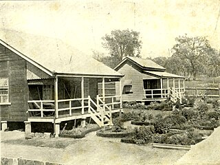
Willows Gemfields is a rural town in the locality of Willows in the Central Highlands Region of Queensland, Australia. In the 2021 census, the town of Willows Gemfields had a population of 101 people.

Dingo is a rural town and locality in the Central Highlands Region, Queensland, Australia. In the 2021 census, the locality of Dingo had a population of 221 people.

Bauhinia is a rural town in the Central Highlands Region and a rural locality split between the Central Highlands Region and the Aboriginal Shire of Woorabinda, both in Queensland, Australia. In the 2021 census, the locality of Bauhinia had a population of 28 people.
Ferny Glen is a rural locality in the Scenic Rim Region, Queensland, Australia. In the 2021 census, Ferny Glen had a population of 91 people.

Frenches Creek is a rural locality in the Scenic Rim Region, Queensland, Australia. In the 2021 census, Frenches Creek had a population of 91 people.
Wilkesdale is a rural locality in the South Burnett Region, Queensland, Australia. In the 2021 census, Wilkesdale had a population of 101 people.
Wyalla is a rural locality in the South Burnett Region, Queensland, Australia. In the 2021 census, Wyalla had a population of 43 people.
Myall Park is a rural locality, north of Miles, in the Western Downs Region, Queensland, Australia. In the 2021 census, Myall Park had a population of 17 people.
Coorumbene is a rural locality in the Central Highlands Region, Queensland, Australia. In the 2021 census, Coorumbene had a population of 40 people.
Barnard is a rural locality in the Central Highlands Region, Queensland, Australia. In the 2021 census, Barnard had a population of 32 people.
Mimosa is a rural locality in the Central Highlands Region, Queensland, Australia. In the 2021 census, Mimosa had a population of 23 people.
Goomally is a rural locality in the Central Highlands Region, Queensland, Australia. In the 2021 census, Goomally had "no people or a very low population".
Wooroona is a rural locality in the Central Highlands Region, Queensland, Australia. In the 2021 census, Wooroona had a population of 12 people.
Oombabeer is a rural locality in the Central Highlands Region, Queensland, Australia. In the 2021 census, Oombabeer had a population of 45 people.
Gainsford is a rural locality in the Central Highlands Region, Queensland, Australia. In the 2021 census, Gainsford had a population of 32 people.

Rewan is a rural locality in the Central Highlands Region, Queensland, Australia. In the 2021 census, Rewan had a population of 49 people.
Balcomba is a rural locality split between the Central Highlands Region and the Aboriginal Shire of Woorabinda, Queensland, Australia. In the 2021 census, Balcomba had a population of 29 people.
Wallaroo is a rural locality split between the Central Highlands Region and the Aboriginal Shire of Woorabinda, Queensland, Australia. In the 2021 census, Wallaroo had "no people or a very low population".
Glenroy is a rural locality in the Rockhampton Region, Queensland, Australia. In the 2021 census, Glenroy had a population of 19 people.
Johnsons Hill is a rural locality in the Rockhampton Region, Queensland, Australia. In the 2021 census, Johnsons Hill had a population of 7 people.


