Mugamba natural region

Last updated
Mugamba natural region
Région naturelle de Mugamba
Natural region
Road between Bujumbura and Makamba - Flickr - Dave Proffer (1).jpg
Hilly landscape, typical of the Mugamba region
Burundi physical map.svg
Red pog.svg
Mugamba natural region
Coordinates: 3°23′05″S29°34′54″E / 3.3846°S 29.5817°E / -3.3846; 29.5817
CountryBurundi

The Mugamba natural region is a natural region of Burundi. It extends along the ridge that divides the Congo watershed from the Nile watershed, and contains the highest peaks in the country.

Contents

Geography

The Mugamba ("Cow") region (Région naturelle de Mugamba) was a region where livestock were the basis of the economy. [1] The Mugamba region extends from north to south through the east of Cibitoke Province, the west of Kayanza Province and Muramvya Province, the east of Bujumbura Province, the west of Mwaro Province and the north of Bururi Province. [2] Mugamba contains the highest peaks of the country: Heha at 2,670 metres (8,760 ft), Teza at 2,655 metres (8,711 ft) and Twinyoni at 2,652 metres (8,701 ft). [3]

The Mugamba region has the geological particularity of being a sharing zone of the hydrographic basins of the two largest rivers in Africa: the Congo and the Nile. [4] The Congo-Nile ridge is now almost entirely covered by artificial afforestation which has replaced the original cover. [5]

Climate

This region is characterized by high relief (2,300 m on average) and annual temperatures between 14° and 17 °C .

The mountainous area experiences a significant annual rainy cycle (between 1300 and 2300 mm /year) with a peak in precipitation observed in September. [6] [5]

Anthropology

Historic populations in this area have created shelters to protect themselves from the relatively low temperatures and high precipitation of this area. The rugo , or traditional Burundian house or housing complex, of this area includes dwellings of all the members of the same family, and is surrounded by a bamboo fence. The dimension of the house is determined by the size of a person lengthened on the ground, extending their right hand outward. A stake having to be used for the tracing of the diameter of the house is then fixed at the end of the finger (the major one). This dimension is function of the social status and the needs for the owner. [7]

The round-shaped main house is surrounded by two large enclosures demarcating the front courtyard ("urugo") and the rear courtyard ("ikigo"). The forecourt ("ikirugu") serves as a livestock park. A hearth ("igicaniro") placed in the center protects these animals against flies. Next to it, there is a pole ("icishinzo") traditionally placed there for cows to rub against. In each enclosure, there are smaller dwellings.

World Heritage Status

This site was added to the UNESCO World Heritage Tentative List on May 9, 2007, in the Cultural category. [7]

Related Research Articles

<span class="mw-page-title-main">Geography of Rwanda</span>

Rwanda is located in East Africa, to the east of the Democratic Republic of the Congo, at the co-ordinates 2°00′S30°0′E.

<span class="mw-page-title-main">South Kivu</span> Province of the Democratic Republic of the Congo

South Kivu is one of 26 provinces of the Democratic Republic of the Congo (DRC). Its capital is Bukavu.
<span class="mw-page-title-main">Bubanza Province</span> Province of Burundi

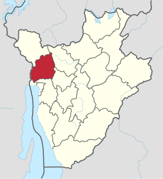
Bubanza is one of the 18 provinces of Burundi.

<span class="mw-page-title-main">Bujumbura Mairie Province</span> Province of Burundi

Bujumbura Mairie Province is one of the eighteen provinces of Burundi. It consists entirely of the city of Bujumbura, Burundi's former capital.

<span class="mw-page-title-main">Bujumbura Rural Province</span> Province of Burundi

Bujumbura Rural Province is one of the eighteen provinces of Burundi. Former President Cyprien Ntaryamira was born here. It surrounds the former national capital Bujumbura and its provincial capital is Isale.

<span class="mw-page-title-main">Bururi Province</span> Province of Burundi

Bururi Province is one of the eighteen provinces of Burundi. It was formerly Burundi's largest province until the communes of Burambi, Buyengero and Rumonge were transferred to the province of Rumonge when it was created in 2015.
<span class="mw-page-title-main">Cibitoke Province</span> Province of Burundi

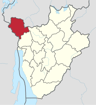
Cibitoke Province is one of the 18 provinces of Republic of Burundi.
<span class="mw-page-title-main">Kayanza Province</span> Province of Burundi

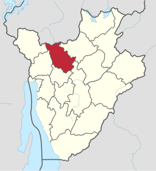
Kayanza Province is one of the 18 provinces of Burundi. Its capital city is also called Kayanza centre.
<span class="mw-page-title-main">Kirundo Province</span> Province of Burundi

Kirundo Province is one of the eighteen provinces of Burundi, in north of the country bordering Rwanda. The economy is mostly based on agriculture, with a dispersed population and few sizable communities. Before 1970 large parts of the province were forested. Migrants from the south then cleared much of the vegetation to create agricultural land, and Kirundo became the breadbasket of Burundi. The civil war from 1993 to 2005 caused agricultural output to drop by more than half. Sice then, lack of farm inputs, poor infrastructure and shortages of water have caused widespread poverty.

<span class="mw-page-title-main">Muramvya Province</span> Province of Burundi

Muramvya Province is one of the 18 provinces of Burundi. The capital city is Muramvya. In 2007 the province was added to the UNESCO World Heritage Tentative List.
<span class="mw-page-title-main">Mwaro Province</span> Province of Burundi

Mwaro Province is one of the 19 provinces of Burundi. Its capital is Mwaro.
<span class="mw-page-title-main">Ruzizi River</span> River in Central Africa

The Ruzizi is a river, 117 kilometres (73 mi) long, that flows from Lake Kivu to Lake Tanganyika in Central Africa, descending from about 1,500 metres (4,900 ft) to about 770 metres (2,530 ft) above sea level over its length. The steepest gradients occur over the first 40 kilometres (25 mi), where hydroelectric dams have been built. Further downstream, the Ruzizi Plain, the floor of the Western Rift Valley, has gentle hills, and the river flows into Lake Tanganyika through a delta, with one or two small channels splitting off from the main channel.
<span class="mw-page-title-main">Gitega Province</span> Province of Burundi

Gitega is one of the 18 provinces of Burundi. Its capital is Gitega, which is also the national capital. It has a population of 725,223 as of 2008 and an area of 1,979 square kilometres (764 sq mi).

<span class="mw-page-title-main">Uvira</span> City in Democratic Republic of the Congo

Uvira is a city strategically located in the South Kivu Province of the eastern region of the Democratic Republic of the Congo (DRC). It is situated between Lake Tanganyika and the Mitumba Mountains, spanning approximately 16 square kilometers.

<span class="mw-page-title-main">Malagarasi River</span> River in Tanzania, Burundi

The Malagarasi River is a river in western Tanzania, flowing through Kigoma Region, although one of its tributaries comes from southeastern Burundi. The river also forms the western border of Tabora Region, the southern border of Kagera Region and the southwestern border of Geita Region. It is the second-longest river in Tanzania behind the Rufiji—Great Ruaha, and has the largest watershed of any river flowing into Lake Tanganyika. The Malagarasi-Muyovozi Wetlands are a designated a Ramsar site. Local tribes have nicknamed the Malagarasi as "the river of bad spirits".

<span class="mw-page-title-main">Itombwe Mountains</span> Mountain range in the Democratic Republic of the Congo

The Itombwe Mountains are a range of mountains in the South Kivu province of the Democratic Republic of the Congo (DRC). They run along the west shore of the northern part of Lake Tanganyika. They contain a vast area of contiguous montane forest and are home to a rich diversity of wildlife.

<span class="mw-page-title-main">Aux Rochers River</span> River in Quebec, Canada

Aux Rochers River, is a river in Sept-Rivières Regional County Municipality, Côte-Nord, Quebec, Canada. It drains an area of 4,180 square kilometres (1,610 sq mi). It is a tributary of the Gulf of Saint Lawrence

<span class="mw-page-title-main">Protected Aquatic Landscape of the North</span>

The Protected Aquatic Landscape of the North, also called the Northern Protected Waterway or Northern Protected Waterscape, is a protected area in Kirundo Province, Burundi. It covers eight lakes in the north of the province, and a forest. It was designated Ramsar site no. 2149 in March 2014.

<span class="mw-page-title-main">Lake Rwihinda</span> Lake in Burundi

Lake Rwihinda, also known as the Lac aux Oiseaux is a lake in the Kirundo Province of Burundi. It is home to diverse migratory birds, which are the main tourist attraction in the region. However, despite being protected, it is under threat from encroaching agriculture in this very poor region.

<span class="mw-page-title-main">Natural regions of Burundi</span>

The Natural regions of Burundi are geographical subdivisions of Burundi that date to colonial times. They can be broadly grouped into the Plain zone in the west beside Lake Tanganyika and the East African Rift valley, the Congo-Nile ridge, the Central Plateaus and the Depressions to the north, east and south of the plateaus.

References

  1. Irambona 2022.
  2. Atlas des quatre sites Ramsar, p. 12.
  3. Segamba et al. 1988, p. 1.
  4. "Le rugo traditionnel du Mugamba", UNESCO Centre du patrimoine mondial, retrieved 2023-05-01
  5. 1 2 http://www.decentralisation.gov.bi/pcdc%20comm/rumonge/MonoBurambi.pdf
  6. https://reliefweb.int/sites/reliefweb.int/files/resources/PLAN_DE_REPONSE_INONDATION_2015__final.pdf
  7. 1 2 Le rugo traditionnel du Mugamba - UNESCO World Heritage Centre

Sources