Mid-West Region, Ireland

Last updated

Mid-West
Mid-West Region Map Ireland 2018.png
The Mid-West of Ireland with each constituent county council highlighted.
CountryFlag of Ireland.svg  Ireland
Region Southern

The Mid-West is a strategic planning area within the Southern Region in Ireland. It is a NUTS Level III statistical region of Ireland (coded IE051). It consists of the counties of Clare and Tipperary, and the city and county of Limerick. Limerick City is the economic centre of the region. It spans 10,511 km2, 14.95% of the total area of the state and as of the 2022 census, it had a population of 505,369. [1]

Contents

Area

The constituent local authorities are the councils of the counties of Clare and Tipperary and the city and county of Limerick, which each send representatives to the Southern Regional Assembly, forming the Mid-West Strategic Planning Area Committee. [2]

The area of the Mid-West was expanded in 2018 as part of an EU-wide revision to NUTS areas, by the inclusion of the whole of County Tipperary. [3] [4] This reflected the merger of North Tipperary and South Tipperary as local government areas in 2014. Prior to 2018, South Tipperary was located in the South-East.

Former Regional Authority

Prior to 2014, the area was a region was administered by the Mid-West Regional Authority, which consisted of 26 elected representatives from the region's councils. [5] These representatives met once a month. The councils were:

The Regional Authorities were dissolved in 2014 and were replaced by Regional Assemblies. [6]

Shannon Development was a development body for the Shannon Region of the lower River Shannon, which encompassed the entire Mid-West Region together with North Kerry (in the South-West Region) and South Offaly (in the Midland Region). It too was dissolved in 2014.

Demographics

The Mid-West has a population of 473,269 which constitutes about 9.94% of Ireland's total population. [7]

The population density of the region is 45.02 persons/km2. Limerick City is the largest urban area in the region with a population of 102,000 people within the larger urban area including the city suburbs. [8]

Economy

The economy of the region is based mainly around the greater Limerick/Shannon corridor. The Shannon Free Zone, Shannon Airport, Shannon Estuary Ports, National Technology Park Limerick and major educational institutions such as the University of Limerick and Limerick Institute of Technology are major drivers of the regional economy with growth prospects in Biotechnology and medical technology, ICT, aerospace, tourism agribusiness and logistics. [9] The Dublin/Limerick corridor and the western corridor linking Galway/Ennis/Limerick/Cork is of strategic importance to the region. [9]

According to CSO figures for 2014, the region has a GDP of €12.116 bn and a GDP per capita of €31,792. [10]

[11] Eurostat figures for 2012, the region has GDP of €11.468 bn and a GDP per capita of €30,300

The 2016 unemployment rate is one of the lowest in Ireland at 6% (the same as that of Dublin). . [12]

The workforce in the region was 160,400 in 2003 which was an employment rate of 96.7% of which 61.8% were employed in services, 29.8% in Industry and 8.3% employed in agriculture. [9]

Agriculture remains a major part of the Mid-West economy. The Clare Marts in Ennis is a major trading post of livestock nationally. The plains of East Limerick are part of Ireland's Golden Vale that stretch from Limerick City into County Tipperary

According to the CSO, the mid-west in 2016 had the lowest value of land sold in Ireland of €16.5 million. Also, the Mid-West region had the lowest volume of land in Ireland of 2,898 acres which could in turn reduce income coming into this region. [13]

Transport

Shannon Airport is the only airport in the region with a wide range of flights available to Britain, continental Europe and transatlantic flights to the United States. The M7 is a high quality motorway connecting Dublin and Limerick. The N18/M18 including the Limerick Tunnel provides a complete bypass of Limerick and improved access to Shannon, Ennis and Galway. The N/M20 road/motorway provides access to Cork and Kerry.

Urban areas

A list of the largest urban areas and regionally important towns with a population of 1,000 or more in the Mid-West Region. County capitals are shown in bold.

RankTownCountyPopulation
(2016 census)
1 Limerick Limerick 94,192
2 Ennis Clare 25,276
3 Clonmel Tipperary 17,140
4 Shannon Clare 9,729
5 Nenagh Tipperary 8,968
6 Thurles Tipperary 7,940
7 Newcastle West Limerick 6,619
8 Carrick-on-Suir Tipperary 5,771
9 Roscrea Tipperary 5,446
10 Tipperary Tipperary 4,979
11 Cashel Tipperary 4,422
12 Cahir Tipperary 3,593
13 Annacotty Limerick 2,930
14 Kilrush Clare 2,719
15 Ballina Tipperary 2,632
16 Sixmilebridge Clare 2,625
17 Castleconnell Limerick 2,107
18 Abbeyfeale Limerick 2,023
19 Newport Tipperary 1,995
20 Templemore Tipperary 1,939
21 Newmarket-on-Fergus Clare 1,784
22 Kilmallock Limerick 1,668
23 Fethard Tipperary 1,545
24 Killaloe Clare 1,484
25 Caherconlish Limerick 1,476
26 Rathkeale Limerick 1,441
27 Ardnacrusha Clare 1,383
28 Murroe Limerick 1,377
29 Croom Limerick 1,159
30 Askeaton Limerick 1,137
31 Adare Limerick 1,129
32 Ennistymon Clare 1,045

Related Research Articles

<span class="mw-page-title-main">Munster</span> Traditional province in the south of Ireland

Munster is one of the four provinces of Ireland, located in the south of the island. In early Ireland, the Kingdom of Munster was one of the kingdoms of Gaelic Ireland ruled by a "king of over-kings". Following the Norman invasion of Ireland, the ancient kingdoms were shired into counties for administrative and judicial purposes. In later centuries, local government legislation has seen further sub-division of the historic counties.
<span class="mw-page-title-main">Limerick</span> City in Ireland

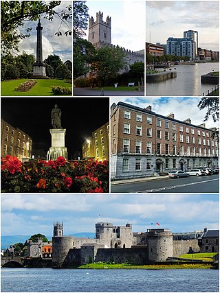
Limerick is a city in western Ireland, in County Limerick. It is in the province of Munster and is in the Mid-West which comprises part of the Southern Region. With a population of 102,287 at the 2022 census, Limerick is the third-most populous urban area in Ireland, and the fourth-most populous city on the island of Ireland. It was founded by Scandinavian settlers in 812, during the Viking Age.

<span class="mw-page-title-main">County Clare</span> County in Ireland

County Clare is a county in the province of Munster in the Southern part of the republic of Ireland, bordered on the west by the Atlantic Ocean. Clare County Council is the local authority. The county had a population of 127,938 at the 2022 census. The county seat and largest settlement is Ennis.

<span class="mw-page-title-main">County Limerick</span> County in mid-western Ireland

County Limerick is a western county in Ireland. It is in the province of Munster and is located in the Mid-West which comprises part of the Southern Region. It is named after the city of Limerick. Limerick City and County Council is the local council for the county. The county's population at the 2022 census was 209,536 of whom 102,287 lived in Limerick City, the county capital.

<span class="mw-page-title-main">County Tipperary</span> County in Ireland

County Tipperary is a county in Ireland. It is in the province of Munster and the Southern Region. The county is named after the town of Tipperary, and was established in the early 13th century, shortly after the Norman invasion of Ireland. It is Ireland's largest inland county and shares a border with eight counties, more than any other. The population of the county was 167,895 at the 2022 census. The largest towns are Clonmel, Nenagh and Thurles.
<span class="mw-page-title-main">Ennis</span> County town of County Clare, Ireland

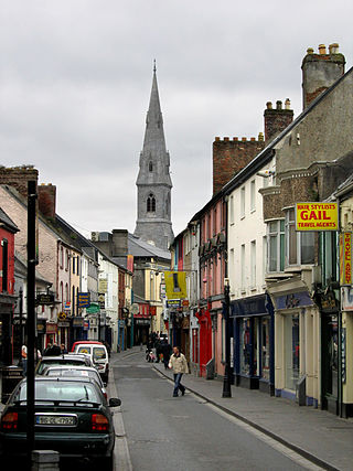
Ennis is the county town of County Clare, in the mid-west of Ireland. The town lies on the River Fergus, north of where the river widens and enters the Shannon Estuary. Ennis is the largest town in County Clare, with a population of 27,923, making it the 6th largest town, and 11th largest urban settlement, as of the 2022 census. Dating from the 12th century the town's Irish name is short for Irish: Inis Cluana Rámhfhada, meaning 'Island of the long rowing meadow', deriving from its location between two courses of the River Fergus.

<span class="mw-page-title-main">North Tipperary</span> Former Irish county (1899–2014)

North Tipperary was a county in Ireland in the province of Munster. It was named after the town of Tipperary and consisted of 48% of the land area of the traditional county of Tipperary. North Tipperary County Council was the local authority for the county. In 2011, the population of the county was 70,322.

<span class="mw-page-title-main">South Tipperary</span> Former Irish county (1899–2014)

South Tipperary was a county in Ireland in the province of Munster. It was named after the town of Tipperary and consisted of 52% of the land area of the traditional county of Tipperary. South Tipperary County Council was the local authority for the county. The population of the county was 88,433 according to the 2011 census. It was abolished on 1 June 2014, and amalgamated with North Tipperary to form County Tipperary under a new Tipperary County Council.

<span class="mw-page-title-main">Shannon, County Clare</span> Town in County Clare, Ireland

Shannon or Shannon Town, named after the river near which it stands, is a town in County Clare, Ireland. It was given town status on 1 January 1982. The town is located just off the N19 road, a spur of the N18/M18 road between Limerick and Ennis. It is the location of Shannon Airport, an international airport serving the Clare/Limerick region in the west of Ireland.

<span class="mw-page-title-main">Greater Dublin Area</span> Metropolitan area in Ireland

The Greater Dublin Area, or simply Greater Dublin, is an informal term that is taken to include the city of Dublin and its hinterland, with varying definitions as to its extent. At the expansive end, it has been defined as including all of the traditional County Dublin and three neighbouring counties, while more commonly it is taken as the contiguous metropolitan area of Dublin plus suburban and commuter towns. The area is defined for strategic planning, and, for example, transport, and it is not a formal administrative or political unit.

<span class="mw-page-title-main">Local government in the Republic of Ireland</span>

The functions of local government in the Republic of Ireland are mostly exercised by thirty-one local authorities, termed County, City, or City and County Councils. The principal decision-making body in each of the thirty-one local authorities is composed of the members of the council, elected by universal franchise in local elections every five years from multi-seat local electoral areas using the single transferable vote. Many of the authorities' statutory functions are, however, the responsibility of ministerially appointed career officials termed Chief executives. The competencies of the city and county councils include planning, transport infrastructure, sanitary services, public safety and the provision of public libraries. Each local authority sends representatives to one of three Regional Assemblies.

<span class="mw-page-title-main">South-West Region, Ireland</span> NUTS 3 region in Ireland

The South-West is a strategic planning area within the Southern Region in Ireland. It is a NUTS Level III statistical region of Ireland. It includes the city of Cork and the counties of Cork and Kerry. The South-West region spans 12,120 km2 (4,680 sq mi), roughly 16% of the total area of the state and according to the 2022 census has a population of 736,489.

<span class="mw-page-title-main">Midland Region, Ireland</span> NUTS 3 region in Ireland

The Midland Region is a NUTS Level III statistical region of Ireland. It consists of the territory of the counties of Laois, Offaly, Westmeath and Longford. The Midland Region spans 6,652 km2, 9.5% of the total area of the state and, according to the 2022 census, had a population of 317,999.
<span class="mw-page-title-main">Economy of Limerick</span>

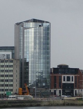
Limerick is the third largest city in the Republic of Ireland and is the capital of Ireland's Mid-West Region comprising the counties of Limerick, Clare and North Tipperary. Traditionally Limerick's economy was mainly agricultural of which a lot of industry in the city was based around due to the city's proximity to the Golden Vale. Important industries at this time were the bacon industry and Limerick lace which provided much employment. Limerick Port was also the main port on the west of Ireland where much this produce was exported. Today Limerick's economy is driven by a cluster of industrial and business parks located along the Limerick/Shannon corridor which include the National Technology Park, Raheen Business Park and the Shannon Free Zone. Limerick/Shannon is also classified as a gateway city as part of the National Spatial Strategy.

<span class="mw-page-title-main">West Region, Ireland</span> Strategic planning area and NUTS Region in Ireland

The West is a strategic planning area within the Northern and Western Region in Ireland. It is a NUTS Level III statistical region of Ireland under the Eurostat classification. It consists of the counties of Galway, Mayo and Roscommon, and the city of Galway. The West spans 13,801 km2 and as of the 2022 census has a population of 485,966.

<span class="mw-page-title-main">Mid-East Region, Ireland</span> Region of the Republic of Ireland

The Mid-East Region is a NUTS Level III statistical region of Ireland. It consists of the territory of the counties of Kildare, Louth, Meath and Wicklow. The Mid-East spans 6,891 km2, 9.8% of the total area of the state and, according to the 2022 census, had a population of 764,154, roughly 14.84% of the national population.
<span class="mw-page-title-main">Border Region</span> NUTS 3 statistical region of the Republic of Ireland

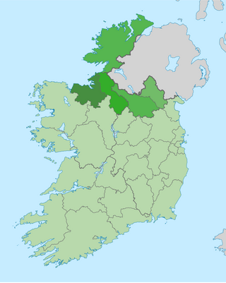
The Border Region is a NUTS Level III statistical region of Ireland. The name of the region refers to its location along the Republic of Ireland–United Kingdom border. It is not a cross-border region. It comprises the Irish counties of Cavan, Donegal, Leitrim, Monaghan and Sligo. The Border Region spans 11,516 km2, 16.4% of the total area of the state, and has a population of 419,473 persons as of the 2022 census, 8.14% of the state total.

<span class="mw-page-title-main">South-East Region, Ireland</span> NUTS region and strategic planning area in Ireland

The South-East is a strategic planning area within the Southern Region in Ireland. It is a NUTS Level III statistical region of Ireland. It comprises the counties of Carlow, Kilkenny and Wexford and the city and county of Waterford. The South-East spans 7,198 km2, 10.2% of the total area of the state and according to the 2016 census had a population of 422,062.

<span class="mw-page-title-main">Southern Region, Ireland</span> NUTS 2 region in Ireland

The Southern Region has been a region in Ireland since 1 January 2015. It is a NUTS Level II statistical region of Ireland.

<span class="mw-page-title-main">Eastern and Midland Region</span> NUTS 2 region in Ireland

The Eastern and Midland Region has been defined as a region in Ireland since 1 January 2015. It is a NUTS Level II statistical region of Ireland.

References

  1. "Press Statement Census of Population 2022 - Preliminary Results - CSO - Central Statistics Office". CSO. Retrieved 8 April 2023.
  2. Local Government Act 1991 (Regional Assemblies) (Establishment) Order 2014 ( S.I. No. 573 of 2014 ), "42. A regional assembly shall establish a strategic planning area committee in respect of each strategic planning area within the region, specified in column (2) of Schedule 3, consisting of the members of the regional assembly appointed by the constituent local authorities specified in column (3) of that Schedule opposite the mention in the said column (2) of the area, and of persons who are not members of the regional assembly, to perform functions, in respect of such area, in relation to the regional spatial and economic strategy in accordance with Chapter III of Part II of the Act of 2000 and any regulations or directions under that Act.". Signed on 16 December 2014. Statutory Instrument of the Government of Ireland .Retrieved from Irish Statute Book on 17 March 2022.
  3. "Revision to the Irish NUTS2 and NUTS3 regions". Central Statistics Office.
  4. Regulation (EU) No 2016/2066 of 21 November 2016 amending the annexes to Regulation (EC) No 1059/2003 of the European Parliament and of the Council on the establishment of a common classification of territorial units for statistics (NUTS)
  5. Local Government Act 1991 (Regional Authorities) (Establishment) Order 1993 ( S.I. No. 394 of 1993 ). Signed on 20 December 1993. Statutory Instrument of the Government of Ireland .Retrieved from Irish Statute Book on 17 March 2022.
  6. Local Government Act 1991 (Regional Authorities) (Amendment) Order 2014 ( S.I. No. 228 of 2014 ). Signed on 29 May 2014. Statutory Instrument of the Government of Ireland .Retrieved from Irish Statute Book on 19 January 2022.
  7. "Census 2016". Central Statistics Office.
  8. "Census of Population 2016" (PDF). Profile 1 – Geographical distribution. Central Statistics Office. 6 April 2017. p. 15. Retrieved 6 April 2017.
  9. 1 2 3 Irish Region Office - Regions of Ireland: Mid-West Region Archived 2011-07-19 at the Wayback Machine
  10. "County Incomes and Regional GDP 2014 - CSO - Central Statistics Office". Archived from the original on 23 March 2017.
  11. "Eurostat - Data Explorer". Archived from the original on 6 October 2014. Retrieved 6 October 2014.
  12. "Quarterly National Household Survey Quarter 4 2016 - CSO - Central Statistics Office". Archived from the original on 22 February 2017.
  13. "Agricultural Land Prices 2016 - CSO - Central Statistics Office". 27 October 2017.