This article includes a list of general references, but it lacks sufficient corresponding inline citations .(September 2018) |
Melmerby Beach Provincial Park is a provincial park located in Little Harbour, Nova Scotia, Canada.
This article includes a list of general references, but it lacks sufficient corresponding inline citations .(September 2018) |
Melmerby Beach Provincial Park is a provincial park located in Little Harbour, Nova Scotia, Canada.
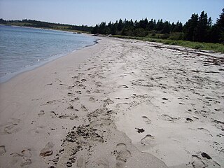
Melmerby Beach Provincial Park is located on Nova Scotia's North Shore, fronting the Northumberland Strait approximately 10 km (6.2 mi) northeast of New Glasgow. The sand barrier beach is approximately 2 km in length and connects Kings Head with Roy Island.
The provincial park was established on 26 July 1977.
The park takes its name from the sailing barque Melmerby, which was travelling from Quebec when it wrecked at the beach in 1890 with considerable loss of life. Before the sinking of the Melmerby, the beach was originally named King's Head Beach.


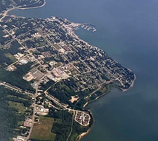
Digby is an incorporated town in southwestern Nova Scotia, Canada. It is in the historical county of Digby and a separate municipality from the Municipality of the District of Digby. The town is situated on the western shore of the Annapolis Basin near the entrance to the Digby Gut, which connects the basin to the Bay of Fundy.
The Nova Scotia Lifeguard Service is a Canadian lifeguard service operating in Nova Scotia.

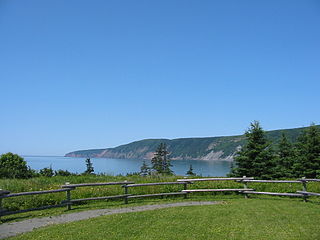
Blomidon Provincial Park is a camping and day-use provincial park located at Cape Blomidon on the shores of the Minas Basin in Nova Scotia, Canada. It is known for its hiking and for views over the world's highest tides. Blomidon is located on 1,875 acres (7.6 km2) of land with 600 ft high cliffs. It is accessible via Nova Scotia Route 358.
Dalem Lake Provincial Park is a provincial park located in the Canadian province of Nova Scotia on Boularderie Island.

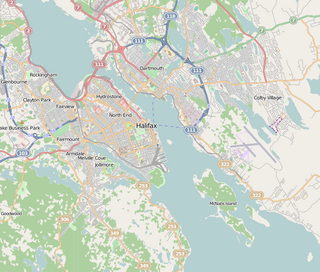
McNabs Island is the largest island in Halifax Harbour located in Halifax Regional Municipality, Nova Scotia, Canada. It played a major role in defending Halifax Harbour and is now a provincial park. The island was settled by Britons in the 1750s and later by Peter McNab, and McNab family members lived on the island until 1934.

The Sunrise Trail is a scenic roadway in the Canadian province of Nova Scotia. It is located along the province's North Shore on the Northumberland Strait for 333 km (207 mi) from Amherst to the Canso Causeway.
The Fleur-de-lis Trail is a scenic roadway located on Nova Scotia's Cape Breton Island. It is approximately 182 km (113 mi) long and runs along the southeastern part of the island through an Acadian region, with a 35 km (22 mi) spur route to and encircling Isle Madame, for a total distance of 217 km (135 mi).
Route 289 is a collector road in the Canadian province of Nova Scotia.

Hubbards is an unincorporated Canadian rural community on the South Shore of Nova Scotia.
Musquodoboit Harbour is a natural harbour in Canada on the Eastern Shore of Nova Scotia.
West Lawrencetown is a residential community within the Halifax Regional Municipality Nova Scotia on the Eastern Shore on Route 207 along the scenic route Marine Drive.
Porters Lake is a rural community in the Eastern Shore region of the Halifax, Nova Scotia, Canada, between Trunk 7 and Route 207, 27.8 km from Halifax. The residents mainly commute to jobs in Dartmouth, Burnside Industrial Park or in Downtown Halifax. The community is built around the lake from which it takes its name.

Nova Scotia is a province located in Eastern Canada fronting the Atlantic Ocean. One of the Maritime Provinces, Nova Scotia's geography is complex, despite its relatively small size in comparison to other Canadian provinces.

Cape Chignecto Provincial Park is a Canadian provincial park located in Nova Scotia. A wilderness park, it derives its name from Cape Chignecto, a prominent headland which divides the Bay of Fundy with Chignecto Bay to the north and the Minas Channel leading to the Minas Basin to the east. The park, which opened in 1998, is the largest provincial park in Nova Scotia. It also anchors one end of the UNESCO Cliffs of Fundy Global Geopark.

Taylor Head Beach is a provincial park on the Eastern Shore of Nova Scotia, Canada. It is located 11 km (6.8 mi) southwest of Sheet Harbour, near the community of Spry Bay.
Kings Head, Nova Scotia is a headland at the end of Melmerby Beach Provincial Park in the Canadian province of Nova Scotia, located in Pictou County. It was the site of a lighthouse of wooden construction marking the entrance to Merigomish Harbour 31. The light is no longer operational but the base building is now a private residence accessed by Levi White Road.

Ship Harbour is a rural community located along the Eastern Shore of Nova Scotia, Canada, in the Halifax Regional Municipality. It is situated at the head of a natural harbour of the same name which opens into the Atlantic Ocean. The community is located along Trunk 7, approximately 80 kilometres (50 mi) east of Halifax, Nova Scotia and 45 kilometres (28 mi) west of Sheet Harbour, Nova Scotia. The area was settled in 1783 by a group of Loyalists from the Royal Nova Scotia Volunteer Regiment. The mi'kmaq referred to the area as Tedumunaboogwek, meaning "water-worn rock". The name of the community was derived from the name of the harbour, which in turn was derived from a rock at the entrance to the harbour, named Ship Rock, as it resembles a vessel from a distance. Ship Harbour is home to the Ship Harbour Mussel Farm, one of the largest mussel farm in North America. It is also home to Ralph's Downeast Diner, a small diner on Highway 7. It was previously Family Fries. There is also a community hall that hosts meeting for the Lake Charlotte region. West Ship Harbour Road collides with Nova Scotia Trunk 7 in Ship Harbour, which connects Ship Harbour with Owls Head, Little Harbour, Clam Harbour, Clam Harbour Beach Provincial Park and Lake Charlotte. Some minor roads include: Head Ship Harbour Loop Road, River Road, Bruce Drive, Newcombes Lane, Eisan Point Road and Goose Lane.

Bayswater is a community in the Canadian province of Nova Scotia, located in the Chester Municipal District on the Aspotogan Peninsula in Lunenburg County on the Lighthouse Route. The community is home to Bayswater Beach Provincial Park, Swissair 111 Memorial, and All Saints Anglican Church.
Chance Harbour is a community in the Canadian province of Nova Scotia, located in Pictou County. It is situated 90 minutes from both Halifax and the scenic Cabot Trail and 30 minutes from the Caribou-Wood Islands Ferry. It is home to Melmerby Beach Provincial Park.

Cabots Landing Provincial Park is a small picnic and beach park on the shore of Aspy Bay in the community of Sugarloaf, 10 kilometres (6.2 mi) north of the Cabot Trail on Cape Breton Island, Nova Scotia, Canada.