Labis لابيس | |
---|---|
Coordinates: 2°22′55″N103°01′12″E / 2.38194°N 103.02000°E | |
Country | Malaysia |
State | Johor |
District | Segamat |
Government | |
• Type | Local government |
• Body | Labis District Council |
• President | Rudy Rizal Mohd Hanapi |
Area | |
• Total | 422 km2 (163 sq mi) |
Population (2010) | |
• Total | 36,053 |
• Density | 85/km2 (220/sq mi) |
Website | mdlabis |
Labis District Council Majlis Daerah Labis | |
---|---|
Type | |
Type | |
History | |
Founded | 29 December 1976 |
Preceded by | South Segamat District Council |
Leadership | |
President | Rudy Rizal Mohd Hanapi |
District Secretary | Fazaruddin Salamat |
Meeting place | |
Majlis Daerah Labis 85300 Labis, Segamat, Johor Darul Ta'zim | |
Website | |
www |
Labis is a town and a mukim (township) in Segamat District in northern Johor, Malaysia. A main trunk road that runs north-south Peninsular Malaysia passes through it, as well as the KTM railway line that connects it with the state's capital in the south, Johor Bahru. [1]
Labis started as a small village known as Kampung Paya Merah. The village got its name from a type of river grass which became the favorite food for river terrapins. In early 20th century, British officers came to the villages to survey for new areas to be developed in Segamat district.
The British officers were surprised to see the river terrapins since they had not seen those animals before. They asked the villagers the name of those animals and the villagers answered, "Labi-labi, tuan," ("River terrapins, sir"). Because they didn't know the name of those animals, the British officers referred to them as labis in the plural form. Therefore, the British officers decided to name the settlement Labis.
Another theory is that in the 17th century, a member of the Malaccan royal family was travelling through the area. He saw something that intrigued him. He called out to his advisors to tell him what it was, he went "Habis? Habis?" thus accidentally blurting out the name Labis.
Malays here planted paddy field and poultry as the main source of food, living in villages such as Kampung Paya Merah, Kampung Tenang and Kampung Sungai Gatom. During the British era, there was a rubber estate known as North Labis Estate was established and the British brought Indian labor as the workforce. During the communist insurgency around 1948, the government brought in Chinese ethnic to the town.
Labis is situated in the north of Johor, bordering the Segamat sub-district and the state of Pahang to the north, the mukim of Bekok to the east, the mukim of Pogoh to the west and the mukim of Cha’ah to the south.
Labis covers an area of 422 km2, making it the second largest mukim in Johor after Bekok. [2]
Labis town, along with the adjacent commune of Bekok and Cha’ah, are granted autonomy from Segamat and administered by the Labis District Council (Majlis Daerah Labis).
There is a waterfall known as Taka Melor famous among locals situated 15 km from the town near Pekan Air Panas and Kampung Tenang.
Labis is an agricultural town whose main export is rubber and is one of the main rubber producer in Johor.
School Code | School Name | Postcode | Coordinates |
---|---|---|---|
JBA7024 | Sekolah Kebangsaan Labis | 85300 | 2°22′52″N103°01′18″E / 2.3810°N 103.0218°E |
JBA7025 | Sekolah Kebangsaan Pekan Air Panas | 85300 | 2°28′26″N103°03′23″E / 2.4739°N 103.0564°E |
JBA7026 | Sekolah Kebangsaan Kampong Tenang | 85300 | 2°28′31″N103°04′06″E / 2.4754°N 103.0682°E |
JBA7027 | Sekolah Kebangsaan Sawah Bahru | 85300 | 2°28′18″N103°01′09″E / 2.4716°N 103.0191°E |
JBA7028 | Sekolah Kebangsaan Lktp Tenang | 85300 | 2°26′33″N103°02′26″E / 2.4425°N 103.0405°E |
JBA7031 | Sekolah Kebangsaan (Felda) Chemplak | 85300 | 2°22′45″N102°56′45″E / 2.3791°N 102.9457°E |
JBA7035 | Sekolah Kebangsaan (Felda) Redong | 85300 | 2°30′14″N103°00′57″E / 2.5038°N 103.0159°E |
JBA7040 | Sekolah Kebangsaan Lktp Maokil 1 | 85300 | 2°17′59″N102°58′03″E / 2.2997°N 102.9675°E |
JBA7042 | Sekolah Kebangsaan Segamat Kecil | 85300 | 2°32′42″N103°00′14″E / 2.5450°N 103.0039°E |
JBA7046 | Sekolah Kebangsaan Lktp Maokil 2 | 85300 | 2°17′27″N102°58′07″E / 2.2908°N 102.9687°E |
JBB7046 | Sekolah Kebangsaan Sri Labis | 85300 | 2°22′54″N103°01′03″E / 2.3818°N 103.0174°E |
JBC7012 | Sekolah Jenis Kebangsaan (Cina) Karas | 85300 | 2°21′20″N103°02′13″E / 2.3555°N 103.0370°E |
JBC7014 | Sekolah Jenis Kebangsaan (Cina) Labis | 85300 | 2°23′19″N103°01′07″E / 2.3886°N 103.0185°E |
JBC7018 | Sekolah Jenis Kebangsaan (Cina) Tenang | 85300 | 2°28′14″N103°03′10″E / 2.4705°N 103.0529°E |
JBD7061 | Sekolah Jenis Kebangsaan (Tamil) Labis | 85300 | 2°22′57″N103°01′03″E / 2.3825°N 103.0176°E |
School Code | School Name | Postcode | Coordinates |
---|---|---|---|
JEA5041 | Sekolah Menengah Kebangsaan Felcra Bukit Kepong | 85300 | 2°22′59″N102°55′02″E / 2.3830°N 102.9171°E |
JEA7037 | Sekolah Menengah Kebangsaan (Lktp) Maokil | 85300 | 2°17′33″N102°57′59″E / 2.2925°N 102.9663°E |
JEA7039 | Sekolah Menengah Kebangsaan Kamarul Ariffin | 85300 | 2°23′59″N103°01′51″E / 2.3997°N 103.0309°E |
JEB7032 | Sekolah Menengah Kebangsaan Labis | 85300 | 2°22′31″N103°00′52″E / 2.3752°N 103.0145°E |
JEE7033 | Sekolah Menengah Kebangsaan Munshi Ibrahim | 85300 | 2°23′39″N103°01′01″E / 2.3942°N 103.0169°E |
As of 2010, Labis has a total population of 36,053 people. It has a large Chinese community. [4]
The town is accessible from Labis railway station.
The Batu Pahat District is a district in the state of Johor, Malaysia. It lies southeast of Muar, southwest of Kluang, northwest of Pontian, south of Segamat and Tangkak District. The capital of the district is Bandar Penggaram.
The Segamat District or simply Segamat is a district in the Malaysian state of Johor. Segamat is also the name of the district's primary town.
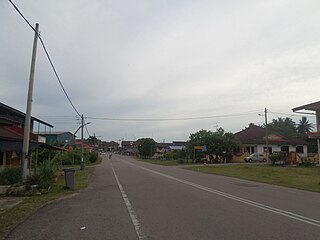
Kuala Dungun is a mukim and the capital of Dungun District, Terengganu, Malaysia. It is situated midway between Tanjung Jara and Paka.
The Jerantut District is a district in north-eastern Pahang, Malaysia. Jerantut is home to the National Park.
Buloh Kasap is a mukim in Segamat District, Johor, Malaysia which is located about 10 km (6 mi) from Segamat town center via Federal Route 1. Because of its location near Segamat, Buloh Kasap may also act as a satellite town of Segamat. Tun Razak Highway is located roughly about 4 km (2 mi) from Buloh Kasap.
Jementah is a mukim in Segamat District, Johor, Malaysia.
Rengit is a town and an autonomous sub-district in Mukim Sungai Kluang, Batu Pahat District, Johor, Malaysia. Rengit has more than 30 villages and 25 schools.
Chaah is a town and mukim in Segamat District, Johor, Malaysia. It is the southernmost mukim in the district, but it is administered as a suburb of Labis.
Bekok is a mukim in Segamat District, Johor, Malaysia. It is the western entrance to Endau Rompin National Park and has a waterfall known as Sungai Bantang Waterfall. Bekok also houses several aborigine settlements (Perkampungan Orang Asli), such as Kampung Kudong and Kampung Kemidak.
Air Panas, also spelt as Ayer Panas, is a small town in Labis, Segamat District, Johor, Malaysia, which is named after the hot springs available there. It is located about 14 km from Labis town via Jalan Ayer Panas. The town is also known as Tenang. A majority of the residents of the town are Chinese and Malay communities.
Renggam is a town and mukim in Kluang District, Johor, Malaysia.
Sik District is a district in Kedah, Malaysia. It is largest district in Kedah.
Mukim Seria is a mukim in Belait District, Brunei. It has an area of 169 square kilometres (65 sq mi); the population was 21,214 in 2016. The mukim encompasses Seria, one of the only two towns in the district. It is home to the oil and gas industry of the country.
Mukim Bangar is a mukim in Temburong District, Brunei. It has a total area of 113 square kilometres (44 sq mi); the population was 2,449 in 2016. The mukim encompasses Bangar, the district's sole town and administrative centre.
Kuala Pahang is a town ward and mukim in Pekan District, Pahang, Malaysia.
Tenang Stesen, commonly known as “Tenang”, is a small town in Segamat District, Johor, Malaysia. The town is located between Genuang and Labis. Pekan Air Panas is located in the same district also named as Tenang.
The Tampin District is a district in Negeri Sembilan, Malaysia. The district covers 878.69 square kilometres (339.26 sq mi) and is further divided into four adat socio-political provinces: Tampin Adat Territory, Air Kuning, Gemencheh and Gemas.