This article needs additional citations for verification .(August 2017) |
Klemme, Iowa | |
---|---|
Coordinates: 43°0′26″N93°36′5″W / 43.00722°N 93.60139°W Coordinates: 43°0′26″N93°36′5″W / 43.00722°N 93.60139°W | |
Country | United States |
State | Iowa |
County | Hancock |
Area | |
• Total | 0.50 sq mi (1.30 km2) |
• Land | 0.50 sq mi (1.30 km2) |
• Water | 0.00 sq mi (0.00 km2) |
Elevation | 1,220 ft (372 m) |
Population (2020) | |
• Total | 441 |
• Density | 882.00/sq mi (340.51/km2) |
Time zone | UTC-6 (Central (CST)) |
• Summer (DST) | UTC-5 (CDT) |
ZIP code | 50449 |
Area code | 641 |
FIPS code | 19-41655 |
GNIS feature ID | 0458123 |
Klemme is a city in Hancock County, Iowa, United States. The population was 441 at the time of the 2020 census. [2]
The city is named for Harmon J. Klemme, the original land owner. [3] Klemme was established in 1889, and incorporated in 1899. [4]
Harmon Klemme's Klemme home is preserved as the Klemme Homestead Museum. His home in Belmond, Iowa, where he lived for many years, is the Klemme House Bed and Breakfast.
A large wind farm is located southwest of Klemme.
Klemme is located at 43°0′26″N93°36′5″W / 43.00722°N 93.60139°W (43.007317, -93.601321) [5] near the East Branch Iowa River.
According to the United States Census Bureau, the city has a total area of 0.51 square miles (1.32 km2), all land. [6]
Year | Pop. | ±% |
---|---|---|
1900 | 262 | — |
1910 | 306 | +16.8% |
1920 | 468 | +52.9% |
1930 | 463 | −1.1% |
1940 | 528 | +14.0% |
1950 | 555 | +5.1% |
1960 | 615 | +10.8% |
1970 | 554 | −9.9% |
1980 | 620 | +11.9% |
1990 | 587 | −5.3% |
2000 | 593 | +1.0% |
2010 | 507 | −14.5% |
2020 | 441 | −13.0% |
Source: "U.S. Census website". United States Census Bureau . Retrieved 2020-03-29. and Iowa Data Center Source: |
As of the census [8] of 2010, there were 507 people, 219 households, and 132 families residing in the city. The population density was 994.1 inhabitants per square mile (383.8/km2). There were 252 housing units at an average density of 494.1 per square mile (190.8/km2). The racial makeup of the city was 98.6% White, 0.4% African American, 0.2% Asian, and 0.8% from two or more races. Hispanic or Latino of any race were 0.4% of the population.
There were 219 households, of which 29.7% had children under the age of 18 living with them, 42.9% were married couples living together, 11.0% had a female householder with no husband present, 6.4% had a male householder with no wife present, and 39.7% were non-families. 32.9% of all households were made up of individuals, and 15.1% had someone living alone who was 65 years of age or older. The average household size was 2.32 and the average family size was 2.87.
The median age in the city was 39.6 years. 26.2% of residents were under the age of 18; 6.3% were between the ages of 18 and 24; 23.6% were from 25 to 44; 27% were from 45 to 64; and 16.8% were 65 years of age or older. The gender makeup of the city was 49.1% male and 50.9% female.
As of the census [9] of 2000, there were 593 people, 246 households, and 170 families residing in the city. The population density was 1,161.0 inhabitants per square mile (448.3/km2). There were 268 housing units at an average density of 524.7 per square mile (202.6/km2). The racial makeup of the city was 98.82% White, 0.17% Asian, 1.01% from other races. Hispanic or Latino of any race were 3.04% of the population.
There were 246 households, out of which 27.2% had children under the age of 18 living with them, 59.8% were married couples living together, 5.7% had a female householder with no husband present, and 30.5% were non-families. 25.6% of all households were made up of individuals, and 14.2% had someone living alone who was 65 years of age or older. The average household size was 2.41 and the average family size was 2.90.
25.5% are under the age of 18, 7.6% from 18 to 24, 27.2% from 25 to 44, 19.1% from 45 to 64, and 20.7% who were 65 years of age or older. The median age was 36 years. For every 100 females, there were 94.4 males. For every 100 females age 18 and over, there were 90.5 males.
The median income for a household in the city was $32,614, and the median income for a family was $36,625. Males had a median income of $27,426 versus $18,281 for females. The per capita income for the city was $15,581. About 4.3% of families and 5.0% of the population were below the poverty line, including 1.9% of those under age 18 and 10.9% of those age 65 or over.
Belmond–Klemme Community School District serves the community. [10]
Klemme was long the home of the Klemme Community School District, which had a 1939 Public Works Administration building with a 1957 expansion for elementary grades. [11] Klemme High's last graduating class was the Class of 1990.[ citation needed ] The Belmond-Klemme district formed on July 1, 1994, as the Klemme district merged with the Belmond district. [12] The school building closed after the district consolidation. Luverne Schmidt and his wife bought the school building in 2000, replaced the roof and for a period operated a restaurant there. [11]
Wright County is a county in the U.S. state of Iowa. As of the 2020 census, the population was 12,943. The county seat is Clarion. The county organization became effective in January 1851, and is believed to be named either after Silas Wright, a governor of New York, or Joseph Albert Wright, a governor of Indiana.
Moulton is a city in Appanoose County, Iowa, United States. The population was 607 at the time of the 2020 census.
St. Olaf is a city in Clayton County, Iowa, United States. The population was 106 at the time of the 2020 census, down from 136 in 2000. Swiss Valley has a large cheese packaging plant in St. Olaf.
Maynard is a city in Fayette County, Iowa, United States. The population was 476 at the time of the 2020 census.
St. Lucas is a city in Fayette County, Iowa, United States. The population was 167 at the time of the 2020 census.
Goodell is a city in Hancock County, Iowa, United States. The population was 140 at the time of the 2020 census.
Kanawha is a city in Hancock County, Iowa, United States. The population was 658 at the time of the 2020 census.
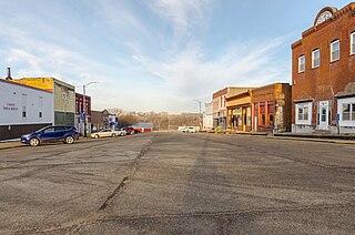
Hills is a city in Johnson County, Iowa, United States. It is part of the Iowa City, Iowa Metropolitan Statistical Area. The population was 863 at the time of the 2020 census. It is part of the Iowa City Community School District.
Wapello is a city in and the county seat of Louisa County, Iowa, United States. The population was 2,084 at the time of the 2020 census.
Braddyville is a city in Page County, Iowa, United States. The population was 147 at the 2020 census.
Runnells is a city in the southeastern corner of Polk County, Iowa, United States. The population was 457 at the time of the 2020 census. It is part of the Des Moines–West Des Moines Metropolitan Statistical Area.
Carson is a city in Pottawattamie County, Iowa, United States. The population was 766 at the 2020 census.
Macedonia is a city in Pottawattamie County, Iowa, United States. The population was 267 at the time of the 2020 census.
Dixon is a city in Scott County, Iowa, United States. The population was 202 at the time of the 2020 census.
Donahue is a city in Scott County, Iowa, United States. The population was 335 at the 2020 census. The city has a mayor-council form of government.
Maysville is a city in Scott County, Iowa, United States. The population was 156 at the time of the 2020 census.
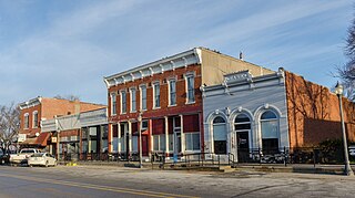
Belmond is a city in Wright County, Iowa, United States. It is located along U.S. Route 69, 14 miles (23 km) by road from Clarion, the county seat. The population was 2,463 in the 2020 census, a decline from 2,560 in 2000.
Rowan is a city in Wright County, Iowa, United States. The population was 123 at the time of the 2020 census.
New Trier is a city in Dakota County, Minnesota, United States. The population was 112 at the 2010 census. Minnesota Highway 50 serves as a main route in the community.
Savoy is a city in Fannin County, Texas, United States. The population was 831 at the 2010 census.