
Lowestoft is a coastal town and civil parish in the East Suffolk district of Suffolk, England. As the most easterly UK settlement, it is 38 miles (61 km) north-east of Ipswich and 22 miles (35 km) south-east of Norwich, and the main town in its district. Its development grew with the fishing industry and as a seaside resort with wide sandy beaches. As fishing declined, oil and gas exploitation in the North Sea in the 1960s took over. While these too have declined, Lowestoft is becoming a regional centre of the renewable energy industry. In 2021 the built-up area had a population of 71,327 and the parish had a population of 47,879.
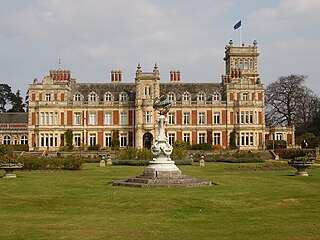
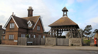
Somerleyton is a village and former civil parish, now in the parish of Somerleyton, Ashby and Herringfleet, in the East Suffolk district, in the north of the English county of Suffolk. It is 4.5 miles (7.2 km) north-west of Lowestoft and 5.5 miles (8.9 km) south-west of Great Yarmouth. The village is closely associated with Somerleyton Hall and was largely rebuilt as a model village in the 19th century at the direction of Samuel Morton Peto. The parish was combined with Herringfleet and Ashby to create the parish of "Somerleyton, Ashby and Herringfleet" on 1 April 1987.
Gorleston-on-Sea, historically and colloquially known as Gorleston, is a seaside town in the borough of Great Yarmouth in Norfolk, England. It lies to the south of Great Yarmouth, on the opposite side of the mouth of the River Yare. Historically in Suffolk, it was a port town at the time of the Domesday Book. It was incorporated into Great Yarmouth in 1836. Gorleston's port became a centre of fishing for herring along with salt pans used for the production of salt to preserve the fish. In Edwardian times the fishing industry rapidly declined and the town's role changed to that of a seaside resort.
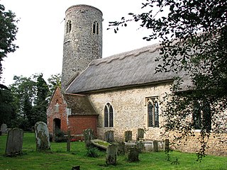
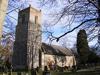
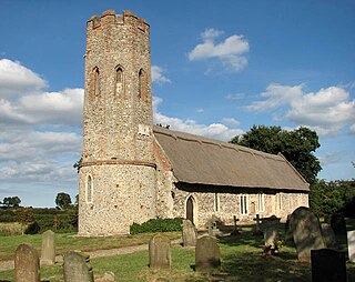
Corton is a village and civil parish in the north of the English county of Suffolk. It is 3 miles (4.8 km) north of the centre of Lowestoft in the East Suffolk district. The village is on the North Sea coast with the county border with Norfolk to the north.
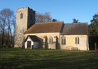
Blundeston is a village and civil parish in the north of the English county of Suffolk. It is 3.5 miles (5.6 km) north-west of Lowestoft, 6 miles (9.7 km) south of Great Yarmouth and around 1.75 miles (2.82 km) inland from the North Sea coast. It is part of the area known as Lothingland in the East Suffolk district. Blundeston Prison was located on the southern edge of the village but closed in early 2014.
Woodton is a village and civil parish in the English county of Norfolk. It is situated some 7 km north-west of the Suffolk town of Bungay, and 20 km south-east of Norwich.
The Centre for Environment, Fisheries and Aquaculture Science (Cefas) is an executive agency of the United Kingdom government Department for Environment, Food and Rural Affairs (Defra). It carries out a wide range of research, advisory, consultancy, monitoring and training activities for a large number of customers around the world.
Sotterley, originally Southern-lea from its situation south of the river, is a village and civil parish in the East Suffolk district, in the English county of Suffolk, located approximately 4 miles (6 km) south-east of Beccles and 1.5 miles (2 km) east of Willingham St Mary and Shadingfield. The parish is primarily agricultural with a dispersed population of 113 at the 2011 census. The parish council operates to administer jointly the parishes of Shadingfield, Willingham St Mary, Sotterley and Ellough.
Rushmere is a village and civil parish in the East Suffolk district of the English county of Suffolk. The village is around 5 miles (8.0 km) south-west of Lowestoft and 5+1⁄2 miles (8.9 km) south-east of Beccles. Neighbouring parishes include Gisleham, Henstead with Hulver Street and Mutford. The Hundred River forms the southern boundary of the parish.
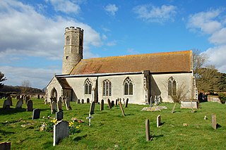
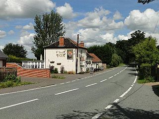
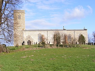
Lound is a village and civil parish in the north of the English county of Suffolk. It is 4.5 miles (7.2 km) north of Lowestoft, 5 miles (8.0 km) south of Great Yarmouth in the East Suffolk district. It is 2 miles (3.2 km) from the North Sea coast at Hopton-on-Sea and is on the border with the county of Norfolk.
Willingham St Mary, also known simply as Willingham, is a village and civil parish in the English county of Suffolk located about 3.5 miles (6 km) south of Beccles in the East Suffolk district. At the 2011 United Kingdom census it had a population of 152.
Ellough is a civil parish in the East Suffolk district of the English county of Suffolk, located approximately 3 miles (5 km) south-east of Beccles. The area is sparsely populated with a mid-2005 population estimate of 40. The parish, which has an area of 4.5 square kilometres (1.7 sq mi), borders Worlingham, North Cove, Mutford, Weston, Sotterley, Willingham St Mary and Henstead with Hulver Street. The parish council operates to administer jointly the parishes of Shadingfield, Willingham St Mary, Sotterley and Ellough.
Weston is a village and civil parish in the English county of Suffolk. It is around 2 miles (3 km) south of Beccles in the East Suffolk district. The parish lies either side of the A145 road and is crossed by the Ipswich to Lowestoft railway line. Neighbouring parishes include Ellough, Ringsfield, Willingham St Mary and Shadingfield. The village is largely dispersed with a population of around 230.
Pakefield is a suburb of the town of Lowestoft, in the East Suffolk district, in the north of the English county of Suffolk. It is located around 2 miles (3.2 km) south of the centre of the town. It 2011 the ward had a population of 6,563.
Ashby is a former civil parish, now in the parish of Somerleyton, Ashby and Herringfleet, in the East Suffolk district, in the north of the English county of Suffolk. It is 5+1⁄2 miles (8.9 km) north-west of Lowestoft.
Gunton is a suburb of Lowestoft, in the East Suffolk district, in the English county of Suffolk. Gunton was a small coastal village, but over the years it has been suburbanised. Gunton has an estimated population of 6,640. The main A12 or Yarmouth Road runs through the area. The eastern part of Gunton, from Yarmouth Road to Gunton Cliff, is one of the most affluent parts of Lowestoft, after the North Broads area of Oulton Broad.
Naughton is a village and former civil parish, now in the civil parish of Nedging-with-Naughton, in the Babergh district, in the county of Suffolk, England. It is 10 miles (16 km) north-west of Ipswich and 7 miles (11 km) south-west of Stowmarket. It was historically within the Cosford Hundred of Suffolk. The civil parish was merged with Nedging on 1 April 1935 to create "Nedging with Naughton". In 1931 the civil parish had a population of 98.
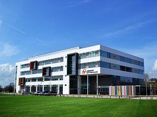
Lowestoft Sixth Form College is a sixth-form college in the town of Lowestoft in the English county of Suffolk. The college opened in September 2011, replacing sixth form provision in the existing high schools in Lowestoft. The college is a member of the Sixth Form College Association, Association of Colleges and the Association of Colleges Eastern Region. The current principal is Mr. David Gartland. Students come to Lowestoft Sixth Form College mainly from high schools in the local area of North Suffolk and South Norfolk.
John Louth Clemence was an English architect, active in Suffolk, particularly Lowestoft.
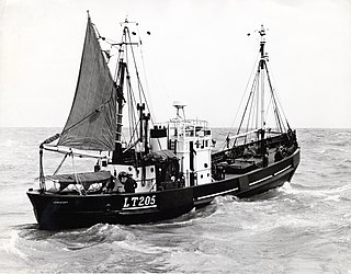
RV Platessa (LT205) was a fisheries research vessel that was operated by the Ministry of Agriculture, Fisheries and Food - Directorate of Fisheries, now known as the Centre for Environment, Fisheries and Aquaculture Science (Cefas) between 1946 and 1967.

