Kearney Regional Airport

Last updated
Kearney Regional Airport
EAR airport logo.png
Kearney-6apr1999.jpg
Summary
Airport typePublic
OwnerCity of Kearney
Serves Kearney, Nebraska
Location Center Township, Buffalo County, Nebraska
Elevation  AMSL 2,131 ft / 650 m
Coordinates 40°43′37″N099°00′24″W / 40.72694°N 99.00667°W / 40.72694; -99.00667
Website www.FlyKearney.com
Map
USA Nebraska relief location map.svg
Airplane silhouette.svg
EAR
Usa edcp relief location map.png
Airplane silhouette.svg
EAR
Runways
Direction LengthSurface
ftm
18/367,0942,162Concrete
13/314,4981,371Concrete
Statistics (2021)
Aircraft operations (year ending 10/31/202121,770
Based aircraft33

Kearney Regional Airport( IATA : EAR, ICAO : KEAR, FAA LID : EAR) (formerly Kearney Municipal Airport) is an airport five miles northeast of Kearney in Buffalo County, Nebraska. [1] Denver Air Connection provides scheduled passenger service to Denver which is supported by the Essential Air Service.

Contents

Federal Aviation Administration records say the airport had 11,956 passenger boardings (enplanements) in calendar year 2008, [2] 10,113 in 2009 and 9,530 in 2010. [3] The National Plan of Integrated Airport Systems for 2011–2015 categorized it as a primary commercial service airport based on enplanements over 10,000 in 2008, [4] but is non-primary commercial service based on enplanements in 2010.

History

In 1940 Kearney had a population of 9,643. In the early 1940s, three Nebraska cities, Kearney, Grand Island and Hastings joined to form the Central Nebraska Defense Council when it was learned that the United States Army Air Forces was considering the site for a military airfield. The group attempted to convince Washington that central Nebraska was suitable. Kearney and Grand Island effectively competed as locations for defense airports which would serve as storage for aircraft made at Offutt Field and the Glenn L. Martin Bomber Plant near Omaha.

As early as 1941 the City of Kearney voted on a $60,000 bond to finance a new airport. Kearney Regional Airport began as Keens Municipal Airport. The cost was more than $360,000, with the balance funded by the Works Progress Administration (WPA). Construction began at the site on Highway 30 on October 21, 1941, and was dedicated as Keens Airport on August 23, 1942, with asphalt runways and one hangar. A handful of buildings from the military era remain at Kearney Airport, notably Hangar #385.

The first airline flights were Mid-West Cessna 190s in 1950–52, then Frontier DC-3s appeared in 1959. Frontier's Convairs lasted until 1979.

In 2008, a newly constructed Armed Forces Reserve Center at the airport housing non-flying units of both the U.S. Army Reserve and the Nebraska Army National Guard was dedicated. [5]

In December 2022, U.S. Sen. Deb Fisher (R) announced that Kearney Regional Airport had been earmarked as the recipient of a $6.28 million grant from the Federal Aviation Administration. According to Mike Morgan, the City Manager of Kearney, funds allocated by the grant will go toward a variety of facility renovation and expansion projects that should enable the airport to "meet the increased passenger demand for years to come." The federal grant comes on the heels of several years of record growth at the airport and a construction project, contracted out by the city of Kearney earlier that year, for a $4.77 million expansion that would increase the terminal building's size by 64% and include an additional TSA screening checkpoint, a baggage scanner, greater secure holding space, and more baggage storage and family restrooms. [6] [7]

Facilities

Kearney Regional Airport covers 2,500 acres (1,012 ha) at an elevation of 2,131 feet (650 m). It has two runways: 18/36 is 7,094 by 100 feet (2,162 x 30 m) concrete; 13/31 is 4,498 by 75 feet (1,371 x 23 m) concrete. [1]

In the year ending October 31, 2021 the airport had 21,770 aircraft operations, average 60 per day: 87% general aviation, 10% airline, 3% air taxi, and <1% military. 33 aircraft were then based at the airport: 25 single-engine, 3 multi-engine, 3 jet, and 3 helicopter. [1]

Airline and destinations

Passenger

AirlinesDestinations
Denver Air Connection Denver (ends October 31, 2024) [8]
United Express Denver (resumes November 1, 2024) [9]

Cargo

AirlinesDestinations
Baron Aviation Services Omaha
Suburban Air Freight Omaha

See also

Related Research Articles

Cortez Municipal Airport is three miles southwest of Cortez, in Montezuma County, Colorado, United States. It has passenger service from one airline: Key Lime Air DBA Denver Air Connection.

Worland Municipal Airport is in Washakie County, Wyoming, three miles south of Worland, which owns it. It was built in 1953. It has no scheduled airline service; Great Lakes Airlines pulled out on September 30, 2016.

<span class="mw-page-title-main">Laramie Regional Airport</span> Airport

Laramie Regional Airport is three miles west of Laramie, in Albany County, Wyoming. It is owned by the Laramie Regional Airport Board. Airline service is subsidized by the Essential Air Service program.

<span class="mw-page-title-main">Cedar City Regional Airport</span> Airport in Utah

Cedar City Regional Airport is two miles northwest of Cedar City, in Iron County, Utah. It is owned by the Cedar City Corporation. Airline flights are subsidized by the Essential Air Service program.
<span class="mw-page-title-main">Central Nebraska Regional Airport</span> Airport in Nebraska

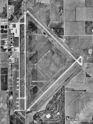
Central Nebraska Regional Airport is three miles northeast of Grand Island, in Hall County, Nebraska. It is owned by the Hall County Airport Authority. The airport sees two airlines, Allegiant Air which flies independently and American Eagle which is subsidized by the federal Essential Air Service program. In 2016 the airport had 68,879 passenger boardings (enplanements), a 6.6% increase from the 64,602 enplanements in 2015. The airport had 7,961 enplanements in calendar year 2008, 20,136 in 2009 and 37,101 in 2010.

<span class="mw-page-title-main">North Platte Regional Airport</span> Airport in North Platte, Nebraska, USA

North Platte Regional Airport is a public airport three miles east of North Platte, in Lincoln County, Nebraska. It is owned by the North Platte Airport Authority and sees one airline, subsidized by the Essential Air Service program.

<span class="mw-page-title-main">Western Nebraska Regional Airport</span> Airport in Scotts Bluff County, Nebraska

Western Nebraska Regional Airport is three miles east of Scottsbluff, in Scotts Bluff County, Nebraska. The airport is owned by the Airport Authority of Scotts Bluff County and is named after William B. Heilig. Known as "Scottsbluff's Mr. Aviation," he was a World War II United States Army Air Force primary flight instructor, a civil flight instructor, and manager of the city's airport.

<span class="mw-page-title-main">Show Low Regional Airport</span> Airport in Navajo County, Arizona

Show Low Regional Airport is 2 miles east of Show Low, in Navajo County, Arizona, United States. It is used for general aviation and commercial services provided by Southern Airways Express which is subsidized by the federal government's Essential Air Service program at a cost of $1,672,000(per year). The National Plan of Integrated Airport Systems for 2011–2015 categorized it as a non-primary commercial service airport.
<span class="mw-page-title-main">San Luis Valley Regional Airport</span> Airport in Colorado, United States of America

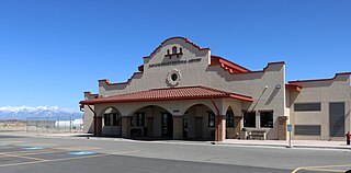
San Luis Valley Regional Airport is two miles south of Alamosa, in Alamosa County, Colorado, United States. It sees one airline, subsidized by the Essential Air Service program. The airport reached 10,000 enplanements for the first time in its EAS participation with Boutique Air and is now classified as a non-hub primary airport.
<span class="mw-page-title-main">Dodge City Regional Airport</span> Airport

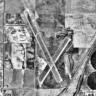
Dodge City Regional Airport is three miles east of Dodge City, in Ford County, Kansas. It is used for general aviation and is subsidized by the Essential Air Service program.

<span class="mw-page-title-main">Liberal Mid-America Regional Airport</span> Airport

Liberal Mid-America Regional Airport is two miles west of Liberal, in Seward County, Kansas. It is used for general aviation and is subsidized by the Essential Air Service program. Formerly Liberal Municipal Airport, it hosts the Mid-America Air Museum.

<span class="mw-page-title-main">Waynesville–St. Robert Regional Airport</span> Airport in Fort Leonard Wood

Waynesville-St. Robert Regional Airport, also known as Forney Field, is a public and military use airport located at Fort Leonard Wood in Pulaski County, Missouri, United States. The airport's passenger terminal is operated under the control of the U.S. Army and general aviation is under the direction of a board named by the cities of Waynesville and St. Robert. Formerly known as Waynesville Regional Airport at Forney Field, it is served by one commercial airline with scheduled service subsidized by the Essential Air Service program.

<span class="mw-page-title-main">Falls International Airport</span> Airport

Falls International Airport is a city-owned public-use airport located in International Falls, a city in Koochiching County, Minnesota, United States. It is mostly used for general aviation but is also served by one commercial airline with scheduled passenger service subsidized by the Essential Air Service program.

<span class="mw-page-title-main">Wrangell Airport</span> Airport

Wrangell Airport is a state-owned public-use airport located one nautical mile (2 km) northeast of the central business district of Wrangell, a city and borough in the U.S. state of Alaska which has no road access to the outside world. Scheduled airline service is subsidized by the Essential Air Service program.
<span class="mw-page-title-main">Petersburg James A. Johnson Airport</span> Airport

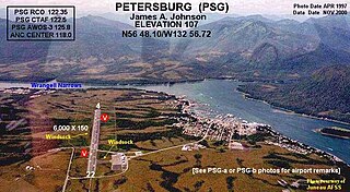
Petersburg James A. Johnson Airport is a state owned, public use airport located one nautical mile (2 km) southeast of the central business district of Petersburg, a city in the Petersburg Borough of the U.S. state of Alaska that has no road access to the outside world. Airline service is subsidized by the Essential Air Service program.

<span class="mw-page-title-main">Yakutat Airport</span> Airport serving Yakutat, Alaska, United States

Yakutat Airport is a state-owned public-use airport located three nautical miles (6 km) southeast of the central business district of Yakutat, a city and borough in the U.S. state of Alaska which has no road access to the outside world. Airline service is subsidized by the Essential Air Service program.

<span class="mw-page-title-main">Brownwood Regional Airport</span> Airport

Brownwood Regional Airport is six miles north of Brownwood, in Brown County, Texas. The National Plan of Integrated Airport Systems for 2011–2015 categorized it as a general aviation facility. The 21st Cavalry Brigade of the III Corps, U.S. Army uses the airport for training in Apache and Blackhawk helicopters.

<span class="mw-page-title-main">Norfolk Regional Airport</span> Airport

Norfolk Regional Airport is four miles southwest of Norfolk, in Madison County, Nebraska. The airport is named for Karl Stefan, a local newspaper editor and radio announcer who served several terms in the United States Congress. Until March 2011 it was known as Karl Stefan Memorial Airport. The FAA's National Plan of Integrated Airport Systems for 2011–2015 categorized it as a general aviation facility.
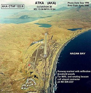
<span class="mw-page-title-main">Atka Airport</span> Airport in Atka Island

Atka Airport is a state-owned, public use airport located two nautical miles (4 km) north of the central business district of Atka, a city on Atka Island in the U.S. state of Alaska. Scheduled commercial airline passenger service is subsidized by the Essential Air Service program.

Akhiok Airport is a state-owned public-use airport located one nautical mile (2 km) southwest of the central business district of Akhiok, a city in the Kodiak Island Borough of the U.S. state of Alaska.

References

  1. 1 2 3 4 FAA Airport Form 5010 for EAR PDF . Federal Aviation Administration. Effective July 13, 2023.
  2. "Enplanements for CY 2008" (PDF, 1.0 MB). CY 2008 Passenger Boarding and All-Cargo Data. Federal Aviation Administration. December 18, 2009.
  3. "Enplanements for CY 2010" (PDF, 189 KB). CY 2010 Passenger Boarding and All-Cargo Data. Federal Aviation Administration. October 4, 2011.
  4. "2011–2015 NPIAS Report, Appendix A" (PDF). National Plan of Integrated Airport Systems. Federal Aviation Administration. October 4, 2010. Archived from the original (PDF, 2.03 MB) on September 27, 2012.
  5. https://nebraska.tv/archive/kearney-armed-forces-readiness-center-dedicated [ bare URL ]
  6. "$4.77 million bid approved for Kearney airport terminal expansion". ksnblocal4.com. 14 September 2022. Retrieved April 12, 2023.
  7. "Set to arrive at Kearney airport: $6.28 million grant to grow facility". nebraskaexaminer.com. Retrieved April 12, 2023.
  8. https://www.regulations.gov/document/DOT-OST-1996-1715-0177 [ bare URL ]
  9. https://www.regulations.gov/document/DOT-OST-1996-1715-0177 [ bare URL ]

Other sources