Ka Lae

Last updated

South Point Complex
Ka Lae.jpg
Rocky cliffs of Ka Lae
USA Hawaii location map.svg
Red pog.svg
Location Big Island of Hawaii
Nearest city Nā'ālehu
Coordinates 18°54′40″N155°40′52″W / 18.9111°N 155.681111°W / 18.9111; -155.681111
Area710 acres (290 ha)
NRHP reference No. 66000291 [1]
Significant dates
Added to NRHPOctober 15, 1966 [1]
Designated NHLDDecember 29, 1962 [2]
Ka Lae Point, with people getting ready to jump the cliff Southernmost Point USA 2002.jpg
Ka Lae Point, with people getting ready to jump the cliff
Wind-blown tree Wind-blown tree Ka Lae Hawaii.jpg
Wind-blown tree

Ka Lae (Hawaiian : the point), also known as South Point, is the southernmost point of the Big Island of Hawaii and of the 50 United States. The Ka Lae area is registered as a National Historic Landmark District under the name South Point Complex. The area is also known for its strong ocean currents and winds and is the home of a wind farm.

Contents

Geography

The name for the southern tip of the island of Hawaiʻi comes from Ka Lae in the Hawaiian language which means "the point". [3] It is often spelled as one word, Kalae, or called South Point or South Cape. [4] A confluence of ocean currents just offshore makes this spot one of Hawaii's most popular fishing spots. Both red snapper and ulua are plentiful here. Locals fish from the cliffs, some dangling perilously over the edge of steep lava ledges. Swimming here, however, is not recommended, due to the current. In fact, it is called the "Halaea Current", named after a chief who was carried off to his death. [5]

The confluence of currents also means the area is prone to accumulation of marine debris. Most of this coastline is very remote and difficult to access, and is probably the most debris-littered coast in the state, primarily due to its difficult access for debris removal. This debris poses an entanglement threat to wildlife and may refloat during storms. The shoreline is used by Hawaiian monk seals and hatchling hawksbill turtles, both endangered species. Efforts to clean the coastline are organized by the Hawaii Wildlife Fund in conjunction with the NOAA. [6]

Ka Lae is accessible via South Point Road, a 12-mile paved narrow road leading from State Route 11 (Hawaii Belt Road), the turn off being about 7 miles (11 km) west of the village of ʻālehu and east of Ocean View, Hawaii. The strong winds cause some trees to become almost horizontal with their branches all growing in the same direction near the ground. The road forks near its end, with one branch leading south to Ka Lae and the other east to Papakolea Beach, known for its green sand.

Ka Lae is the southernmost point in the 50 United States.

History

South Point archaeological site

Ka Lae is the site of one of the earliest Hawaiian settlements, and it has one of the longest archaeological records on the islands. [2] It is generally thought that this is where the Polynesians first landed because the Big Island is the closest of the Hawaiian Islands to Tahiti, and Ka Lae would be the point of first landfall. [7] Ruins of an ancient Hawaiian temple ( heiau ) and a fishing shrine can be found here. In addition, ancient Hawaiians drilled numerous holes in the rock ledges to use for mooring their canoes. Tying long ropes to their boats, they would drift out to sea to fish without fear of being carried away by the strong currents. [8] Anthropologists from the Bishop Museum excavated the area in the 1960s. [9] [10] [11]

Ka Lae Light

On March 5, 1906, a small lighthouse opened at the point. In 1908 about 10 acres (4.0 ha) were set aside for the United States Coast Guard to build a house for a keeper. At the request of William Tufts Brigham of the Bishop Museum, care was taken not to destroy the archaeological site. In 1929 a steel tower was built for the light, and in 1972 a new 32 foot (10m) concrete tower with solar power was built. [12] [13]

A NOAA Weather Radio transmitter broadcasts weather reports from KBA99 with callsign WWG27 on 162.55 MHz. [14] A weather station also monitors wind speed. [15]

Recent history

Old Kamaoa wind farm at South Point Kamaoa wind farm 258089172 431b470d25 o.jpg
Old Kamaoa wind farm at South Point
South Point navigational marker South point nav marker.jpg
South Point navigational marker
South Point Satellite Station Swedish Space Corporation - South Point Satellite Station.jpg
South Point Satellite Station

During World War II, the US Air Force built a landing strip called Morse Field on the point. The airfield was closed in 1953. [16] In 1961 South Point was on the list of final sites to be considered by NASA to launch crewed rockets to space, but was considered too remote [17] although it was later used to launch sounding rockets for testing of instruments at the Air Force's Maui Space Surveillance Center. [18] The low latitude of the location also made it (and nearby areas that are as remote) attractive as a site for private rocket launches, but these plans were dropped in the face of high costs and local opposition. [19]

A space tracking station was operated from 1964 to 1965, and in the 21st century the Swedish Space Corporation's Universal Space Network again established a remote ground station for space tracking and communications, now consisting of two 13-meter parabolic antennas on the east side of South Point Road. [20] Also at Ka Lae are the large shortwave radio antennas of World Harvest Radio International, which used callsign KWHR until 2009. [21]

In 1987 the Kamaoa Wind Farm began operation with thirty-seven Mitsubishi 250 kW wind turbines with an operationally typical total peak output of 7.5 MW. [22] By 2006 the turbines at 18°59′33″N155°40′5″W / 18.99250°N 155.66806°W / 18.99250; -155.66806 (Kamaoa Wind Farm) were falling into disrepair, and they were finally shut down on August 15, 2006. At the end of August 2006, components for a new set of wind turbines were transported to South Point. The Pakini Nui project consists of 14 General Electric wind turbines constructed at 18°58′20″N155°41′21″W / 18.97222°N 155.68917°W / 18.97222; -155.68917 (Pakini Nui Wind Farm) , about 1.5 miles (2.4 km) from the old Kamaoa wind farm. Completed in April 2007, Pakini Nui supplies up to 20.5 MW of power to the island electricity grid of Hawaii Electric Light Company. [23] The wind farm is operated by Tawhiri Power, LLC. [24] It is the southernmost wind farm in the United States. [25] The turbines of the old wind farm have been disassembled.

Southernmost point

Ka Lae Point is the southernmost point of all fifty states in the United States, but technically it is not the southernmost point in the United States. The southernmost point of all U.S. territory is Rose Atoll, American Samoa. However, Palmyra Atoll contains the southernmost point of all 'incorporated' U.S. territory, according to the doctrine of "incorporation" defined in the Supreme Court's Insular Cases. Palmyra's south point on Holei Island at 5°52'15" N latitude is officially the southernmost point of all incorporated territory of the United States of America. [26]

See also

Related Research Articles

<span class="mw-page-title-main">Hawaii (island)</span> Largest of the Hawaiian islands

Hawaii is the largest island in the United States, located in the eponymous state of Hawaii. It is the southeasternmost of the Hawaiian Islands, a chain of volcanic islands in the North Pacific Ocean. With an area of 4,028 square miles (10,430 km2), it has 63% of the Hawaiian archipelago's combined landmass. However, it has only 13% of the archipelago's population. The island of Hawaiʻi is the third largest island in Polynesia, behind the north and south islands of New Zealand.
<span class="mw-page-title-main">Naalehu, Hawaii</span> Census-designated place in Hawaii, U.S.

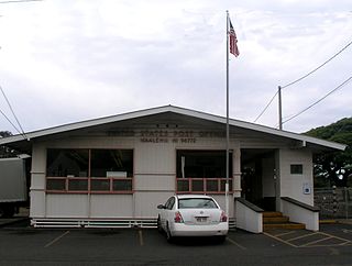
Nāʻālehu is a community in Hawaiʻi County, Hawaii, United States. Nāʻālehu is Hawaiian for "the volcanic ashes". It is one of the southernmost communities with a post office in the 50 states of the United States. For statistical purposes, the United States Census Bureau has defined Naalehu as a census-designated place (CDP). The census definition of the area may not precisely correspond to local understanding of the area with the same name. The population was 866 at the 2010 census, down from 919 at the 2000 census.
<span class="mw-page-title-main">Bernice Pauahi Bishop</span> Hawaiian aristocrat and philanthropist

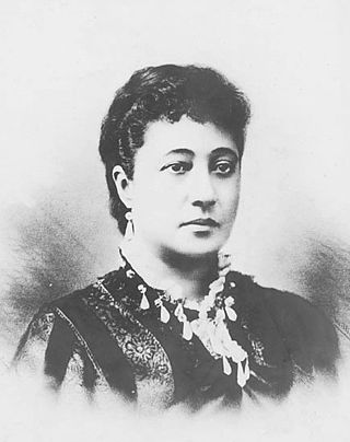
Bernice Pauahi Pākī Bishop KGCOK RoK was an aliʻi (noble) of the royal family of the Kingdom of Hawaii and a well known philanthropist. At her death, her estate was the largest private landownership in the Hawaiian Islands, comprising approximately 9% of Hawaii's total area. The revenues from these lands are used to operate the Kamehameha Schools, which were established in 1887 according to Pauahi's will. Pauahi was married to businessman and philanthropist Charles Reed Bishop.

<span class="mw-page-title-main">Bishop Museum</span> Museum of history and science in Hawaii, US

The Bernice Pauahi Bishop Museum, designated the Hawaiʻi State Museum of Natural and Cultural History, is a museum of history and science in the historic Kalihi district of Honolulu on the Hawaiian island of Oʻahu. Founded in 1889, it is the largest museum in Hawaiʻi and has the world's largest collection of Polynesian cultural artifacts and natural history specimens. Besides the comprehensive exhibits of Hawaiian cultural material, the museum's total holding of natural history specimens exceeds 24 million, of which the entomological collection alone represents more than 13.5 million specimens. The Index Herbariorum code assigned to Herbarium Pacificum of this museum is BISH and this abbreviation is used when citing housed herbarium specimens.

<span class="mw-page-title-main">Hawaiʻi Volcanoes National Park</span> National park in Hawaii, United States

Hawaiʻi Volcanoes National Park is a national park of the United States located in Hawaii on the island of Hawaii. The park encompasses two active volcanoes: Kīlauea, one of the world's most active volcanoes, and Mauna Loa, the world's largest shield volcano. The park provides scientists with insight into the development of the Hawaiian Islands and access for studies of volcanism. For visitors, the park offers dramatic volcanic landscapes, glimpses of rare flora and fauna, and a view into the traditional Hawaiian culture connected to these landscapes.

<span class="mw-page-title-main">Ancient Hawaii</span> Period in Hawaiian history

Ancient Hawaiʻi is the period of Hawaiian history preceding the establishment in 1795 of the Kingdom of Hawaiʻi by Kamehameha the Great. Traditionally, researchers estimated the first settlement of the Hawaiian islands as having occurred sporadically between 400 and 1100 CE by Polynesian long-distance navigators from the Samoan, Marquesas, and Tahiti islands within what is now French Polynesia. In 2010, a study was published based on radiocarbon dating of more reliable samples which suggests that the islands were settled much later, within a short timeframe, in about 1219 to 1266.

The following is an alphabetical list of articles related to the U.S. state of Hawaii:

The aliʻi were the traditional nobility of the Hawaiian islands. They were part of a hereditary line of rulers, the noho aliʻi.

<span class="mw-page-title-main">Punaluʻu Beach</span> Black Sand Beach, Big Island, Hawaii, US

Punaluʻu Beach is a beach between Pāhala and Nāʻālehu on the Big Island of the U.S. state of Hawaii. The beach has black sand made of basalt and created by lava flowing into the ocean which explodes as it reaches the ocean and cools. This volcanic activity is in the Hawaiʻi Volcanoes National Park. Punaluʻu is frequented by endangered hawksbill and green turtles, which can often be seen basking on the black sand.
<span class="mw-page-title-main">Kau, Hawaii</span> District of Hawaii County, Hawaii, US

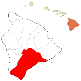
Kaʻū is the southernmost and largest district of Hawaii County, Hawaii, located on the island of Hawaiʻi.
<span class="mw-page-title-main">Papakolea Beach</span> Green sand beach in Kaʻū district, Hawaii, US

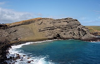
Papakōlea Beach is a green sand beach located near South Point, in the Kaʻū district of the island of Hawaiʻi. It is one of only four green sand beaches in the world, the others being Talofofo Beach, Guam; Punta Cormorant on Floreana Island in the Galapagos Islands; and Hornindalsvatnet, Norway. It gets its distinctive coloring from olivine sand eroded out of the enclosing volcanic cone.

The Hawaiʻi Belt Road is a modern name for the Māmalahoa Highway and consists of Hawaiʻi state Routes 11, 19, and 190 that encircle the Island of Hawaiʻi. The southern section, between Hilo and Kailua-Kona is numbered as Route 11. The section between Hilo and Waimea is Route 19. Between Waimea and Kailua-Kona, the road is split in two: the original "mauka" route and a "makai" Route 19, completed in 1975, which serves as access to the Kona and Kohala Coast resorts. In the Hawaiian language, mauka means "towards the mountain" and makai means "towards the sea". These terms are commonly used in travel directions.

<span class="mw-page-title-main">Amy B. H. Greenwell Ethnobotanical Garden</span> Botanical garden in Hawaii, United States

The Amy B. H. Greenwell Ethnobotanical Garden is a Hawaiian botanical garden near Captain Cook, Hawaii in the Kona District on the Big Island of Hawaii. Undergoing a change in management, the gardens were closed to the public from 2016–2019. It is now operated by Friends of the Garden and is open to the public Thursday through Sunday from 9 am to 2 pm, with free admission.
<span class="mw-page-title-main">Mary Kawena Pukui</span> Hawaiian scholar, author, composer, hula expert and educator

Mary Abigail Kawenaʻulaokalaniahiʻiakaikapoliopele Naleilehuaapele Wiggin Pukui, known as Kawena, was a Hawaiian scholar, author, composer, hula expert, and educator.

<span class="mw-page-title-main">Kalaniʻōpuʻu</span> Hawaiian monarch (d. 1782)

Kalaniʻōpuʻu-a-Kaiamamao was the aliʻi nui of the island of Hawaiʻi. He was called Terreeoboo, King of Owhyhee by James Cook and other Europeans. His name has also been written as Kaleiopuu.

<span class="mw-page-title-main">Kamilo Beach</span>

Kamilo Beach, is a beach located on the southeast coast of the island of Hawaii. It is known for its accumulation of plastic marine debris from the Great Pacific Garbage Patch.

Yosihiko H. Sinoto was a Japanese-born American anthropologist at the Bishop Museum in Honolulu, Hawaii. He is known for his anthropological expeditions throughout the Pacific, particularly Hawaii and French Polynesia.

<span class="mw-page-title-main">Keōua Kūʻahuʻula</span> Alii Nui of Kaū

Keōua Kūʻahuʻula was an Aliʻi during the time of the unification of the Kingdom of Hawaiʻi.

<span class="mw-page-title-main">Mauna Kea Ice Age Reserve</span> United States historic place

The Mauna Kea Ice Age Natural Area Reserve is a Hawaii state natural reserve that includes the Mauna Kea Adz Quarry, on the southern slope of Mauna Kea on the island of the Hawaiʻi.

Kaneʻalai was a Queen regnant of the Hawaiian island of Molokai, who lived in the 18th century. She ruled as Alii nui of Molokai.

References

  1. 1 2 "National Register Information System". National Register of Historic Places . National Park Service. July 9, 2010.
  2. 1 2 "South Point Complex". National Historic Landmark summary listing. National Park Service. Archived from the original on May 11, 2011. Retrieved July 4, 2008.
  3. Mary Kawena Pukui; Samuel Hoyt Elbert; Esther T. Mookini (2004). "lookup of Ka Lae ". in Place Names of Hawai'i. Ulukau, the Hawaiian Electronic Library, University of Hawaii Press . Retrieved September 20, 2010.
  4. U.S. Geological Survey Geographic Names Information System: Kalae
  5. "Kaʻu". Coffee Times.
  6. "Marine Debris Removal from the Waiohinu-Ka Lae Coast Hawaii Island". Marine Debris Program. NOAA. September 18, 2006.
  7. "Ka Lae, Ka'u, Kailua-Kona". Kailua-Kona Travel Guide. Virtual Tourist. October 5, 2002.
  8. Bendure, Glenda; Friary, Ned (September 1997). "Hawaii — The Big Island". Hawaii (4th ed.). Australia: Lonely Planet. pp.  327–28. ISBN   0-86442-489-2.
  9. Kelly, M. (Marion) (1969). "Historical background of the South Point area, Ka'u, Hawaii". Pacific anthropological records (6). Honolulu, HI: Dept. of Anthropology, Bernice Pauahi Bishop Museum. ISSN   0078-740X. LCCN   77029164. OCLC   659366796.
  10. Emory, Kenneth P.; Sinoto, Yosihiko H. (1969). "Age of the sites in the South Point area, Ka'u, Hawaii". Pacific anthropological records (8). Honolulu, HI: Dept. of Anthropology, Bernice Pauahi Bishop Museum. ISSN   0078-740X. LCCN   71029054. OCLC   659366796.
  11. Underwood, Jane H. (1969). "Human skeletal remains from Sand Dune site (H1), South Point (Ka Lae), Hawaii: a preliminary examination". Pacific anthropological records (9). Honolulu, HI: Dept. of Anthropology, Bernice Pauahi Bishop Museum. ISSN   0078-740X. OCLC   659366796.
  12. "Minor light of Hawai'i - Ka Lae, HI". Lighthouse Friends web site. Retrieved April 15, 2010.
  13. Love Dean (1991). The lighthouses of Hawai'i. University of Hawaii Press. ISBN   978-0-8248-1319-2.
  14. "NOAA Weather Radio WWG27". National Oceanic and Atmospheric Administration . Retrieved April 15, 2010.
  15. "South Point, Hawaii ARC Wind Sensor". National Weather Service. Retrieved April 15, 2010.
  16. Pauk Freeman (January 1, 2010). "Morse Field, South Point, HI". Abandoned & Little-Known Airfields: Hawaii, Hawaii island. Retrieved April 15, 2010.
  17. Cliff Lethbridge (2000). "Space Program Has A Space Problem And A New Spaceport Is Born". History of Cape Canaveral. Archived from the original on August 29, 2012. Retrieved April 15, 2010.
  18. "South Cape (Morse Field) Airport". Hawaii Aviation Archive. State of Hawaii Department of Transportation, Airports Division. Retrieved April 15, 2010.
  19. Jonathan Eberhart (March 26, 1988). "Hawaii: A Stepping Stone to Space?". Science news.
  20. "Universal Space Network Expands Satellite Ground Stations". SSC Group. September 19, 2007. Archived from the original on January 1, 2014. Retrieved March 29, 2014.
  21. "Station Record - KWHR". Federal Communications Commission . Retrieved April 15, 2010.
  22. "History of Wind Energy Projects in Hawaii". State of Hawaii Department of Business, Economic Development & Tourism web site. April 15, 2002. Archived from the original on July 24, 2008. Retrieved April 15, 2010.
  23. Associated Press (July 20, 2007). "Big Isle wind farm boosts grid". Honolulu Star-Bulletin . Retrieved April 15, 2010.
  24. Tawhiri Power, LLC
  25. "Pakini Nui Find Farm". Tawhiri Power LLC web site. Retrieved April 15, 2010.
  26. "GAO/OGC-98-5 – U.S. Insular Areas: Application of the U.S. Constitution". U.S. Government Printing Office. November 7, 1997. Retrieved March 18, 2018.