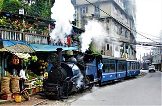
Darjeeling is a town and municipality in the northernmost region of the state of West Bengal, India. Located in the Eastern Himalayas, it has an average elevation of 2,045 metres (6,709 ft). Most of the state of West Bengal lies to the south and southwest, connected to the Darjeeling region by a narrow tract. Kangchenjunga, the world's third-highest mountain, rises to the north and is prominently visible on clear days.
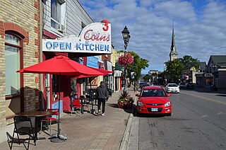
Richmond Hill is a city in south-central York Region, Ontario, Canada. Part of the Greater Toronto Area, it is the York Region's third most populous municipality and the 27th most populous municipality in Canada. Richmond Hill is situated between the cities of Markham and Vaughan, north of Thornhill, and south of Aurora.

Kurseong is a town and a municipality in Darjeeling district in the Indian state of West Bengal. It is the headquarters of the Kurseong subdivision.
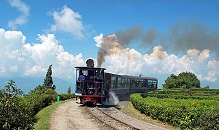
Ghum is a small hilly neighbourhood in the Darjeeling Himalayan hill region of West Bengal, India. It comes under ward number one of the Darjeeling Municipality. Ghum railway station of the Darjeeling Himalayan Railway is the highest railway station in India. It is situated at an altitude of 2,258 metres (7,407 ft). The place is the home of the Ghum Monastery and the Batasia Loop, a bend of the Darjeeling Himalayan Railway.

Bhutia Busty monastery or Karma Dorjee Chyoling monastery is a Buddhist monastery located in Bhutia Busty, Darjeeling district, India. It belongs to the Red Sect of Buddhist Lamas.
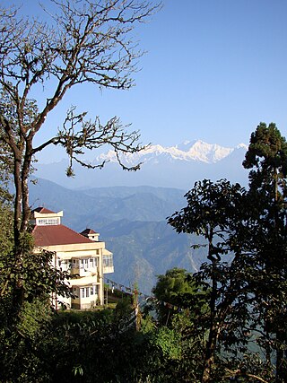
Observatory Hill is a hill near Chowrasta square, or The Mall as it is popularly known, in Darjeeling, West Bengal, India. Views of snow-clad peaks, including Mount Kanchenjunga, are visible from the Observatory Hill. The Bhutia Busty monastery was originally located here. Now the hill has the temple of Mahakal. Two important arteries of the town, Nehru Road and Bhanubhakta Sarani, meet at Chowrasta. Another school of thought suggests that the presence of the megalithic core to have been a place of worship of the Rongs, representing a sacred location of the classic Long Chok type.
Katapahar is a ridge in Darjeeling town in the Indian state of West Bengal. Katapahar and Jalapahar ridges meet at Observatory Hill.
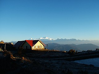
Tonglu is the one of the higher peaks of the Singalila Ridge and a small settlement inside the Singalila National Park in the Darjeeling subdivision, Darjeeling district in the state of West Bengal in India near the India - Nepal border. It is a roadside halt along the trekking route from Manebhanjan to Sandakphu.
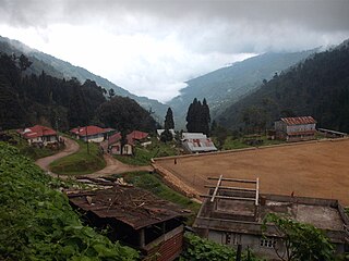
Maney Bhanjyang is a small transit-town in the Darjeeling Sadar subdivision, Darjeeling district in the state of West Bengal in India. It is located at the gateway of the Singalila National Park, 28 km away from Darjeeling town. The income of the local residents is geared towards tourism, especially foreign trekkers. Maney Bhanjyang is the start of the trailhead for the trek to Sandakphu on the Singalila Ridge, the highest point in West Bengal. Conveyance for Sandakphu is also available mainly from Maney Bhanjyang in the form of Land Rovers of 1960 model. The 4-hour ride can be quite 'jumpy' as drivers maneuver their prized possessions along snaky curves and uphill roads.
Bijanbari is a village in Darjeeling Pulbazar CD block in the Darjeeling Sadar subdivision of the Darjeeling district in West Bengal, India. It is a place of importance in Darjeeling district mainly because of the Block Divisional Office and a Hydel Power Plant.
Rimbick is a village in the Darjeeling Pulbazar CD block in the Darjeeling Sadar subdivision of the Darjeeling district in West Bengal, India.
Darjeeling Pulbazar is a community development block that forms an administrative division in the Darjeeling Sadar subdivision of the Darjeeling district in the Indian state of West Bengal.
Jorebunglow Sukhiapokhri is a community development block that forms an administrative division in the Darjeeling Sadar subdivision of the Darjeeling district in the Indian state of West Bengal.
Rangli Rangliot is a community development block that forms an administrative division in the Darjeeling Sadar subdivision of the Darjeeling district in the Indian state of West Bengal.
Kalimpong II was a community development block that forms an administrative division in the Kalimpong subdivision of the Kalimpong district in the Indian state of West Bengal.
Gorubathan is a community development block that forms an administrative division in the Kalimpong subdivision of the Kalimpong district in the Indian state of West Bengal.
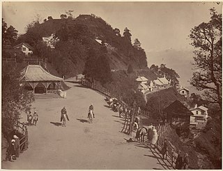
Chowrasta is a historical public square in the Victorian era hill resort town of Darjeeling in the state of West Bengal, India. Located in the heart of the town it was the fashionable place of assembly for residents and visitors in the 18th century. Chowrasta is situated on the ridge of the Darjeeling hill range and is now a focal center of tourist attraction and a popular spot for the residents to assemble, leisure or just stroll in the tranquility that that part of the hill station offers.
Ging Tea Garden is a census town in the Darjeeling Pulbazar CD block in the Darjeeling Sadar subdivision of the Darjeeling district in the state of West Bengal, India.
Badamtam Tea Garden is a census town and a gram panchayat in the Darjeeling Pulbazar CD block in the Darjeeling Sadar subdivision of the Darjeeling district in the state of West Bengal, India.
Singla Tea Garden is a village in the Darjeeling Pulbazar CD block in the Darjeeling Sadar subdivision of the Darjeeling district in the state of West Bengal, India.


