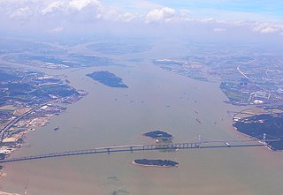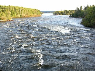
The Madeira River is a major waterway in South America. It is estimated to be 1,450 km (900 mi) in length,while the Madeira-Mamoréis estimated near 3,250 km (2,020 mi) or 3,380 km (2,100 mi) in length depending on the measuring party and their methods. The Madeira is the biggest tributary of the Amazon,accounting for about 15% of the water in the basin. A map from Emanuel Bowen in 1747,held by the David Rumsey Map Collection,refers to the Madeira by the pre-colonial,indigenous name Cuyari:
The River of Cuyari,called by the Portuguese Madeira or the Wood River,is formed by two great rivers,which join near its mouth. It was by this River,that the Nation of Topinambes passed into the River Amazon.

The Three Gorges Dam is a hydroelectric gravity dam that spans the Yangtze River by the town of Sandouping,in Yiling District,Yichang,Hubei province,central China,downstream of the Three Gorges. The Three Gorges Dam has been the world's largest power station in terms of installed capacity (22,500 MW) since 2012. The dam generates an average 95±20 TWh of electricity per year,depending on annual amount of precipitation in the river basin. After the extensive monsoon rainfalls of 2020,the dam's annual production nearly reached 112 TWh,breaking the previous world record of ~103 TWh set by Itaipu Dam in 2016.

The Pearl River,also known by its Chinese name Zhujiang or Zhu Jiang in Mandarin pinyin or Chu Kiang and formerly often known as the Canton River,is an extensive river system in southern China. The name "Pearl River" is also often used as a catch-all for the watersheds of the Xi ("West"),Bei ("North"),and Dong ("East") rivers of Guangdong. These rivers are all considered tributaries of the Pearl River because they share a common delta,the Pearl River Delta. Measured from the farthest reaches of the Xi River,the 2,400-kilometer (1,500 mi)-long Pearl River system is China's third-longest river,after the Yangtze River and the Yellow River,and second largest by volume,after the Yangtze. The 453,700 km2 (175,200 sq mi) Pearl River Basin (珠江流域) drains the majority of Liangguang,as well as parts of Yunnan,Guizhou,Hunan and Jiangxi in China;it also drains northern parts of Vietnam's Northeast Cao Bằng and Lạng Sơn provinces.

The Li River or Li Jiang is the name for the upper reaches of the Gui River in northwestern Guangxi,China. It is part of the Xijiang River system in the Pearl River Basin. The river flows 164 kilometres (102 mi) from Xing'an County to Pingle County,where the karst mountains and river sights highlight the famous Li River cruise.

The Xi River or Si-Kiang is the western tributary of the Pearl River in southern China. It is formed by the confluence of the Gui and Xun Rivers in Wuzhou,Guangxi. It originates from the eastern foot of the Maxiong Mountain in Qujing City,Yunnan Province. Then it flows east through Guangdong,and enters the Pearl River Delta just east of the Lingyang Gorge in Zhaoqing. The main branch of the Xi River flows southeast through the delta entering the South China Sea at Modao Men,just west of Macau. The major cities along the Xi include Wuzhou,Zhaoqing,and Jiangmen.

The Churchill River is a major river in Alberta,Saskatchewan and Manitoba,Canada. From the head of the Churchill Lake it is 1,609 kilometres (1,000 mi) long. It was named after John Churchill,1st Duke of Marlborough and governor of the Hudson's Bay Company from 1685 to 1691.
Longtan Dam is a large roller-compacted concrete (RCC) gravity dam on the Hongshui River in Tian'e County of the Guangxi Zhuang Autonomous Region,China,a tributary of the Xi River and the Pearl River. The dam is 216.2 metres (709.3 ft) high and 849 m (2,785 ft) long;it is the tallest of its type in the world. The dam is intended for hydroelectric power production,flood control and navigation. The dam contains seven surface spillways,two bottom outlets and an underground power station. The Longtan ship lift,part of the dam complex,will be the tallest ship lift system in the world.

The Sakuma Dam is a dam on the TenryūRiver,located on the border of Toyone,Kitashitara District,Aichi Prefecture on the island of Honshū,Japan. It is one of the tallest dams in Japan and supports a 350 MW hydroelectric power station. Nearby a frequency converter station is installed,allowing interchange of power between Japan's 50 Hz and 60 Hz AC networks.

Hydroelectricity is,as of 2019,the second-largest renewable source of energy in both generation and nominal capacity in the United States. In 2021,hydroelectric power produced 31.5% of the total renewable electricity,and 6.3% of the total U.S. electricity.
The Yantan Ship Lift is a large ship lift located on the Hongshui River,a tributary of the Pearl River in China. The ship lift's basin can carry vessels of up to 250 tons. The ship lift's basin is 40 metres (130 ft) ×10.8 metres (35 ft) ×1.8 metres (5.9 ft). It lifts vessels 68.5 metres (225 ft). It is an example of a Vertical Hoist Shiplift.

Beipan River is a river in Guizhou and Yunnan provinces,China,and part of the great Pearl River basin.

The Qian River is the name of a short section of the Xi River system and,thus,the greater Pearl River system in Guangxi,China. It is formed by where the Liu Jiang meets the larger Hongshui He east of Laibin,then flows southeast through Wuxuan. At Guiping it is joined by the more southerly Yu Jiang to form the Xun branch of the Xi Jiang. The Qian,for most of its length,winds between the Dayao and Lianhua Mountains,before entering the valley just below Xishan Mountain west of Guiping.

The Liu River is a tributary within the Pearl River system in Guangxi,China. It is formed by the confluence of the Rong and Long rivers in Fengshan. It flows south through Liuzhou and then the Luoqing Jiang enters from the north. It meets the larger Hongshui He east of Laibin where it becomes known as the Qian Jiang.

The Polavaram Project is an under construction multi-purpose irrigation project on the Godavari River in the Eluru District and East Godavari District in Andhra Pradesh. The project has been accorded National project status by the Union Government of India. Its reservoir back water spreads up to the Dummugudem Anicut and approx 115 km on Sabari River side. Thus back water spreads into parts of Chhattisgarh and Odisha States. It gives major boost to tourism sector in Godavari Districts as the reservoir covers the famous Papikonda National Park,Polavaram hydro electric project (HEP) and National Waterway 4 are under construction on left side of the river. It is located 40 km to the upstream of Sir Arthur Cotton Barrage in Rajamahendravaram City and 25 km from Rajahmundry Airport.

The Yantan Dam is a gravity dam on the Hongshui River near Dahua County,Guangxi China. The main purpose of the dam is hydroelectric power production and it has an associated 1,210 MW power station consisting of 4 x 302.5 MW Francis turbine-generators.

The Pearl River Basin is one of China's largest river basins,located in South China within total area approximately 453,700 square kilometers in Guangdong,Guangxi,Guizhou,Yunnan,Hunan,Jiangxi and Fujian provinces,and part of Northeastern Vietnam.

Kullar Dam is a small flanking dam which impounds Kullar river in Seethathode village,Pathanamthitta District in Kerala,India. The Dam was built as a part of Sabarigiri Hydroelectric Project. The release from the dam flows to Pamba River and from there it flows through Ranni,Konni,Kozhencherry,Thiruvalla,Chengannur,Kuttanadu,Mavelikara and Karthikappally taluks.


