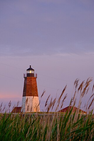
Point Judith Light is located on the west side of the entrance to Narragansett Bay, Rhode Island as well as the north side of the eastern entrance to Block Island Sound. The confluence of two waterways make this area busy with water traffic and the waters around Point Judith are very cold and dangerous. Historically, even with active lighthouses, there have been many shipwrecks off these coasts.
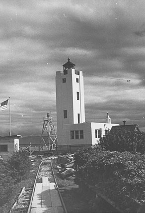
The Mary Island Light Station is a lighthouse located on the northeastern part of Mary Island in southeastern Alaska, United States.
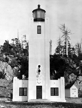
The Tree Point Light is a lighthouse located adjacent to Revillagigedo Channel in Southeast Alaska, United States. It is located near the southernmost point of mainland Alaska.
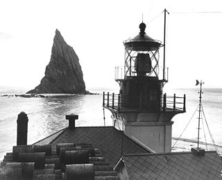
The Cape St. Elias Light is a lighthouse on Kayak Island in Alaska.

Point Retreat Light is a lighthouse located on the Mansfield Peninsula at the northern tip of Admiralty Island in southeastern Alaska, United States. It provides aid in navigation through the Lynn Canal.
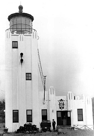
The Cape Hinchinbrook Light is a lighthouse located near the southern end of Hinchinbrook Island adjacent to Prince William Sound, in Alaska, United States.
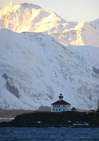
The Eldred Rock Light is an historic octagonal lighthouse adjacent to Lynn Canal in Alaska. It is the last of the ten lighthouses constructed in Alaska between 1902 and 1906. It was also the last of 12 manned lighthouses that were started in Alaska. It is listed on the National Register of Historic Places as Eldred Rock Lighthouse.
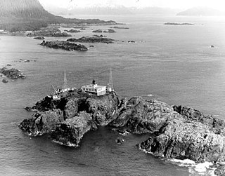
The Cape Spencer Light is a lighthouse in Alaska, United States, next to the entrance to Cross Sound and Icy Strait. The light is still an active aid to navigation. It is located on an islet in the southernmost end of Glacier Bay National Park and Preserve.

The Five Finger Islands Light is a lighthouse located on a small island that lies between Stephens Passage and Frederick Sound in southeastern Alaska. It and Sentinel Island Light Station were the first U.S. government lighthouses opened in Alaska, first lit on March 21, 1902.
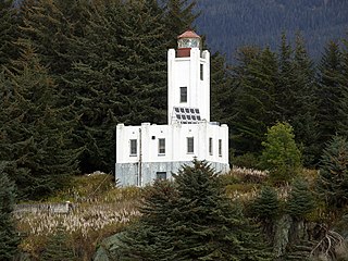
The Sentinel Island Light is a lighthouse in Alaska adjacent to Lynn Canal.
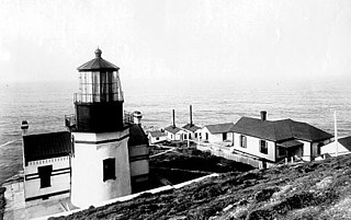
Point Conception Light is a lighthouse in Santa Barbara County, California, on Point Conception at the west entrance of the Santa Barbara Channel, California. One of the earliest California lighthouses, it is listed on the National Register of Historic Places on the Gaviota Coast.
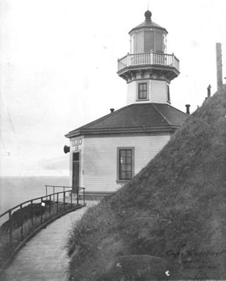
Cape Sarichef Light is a lighthouse located on the northwest tip of Unimak Island, approximately 630 miles (1,010 km) southwest of Anchorage, Alaska. The most westerly and most isolated lighthouse in North America, Cape Sarichef Light marks the northwest end of Unimak Pass, the main passage through the Aleutian Islands between the Bering Sea and the Pacific Ocean. When it was first lit on July 1, 1904, it was Alaska's second coastal lighthouse, and the only staffed U.S. lighthouse on the Bering Sea. Today, the lighthouse is automated, and the beacon is mounted on a skeleton tower.
The Fairway Island Lighthouse is a lighthouse located on the eastern entrance to Peril Strait, Alaska. It is located on a small islet that lies between the southeastern end of Chichagof Island and northern Catherine Island, within the limits of Sitka City and Borough.
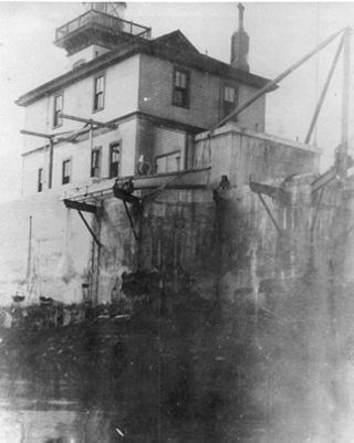
The Lincoln Rock Lighthouse was a lighthouse located on Lincoln Island, a small islet in Clarence Strait in southeastern Alaska, United States. It lay just off the west coast of Etolin Island, between it and Prince of Wales Island.
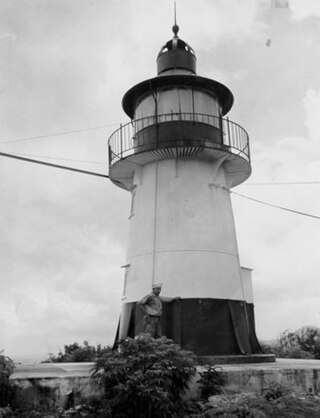
The Hams Bluff Light is an historic lighthouse on Saint Croix, U.S. Virgin Islands. It was first lit in 1915 under the Danish Government. It was since transferred to the United States Lighthouse Service and later came under the jurisdiction of the United States Coast Guard. The historic tower has been abandoned; the beacon is now mounted on an adjacent new truss tower. The light displays two white flashes every 30 seconds at a focal plane of 394 feet (120 m). The lighthouse was listed on the United States National Register of Historic Places in 2019.
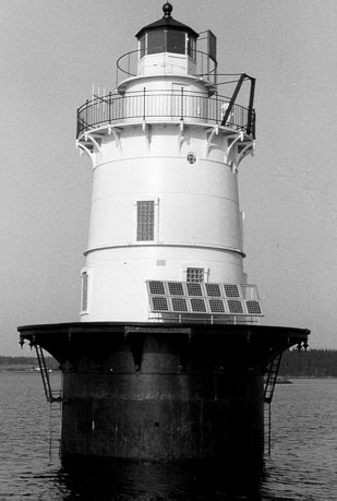
Goose Rocks Light is a sparkplug lighthouse located near North Haven, Maine in Penobscot Bay. It stands at the eastern entrance to the Fox Islands Thoroughfare, a busy mile-wide passage separating North Haven from Vinalhaven. Built in 1890, it was added to the National Register of Historic Places as Goose Rocks Light Station on January 21, 1988. The structure is now privately owned by a preservation group, and remains an active aid to navigation.

Bird Island Light is a historic lighthouse at the entrance to Sippican Harbor in Marion, Massachusetts. Built in 1819, its tower is a well-preserved example of an early 19th-century masonry lighthouse. The tower and the island on which it stands were added to the National Register of Historic Places as Bird Island Light on September 28, 1987.

The Ten Pound Island Light is a historic lighthouse in Gloucester Harbor in Gloucester, Massachusetts. It is located on Ten Pound Island, near the eastern end of the harbor. The tower, built in 1881, is a conical cast iron structure 30 feet (9.1 m) tall, replacing a stone tower first built on the site in 1821. The main body is painted white, and the top is painted black.

Egg Rock Light is a lighthouse on Frenchman Bay, Maine. Built in 1875, it is one of coastal Maine's architecturally unique lighthouses, with a square tower projecting through the square keeper's house. Located on Egg Rock, midway between Mount Desert Island and the Schoodic Peninsula, it is an active aid to navigation, flashing red every 40 seconds. The light was listed on the National Register of Historic Places as Egg Rock Light Station in 1988.

Saddleback Ledge Light is a lighthouse on Saddleback Ledge, an islet lying between Isle au Haut and Vinalhaven, Maine, in the middle of the southeastern entrance to Penobscot Bay. The station was established and the current structure, designed by Alexander Parris, was built in 1839. One of Maine's oldest lighthouses, it was listed on the National Register of Historic Places as Saddleback Ledge Light Station on March 14, 1988.


