Grant, Nebraska | |
---|---|
Coordinates: 40°50′41″N101°43′32″W / 40.84472°N 101.72556°W | |
Country | United States |
State | Nebraska |
County | Perkins |
Area | |
• Total | 0.79 sq mi (2.04 km2) |
• Land | 0.79 sq mi (2.04 km2) |
• Water | 0.00 sq mi (0.00 km2) |
Elevation | 3,416 ft (1,041 m) |
Population (2020) | |
• Total | 1,197 |
• Density | 1,519.04/sq mi (586.62/km2) |
Time zone | UTC-7 (Mountain (MST)) |
• Summer (DST) | UTC-6 (MDT) |
ZIP code | 69140 |
Area code | 308 |
FIPS code | 31-19910 [5] |
GNIS feature ID | 2394965 [4] |
Website | grantnebraska.com |
Grant is a city and county seat of Perkins County, Nebraska, United States. [6] The population was 1,165 at the 2010 census.
Grant was platted in 1886 when the Chicago, Burlington and Quincy Railroad was extended to that point. [7] [8] The city is named for Ulysses S. Grant, 18th President of the United States. [9]
According to the United States Census Bureau, the city has a total area of 0.73 square miles (1.89 km2), all land. [10]
Census | Pop. | Note | %± |
---|---|---|---|
1890 | 315 | — | |
1900 | 162 | −48.6% | |
1910 | 358 | 121.0% | |
1920 | 585 | 63.4% | |
1930 | 798 | 36.4% | |
1940 | 897 | 12.4% | |
1950 | 1,091 | 21.6% | |
1960 | 1,166 | 6.9% | |
1970 | 1,099 | −5.7% | |
1980 | 1,270 | 15.6% | |
1990 | 1,239 | −2.4% | |
2000 | 1,225 | −1.1% | |
2010 | 1,165 | −4.9% | |
2020 | 1,197 | 2.7% | |
U.S. Decennial Census |
As of the census [11] of 2010, there were 1,165 people, 520 households, and 317 families living in the city. The population density was 1,595.9 inhabitants per square mile (616.2/km2). There were 588 housing units at an average density of 805.5 units per square mile (311.0 units/km2). The racial makeup of the city was 97.7% White, 0.1% African American, 0.4% Native American, 0.4% Asian, 1.0% from other races, and 0.3% from two or more races. Hispanic or Latino of any race were 2.7% of the population.
There were 520 households, of which 26.2% had children under the age of 18 living with them, 53.5% were married couples living together, 4.8% had a female householder with no husband present, 2.7% had a male householder with no wife present, and 39.0% were non-families. 36.5% of all households were made up of individuals, and 21.2% had someone living alone who was 65 years of age or older. The average household size was 2.16 and the average family size was 2.79.
The median age in the city was 46.4 years. 23.3% of residents were under the age of 18; 5.6% were between the ages of 18 and 24; 19.9% were from 25 to 44; 26.4% were from 45 to 64; and 24.8% were 65 years of age or older. The gender makeup of the city was 47.6% male and 52.4% female.
As of the census [5] of 2000, there were 1,225 people, 535 households, and 331 families living in the city. The population density was 1,674.6 inhabitants per square mile (646.6/km2). There were 591 housing units at an average density of 807.9 units per square mile (311.9 units/km2). The racial makeup of the city was 98.78% White, 0.33% Native American, 0.16% Asian, 0.24% from other races, and 0.49% from two or more races. Hispanic or Latino of any race were 1.22% of the population.
There were 535 households, out of which 28.4% had children under the age of 18 living with them, 54.6% were married couples living together, 5.8% had a female householder with no husband present, and 38.1% were non-families. 36.8% of all households were made up of individuals, and 25.8% had someone living alone who was 65 years of age or older. The average household size was 2.19 and the average family size was 2.86.
In the city, the population was spread out, with 23.4% under the age of 18, 4.4% from 18 to 24, 21.6% from 25 to 44, 22.8% from 45 to 64, and 27.8% who were 65 years of age or older. The median age was 45 years. For every 100 females, there were 86.5 males. For every 100 females age 18 and over, there were 80.7 males.
As of 2000 the median income for a household in the city was $31,625, and the median income for a family was $42,692. Males had a median income of $30,050 versus $20,673 for females. The per capita income for the city was $18,909. About 6.1% of families and 8.9% of the population were below the poverty line, including 12.2% of those under age 18 and 9.8% of those age 65 or over.
Louisville is a city in northern Cass County, Nebraska, United States. The population was 1,319 at the 2020 census.
Plattsmouth is a city and county seat of Cass County, Nebraska, United States. The population was 6,620 at the 2020 census.
Edgar is a city in Clay County, Nebraska, United States. The population was 498 at the 2010 census. It is part of the Hastings, Nebraska Micropolitan Statistical Area.
Fairfield is a city in Clay County, Nebraska, United States. The population was 387 at the 2010 census. It is part of the Hastings, Nebraska Micropolitan Statistical Area.
Mason City is a village in Custer County, Nebraska, United States. The population was 171 at the 2010 census.
Ralston is a city in Douglas County, Nebraska, United States. The population was 6,494 at the 2020 census. A suburb of Omaha, Ralston is surrounded on three sides by the city of Omaha by 84th, 72nd, and L Streets, and by Sarpy County on the south side.
Valley is a city in Douglas County, Nebraska, United States. The population was 3,037 at the 2020 census.
Beaver City is a city in Furnas County, on the southern border of Nebraska, United States. The population was 609 at the 2010 census. It is the county seat of Furnas County.
Burwell is a city in Garfield County, Nebraska, United States. The population was 1,210 at the 2010 census. It is the county seat of Garfield County.
Auburn is a city in Nemaha County, Nebraska, United States, and its county seat. The population was 3,470 at the 2020 census.
Nelson is a village and the county seat of Nuckolls County, Nebraska, United States. The population was 488 at the 2010 census. The city was named for C. Nelson Wheeler, the original owner of the town site.
Pawnee City is a city in and the county seat of Pawnee County, Nebraska, United States. The population was 878 at the 2010 census.
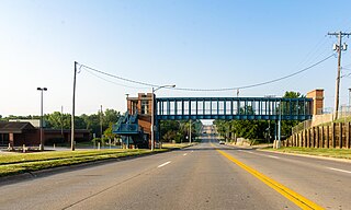
La Vista is a city in Sarpy County, Nebraska, United States. The population was 16,746 at the 2020 census, making it the 12th most populous city in Nebraska. The city was incorporated on February 23, 1960.
Yutan is a small city in Saunders County, Nebraska, United States. It sits along Upper Clear Creek near the Platte River.
Seward is a city and county seat of Seward County, Nebraska, United States. The population was 7,643 at the 2020 census. Seward is part of the Lincoln, Nebraska Metropolitan Statistical Area.
Rushville is a city in Sheridan County, Nebraska, United States, in the remote Sandhills Region. Its population was 890 at the 2010 census. It is the county seat of Sheridan County.
Stanton is a city in Stanton County, Nebraska, United States. The population was 1,577 at the 2010 census. It is the county seat of Stanton County. Stanton was platted in 1870. Both the city and county are named after Edwin Stanton, secretary of war for president Abraham Lincoln during the American Civil War.
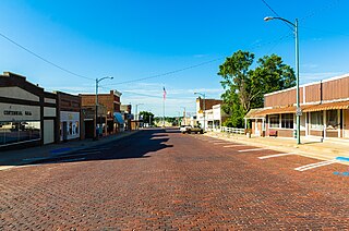
Deshler is a city in Thayer County, Nebraska, United States. The population was 739 at the 2020 census.
Blair is a city in and the county seat of Washington County, Nebraska, United States. The population was 7,990 at the 2010 census. Blair is a part of the Omaha-Council Bluffs Metropolitan Statistical Area.
Wayne is a city in Wayne County, Nebraska, United States. The population was 5,660 at the 2010 census. It is the county seat of Wayne County and the home of Wayne State College.