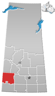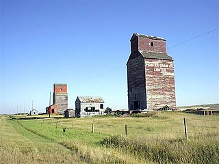
Division No. 8 is one of eighteen census divisions in the province of Saskatchewan, Canada, as defined by Statistics Canada. It is located in the west-southwestern part of the province, bordering Alberta. The most populous community in this division is Swift Current.

Hallonquist is a hamlet in Coulee Rural Municipality No. 136, Saskatchewan, Canada. The hamlet is located on Highway 363 about 21 km (13 mi) west of Hodgeville.

Neidpath, is a hamlet in Coulee Rural Municipality No. 136, Saskatchewan, Canada. The hamlet is located on Highway 363 and Highway 720 about 25 km east of the city of Swift Current.
Val Marie No. 17 is a rural municipality in the Canadian province of Saskatchewan, located in the southwestern part of the province on the United States border. It includes the western portion of Grasslands National Park in its southeastern portion. The RM lies adjacent to the United States border at Phillips County, Montana. It is part of Division No. 4, Saskatchewan.

Chortitz is a hamlet in Coulee Rural Municipality No. 136, Saskatchewan, Canada. Listed as a designated place by Statistics Canada, the hamlet had a population of 26 in the Canada 2006 Census. The hamlet is located on Highway 379, about 25 km south of Swift Current.
Main Centre is a hamlet in the Canadian province of Saskatchewan. Listed as a designated place by Statistics Canada, the hamlet had a reported population of 5 living in 3 of its 4 total private dwellings in the Canada 2011 Census.

Wymark is a hamlet in Swift Current Rural Municipality No. 137, Saskatchewan, Canada. Listed as a designated place by Statistics Canada, the hamlet had a population of 144 in the Canada 2006 Census. The hamlet is located on Highway 628 about 2 km north of Highway 363, about 15 km south of Swift Current.

Rosenhof is a hamlet in Coulee Rural Municipality No. 136, Saskatchewan, Canada. The hamlet is located on Range Rd. 123 4 km south of Highway 363, about 15 km south of Swift Current.

Rosenort is a hamlet in Coulee Rural Municipality No. 136, Saskatchewan, Canada. The hamlet is located on Range Rd. 123 5 km north of Highway 379, about 25 km south of Swift Current.

Schantzenfeld is a hamlet in Saskatchewan, Canada. There are 2 small businesses located in Schantzenfeld.

Rheinfeld is a hamlet in Coulee Rural Municipality No. 136, Saskatchewan, Canada. The hamlet is located on Highway 628 9 km north of Highway 363, about 15 km south of Swift Current.

McMahon is a hamlet in Coulee Rural Municipality No. 136, Saskatchewan, Canada. The hamlet is located on Saskatchewan Highway 379, about 40 km southeast of Swift Current.

South Gnadenthal is a hamlet in Coulee Rural Municipality No. 136, Saskatchewan, Canada. The hamlet is located on Highway 721, about 35 km southeast of Swift Current.

Schoenwiese is a hamlet in Swift Current Rural Municipality No. 137, Saskatchewan, Canada. The hamlet is located on Highway 628 about 2 km north of Highway 379, about 15 km south of Swift Current.
Douglas No. 436 is a rural municipality in the Canadian province of Saskatchewan, located in the Census Division 16. The seat of the municipality is located in the Village of Speers.
Glenside No. 377 is a rural municipality in the Canadian province of Saskatchewan, located in the Census Division 12. The seat of the municipality is located in the Town of Biggar.

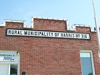
Harris No. 316 is a rural municipality in the Canadian province of Saskatchewan, located in Census Division 12. The seat of the municipality is located in the Village of Harris.
Perdue No. 346 is a rural municipality in the Canadian province of Saskatchewan, located in the Census Division 12. The seat of the municipality is located in the Village of Perdue.
Donavon is a hamlet in Montrose Rural Municipality 315, Saskatchewan, Canada. The hamlet is located southwest of Saskatoon along Highway 45 and Canadian National Railway, Delisle-Tichfield Junction stub.
Cutbank is an unincorporated hamlet in Loreburn Rural Municipality No. 254, Saskatchewan, Canada. The hamlet is located 40 km south east of the Town of Outlook east of highway 44 east of the Gardiner Dam & Danielson Provincial Park.


