Fayette | |
---|---|
Coordinates: 33°41′31″N87°49′56″W / 33.69194°N 87.83222°W | |
Country | United States |
State | Alabama |
County | Fayette |
Area | |
• Total | 8.63 sq mi (22.36 km2) |
• Land | 8.55 sq mi (22.14 km2) |
• Water | 0.08 sq mi (0.21 km2) |
Elevation | 371 ft (113 m) |
Population (2020) | |
• Total | 4,285 |
• Density | 501.17/sq mi (193.51/km2) |
Time zone | UTC-6 (Central (CST)) |
• Summer (DST) | UTC-5 (CDT) |
ZIP code | 35555 |
Area code(s) | 205, 659 |
FIPS code | 01-25840 |
GNIS feature ID | 0157950 |
Website | fayetteal |
Fayette is a city and the county seat of Fayette County, Alabama, United States. The population was 4,619 at the 2010 census, [2] down from 4,922 at the 2000 census.
Originally known as "La Fayette", it incorporated on January 15, 1821. [3] When Fayette County was created in 1824, the town's name was officially changed to "Fayette Court House", though it was also known as "Fayetteville", which was the name shown on maps and on the U.S. Census in 1880 and 1890. It was officially shortened to "Fayette" in 1898.
In 1928, Victor and Lucy Patterson began manufacturing Golden Eagle Syrup in Fayette. The syrup is still produced locally in a manufacturing facility in downtown Fayette. [4]
Fayette is located in west-central Fayette County at 33°41′31″N87°49′56″W / 33.69194°N 87.83222°W (33.692068, -87.832358). [5]
According to the U.S. Census Bureau, the city has a total area of 8.6 square miles (22.4 km2), of which 8.5 square miles (22.1 km2) is land and 0.1 square miles (0.2 km2), or 0.95%, is water. [2]
Climate data for Fayette, Alabama, 1991–2020 normals, extremes 1892–2011 | |||||||||||||
---|---|---|---|---|---|---|---|---|---|---|---|---|---|
Month | Jan | Feb | Mar | Apr | May | Jun | Jul | Aug | Sep | Oct | Nov | Dec | Year |
Record high °F (°C) | 84 (29) | 85 (29) | 91 (33) | 99 (37) | 101 (38) | 105 (41) | 110 (43) | 106 (41) | 106 (41) | 97 (36) | 87 (31) | 86 (30) | 110 (43) |
Mean maximum °F (°C) | 72.0 (22.2) | 76.1 (24.5) | 82.9 (28.3) | 87.3 (30.7) | 91.4 (33.0) | 96.4 (35.8) | 99.0 (37.2) | 98.4 (36.9) | 94.6 (34.8) | 88.0 (31.1) | 80.2 (26.8) | 72.6 (22.6) | 100.1 (37.8) |
Mean daily maximum °F (°C) | 54.6 (12.6) | 59.3 (15.2) | 67.9 (19.9) | 75.8 (24.3) | 82.8 (28.2) | 89.1 (31.7) | 91.8 (33.2) | 90.9 (32.7) | 86.5 (30.3) | 76.5 (24.7) | 65.2 (18.4) | 57.1 (13.9) | 74.8 (23.8) |
Daily mean °F (°C) | 44.5 (6.9) | 48.3 (9.1) | 55.5 (13.1) | 62.9 (17.2) | 70.8 (21.6) | 78.0 (25.6) | 81.3 (27.4) | 80.0 (26.7) | 74.9 (23.8) | 63.9 (17.7) | 53.0 (11.7) | 46.8 (8.2) | 63.3 (17.4) |
Mean daily minimum °F (°C) | 34.4 (1.3) | 37.2 (2.9) | 43.1 (6.2) | 50.0 (10.0) | 58.9 (14.9) | 67.0 (19.4) | 70.7 (21.5) | 69.2 (20.7) | 63.3 (17.4) | 51.3 (10.7) | 40.9 (4.9) | 36.5 (2.5) | 51.9 (11.0) |
Mean minimum °F (°C) | 15.6 (−9.1) | 18.5 (−7.5) | 24.5 (−4.2) | 32.6 (0.3) | 42.9 (6.1) | 54.7 (12.6) | 61.8 (16.6) | 60.6 (15.9) | 45.8 (7.7) | 32.3 (0.2) | 24.8 (−4.0) | 18.5 (−7.5) | 12.0 (−11.1) |
Record low °F (°C) | −5 (−21) | 0 (−18) | 8 (−13) | 25 (−4) | 32 (0) | 41 (5) | 49 (9) | 49 (9) | 33 (1) | 21 (−6) | 6 (−14) | −1 (−18) | −5 (−21) |
Average precipitation inches (mm) | 5.45 (138) | 5.45 (138) | 5.30 (135) | 5.81 (148) | 3.95 (100) | 5.20 (132) | 4.88 (124) | 4.01 (102) | 3.33 (85) | 3.49 (89) | 4.28 (109) | 5.73 (146) | 56.88 (1,446) |
Average snowfall inches (cm) | 0.2 (0.51) | 0.0 (0.0) | 0.0 (0.0) | 0.0 (0.0) | 0.0 (0.0) | 0.0 (0.0) | 0.0 (0.0) | 0.0 (0.0) | 0.0 (0.0) | 0.0 (0.0) | 0.0 (0.0) | 0.1 (0.25) | 0.3 (0.76) |
Average precipitation days (≥ 0.01 in) | 10.8 | 10.4 | 10.1 | 8.1 | 7.6 | 9.9 | 9.5 | 9.1 | 6.3 | 7.1 | 8.7 | 9.6 | 107.2 |
Average snowy days (≥ 0.1 in) | 0.2 | 0.0 | 0.0 | 0.0 | 0.0 | 0.0 | 0.0 | 0.0 | 0.0 | 0.0 | 0.0 | 0.0 | 0.2 |
Source 1: NOAA [6] | |||||||||||||
Source 2: National Weather Service (mean maxima/minima 1981–2010) [7] |
Census | Pop. | Note | %± |
---|---|---|---|
1880 | 180 | — | |
1900 | 452 | — | |
1910 | 636 | 40.7% | |
1920 | 1,741 | 173.7% | |
1930 | 2,109 | 21.1% | |
1940 | 2,668 | 26.5% | |
1950 | 3,707 | 38.9% | |
1960 | 4,227 | 14.0% | |
1970 | 4,568 | 8.1% | |
1980 | 5,287 | 15.7% | |
1990 | 4,909 | −7.1% | |
2000 | 4,922 | 0.3% | |
2010 | 4,619 | −6.2% | |
2020 | 4,285 | −7.2% | |
U.S. Decennial Census [8] 2013 Estimate [9] |
At the 2000 census there were 4,922 people, 2,092 households, and 1,303 families living in the city. The population density was 575.1 inhabitants per square mile (222.0/km2). There were 2,336 housing units at an average density of 273.0 per square mile (105.4/km2). The racial makeup of the city was 75.34% White, 23.38% Black or African American, 0.12% Native American, 0.28% Asian, 0.30% from other races, and 0.57% from two or more races. One percent of the population was Hispanic or Latino of any race. [10] Of the 2,092 households 26.9% had children under the age of 18 living with them, 45.2% were married couples living together, 14.2% had a female householder with no husband present, and 37.7% were non-families. 35.5% of households were one person and 19.0% were one person aged 65 or older. The average household size was 2.20 and the average family size was 2.85.
The age distribution was 21.4% under the age of 18, 9.0% from 18 to 24, 24.2% from 25 to 44, 23.9% from 45 to 64, and 21.6% 65 or older. The median age was 42 years. For every 100 females, there were 81.4 males. For every 100 females age 18 and over, there were 75.7 males.
The median household income was $25,714 and the median family income was $36,589. Males had a median income of $29,857 versus $21,899 for females. The per capita income for the city was $15,553. About 12.5% of families and 18.0% of the population were below the poverty line, including 21.2% of those under age 18 and 22.9% of those age 65 or over.
At the 2010 census there were 4,619 people, 1,924 households, and 1,206 families living in the city. The population density was 530.2 inhabitants per square mile (204.7/km2). There were 2,239 housing units at an average density of 257.4 per square mile (99.4/km2). The racial makeup of the city was 73.4% White, 24.3% Black or African American, 0.3% Native American, 0.3% Asian, 0.6% from other races, and 1.2% from two or more races. 1.4% of the population was Hispanic or Latino of any race. [11] Of the 1,924 households 26.5% had children under the age of 18 living with them, 40.8% were married couples living together, 18.2% had a female householder with no husband present, and 37.3% were non-families. 32.8% of households were one person and 14.0% were one person aged 65 or older. The average household size was 2.27 and the average family size was 2.88.
The age distribution was 22.9% under the age of 18, 9.6% from 18 to 24, 23.0% from 25 to 44, 25.6% from 45 to 64, and 18.9% 65 or older. The median age was 40.2 years. For every 100 females, there were 88.6 males. For every 100 females age 18 and over, there were 88.6 males.
The median household income was $31,705 and the median family income was $41,905. Males had a median income of $34,271 versus $27,500 for females. The per capita income for the city was $16,602. About 15.4% of families and 20.4% of the population were below the poverty line, including 23.2% of those under age 18 and 15.9% of those age 65 or over.
Race | Num. | Perc. |
---|---|---|
White (non-Hispanic) | 2,877 | 67.14% |
Black or African American (non-Hispanic) | 1,057 | 24.67% |
Native American | 14 | 0.33% |
Asian | 27 | 0.63% |
Other/Mixed | 170 | 3.97% |
Hispanic or Latino | 140 | 3.27% |
As of the 2020 United States census, there were 4,285 people, 1,888 households, and 1,178 families residing in the city.
The Times-Record is the local newspaper.
Fayette is organized in a mayor-council form of city government, with a mayor elected citywide and five council members elected from districts. [13]
Bevill State Community College has a location in Fayette.
The climate in this area is characterized by hot, humid summers and generally mild to cool winters. According to the Köppen Climate Classification system, Fayette has a humid subtropical climate, abbreviated "Cfa" on climate maps. [14]
Fayette County is a county located in the U.S. state of Alabama. As of the 2020 census, the population was 16,321. Its county seat is Fayette. Its name is in honor of the Marquis de Lafayette, who aided General George Washington in the American Revolutionary War.
Lamar County is a county in the U.S. state of Alabama. As of the 2020 census, the population was 13,972. Its county seat is Vernon and it is a dry county. It is named in honor of Lucius Quintus Cincinnatus Lamar, a former Confederate officer and former member of both houses of the United States Congress from Mississippi.
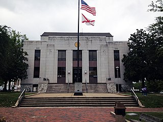
Marion County is a county of the U.S. state of Alabama. As of the 2020 census the population was 29,341. The county seat is Hamilton. The county was created by an act of the Alabama Territorial General Assembly on February 13, 1818. The county seat was originally established in Pikeville in 1820, and moved to Hamilton in 1881. The county was named by planter and US Indian agent John Dabney Terrell, Sr., in recognition of General Francis Marion of South Carolina.
Walker County is a county located in the central portion of the U.S. state of Alabama. As of the 2020 census, the population was 65,342. Its county seat is Jasper. Its name is in honor of John Williams Walker, the first U.S. senator elected from Alabama.
LaFayette is the county seat of Chambers County, Alabama, United States, 47 miles (76 km) northwest of Columbus, Georgia. As of the 2010 census, the population of the city was 3,003.
Calera is a city in Shelby and Chilton counties in the U.S. state of Alabama. It is the location of the Shelby County Airport.
Heflin is a city and the county seat of Cleburne County, Alabama, United States. At the 2020 census, the population was 3,431. It is located approximately halfway between Birmingham and Atlanta along Interstate 20.
East Brewton is a city in Escambia County, Alabama, United States. It was incorporated in October 1918. At the 2020 census, the population was 2,293. The community grew around Fort Crawford, a fort built to protect early settlers of the area.
Belk is a town in Fayette County, Alabama, United States. Its citizens voted to incorporate in January 1969. At the 2020 census, the population was 186.
Berry is a town in Fayette County, Alabama, United States. At the 2010 census the population was 1,148, down from 1,238 at the 2000 census.
Glen Allen is a town located in Fayette and Marion counties in the U.S. state of Alabama. The town incorporated in May 1959. At the 2020 census, the population was 433, down from 510 at the 2010 census. Glen Allen is positioned along the BNSF railway and is near Interstate 22, providing access to multiple expanding industries.
Gu-Win is a town in Fayette and Marion counties in the U.S. state of Alabama. It incorporated in 1956. At the 2020 census the population was 141, down from 176 at the 2010 census. Although a small portion of the town is within Fayette County, all of the population as of 2010 resided in Marion County.
Winfield is a city in Marion and Fayette counties in the U.S. state of Alabama. The population was 4,845 at the 2020 census, the second largest city in Marion County.
Tarrant is a city in Jefferson County, Alabama, bordering Birmingham's north side. At the 2020 census, the population was 6,124. It is home to the ABC Coke plant owned by the Drummond Company, "the largest single producer of foundry coke in the U.S.".
Frisco City is a town in Monroe County, Alabama, United States. The population was 1,170 at the 2020 census.
Camp Hill is a town in Tallapoosa County, Alabama, United States. It was incorporated in 1895. At the 2010 census the population was 1,014, down from 1,273 in 2000. Camp Hill is the home to Southern Preparatory Academy.
Brookwood is a city in Tuscaloosa County, Alabama, United States. It incorporated in September 1977. As of the 2020 census, the population of the town is 2,504.
Jasper is a city in and the county seat of Walker County, Alabama, United States. Its population was 14,352 as of the 2010 census. Named in honor of Sergeant William Jasper, an American Revolutionary War hero, Jasper was settled around 1815 and incorporated on August 18, 1886.
Double Springs is a town in Winston County, Alabama, United States. The city is the county seat of Winston County. The county seat was initially located at Houston, but by referendum in 1883, Double Springs prevailed and it was removed to there. It was incorporated on May 17, 1943. At the 2010 census the population was 1,083, up from 1,003 in 2000.
Switz City is a town in Fairplay and Grant townships, Greene County, Indiana, United States. The population was 293 at the 2010 census. It is part of the Bloomington, Indiana, Metropolitan Statistical Area.