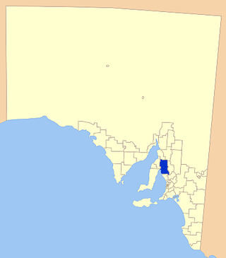
Wakefield Regional Council is a local government area in the Yorke and Mid North region of South Australia. The council seat is at Balaklava.
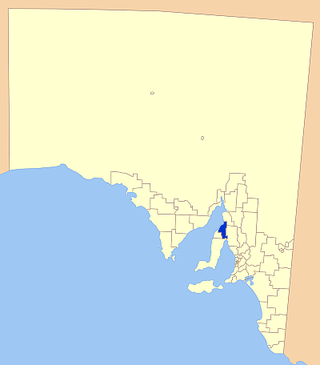
The Barunga West Council is a local government area in the Yorke and Mid North region of South Australia. The council seat is at Port Broughton, with a sub-office at Bute.
Since 1970, the South Australian House of Assembly — the lower house of the Parliament of South Australia — has consisted of 47 single-member electoral districts consisting of approximately the same number of enrolled voters. The district boundaries are regulated by the State Electoral Office, according to the requirements of the South Australian Constitution and are subject to mandatory redistributions by the South Australian Electoral Districts Boundaries Commission in order to respond to changing demographics.
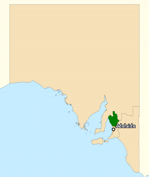
The Division of Wakefield was an Australian electoral division in the state of South Australia. The seat was a hybrid rural-urban electorate that stretched from Salisbury in the outer northern suburbs of Adelaide at the south of the seat right through to the Clare Valley at the north of the seat, 135 km from Adelaide. It included the suburbs of Elizabeth, Craigmore, Munno Para, and part of Salisbury, and the towns of Balaklava, Clare, Freeling, Gawler, Kapunda, Mallala, Riverton, Tarlee, Virginia, Williamstown, and part of Port Wakefield.

The Yorke Peninsula Council is a local government area in South Australia. Its boundaries include most of the Yorke Peninsula. The main Council office is at Maitland; the council also maintains branch offices at Minlaton and Yorketown.
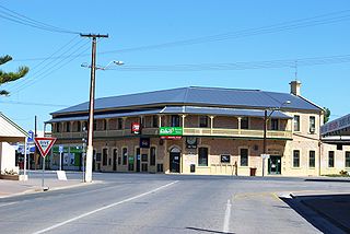
Yorketown is a town and a locality in the Australian state of South Australia located in the southern Yorke Peninsula about 91 kilometres (57 mi) west of the state capital of Adelaide and about 70 kilometres (43 mi) south of the municipal seat of Maitland.

Goyder was an electoral district of the South Australian House of Assembly. It was a 9,258 km2 rural electorate located on the Yorke Peninsula and taking in the towns of Ardrossan, Bute, Edithburgh, Kadina, Maitland, Minlaton, Moonta, Port Wakefield, Wallaroo and Yorketown. The electorate was named after George Goyder, a former state Surveyor-General famous for developing Goyder's Line, which indicated the area of the state that had enough rainfall to be suitable for agriculture.

Frome is a single-member electoral district for the South Australian House of Assembly. It is named after Edward Charles Frome, the third surveyor-general of South Australia. The electorate stretches north-eastwards from the Gawler River and Gulf St Vincent in the south, and includes many of the agricultural areas of the Clare and Gilbert Valleys. It covers a total of 12,921 km2 (4,989 sq mi) and takes in the towns of Auburn, Clare, Mintaro, Port Broughton, Saddleworth, Snowtown and Riverton. Prior to the 2020 redistribution, its main population centre was Port Pirie, since transferred to Stuart.

Stuart is a single-member electoral district for the South Australian House of Assembly. At 323,131 km², it is a vast country district extending from the Spencer Gulf as far as the Northern Territory border in the north and the Queensland and New South Wales borders in the east. The district includes pastoral lease and unincorporated Crown Lands, Lake Eyre and part of the Simpson Desert in the far north. Its main population centres since the 2020 boundaries redistribution are the industrial towns of Port Pirie and Port Augusta.

Taylor is a single-member electoral district for the South Australian House of Assembly. This district is named after Doris Irene Taylor MBE, a leading force in the founding of Meals on Wheels, and Labor activist. Taylor is a 246.2 km2 semi-urban electorate in Adelaide's outer northern suburbs and market gardens on the Adelaide Northern plains. A large portion of the district lives in the western half of the City of Playford and it is regarded as a safe Labor seat. It now includes the suburbs and townships of Andrews Farm, Angle Vale, Bolivar, Buckland Park, Davoren Park, Edinburgh, Edinburgh North, Elizabeth North, Eyre, Macdonald Park, Munno Para West, Penfield, Penfield Gardens, Riverlea Park, Smithfield, Smithfield Plains, St Kilda, Virginia, and Waterloo Corner.
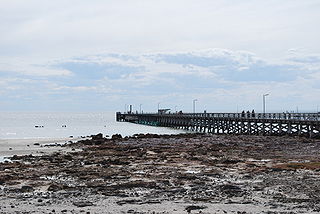
Moonta Bay is located in the Copper Coast region of Northern Yorke Peninsula South Australia, adjacent to the historic town of Moonta and Port Hughes.
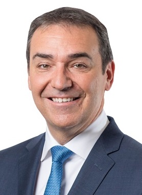
The 2018 South Australian state election to elect members to the 54th Parliament of South Australia was held on 17 March 2018. All 47 seats in the House of Assembly or lower house, whose members were elected at the 2014 election, and 11 of 22 seats in the Legislative Council or upper house, last filled at the 2010 election, were contested. The record-16-year-incumbent Australian Labor Party (SA) government led by Premier Jay Weatherill was seeking a fifth four-year term, but was defeated by the opposition Liberal Party of Australia (SA), led by Opposition Leader Steven Marshall. Nick Xenophon's new SA Best party unsuccessfully sought to obtain the balance of power.
Sultana Point is a locality in the Australian state of South Australia located on the Yorke Peninsula immediately adjoining the western head of Gulf St Vincent about 80 kilometres west of the state capital of Adelaide.
Sandilands is a locality in the Australian state of South Australia located on the east coast of Yorke Peninsula immediately adjoining Gulf St Vincent about 88 kilometres (55 mi) north-west of the state capital of Adelaide and about 18 kilometres (11 mi) south-east of the municipal seat in Maitland.
South Hummocks is a locality in the Mid North of South Australia at the head of Gulf St Vincent adjacent to Yorke Peninsula on the southeastern slopes of the Hummock Range.

Hurtle Vale is a single-member electoral district for the South Australian House of Assembly, located in the southern suburbs of Adelaide. It was created by the redistribution conducted in 2016, and was contested for the first time at the 2018 state election.

Black is a single-member electoral district for the South Australian House of Assembly. It was created by the redistribution conducted in 2016, and was contested for the first time at the 2018 state election. Black is named after Dorrit Black, a South Australian modern artist, best known for linocuts, oil and watercolour paintings.

Badcoe is a single-member electoral district for the South Australian House of Assembly. It was created by the redistribution conducted in 2016, and was contested for the first time at the 2018 state election.
Wauraltee is a locality in the Australian state of South Australia located on the Yorke Peninsula about 102 kilometres (63 mi) west of the state capital of Adelaide and about 25 kilometres (16 mi) south-west of the municipal seat of Maitland.
Koolywurtie is a locality in the Australian state of South Australia located on the Yorke Peninsula about 93 kilometres (58 mi) west of the state capital of Adelaide and about 20 kilometres (12 mi) south of the municipal seat of Maitland.


