Eatonville, Nova Scotia (formerly Three Sisters) | |
---|---|
Coordinates: 45°25′12.5″N64°54′55.2″W / 45.420139°N 64.915333°W | |
Country | Canada |
Province | Nova Scotia |
Founded | 1826 |
Abandoned | circa 1940 |
Population | |
• mid-1880s | 350 (Peak) |
Website | www |
Eatonville is a former lumber and shipbuilding village in Cumberland County, Nova Scotia. It includes a large tidal harbour at the mouth of the Eatonville Brook beside several dramatic sea stacks known as the "Three Sisters". It was founded in 1826 and abandoned in the 1940s. The site of the village is now part of Cape Chignecto Provincial Park.
The complex geology of Eatonville Harbour and powerful erosion forces of the Bay of Fundy tides created a series of dramatic sea stacks, stone arches and caves. Three of the sea stacks are closely grouped and known as the "Three Sisters". According to a Mi'kmaw legend, they were created by the mythical figure Glooscap when he turned a pack of dogs pursuing a moose into the stone towers. The fleeing moose became the Isle Haute and can be seen in the distance from the frozen stone forms of the Three Sisters. [1]
Settlers established a small sawmill on crown land at the tidal harbour beside the sea stacks about 1826. Early families at the settlement which became known as "Three Sisters" included the McDade, McNamara, Atkinson and Spicer families. By 1837 they had built a rough, but much-used road to Advocate, the beginnings of what came to be known as the "Eatonville Road". The land around the community was granted to James McDade in 1851. The land around the harbour and extensive timber holdings inland along Cape Chignecto were purchased by David Rufus Eaton and Charles Frederick Eaton in 1864. [2]
The Eatons built a series of saw mills, lumber camps and a large shipyard. The growing settlement around their mills was named after their family. [3] A shipyard at the harbour produced over 20 large vessels beginning with the 1000 ton barque Chignecto in 1874 [4] and finishing with the tern schooner J. L. Ralston in 1919. [5]
Eatonville ships were noteworthy enough to attract coverage from Harpers Weekly Magazine which published an illustrated feature article on the launch of the barque Argenta at the Eaton's yard in 1890. [6] A notable example was the large ship Joseph H. Scammell built at Eatonville in 1884 which became a famous shipwreck in Australia when she sank in 1891. Eatonville Harbour attracted considerable shipping for the timber export trade. Two small tugs were based at the harbour to assist in docking ships and moving timber rafts [7] and the volume of shipping led to the construction of the Eatonville Lighthouses on the beach south of the wharf which operated from 1909 to 1923. [8]
The harbour witnessed several shipwrecks including the spectacular wreck of the three masted schooner Marjorie J. Sumner which was severely damaged in the harbour in 1906 when it toppled over at low tide and was crushed by its large deckload of timber. [9] The shipyard and large sawmill were located at the harbour while the main village, known as "the Old Town" was located 1 mile (2 km) inland. The two were connected by a "tramway", a horse-drawn pole railway.[ citation needed ]
This section needs additional citations for verification .(May 2023) |
The Eaton's first sawmill was upriver in the "Old Town". In the 1890s, they built a much larger sawmill at Eatonville Harbour. The mill was a large steam-powered operation which could produce 60,000 board feet (100 m3) of lumber a day, but the Eatons "preferred to cut less, waste nothing and strive for quality." This allowed them to make the most sustainable use of their Cape Chignecto timber holdings which also had the advantage of very few forest fires because the "fog forests" of Cape Chignecto are constantly damp from Bay of Fundy fogs.
A network of logging camps across Cape Chignecto connected by trails and log driving streams fed the Eatonville Mills while the adjacent settlement of New Yarmouth provided supplies, horse teams and workers. The village had a population of 350 people in its peak years. About 250 people lived in the Old Town which included a post office, two stores, a combined school and church and a blacksmith shop. About 100 people lived in Eatonville Harbour which had a separate post office and a large store. The store attracted customers from surrounding villages across eastern Cumberland County, drawn by its extensive array of imported goods. The store boasted fine parquet floors and one of the earliest telephone connections in the area. [10]
The Eatons sold their holdings to the Elderkin family in 1897. The population dwindled after World War One as timber stands were exhausted and wooden shipbuilding collapsed. The large mill was eventually destroyed by fire. The village was largely abandoned by the 1930s. Seasonal cutting and exports of timber from scows continued into the 1940s. The last year-round resident left in 1943, although the descendants of several Eatonville families maintain cabins in the area. The surrounding forests were logged by various Cumberland County Mills but especially for pulpwood by the Scott Paper Company until the 1980s.
The Eatonville Road became a seasonal wilderness public road for off-road vehicles maintained by volunteers from Advocate to Eatonville and through to Spicers Cove. In 1989, the Eatonville site became part of Cape Chignecto Provincial Park. The old village site is crossed by the park's main backpacking trail which follows the former tramway for several kilometres and connects to a bunkhouse and wilderness campsites at Eatonville's "Old Town" site. The sea stacks and beach at the harbour are a popular kayak destination. In July 2009, the Park built an "off-the-grid" seasonal interpretation centre accessible by car from Spicers Cove along with a network of short day hikes overlooking the harbour, the Three Sisters sea stacks and a dramatic Raised beach at nearby Squally Point. The interpretation centre closed due to environmental problems in 2013 but the trails and look-offs remain open. [11]
The tidal harbour at Eatonville floods very quickly at high tide and can trap hikers attempting to explore the sea stacks from the beach. Two hikers and a dog were trapped by the tide in 2014 and had to be rescued by a helicopter from CFB Greenwood. [12]
In 2020, the Eatonville Day Use trail system centred on the Three Sisters sea stacks became an anchor of the UNESCO "Cliffs of Fundy Global Geopark which begin at Eatonville and stretch around Cape Chignecto and down the coast to Debert. [13] [14]
The Bay of Fundy is a bay between the Canadian provinces of New Brunswick and Nova Scotia, with a small portion touching the U.S. state of Maine. It is an arm of the Gulf of Maine. Its tidal range is the highest in the world. The name is probably a corruption of the French word fendu, meaning 'split'.
Pugwash is an incorporated village in Cumberland County, Nova Scotia, Canada, located on the Northumberland Strait at the mouth of the Pugwash River. It had a population of 746 as of the 2021 census. The name Pugwash is derived from the Mi'kmaq word, Pakwesk meaning "a shoal", in reference to a reef near the mouth of the harbour.
The Minas Basin is an inlet of the Bay of Fundy and a sub-basin of the Fundy Basin located in Nova Scotia, Canada. It is known for its extremely high tides.
Spencer's Island is a rural community in Cumberland County, Nova Scotia, located at the western end of Greville Bay on the Bay of Fundy. The community is named after a small island 45°19′50″N64°41′30″W of the same name located offshore from nearby Cape Spencer. According to local oral history, the island, cape and community trace their name to a man named Spencer who is buried on the island. However the name more likely comes from Lord Spencer, a British statesman at the time the community was settled.
Advocate Harbour is a rural community located in Cumberland County, Nova Scotia, Canada.
Parrsboro is a community located in Cumberland County, Nova Scotia, Canada.
Joggins is a rural community located in western Cumberland County, Nova Scotia, Canada. On July 7, 2008 a 15-km length of the coast constituting the Joggins Fossil Cliffs was officially inscribed on the World Heritage List.
The Glooscap Trail is a scenic roadway in the Canadian province of Nova Scotia.
Route 209 is a collector road in the Canadian province of Nova Scotia.
The Fundy Shore Ecotour is a former scenic drive and network of tourist destinations in the Canadian province of Nova Scotia and encircles several sub-basins of the Bay of Fundy, which contains the highest tidal range on the planet.
Nova Scotia is a province located in Eastern Canada fronting the Atlantic Ocean. One of the Maritime Provinces, Nova Scotia's geography is complex, despite its relatively small size in comparison to other Canadian provinces.
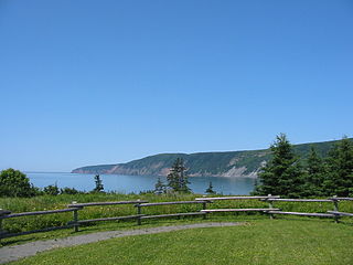
Cape Chignecto Provincial Park is a Canadian provincial park located in Nova Scotia. A wilderness park, it derives its name from Cape Chignecto, a prominent headland which divides the Bay of Fundy with Chignecto Bay to the north and the Minas Channel leading to the Minas Basin to the east. The park, which opened in 1998, is the largest provincial park in Nova Scotia. It also anchors one end of the UNESCO Cliffs of Fundy Global Geopark.
Partridge Island is a significant historical, cultural and geological site located near the mouth of Parrsboro Harbour and the town of Parrsboro on the Minas Basin, in Cumberland County, Nova Scotia, Canada. It attracts many visitors including sightseers, swimmers, photographers, hikers and amateur geologists. Partridge Island is actually a peninsula that is connected to the mainland by a sandbar isthmus. According to local legend, the isthmus was created during the Saxby Gale of 1869. The hiking trail to the top of the island affords scenic views of key landforms on the Minas Basin including Cape Blomidon, Cape Split and Cape Sharp. The nearby Ottawa House By-the-Sea Museum contains artifacts and exhibits illustrating the history of the former village at Partridge Island, which dates from the 1770s. Partridge Island is a favourite hunting ground for rockhounds because its ancient sandstone and basalt cliffs are steadily eroded by the fast-moving currents of the world's highest tides. Rocks and debris worn away from its cliffs are dragged down the beach making it possible to find gemstones, exotic-looking zeolite minerals and fossils. Fossil hunters are warned, however, that although one or two loose specimens may be collected, Nova Scotia law requires that they be sent or taken to a museum for further study, and no fossils may be excavated from bedrock without a permit.
Cape Chignecto is a headland located on the Bay of Fundy coast of the Canadian province of Nova Scotia.
Apple River is a community in the Canadian province of Nova Scotia, located in Cumberland County.
New Yarmouth is an abandoned farming and forestry community which is now part of the Cape Chignecto Provincial Park in Cumberland County, Nova Scotia near the village of Advocate.
The Parrsboro Shore is an area of Cumberland County, Nova Scotia consisting of the shoreline communities west of the town of Parrsboro. The Parrsboro Shore is generally defined as stretching along the Bay of Fundy from the town of Parrsboro westward around Cape Chignecto as far as Apple River. It includes the communities of Diligent River, Fox River, Port Greville, Ward's Brook, Fraserville, Spencer's Island, Advocate, the ghost town of Eatonville. Linked by Nova Scotia's Route 209, the communities form part of the Fundy Shore Ecotour.
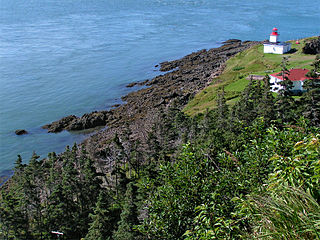
Cape d'Or is a headland located near Advocate, Cumberland County, on the Bay of Fundy coast of the Canadian province of Nova Scotia.
The Fundy Shore Scenic Drive is a scenic drive in the Canadian province of Nova Scotia. It located along the northeastern portion of the Bay of Fundy, following the Chignecto Peninsula which separates Chignecto Bay and Minas Basin, an area which contains the highest tidal range on the planet.