Ditchingham

Last updated

Ditchingham
St Mary's church - geograph.org.uk - 1406281.jpg
St. Mary's Church
Norfolk UK location map.svg
Red pog.svg
Ditchingham
Location within Norfolk
Area8.56 km2 (3.31 sq mi)
Population1,823 (2021 census)
  Density 213/km2 (550/sq mi)
OS grid reference TM 340 910
  London 93 miles
Civil parish
  • Ditchingham
District
Shire county
Region
Country England
Sovereign state United Kingdom
Post town BUNGAY
Postcode district NR35
Dialling code 01986
Police Norfolk
Fire Norfolk
Ambulance East of England
UK Parliament
List of places
UK
England
Norfolk
52°28′00″N1°26′37″E / 52.46676°N 1.44351°E / 52.46676; 1.44351

Ditchingham is a village and civil parish in the English county of Norfolk.

Contents

Ditchingham is located 1.3 miles (2.1 km) north of Bungay and 12 miles (19 km) south-east of Norwich, along the course of the River Waveney.

History

Ditchingham's name is of Anglo-Saxon origin and derives from the Old English for the homestead or settlement of 'Dicca's' people. [1]

In the Domesday Book, Ditchingham is listed as a settlement of 36 households in the hundred of Lodding. In 1086, the village formed part of the East Anglian estates of King William I. [2]

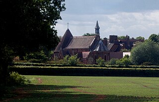
In 1855, an Anglican convent known as the Community of All Hallows was founded in Ditchingham by Lavinia Crosse and Reverend William E. Scudamore. The convent acted as a refuge for women in 'moral danger' and other destitute individuals. The community closed in 2018. [3]

Lilias Rider Haggard's novel, The Rabbit Skin Cap (1939) tells the life story of George Baldry, a local inventor and poacher. The picture on the front cover of the book is a painting by Edward Seago of local schoolboy, Douglas Walter Gower. In later life, Gower discovered the tusk of a woolly mammoth near the long barrow on Broome Heath which is now displayed in Norwich Castle Museum. [4]

Much of the surrounding countryside is part of the estate centred on Ditchingham Hall which was built in the 18th century and features gardens designed by Capability Brown. The Hall is the ancestral seat of the Earl Ferrers and is currently in the possession of Robert Shirley, 14th Earl Ferrers. [5]

In the Nineteenth Century, a silk factory was built in Ditchingham which was later converted into a maltings and later use as a depot for the US Army during the Second World War. The building was severely damaged by fire in 1999 and is now in residential use. [6]

Geography

According to the 2021 census, Ditchingham has a total population of 1,823 people which demonstrates an increase from the 1,635 people listed in the 2011 census. [7]

Ditchingham is located on the course of the River Waveney with the junction of the A143, between Gorleston-on-Sea and Haverhill, and the B1332, between Trowse and Ditchingham, is located in the parish.

St. Mary's Church

Ditchingham's parish church is dedicated to Saint Mary and dates from the Fifteenth Century. St. Mary's is located on Church Lane and has been Grade I listed since 1960. [8]

St. Mary's was restored in 1846 by Anthony Salvin and again in the 1870s by Frederick Preedy.The church boasts an interesting set of stained-glass windows depicting Edmund Tudor with Lady Margaret Beaufort as well as others which may have been imported from Europe after the Napoleonic Wars. [9]

Chicken Roundabout

Ditchingham's Chicken Roundabout had been home to a group of feral chickens as early as the mid-1990s, cared for by a local man called Gordon Knowles. The number of birds living at the roundabout increased and declined over the years due to a range of factors including Avian influenza and theft. In 2010, the remaining chickens were given to an animal charity with a plaque to Knowles' role in the community being erected in 2012. [10]

Amenities

Parravani's ice creams were established in the village in the early C20, and Lamberts Coaches are another long-established local company.

Notable residents

Governance

Ditchingham is part of the electoral ward of Ditchingham & Earsham for local elections and is part of the district of South Norfolk.

The village's national constituency is Waveney Valley which has been represented by the Green Party's Adrian Ramsay MP since 2024.

War Memorial

Ditchingham War Memorial is located inside St. Mary's Church and is a brass structure including a life-sized prone statue of a British soldier created by Derwent Wood. The memorial lists the following names for the First World War: [11] [12]

RankNameUnitDate of DeathBurial
Sgt.Herbert H. Bird2/6th Bn., Gloucestershire Regiment 19 Jul. 1916 Loos Memorial
Sgt.Ernest W. Seeley6th Bn., South Lancashire Regiment 10 Aug. 1915 Helles Memorial
LSgt.Hubert G. Strowger2nd Bn., Norfolk Regiment 31 Dec. 1916 Basra Memorial
Cpl.Bertie A. Johnson7th Bn., Suffolk Regiment 27 Mar. 1918 Pozières Memorial
Cpl.J. William Sampson7th Bn., Suffolk Regt.27 Mar. 1918 Pozières Memorial
LCpl.Harold C. Edmunds1st Bn., Cambridgeshire Regiment 18 Sep. 1918 Épehy Wood Cemetery
LCpl.Gordon C. Williams1st Bn., Norfolk Regiment 30 Aug. 1918 Terlincthun Cemetery
Gnr.Harry Runicles86th Bde., Royal Field Artillery 9 Jul. 1916 Thiepval Memorial
Gnr.George A. Smith321st Bty., Royal Garrison Artillery 3 Jun. 1917 Lijssenthoek Cemetery
Pte.Harold A. FiskeA Coy., Army Service Corps 20 Apr. 1915 All Saints' Cemetery
Pte.Ernest A. Reynolds8th Bn., Border Regiment 5 Jul. 1916 Thiepval Memorial
Pte.Philip C. Simmons5th Bn., The Buffs 28 Sep. 1916 North Gate War Cemetery
Pte.Ralph R. Butcher2nd Bn., Coldstream Guards 16 Sep. 1916 Lesbœufs Cemetery
Pte.Daniel D. Fairhead34th Bn., Royal Fusiliers 14 May 1918 St. Sever Cemetery
Pte.Jacob E. Kent1st Bn., Royal Irish Fusiliers 18 Apr. 1918 Tyne Cot
Pte.Sidney Bird76th Coy., Machine Gun Corps 29 Sep. 1917 Brandhoek Cemetery
Pte.Albert V. Gorbel1st Bn., Middlesex Regiment 26 Aug. 1916 Thiepval Memorial
Pte.Reginald H. V. Dobbie Wellington Regt., NZEF 8 Aug. 1915 Chunuk Bair Memorial
Pte.Augustus G. Williams1st Bn., Norfolk Regiment 25 Oct. 1914 Le Touret Memorial
Pte.Harry Codling1/4th Bn., Norfolk Regt.20 Aug. 1915 Helles Memorial
Pte.William H. Norman8th Bn., Norfolk Regt.22 Oct. 1916 Thiepval Memorial
Pte.Arthur Gillingwater9th Bn., Norfolk Regt.13 May 1916 La Brique Cemetery
Pte.Harry A. Hale1st Bn., Northamptonshire Regiment 21 Dec. 1916 Caterpillar Valley Cem.
Pte.Kenneth R. Hamilton1st Bn., Northamptonshire Regt.19 Nov. 1916 St. Sever Cemetery
Pte.Herbert Prior2nd Bn., Queen's Royal Regiment 2 Apr. 1917 Croisilles Cemetery
Pte.Alan G. Attoe15th (Reserve) Bn., Rifle Brigade 1 Jan. 1918 Bungay Cemetery
Pte.Arthur L. Garrould15th Bn., Royal Scots 9 Apr. 1918 Three Trees Cemetery
Pte.L. Claud Gray1/4th Bn., Suffolk Regiment 29 Aug. 1916 Thiepval Memorial
Pte.George H. Hansy7th Bn., Suffolk Regt.9 Sep. 1915 Nieppe Cemetery
NurseMary A. Rodwell [a] Queen Alexandra's Nursing Corps 17 Nov. 1915 Hollybrook Cemetery

And, the following from the Second World War:

RankNameUnitDate of DeathBurial
2Lt.Jerome E. Treherne Ox and Bucks Light Infantry 27 Jul. 1944 Hermanville War Cemetery
LACJames C. Lambert Royal Air Force Volunteer Reserve 31 Dec. 1941St. Mary's Churchyard
Gnr.Frederick A. Plumb127th Bty., Royal Artillery 14 Feb. 1941St. Mary's Churchyard
Pte.Sidney D. Fairhead5th Bn., Royal Norfolk Regiment 23 Jun. 1943 Kanchanaburi War Cemetery
Pte.William Reeve1st Bn., Hertfordshire Regiment 1 Dec. 1941 Knightsbridge War Cemetery

Notes

Related Research Articles

<span class="mw-page-title-main">Beccles</span> Town in Suffolk, England

Beccles is a market town and civil parish in the East Suffolk district, in the county of Suffolk, England. The town on the A145 and A12 roads, situated 16 miles (26 km) south-east of Norwich and 33 miles (53 km) north-northeast of Ipswich. Nearby towns include Lowestoft to the east and Great Yarmouth to the north-east. The town lies on the River Waveney on the edge of The Broads National Park.
<span class="mw-page-title-main">River Waveney</span> River in east England

The River Waveney is a river which forms the boundary between Suffolk and Norfolk, England, for much of its length within The Broads. The earliest attestation of the name is from 1275, Wahenhe, from *wagen + ea, meaning the river by a quagmire.

<span class="mw-page-title-main">Bungay</span> Town in Suffolk, England

Bungay is a market town, civil parish and electoral ward in the East Suffolk district of Suffolk, England. It lies in the Waveney Valley, 5+12 miles west of Beccles on the edge of The Broads, and at the neck of a meander of the River Waveney. In 2011 it had a population of 5,127.
<span class="mw-page-title-main">Dilham</span> Human settlement in England

Dilham is a village and civil parish in the English county of Norfolk.
<span class="mw-page-title-main">Brumstead</span> Human settlement in England

Brumstead is a village and a civil parish in the English county of Norfolk.
<span class="mw-page-title-main">Denton, Norfolk</span> Village in Norfolk, England

Denton is a village and civil parish in the English county of Norfolk.

<span class="mw-page-title-main">Dunton, Norfolk</span> Village in Norfolk, England

Dunton is a village and civil parish in the North Norfolk district, of the English county of Norfolk.

<span class="mw-page-title-main">Carleton Rode</span> Village and civil parish in Norfolk, England

Carleton Rode is a village and civil parish in the English county of Norfolk.

<span class="mw-page-title-main">Brockdish</span> Human settlement in England

Brockdish is a village and civil parish in the English county of Norfolk.

<span class="mw-page-title-main">Broome, Norfolk</span> Village in Norfolk, England

Broome is a village and civil parish in the English county of Norfolk.

<span class="mw-page-title-main">Burgh St Peter</span> Village in Norfolk, England

Burgh St Peter is a village and civil parish in the English county of Norfolk.

<span class="mw-page-title-main">Bradenham, Norfolk</span> Village in Norfolk, England

Bradenham is a village and civil parish, a conglomeration of East and West Bradenham, in the English county of Norfolk.
<span class="mw-page-title-main">Ellingham, Norfolk</span> Village in Norfolk, England

Ellingham is a village and civil parish in the English county of Norfolk. The village is located 2.3 miles (3.7 km) north-east of Bungay and 13 miles (21 km) south-east of Norwich, along the River Waveney. The majority of the population lies in the east of the parish in Kirby Row.
<span class="mw-page-title-main">Community of All Hallows</span> Religious order based in Suffolk, England

The Community of All Hallows is an Anglican religious order based in Ditchingham, near Bungay, Suffolk, under the jurisdiction of the Church of England. The religious sisters lead a life of prayer and service providing hospitality and spiritual direction in two retreat house, one in the grounds of their former convent at Ditchingham and another on the Isle of Mull.
<span class="mw-page-title-main">Mettingham</span> Human settlement in England

Mettingham is a village and civil parish in the north of the English county of Suffolk. It is 2 miles (3.2 km) east of the market town of Bungay in the East Suffolk district. It had a population of 211 at the 2011 United Kingdom census.
<span class="mw-page-title-main">Waveney Valley line</span> Railway branch line

The Waveney Valley line was a branch line running from Tivetshall in Norfolk to Beccles in Suffolk connecting the Great Eastern Main Line at Tivetshall with the East Suffolk line at Beccles. It provided services to Norwich, Great Yarmouth, Lowestoft, Ipswich and many other towns in Suffolk with additional services to London. It was named after the River Waveney which follows a similar route.

<span class="mw-page-title-main">Dickleburgh</span> Village in Norfolk, England

Dickleburgh is a village and former civil parish, now in the parish of Dickleburgh and Rushall, in the South Norfolk district of the English county of Norfolk.

<span class="mw-page-title-main">Cranworth</span> Village in Norfolk, in England

Cranworth is a village and civil parish in the Breckland district of the English county of Norfolk.

<span class="mw-page-title-main">Didlington</span> Village in Norfolk, England

Didlington is a village and civil parish in the Breckland district of the English county of Norfolk.

<span class="mw-page-title-main">Chicken roundabout</span> Roundabout in Suffolk, United Kingdom

The chicken roundabout is a roundabout located on the A143 road, on the Bungay and Ditchingham bypass in Suffolk, United Kingdom. The roundabout was famous for being the habitat for a large group of feral chickens, which were fed and cared for by a local man until their numbers declined and they were relocated in 2010.

References

  1. "Key to English Place-names". kepn.nottingham.ac.uk. Retrieved 2 January 2025.
  2. "Ditchingham | Domesday Book". opendomesday.org. Retrieved 2 January 2025.
  3. "All Hallows: Ditchingham convent to close after 150 years". BBC News. 25 February 2018. Retrieved 2 January 2025.
  4. "Long barrow and round barrows on Broome Heath, Broome - 1004002 | Historic England". historicengland.org.uk. Retrieved 2 January 2025.
  5. "DITCHINGHAM HALL, Ditchingham - 1153041 | Historic England". historicengland.org.uk. Retrieved 2 January 2025.
  6. "MNF23024 - Norfolk Heritage Explorer". www.heritage.norfolk.gov.uk. Retrieved 2 January 2025.
  7. "Ditchingham (Parish, United Kingdom) - Population Statistics, Charts, Map and Location". www.citypopulation.de. Retrieved 2 January 2025.
  8. "CHURCH OF ST MARY, Ditchingham - 1050612 | Historic England". historicengland.org.uk. Retrieved 2 January 2025.
  9. "Norfolk Churches". www.norfolkchurches.co.uk. Retrieved 2 January 2025.
  10. "Tributes to 'Ole Chicken Man of Bungay' who catapulted roundabout into national spotlight". Eastern Daily Press. 27 January 2020. Retrieved 2 January 2025.
  11. "Roll of Honour - Norfolk - Ditchingham". www.roll-of-honour.com. Retrieved 2 January 2025.
  12. "Geograph:: Denton to Dunton cum Doughton :: War Memorials in Norfolk". www.geograph.org.uk. Retrieved 2 January 2025.

Footnotes

  1. Nurse Rodwell was likely killed in the sinking of HMHS Anglia which struck a mine in the English Channel.