
The Yorke Peninsula Council is a local government area in South Australia. Its boundaries include most of the Yorke Peninsula. The council seat is at Maitland; the council also maintains branch offices at Minlaton and Yorketown.
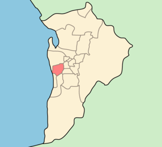
The City of West Torrens is a local government area in the western suburbs of Adelaide, South Australia. Since the 1970s the area was mainly home to many open spaces and parks, however after the mid-1990s (1993-1995) the LGA became more residential.

The District Council of Orroroo Carrieton is a local government area in the Yorke and Mid North region of South Australia. The principal towns are Orroroo and Carrieton; it also includes the localities of Belton, Black Rock, Coomooroo, Erskine, Eurelia, Johnburgh, Minburra, Pekina, Walloway, Yalpara and Yanyarrie, and part of Cradock, Hammond, Moockra, Morchard, Tarcowie and Yatina.

Eurelia is a town and locality in the Australian state of South Australia located on the east side of the Flinders Ranges about 264 kilometres (164 mi) north of the state capital of Adelaide and about 20 kilometres (12 mi) from the municipal seat of Orroroo.
Whyte Yarcowie is a town and locality in the Australian state of South Australia. It is on the Barrier Highway between Hallett and Terowie.
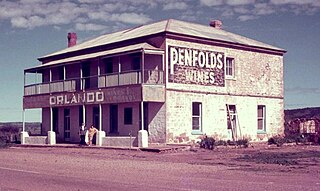
Yatina is a town and locality in the Australian state of South Australia located on the RM Williams Way about 222 kilometres (138 mi) north of the state capital of Adelaide and about 31 kilometres (19 mi) and 21 kilometres (13 mi) respectively from the municipal seats of Jamestown and Orroroo.
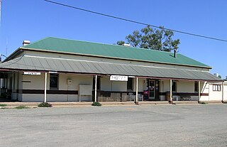
Ucolta is a locality in the Mid North region of South Australia. It is named for a railway station on the Broken Hill-Port Pirie railway line. Trains no longer stop at Ucolta. It is also where the Barrier Highway first meets the railway line, and the Wilmington–Ucolta Road which connects across the northern side of the Mid North, providing the shortest road route from Western Australia and Eyre Peninsula via Port Augusta to Broken Hill and New South Wales.
The District Council of Port Germein was a local government area in South Australia, centred on the town of Port Germein. It was gazetted on 5 January 1888 under the provisions of the District Councils Act 1887 and encompassed the hundreds of Baroota, Wongyarra, Booleroo, Telowie, Darling and Appila. It replaced an abortive earlier municipality, the Corporate Town of Port Germein, which had been established on 15 September 1887 when residents, concerned about increased taxation and their interests being lost in a broader shire under the forthcoming reforms, decided to incorporate the town. The local residents reportedly regretted the decision, and when the Act passed late in the year creating the new District Council, state parliament agreed to amalgamate the Corporate Town into the new municipality.

The District Council of Coglin was a local government area in South Australia. It came into operation on 5 January 1888 under the provisions of the District Councils Act 1887. At its inception, it comprised the Hundreds of Cavenagh, Coglin, Gumbowie, Parnaroo, Hardy, Nackara, and Paratoo. It was divided into four wards: Coglin, Gumbowie, East and North. Meetings were held alternately at Dawson and Lancelot until 1899, and thereafter at Penn.
The District Council of Yongala was a local government area in South Australia from 1883 to 1935, seated at Yongala.

The Corporate Town of Peterborough was a local government area in South Australia centred on the town of Peterborough. It came into existence on 7 October 1886 when it separated from the surrounding District Council of Yongala. It was initially known as Petersburg; it was renamed Peterborough on 10 January 1918, one of many South Australian places to be renamed as a consequence of World War I. It gained additional sections from the Yongala council on 30 August 1888 and 25 November 1897, but lost some territory in 1935 when Yongala amalgamated with the adjacent District Council of Coglin to create the District Council of Peterborough. The two municipalities would coexist alongside each other, the town surrounded by the district council, for more than sixty years.
The District Council of Jamestown was a local government area in South Australia, centred on the region surrounding the town of Jamestown. The District Council came into existence on 21 March 1935 following the amalgamation of 95% of the District Council of Belalie with the District Council of Caltowie and the Hundred of Mannanarie, which had been in the abolished District Council of Yongala. For almost all of its history, it surrounded but did not include the town of Jamestown itself; the Jamestown township had separated from Belalie as the Corporate Town of Jamestown in 1878, and would not merge back into the broader municipality until 1991.
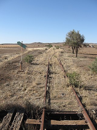
Walloway is a locality in the Australian state of South Australia located about 255 kilometres (158 mi) north of the state capital of Adelaide and about 10 kilometres (6.2 mi) north of the municipal seat of Orroroo.
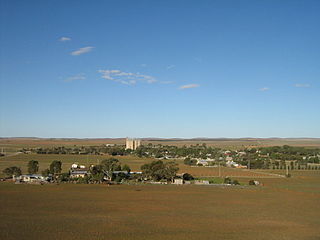
The County of Dalhousie is one of the 49 cadastral counties of South Australia in straddling the Mid North and Flinders Ranges regions. It was proclaimed in 1871 by Governor James Fergusson and was named for Fergusson's father-in-law James Broun-Ramsay, 1st Marquess of Dalhousie.

The Hundred of Yongala is a cadastral unit of hundred located in the Mid North of South Australia. It is one of the 12 hundreds of the County of Dalhousie and was proclaimed by Governor James Fergusson in 1871. The eponymous township of Yongala lies in the west of the hundred and the larger township of Peterborough in the north east. The locality of Sunnybrae occupies the remainder of the hundred.
County of Herbert is a cadastral unit located in the Australian state of South Australia that covers land to the east of the Flinders Ranges about 55 kilometres (34 mi) north-east of the town of Peterborough. It was proclaimed in 1877 and named after a prominent man of the time with either a title or a surname containing the name ‘Herbert’. It has been partially divided in the following sub-units of hundreds – Cavenagh, Coglin, Minburra, Nackara, Paratoo and Waroonee.

Johnburgh is a town and a locality in the Australian state of South Australia located on the eastern side of the Flinders Ranges about 275 kilometres (171 mi) north of the state capital of Adelaide and about 32 kilometres (20 mi) north-east of the municipal seat of Orroroo.

Cavenagh is a locality in the Australian state of South Australia located about 247 kilometres (153 mi) north of the state capital of Adelaide and about 37 kilometres (23 mi) north-east of the municipal seat in Peterborough.
Hardy is a locality in the Australian state of South Australia located about 231 kilometres (144 mi) north of the state capital of Adelaide and about 40 kilometres (25 mi) east of the municipal seat in Peterborough.

County of Kimberley is a cadastral unit located in the Australian state of South Australia that covers land to the east of the Flinders Ranges about 45 kilometres (28 mi) east of the town of Peterborough. It was proclaimed in 1871 and named after John Wodehouse, 1st Earl of Kimberley, a British Secretary of State for the Colonies. It has been partially divided in the following sub-units of hundreds – Gumbowie, Hardy, Ketchowla, Parnaroo, Terowie and Wonna.


