Dalworthington Gardens, Texas

Last updated

Dalworthington, Texas
City of Dalworthington Gardens
Motto: 
"A rural oasis in the heart of the metroplex" [1]
Tarrant County Texas Incorporated Areas Dalworthington Gardens highlighted.svg
Location of Dalworthington Gardens in Tarrant County, Texas
Coordinates: 32°41′37″N97°9′24″W / 32.69361°N 97.15667°W / 32.69361; -97.15667
Country Flag of the United States.svg United States
State Flag of Texas.svg  Texas
County Flag of Tarrant County, Texas.svg Tarrant
Area
[2]
  Total1.82 sq mi (4.72 km2)
  Land1.79 sq mi (4.63 km2)
  Water0.04 sq mi (0.09 km2)  1.95%
Elevation
[3]
574 ft (175 m)
Population
 (2020) [4]
  Total2,293
  Density1,282.44/sq mi (495.15/km2)
Time zone UTC-6 (CST)
  Summer (DST) UTC-5 (CDT)
FIPS code 48-19084 [5]
GNIS feature ID2410290 [3]
Website http://www.cityofdwg.net/

Dalworthington Gardens is a city in Tarrant County, Texas, United States and a suburb of Arlington.

Contents

History

The community was established in 1934 as a subsistence homestead project during the Great Depression under the authority of the National Industrial Recovery Act as part of the Subsistence Homesteads Division. The purpose of the homestead program was to help families attain a better standard of living through a combination of part-time industrial employment and subsistence agriculture. Dalworthington Gardens was one of five such projects located in Texas. Its inclusion in the group was at the suggestion of Eleanor Roosevelt, who happened upon the area while visiting the Fort Worth family of the woman to whom the son of her and President Roosevelt, Elliot, had become engaged. Of the five sites selected for this program, Dalworthington "colony" as it was originally called, is the only one still in existence today. Since it has been in constant operation from its inception, it maintains its original zoning regulations, which allow subsistence farming and livestock on any lots over one-half acre that remain owned and occupied from the time the zoning was first put into effect. Thus, one can see small, older frame homes with livestock on their lot, near and even adjacent to large modern homes with values in excess of $1 million. [1] [6] The community's name is a portmanteau of the names of the three anchor cities of the metroplex: Dallas, Fort Worth, and Arlington. [6]

Geography

According to the United States Census Bureau, the city has a total area of 1.8 square miles (4.7 km2), of which 0.04 square miles (0.1 km2), or 1.95%, is covered by water. [7]

The town's northern border adjoins Pantego; both towns are completely surrounded by the city of Arlington.

Demographics

Historical population
CensusPop.Note
1950 267
1960 43061.0%
1970 75776.0%
1980 1,10045.3%
1990 1,75859.8%
2000 2,18624.3%
2010 2,2593.3%
2020 2,2931.5%
2021 (est.)2,273 [8] −0.9%
U.S. Decennial Census [9]
Dalworthington Gardens racial composition (2020) [10]
(NH = Non-Hispanic) [lower-alpha 1]
RaceNumberPercentage
White (NH)1,62570.87%
Black or African American (NH)2018.77%
Native American or Alaska Native (NH)50.22%
Asian (NH)1355.89%
Pacific Islander (NH)30.13%
Some other race (NH)80.35%
Mixed/multiracial (NH)873.79%
Hispanic or Latino 2299.99%
Total2,293

As of the 2020 United States census, 2,293 people, 789 households, and 657 families resided in the city. Its population was 2,259 at the 2010 census. [13]

Politics

Dalworthington Gardens is a largely Republican jurisdiction in modern times, having supported the GOP in the last six presidential elections, and the last seven Texas gubernatorial elections.

Dalworthington Gardens city vote
by party in presidential elections
Year Democratic Republican Third Parties
2020 [14] 32.96% 46767.04%9500.00% 0
2016 [15] 26.32% 34868.91%9114.77% 63
2012 [16] 22.48% 30575.76%1,0281.77% 24
2008 [17] 25.09% 35273.98%1,0380.93% 13
2004 [18] 21.58% 31177.10%1,1111.32% 19
2000 [19] 22.66% 26173.96%8523.39% 39
Dalworthington Gardens city vote
by party in gubernatorial elections
Year Democratic Republican Third Parties
2022 [20] 31.61% 37867.39%8061.00% 12
2018 [21] 23.52% 29475.28%9411.20% 15
2014 [22] 24.46% 23674.61%7200.93% 9
2010 [23] 22.05% 20474.16%6863.78% 35
2006 [24] 19.83% 19051.36%49228.81% 276
2002 [25] 24.34% 22374.34%6815.32% 12
1998 [26] 17.69% 13381.38%6120.93% 7

Education

Public education

Dalworthington Gardens lies within the Arlington Independent School District. [27] Dalworthington Gardens is served by Key Elementary School, Gunn Junior High School, Martin High School, and Arlington High School.

In Texas, school district boundaries do not always follow city and county boundaries because all aspects of the school district government apparatus, including school district boundaries, are independent from the city and county government. In the case of Dalworthington Gardens, no independent school district was ever established. The proximity of the already established Arlington ISD led to the entirety of Dalworthington Gardens being served by the AISD since the middle of the 20th century.

Colleges and universities

No colleges or universities are located in this community, but the town lies in proximity to the University of Texas at Arlington. The community is also served by the Tarrant County College district of junior colleges, which has campuses located in some surrounding cities.

Related Research Articles

<span class="mw-page-title-main">Tarrant County, Texas</span> County in Texas, United States

Tarrant County is a county located in the U.S. state of Texas with a 2020 U.S. census population of 2,110,640, making it the third-most populous county in Texas and the 15th-most populous in the United States. Its county seat is Fort Worth. Tarrant County, one of 26 counties created out of the Peters Colony, was established in 1849 and organized the next year. It is named after Edward H. Tarrant, a lawyer, politician, and militia leader.

<span class="mw-page-title-main">Arlington, Texas</span> City in Texas, United States

Arlington is a city in Tarrant County, Texas, United States. It is part of the Mid-Cities region of the Dallas–Fort Worth–Arlington metropolitan statistical area, and is a principal city of the metropolis and region. The city had a population of 394,266 in 2020, making it the second-largest city in the county after Fort Worth and the third-largest city in the metropolitan area, after Dallas and Fort Worth. Arlington is the 50th-most populous city in the United States, the seventh-most populous city in the state of Texas, and the largest city in the state that is not a county seat.

<span class="mw-page-title-main">Homestead Meadows North, Texas</span> Census-designated place in Texas, United States

Homestead Meadows North is a census-designated place (CDP) in El Paso County, Texas, United States. The population was 5,124 at the 2010 census. It is part of the El Paso Metropolitan Statistical Area.

<span class="mw-page-title-main">Atascocita, Texas</span> Census-designated place in Harris County, Texas, United States

Atascocita is a census-designated place (CDP) in Harris County, Texas, United States, within the Houston metropolitan area. As of the 2020 census it had a population of 88,174. It is located north and south of Farm to Market Road 1960 about 6 miles (10 km) east of Humble and 18 miles (29 km) northeast of downtown Houston in northeastern Harris County.
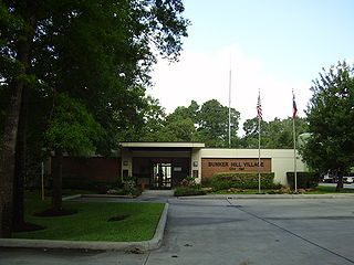
<span class="mw-page-title-main">Bunker Hill Village, Texas</span> City in the United States

Bunker Hill Village is a city in Harris County, Texas, United States, part of Houston–The Woodlands–Sugar Land metropolitan area. The population was 3,822 at the 2020 census. It is part of a collection of upscale residential communities in west Houston known as the Memorial Villages. As of 2010, Bunker Hill Village was the sixth wealthiest place in Texas. Also, Bunker Hill Village is one of Forbes' top 25 places to retire rich.

<span class="mw-page-title-main">Euless, Texas</span> City in Texas, United States

Euless is a city in Tarrant County, Texas, United States, and a suburb of Dallas and Fort Worth. Euless is part of the Mid-Cities region between Dallas and Fort Worth. In 2020 Census, the population of Euless was 61,032. The population of the city increased by 19.02% in 10 years. The city's population was 51,277 as of the 2010 census.

<span class="mw-page-title-main">Everman, Texas</span> City in Texas, United States

Everman is a city in Tarrant County, Texas, United States. Its population was 6,154 in the 2020 census, an increase over the figure of 6,108 tabulated in 2010.

<span class="mw-page-title-main">Forest Hill, Texas</span> City in Texas, United States

Forest Hill is a suburb of Fort Worth in Tarrant County, Texas, United States. The population was 13,955 at the 2020 census.

<span class="mw-page-title-main">Haltom City, Texas</span> City in Texas

Haltom City is a city in the U.S. state of Texas, located in Tarrant County. It is part of the Mid-Cities region of the Dallas-Fort Worth metroplex. Its population was 46,073 at the 2020 census. Haltom City is an inner suburb of Fort Worth, a principal city of the DFW Metroplex. The city is six miles from downtown Fort Worth, 30 miles from the American Airlines Center in Dallas, and 20 miles from the Dallas/Fort Worth International Airport. Haltom City is surrounded almost entirely by Fort Worth, North Richland Hills, Watauga, and Richland Hills.

<span class="mw-page-title-main">Hurst, Texas</span> City in Texas, United States

Hurst is a city in the U.S. state of Texas located in the densely populated portion of northeastern Tarrant County and is part of the Dallas–Fort Worth metropolitan area. It is considered a Dallas and Fort Worth suburb and is part of the Mid-Cities region. It is 13 miles from the Dallas/Fort Worth International Airport. As of the 2020 census, it had a population of 40,413.

<span class="mw-page-title-main">Kennedale, Texas</span> City in Texas, United States

Kennedale is a city in Tarrant County, Texas, United States. The city had a population of 8,517 as of 2020.

<span class="mw-page-title-main">Lake Worth, Texas</span> City in Texas, United States

Lake Worth is a city in Tarrant County, Texas, United States. The population was 4,711 at the 2020 census. The city is adjacent to, and named after, Lake Worth, a popular recreational lake in the northwestern portion of Tarrant County.
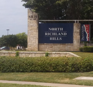
<span class="mw-page-title-main">North Richland Hills, Texas</span> City in Texas, United States

North Richland Hills, commonly known as NRH, is a city in the U.S. state of Texas, located in Tarrant County. It is a mid-to-high end suburb of Fort Worth and forms part of the Mid-Cities region of the Dallas-Fort Worth Metroplex. The population was 69,917 at the 2020 census, making it the third largest city in Tarrant County. In 2006, North Richland Hills was selected as one of the “Top 100 Best Places to live in America” according to Money magazine, and in 2016, the Dallas Morning News ranked North Richland Hills #9 on its list of best Dallas–Fort Worth neighborhoods. Major streets and highways include: FM 1938, Mid Cities Boulevard, Bedford-Euless Road, Interstate Highway 820, North Tarrant Parkway, FM 3029, and TX SH 26. It is home to the Birdville Independent School District, and the northern portion is served by Keller ISD.

<span class="mw-page-title-main">Pantego, Texas</span> Town in Texas, United States

Pantego is a town in Tarrant County, Texas, United States. Its population was 2,568 at the 2020 census. It is entirely surrounded by the cities of Arlington and Dalworthington Gardens. It is in the middle of the Dallas–Fort Worth metroplex, a metropolitan area spanning several counties.

<span class="mw-page-title-main">River Oaks, Texas</span> City in Texas, United States, population 7,427

River Oaks is a city in Tarrant County, Texas, United States. Its population was 7,646 at the 2020 census.

<span class="mw-page-title-main">Sansom Park, Texas</span> City in Texas, United States

Sansom Park is a city in Tarrant County, Texas, United States. Its population was 5,454 at the 2020 census.

<span class="mw-page-title-main">Westover Hills, Texas</span> Town in Texas, United States

Westover Hills is a town in Tarrant County, Texas, United States. The population was 641 at the 2020 census.
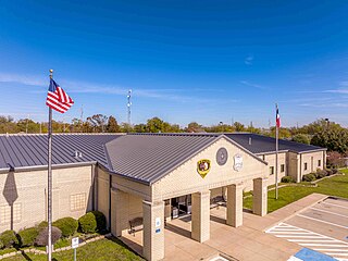
<span class="mw-page-title-main">White Settlement, Texas</span> City in Tarrant County, Texas, United States

White Settlement is a city in Tarrant County, Texas, United States, and a northwestern suburb of Fort Worth. The population was estimated to be 18,084 in 2021.

<span class="mw-page-title-main">Crowley, Texas</span> Multi-county city in Texas, United States

Crowley is a city located mainly in Tarrant County in the U.S. state of Texas. The population was 18,070 at the 2020 census, up 40.8% from the 2010 census.

Beauxart Gardens is an unincorporated community and census-designated place (CDP) in eastern Jefferson County, Texas, United States. It is located between U.S. Highway 69, U.S. Highway 96, U.S. Highway 287, and Spur 93. The community is six miles (10 km) southeast of downtown Beaumont and slightly to the west of Southeast Texas Regional Airport. It is across a highway from the unincorporated community of Viterbo. It was first listed as a CDP in the 2020 census with a population of 1,064.

References

  1. 1 2 "The City of Dalworthington Gardens". The City of Dalworthington Gardens. Retrieved October 19, 2012.
  2. "2019 U.S. Gazetteer Files". United States Census Bureau. Retrieved August 7, 2020.
  3. 1 2 U.S. Geological Survey Geographic Names Information System: Dalworthington Gardens, Texas
  4. "Profile of General Population and Housing Characteristics: 2020 Demographic Profile Data (DP-1): Dalworthington Gardens city, Texas". United States Census Bureau . Retrieved February 9, 2024.
  5. "U.S. Census website". United States Census Bureau . Retrieved January 31, 2008.
  6. 1 2 Bagby, Pam. "History of Dalworthington Gardens". City of DWG. Archived from the original on August 27, 2013. Retrieved September 5, 2013.
  7. "Geographic Identifiers: 2010 Demographic Profile Data (G001): Dalworthington Gardens city, Texas". United States Census Bureau . Retrieved November 30, 2011.
  8. "Population and Housing Unit Estimates". United States Census Bureau. May 24, 2020. Retrieved May 27, 2020.
  9. "Census of Population and Housing". Census.gov. Retrieved June 4, 2015.
  10. "Explore Census Data". data.census.gov. Retrieved May 22, 2022.
  11. "Census.gov". Census.gov.
  12. "About the Hispanic Population and its Origin". www.census.gov. Retrieved May 18, 2022.
  13. "Profile of General Population and Housing Characteristics: 2010 Demographic Profile Data (DP-1): Dalworthington Gardens city, Texas". United States Census Bureau . Retrieved November 30, 2011.
  14. Tarrant County hadn’t voted Democrat for president since 1964. How did Joe Biden win? star-telegram.com (subscription required)
  15. Precinct Report — Official tarrantcounty.com
  16. Official results clarityelections.com
  17. Precinct Report — Total Voters — Official tarrantcounty.com
  18. Precinct report tarrantcounty.com
  19. Official canvass tarrantcounty.com
  20. "Election Night Reporting". results.enr.clarityelections.com. Retrieved November 29, 2023.
  21. 2018 elections
  22. 2014 elections
  23. "2010 elections" (PDF). Retrieved November 29, 2023.
  24. "2006 elections" (PDF). Retrieved November 29, 2023.
  25. 2002 elections
  26. 1998 elections
  27. "Arlington Independent School District". Arlington Independent School District. Archived from the original on October 15, 2012. Retrieved October 19, 2012.
  1. Note: the US Census treats Hispanic/Latino as an ethnic category. This table excludes Latinos from the racial categories and assigns them to a separate category. Hispanics/Latinos can be of any race. [11] [12]