This article needs additional citations for verification .(August 2020) |
Craven Arms | |
---|---|
Corvedale Road | |
Location within Shropshire | |
Population | 2,289 |
OS grid reference | SO432828 |
Civil parish |
|
Unitary authority | |
Ceremonial county | |
Region | |
Country | England |
Sovereign state | United Kingdom |
Post town | CRAVEN ARMS |
Postcode district | SY7 |
Dialling code | 01588 |
Police | West Mercia |
Fire | Shropshire |
Ambulance | West Midlands |
UK Parliament | |
Website | https://visitcravenarms.co.uk/ |
Craven Arms is a market town and civil parish in Shropshire, England. It is sited on the A49 road and the Welsh Marches railway line, which link it north and south to the larger towns of Shrewsbury and Ludlow respectively. The town is enclosed to the north by the Shropshire Hills Area of Outstanding Natural Beauty and to the south is the fortified manor house of Stokesay Castle.
Craven Arms is a market town for the surrounding rural area, with a number of shops, estate agents, a supermarket, an abattoir and many commercial/light industrial businesses. It is also a visitor destination, being home or nearby to a number of attractions, and is a centre for visitors to the area of outstanding natural beauty. It describes itself as the Gateway to the Marches .
Craven Arms is a relatively new town (for Shropshire), being only a small village called Newton on a map of 1695. The settlement grew when the railway station came during the mid to late 19th century, making it a railway town. Newton or Newtown is still the name for the southeastern part of the present day town, while the northern part is called Newington or New Inn (another small village which existed prior to the town). The town takes its name from the Craven Arms Hotel, which was situated on the junction of the A49 and B4368 roads, which in turn is named after the Lords Craven (who owned nearby Stokesay Castle).
The civil parish of Craven Arms was formed in 1987 by the merging of two older parishes: Stokesay and Halford. These two older entities continued as parish wards; however, a review of the governance of the parish in 2012 concluded that these two wards would be abolished from May 2013. [1] Small parts of the settlement overlap into neighbouring Wistanstow and Sibdon Carwood parishes.
Nearby towns are Bishop's Castle, Clun, Church Stretton and Ludlow, of which the last is the most substantial with 10,000 inhabitants.
The River Onny flows to the town's east and just over the river is the small village of Halford. To the south is the small village of Stokesay, while to the north is the village of Wistanstow.
Wenlock Edge is located to the north-east of the town and runs in a northeasterly direction, towards Much Wenlock.
Craven Arms railway station lies at the junction of the Welsh Marches Line and the Heart of Wales Line, 20 miles (32 km) south of Shrewsbury. All passenger trains calling at the station are operated by Transport for Wales, who also manage it. Most services run along a route between Carmarthen, Cardiff Central, Hereford, Shrewsbury, Crewe and Manchester Piccadilly; there are also irregular trains north to Holyhead and south-west to Llandrindod. [2]
Minsterley Motors operate two bus routes which connect Craven Arms with Ludlow, Church Stretton, Shrewsbury and Pontesbury. [3]
There are three main visitor attractions in the Craven Arms civil parish. In the town there is the Shropshire Hills Discovery Centre, a centre featuring exhibits about the county's geography; [4] and Stella Mitchell's Land of Lost Content Museum, a collection of 20th-century memorabilia. [5] Stokesay Castle is a fortified manor house located within the parish, just south of the town.
Craven Arms is home to several churches. The Anglican parish church is the grade II listed church of St Thomas, outside the town in the village of Halford. [6] [7] The grade I listed Church of St John the Baptist, Stokesay is south of the town near Stokesay Castle. [8] St Andrews Community Church in the town centre is "non-denominational, evangelical & charismatic", [9] and there is a Methodist church, [10] and a Jehovah's Witnesses Kingdom Hall. A small Islamic centre is in the town on Newton Street. [11] It is the only mosque for the surrounding Shropshire Hills. The other nearest mosques are in Shrewsbury and Telford.[ citation needed ]
The town has recently[ when? ] gone through a phase of expansion and this looks set to continue with the (2009 abolished) South Shropshire District Council stating that they wished to see the town become the district's second main market town (after Ludlow) by 2026. Much of the recent housing development is on the west side of the town, whilst commercial development is taking place more on the northern end. Development potential towards the east is restricted by the floodplain of the River Onny, whilst to the south lies the historically important Stokesay Castle.
The town centre itself has seen some notable developments in recent years, with new commercial buildings built on Dale Street by the A49 road. Additionally, to the immediate south of the town centre is the Shropshire Hills Discovery Centre which opened in 2001 and some new housing.
Shropshire is a ceremonial county in the West Midlands of England, on the Welsh border. It is bordered by Wrexham County Borough and Cheshire to the north, Staffordshire to the east, Worcestershire to the south-east, Herefordshire to the south and Powys to the west. The largest settlement is Telford, and Shrewsbury is the county town.
Church Stretton is a market town and civil parish in Shropshire, England, 13 miles (21 km) south of Shrewsbury and 15 miles (24 km) north of Ludlow. The population in 2011 was 4,671.
The A49 is an A road in western England, which traverses the Welsh Marches region. It runs north from Ross-on-Wye in Herefordshire via Hereford, Leominster, Ludlow, Shrewsbury and Whitchurch, then continues through central Cheshire to Warrington and Wigan before terminating at its junction with the A6 road just south of Bamber Bridge, near the junction of the M6, M65 and M61 motorways.
All Stretton is a village and a now separate civil parish in Shropshire, England. Much of it is covered by a Conservation Area.
Wistanstow is a village and parish in Shropshire, England. Wistanstow is located about 5 miles (8.0 km) south of Church Stretton and 8+1⁄2 miles (13.7 km) north of Ludlow. It is about 2 miles (3.2 km) north of Craven Arms. It is just off the main Shrewsbury-Hereford road, the A49. The large parish, of 5,231 acres, includes a number of other small settlements: Woolston, Upper Affcot, Cwm Head, Bushmoor, Strefford, Whittingslow, Felhampton and Cheney Longville, and a population of 724 was recorded in the 2001 census, increasing to 812 at the 2011 Census.
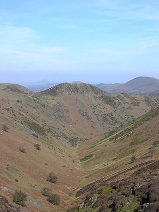
The Shropshire Hills National Landscape is a designated Area of Outstanding Natural Beauty (AONB) in Shropshire, England. It is located in the south of the county, extending to its border with Wales. Designated in 1958, the area encompasses 802 square kilometres (310 sq mi) of land primarily in south-west Shropshire, taking its name from the upland region of the Shropshire Hills. The A49 road and Welsh Marches Railway Line bisect the area north–south, passing through or near Shrewsbury, Church Stretton, Craven Arms and Ludlow.
Stokesay is a village and former civil parish, now in the parish of Craven Arms, in the Shropshire district, in the ceremonial county of Shropshire, England. It is just south of Craven Arms on the A49 road, also fleetingly visible from the Shrewsbury to Hereford Welsh Marches railway line. In 1961 the parish had a population of 1217.
Church Stretton railway station is a railway station serving the town of Church Stretton in Shropshire, England on the Welsh Marches Line, 12+3⁄4 miles (20.5 km) south of Shrewsbury railway station; trains on the Heart of Wales Line also serve the station. All trains services are operated by Transport for Wales, who also manage the station.
Bromfield is a village and civil parish in Shropshire, England.
Sibdon Carwood is a hamlet and parish in Shropshire, England. To the east is the town of Craven Arms.
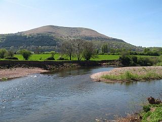
The Marches Way is a partially waymarked long-distance footpath in the United Kingdom. It runs for 351 kilometres (218 mi) through the Welsh–English borderlands, traditionally known as the Welsh Marches, and links the cities of Chester in the north and Cardiff in the south.
Halford is a hamlet and former civil parish, now in the parish of Craven Arms, in the Shropshire district, in south Shropshire, England. It lies just east of the market town of Craven Arms, on the other side of the River Onny. In 1961 the parish had a population of 167.
Onibury is a village and civil parish on the River Onny in southern Shropshire, about 4 miles (6.4 km) northwest of the market town of Ludlow.
Cheney Longville is a small village in Shropshire, England.
National Cycle Network Route 44, part of the National Cycle Network, connects Shrewsbury, Shropshire with Cinderford, Gloucestershire. The part of the route from Shrewsbury to Bromfield is signed - the remainder of the route is currently unsigned.
Strefford is a historic hamlet in Shropshire, England.
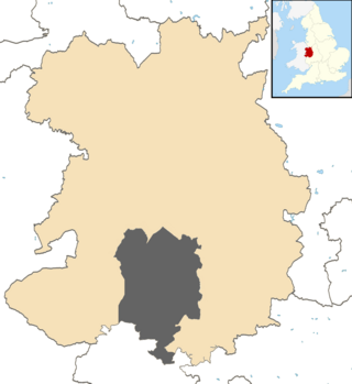
Munslow is a hundred of Shropshire, England. It was formed with the amalgamation of the Anglo-Saxon hundreds of Patton and Culvestan during the reign of Henry I. Hundreds in England had various judicial, fiscal and other local government functions, their importance gradually declining from the end of manorialism to the latter part of the 19th century.
Halford: St Thomas ... This is the parish church