This article needs additional citations for verification . (July 2013) (Learn how and when to remove this template message) |
Chandapur | |
---|---|
Village | |
Coordinates: 20°21′22″N86°09′32″E / 20.355994°N 86.158819°E Coordinates: 20°21′22″N86°09′32″E / 20.355994°N 86.158819°E | |
Country | |
State | Odisha |
District | Nayagarh |
Population (2011) | |
• Total | 7,000 |
Languages | |
• Official | Oriya |
Time zone | UTC+5:30 (IST) |
Vehicle registration | OD |
Website | odisha |
Chandapur is a village in Nayagarh district in the state of Odisha, India. Chandpur one of the business centre of Ranpur block.
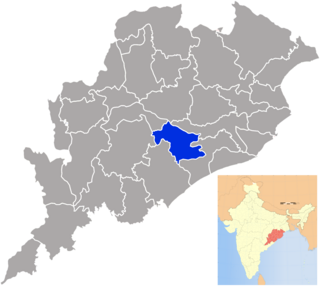
Nayagarh district is one of the 30 districts of Odisha State in eastern India. It was created in 1992 when the erstwhile Puri District was split into three distinct districts, namely Khurdha, Nayagarh and Puri. It is home to the Baisipali Wildlife Sanctuary. It is like a Hill station, so far as natural scenery is concerned. Chhena Poda is the favourite sweet for which Nayagarh is famous in Odisha.
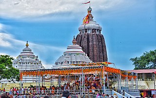
Odisha is one of the 28 states of India. Located in eastern India, it is surrounded by the states of West Bengal to the northeast, Jharkhand to the north, Chhattisgarh to the west and northwest, and Andhra Pradesh to the south. Odisha has 485 kilometres (301 mi) of coastline along the Bay of Bengal on its east, from Balasore to Ganjam. It is the 8th largest state by area, and the 11th largest by population. The state also has the third largest population of Scheduled Tribes in India. Odia is the official and most widely spoken language, spoken by 36.6 million according to the 2016 Census.
As of 2001 [update] India census, [1] Chandapur had a population of 5260. Males constitute 51% of the population and females 49%. Chandapur has an average literacy rate of 70%, higher than the national average of 59.5%; with male literacy of 76% and female literacy of 63%. 10% of the population is under 6 years of age.
A census is the procedure of systematically acquiring and recording information about the members of a given population. This term is used mostly in connection with national population and housing censuses; other common censuses include traditional culture, business, supplies, and traffic censuses. The United Nations defines the essential features of population and housing censuses as "individual enumeration, universality within a defined territory, simultaneity and defined periodicity", and recommends that population censuses be taken at least every ten years. United Nations recommendations also cover census topics to be collected, official definitions, classifications and other useful information to co-ordinate international practices.
Puthunagaram is a village and gram panchayat in the Palakkad district, state of Kerala, India.
Desur is a Town panchayat in Tiruvanamalai district in the Indian state of Tamil Nadu.
Herohalli is a census town in Bangalore district in the Indian state of Karnataka.
Hunasamaranahalli is a census town in Bangalore District in the Indian state of Karnataka.
Kothnur is a census town in Bangalore district in the Indian state of Karnataka.
Kureekkad is a census town in Ernakulam district in the Indian state of Kerala.
Lohian Khas is a town and a nagar panchayat in Jalandhar district in the Indian state of Punjab. There are 11 Wards in it. A bus stand and railway station also situated here. By train people go to Makhu, Ferozpur, Sultanpur Lodhi, Kapurthala, Nakodar, Jalandhar and Ludhiana. There are schools for computer education and Ielts academies also here.
Naravarikuppam is a town in Thiruvallur district in the Indian state of Tamil Nadu.also called redhills
Padianallur is a census town in northern suburb of Chennai, Thiruvallur district in the Indian state of Tamil Nadu.
Peerkankaranai is a town in Southern part of the metropolitan city of Chennai in the Indian state of Tamil Nadu.
Perumbaikad is a census town in Kottayam district in the Indian state of Kerala.
Ramjibanpur is a city and a municipality in Paschim Medinipur district in the Indian state of West Bengal.
Sadasivpet is a town in sangareddy district of the Indian state of Telangana.
Sahnewal is a town and a Municipal Concil in Ludhiana district in the Indian state of Punjab. The town is situated on National Highway No. 44, between Khanna and Ludhiana.
Salumbar is a small town and a municipality in Udaipur district in the Indian state of Rajasthan. It was ruled by the Chundawat Sisodia rajputs of Mewar.
Thevaram is a town in Theni district in the Indian state of Tamil Nadu. Thevaram is located in Tamil Nadu near on border of Kerala at the Eastern side foot-hill of the Western Ghats. It is connected with State Highway SH100.
Uttarahalli is a suburb of Bangalore in the Indian state of Karnataka.
Vengathur is a census town in Thiruvallur district in the Indian state of Tamil Nadu.
Venkatapur is a census town in Bhatkal Taluk in Uttara Kannada district of Karnataka.
Kerur is a City in Bagalkot district in Karnataka, which located on NH 218. It has an average elevation of 617 meters (2024 feet). It's a birthplace of Jagadish Shettar, a former Chief Minister of Karnataka. Kerur is a Town Panchayat city in district of Bagalkot, Karnataka. The Kerur city is divided into 16 wards for which elections are held every five years. The Kerur Town Panchayat has population of 19,731 of which 9,929 are males while 9,802 are females as per report released by Census India 2011.
This article about a location in Nayagarh district, Odisha, India is a stub. You can help Wikipedia by expanding it. |