Tadley is a town and civil parish in the Basingstoke and Deane district of Hampshire, England, 5.5 miles (8.9 km) north of Basingstoke and 11 miles (17 km) south west of Reading.

Hindhead is a village in the Waverley district of the ceremonial county of Surrey, England. It is the highest village in the county and its buildings are between 185 metres (607 ft) and 253 metres (830 ft) above sea level. The village forms part of the Haslemere parish. Situated on the county border with Hampshire, it is best known as the location of the Devil's Punch Bowl, a beauty spot and site of special scientific interest.
Kings Worthy is a village and civil parish in Hampshire, England, approximately two miles north-east of Winchester. Kings Worthy was a tithing of Barton Stacey when the Domesday Book was written.

Theale is a village and civil parish in West Berkshire, England. It is 5 miles (8 km) southwest of Reading and 10 miles (16 km) east of Thatcham. The compact parish is bounded to the south and south-east by the Kennet & Avon Canal, to the north by a golf course, to the east by the M4 motorway and to the west by the A340 road.
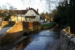
Hampstead Norreys is a village and civil parish in Berkshire, England. It is centred on the River Pang, north of Newbury. As well as the nucleus of Hampstead Norreys, the parish includes the hamlets of Bothampstead, Eling and Wyld Court. The village was recorded in the Domesday Book of 1086 as Hanstede.
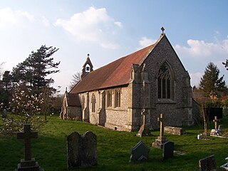
East Woodhay is a village and civil parish in Hampshire, England. The village is approximately 5.5 miles (9 km) south-west of Newbury in Berkshire. At the 2011 census the parish had a population of 2,914.

Aldermaston railway station serves the village of Aldermaston in Berkshire, England. The station is at nearby Aldermaston Wharf and about 2 miles (3 km) north of Aldermaston village. It is 44 miles 63 chains measured from London Paddington.
Whitchurch is a town in the borough of Basingstoke and Deane in Hampshire, England. It is on the River Test, 13 miles (21 km) south of Newbury, Berkshire, 12 miles (19 km) north of Winchester, 8 miles (13 km) east of Andover and 12 miles (19 km) west of Basingstoke. Much of the town is a Conservation Area. Because of the amount of wildlife in and near the River Test, its course and banks are designated as Site of Special Scientific Interest. Whitchurch markets itself as a gateway to the North Wessex Downs National Landscape; the third largest of Britain's National Landscapes.

Beech Hill is a small village and civil parish in Berkshire, England. It is in the south east of the West Berkshire unitary authority area and bounds Hampshire and Wokingham district.

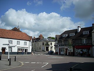
Kingsclere is a large village and civil parish in Hampshire, England.

Overton is a large village and parish in Hampshire, England, west of Basingstoke and east of Andover and Whitchurch. The village contains the smaller hamlets of Southington, Northington, Ashe, Polhampton, and Quidhampton, the latter two lying to the north of the village. The River Test has its source 1 mile (1.6 km) to the east in Ashe.
Cliddesden is a village and a parish in Hampshire, England located 3 miles south of Basingstoke, close to the M3 motorway. In the 2001 census it had a population of 489, increasing to 497 at the 2011 Census. The land and housing are currently protected as it is within a Conservation Zone and has many areas of beauty and rolling countryside.
Litchfield is a village and former civil parish, now in the parish of Litchfield and Woodcott, in the Basingstoke and Deane district of Hampshire, England. It is closely bypassed by the A34 trunk road between Newbury and Whitchurch, which follows the course of the former Didcot, Newbury and Southampton Railway. Litchfield railway station, which closed in 1960, was on this line. The station is a private house, not owned by C.A.H Wills who owns Litchfield farms estate and lives in the village. The station was sold by Hampshire County Council in 1978 and has been restored. The approach road is now a private drive to the property. In 1976 the Litchfield - Whitchurch bypass was opened and made use of the DN&SR trackbed south of Litchfield towards Whitchurch for a distance of one mile. In 1931 the parish had a population of 88.

Ashmansworth is a village and civil parish in the Basingstoke and Deane district of the English county of Hampshire.

Barton Stacey is a village and undulating civil parish, which includes the hamlets of Bransbury, Newton Stacey, Drayton and Cocum, in the Test Valley district of Hampshire, England, centred about 7 miles (11 km) south-east of Andover. It is bounded to the north by the estate of Drayton Lodge, and, to the south, by the minor A30 road; both being east–west routes, and connected by The Street/Cocum Road, the main road that bisects the village. The distance between the A303 and A30 at this point is 2 miles (3.2 km), which is twice the width of the parish.

Micheldever is a village and civil parish in Hampshire, England, situated 6 miles (10 km) north of Winchester. It lies upon the River Dever.

Highclere is a village and civil parish situated in the North Wessex Downs in the Basingstoke and Deane district of Hampshire, England. It lies in the northern part of the county, near the Berkshire border. It is most famous for being the location of Highclere Castle, a noted Victorian house of the Earl of Carnarvon. It is the setting for numerous films and TV series, including Downton Abbey.

Old Burghclere is part of Burghclere in Hampshire, England, located south of the large town of Newbury near the A34 road. The village of Burghclere, but less so Old Burghclere, was once on the A34 and has now been by-passed, although this section is not really part of the Newbury bypass.
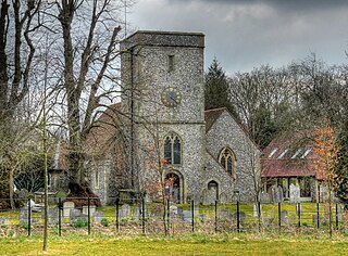
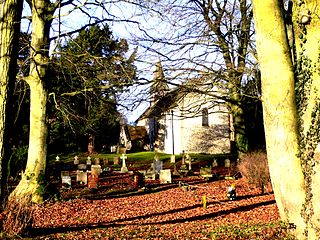
Warnford is a village and civil parish in the City of Winchester district of Hampshire, England. The parish covers 1283 hectares. The village lies on the A32 in the upper valley of the River Meon between West Meon and Exton. The population in 2019 was estimated at 220. The village is rural in character, with most of the buildings along River Lane, Lippen Lane and Hayden Lane.

Woolton Hill is a village in Hampshire, England, in the civil parish of East Woodhay. The village lies approximately 4 miles (6 km) south-west of the centre of Newbury and encompasses the hamlet of Broad Layings on its northern edge.


