Boone County, West Virginia

Last updated

Boone County
Boone County Courthouse West Virginia.jpg
Seal of Boone County, West Virginia.png
Map of West Virginia highlighting Boone County.svg
Location within the U.S. state of West Virginia
West Virginia in United States.svg
West Virginia's location within the U.S.
Coordinates: 38°01′N81°43′W / 38.02°N 81.72°W / 38.02; -81.72
CountryFlag of the United States.svg United States
StateFlag of West Virginia.svg  West Virginia
FoundedMarch 11, 1847
Named for Daniel Boone
Seat Madison
Largest cityMadison
Area
  Total503.19 sq mi (1,303.3 km2)
  Land501.53 sq mi (1,299.0 km2)
  Water1.66 sq mi (4.3 km2)
Population
 (2020)
  Total21,809
  Estimate 
(2021)
21,312 Decrease2.svg
  Density43.48/sq mi (16.79/km2)
Time zone UTC−5 (Eastern)
  Summer (DST) UTC−4 (EDT)
Congressional district 1st
Website www.boonecountywv.org

Boone County is a county in the U.S. state of West Virginia. As of the 2020 census, the population was 21,809. [1] Its county seat is Madison. [2] Boone County is part of the Charleston, WV Metropolitan Statistical Area. Leading industries and chief agricultural products in Boone County include coal, lumber, natural gas, tobacco, and strawberries.

Contents

History

The county was formed in 1847 with territories annexed from Kanawha, Cabell, and Logan counties. It was named for frontiersman Daniel Boone, who lived in the Great Kanawha Valley from 1789 until 1795. [3]

In 1863, West Virginia's counties were divided into civil townships, with the intention of encouraging local government. This proved impractical in the heavily rural state, and in 1872 the townships were converted into magisterial districts. [4] Boone County was divided into five districts: Crook, Peytona, Scott, Sherman, and Washington. Between 1980 and 1990, the county was redivided into three magisterial districts: District 1, District 2, and District 3. [5]

On February 1, 2006, two fatal mining accidents occurred in the communities of Uneeda and Wharton in Boone County. These two deaths with the addition of January's Sago Mine disaster and the Aracoma Alma Mine disaster caused West Virginia Governor Joe Manchin to close all of West Virginia's mines in a "mine safety stand-down."

Geography

Boone County lies in the central southwestern part of West Virginia. Its terrain consists of low wooded mountains, carved with drainages. [6] The terrain slopes to the north and west, with its highest point at its south corner, at 3,212 ft (979 m) ASL. [7] The county has a total area of 503 square miles (1,300 km2), of which 502 square miles (1,300 km2) is land and 1.7 square miles (4.4 km2) (0.3%) is water. [8]

Major highways

Adjacent counties

Demographics

Historical population
CensusPop.Note
1850 3,237
1860 4,84049.5%
1870 4,553−5.9%
1880 5,82427.9%
1890 6,88518.2%
1900 8,19419.0%
1910 10,33126.1%
1920 15,31948.3%
1930 24,58660.5%
1940 28,55616.1%
1950 33,17316.2%
1960 28,764−13.3%
1970 25,118−12.7%
1980 30,44721.2%
1990 25,870−15.0%
2000 25,535−1.3%
2010 24,629−3.5%
2020 21,809−11.4%
2021 (est.)21,312 [9] −2.3%
US Decennial Census [10]
1790–1960 [11] 1900–1990 [12]
1990–2000 [13] 2010–2020 [1]

2010 census

As of the census of 2010, there were 24,629 people, 9,928 households, and 7,014 families in the county. [14] The population density was 49.1 people per square mile (19.0 people/km2). There were 11,070 housing units at an average density of 22.1 units per square mile (8.5 units/km2). [15] The racial makeup of the county was 98.5% white, 0.5% black or African American, 0.1% Asian, 0.1% American Indian, 0.2% from other races, and 0.6% from two or more races. Those of Hispanic or Latino origin made up 0.4% of the population. [14] In terms of ancestry, 15.4% were German, 13.3% were American, 12.9% were Irish, and 8.3% were English. [16]

Of the 9,928 households, 32.2% had children under the age of 18 living with them, 54.0% were married couples living together, 11.3% had a female householder with no husband present, 29.4% were non-families, and 25.7% of all households were made up of individuals. The average household size was 2.47 and the average family size was 2.94. The median age was 40.7 years. [14]

The median income for a household in the county was $39,783 and the median income for a family was $47,981. Males had a median income of $51,740 versus $32,110 for females. The per capita income for the county was $20,457. About 15.6% of families and 19.3% of the population were below the poverty line, including 25.9% of those under age 18 and 13.4% of those age 65 or over. [17]

2000 census

As of the census of 2000, there were 25,535 people, 10,291 households, and 7,460 families in the county. The population density was 50.9 people per square mile (19.7 people/km2). There were 11,575 housing units at an average density of 23.1 units per square mile (8.9 units/km2). The racial makeup of the county was 98.53% White, 0.65% Black or African American, 0.12% Native American, 0.07% Asian, 0.02% Pacific Islander, 0.07% from other races, and 0.54% from two or more races. 0.46% of the population were Hispanic or Latino of any race.

The largest ancestry groups in Boone County are English (13%), Irish (12%) and German (11%). [18]

There were 10,291 households, out of which 31.10% had children under the age of 18 living with them, 57.50% were married couples living together, 10.50% had a female householder with no husband present, and 27.50% were non-families. 24.60% of all households were made up of individuals, and 11.00% had someone living alone who was 65 years of age or older. The average household size was 2.47 and the average family size was 2.92.

The county contained 23.20% under the age of 18, 9.00% from 18 to 24, 28.00% from 25 to 44, 26.30% from 45 to 64, and 13.60% who were 65 years of age or older. The median age was 39 years. For every 100 females, there were 95.50 males. For every 100 females age 18 and over, there were 92.50 males.

The median income for a household in the county was $25,669, and the median income for a family was $31,999. Males had a median income of $34,931 versus $19,607 for females. The per capita income for the county was $14,453. About 18.30% of families and 22.00% of the population were below the poverty line, including 27.90% of those under age 18 and 13.90% of those age 65 or over.

Politics

With the exception of the 1972 Nixon landslide, Boone County voted Democratic in every presidential election from 1924 until 2012. In 2012, Republican Mitt Romney won over sixty percent of the vote in the process of becoming the first presidential candidate to sweep every county in the state. Also in 2012, in the state's Democratic primaries, Boone County was one of the West Virginia counties that voted for eccentric perennial candidate Keith Russell Judd, who at the time was still in prison on felony charges, over incumbent president Barack Obama.

United States presidential election results for Boone County, West Virginia [19]
Year Republican Democratic Third party(ies)
No.%No.%No.%
2020 6,81675.62%2,04122.65%1561.73%
2016 6,50474.09%1,79020.39%4855.52%
2012 5,46764.30%2,79032.82%2452.88%
2008 3,63243.39%4,52954.11%2092.50%
2004 4,20741.25%5,93358.18%580.57%
2000 3,35336.68%5,65661.88%1321.44%
1996 1,91721.49%6,04867.79%95710.73%
1992 2,02120.93%6,57668.09%1,06110.99%
1988 2,78629.81%6,53969.97%200.21%
1984 4,65639.39%7,12160.24%440.37%
1980 4,16434.70%7,51562.63%3212.68%
1976 3,07226.48%8,52873.52%00.00%
1972 5,98552.84%5,34247.16%00.00%
1968 2,97028.87%6,39162.13%9269.00%
1964 2,46722.27%8,60977.73%00.00%
1960 4,10433.74%8,05866.26%00.00%
1956 5,19642.17%7,12657.83%00.00%
1952 4,10033.31%8,20966.69%00.00%
1948 2,90930.00%6,76969.81%190.20%
1944 3,44935.14%6,36664.86%00.00%
1940 4,12834.31%7,90465.69%00.00%
1936 3,47731.12%7,69768.88%00.00%
1932 3,55537.06%5,97362.26%650.68%
1928 4,00045.27%4,80554.39%300.34%
1924 3,01041.32%3,32645.66%94813.01%
1920 2,67450.31%2,52947.58%1122.11%
1916 1,50450.03%1,39746.47%1053.49%
1912 41616.80%1,11945.19%94138.00%

Education

Madison

Van

Seth

Communities

City

Towns

Magisterial districts

Census-designated places

Unincorporated communities

Notable people

See also

Related Research Articles

<span class="mw-page-title-main">Ohio County, West Virginia</span> County in West Virginia, United States

Ohio County is a county located in the Northern Panhandle of the U.S. state of West Virginia, and forms part of the Wheeling metropolitan area. As of the 2020 census, the population was 42,425. Its county seat is Wheeling. The county was formed in 1776 from the District of West Augusta, Virginia. It was named for the Ohio River, which forms its western boundary with the state of Ohio. West Liberty was designated as the county seat in 1777, serving to 1797.

<span class="mw-page-title-main">Raleigh County, West Virginia</span> County in West Virginia, United States

Raleigh County is a county in the U.S. state of West Virginia. As of the 2020 census, the population was 74,591. Its county seat is Beckley. The county was founded in 1850 and is named for Sir Walter Raleigh. Raleigh County is included in the Beckley, West Virginia, Metropolitan Statistical Area.

<span class="mw-page-title-main">Monroe County, West Virginia</span> County in West Virginia, United States

Monroe County is a county in the U.S. state of West Virginia. As of the 2020 census, the population was 12,376. Its county seat is Union.Monroe County was the home of Andrew Summers Rowan of Spanish–American War fame, who is immortalized in Elbert Hubbard's classic A Message to Garcia. The county was also the site of the 1928 discovery of the 34.48 carat Jones Diamond by Grover C. Jones and William "Punch" Jones. Monroe County celebrates its own holiday, Farmers' Day.

<span class="mw-page-title-main">Fayette County, West Virginia</span> County in West Virginia, United States

Fayette County is a county in the U.S. state of West Virginia. As of the 2020 census, the population was 40,488. Its county seat is Fayetteville. It is part of the Beckley, WV Metropolitan Statistical Area in Southern West Virginia.

<span class="mw-page-title-main">Gallatin County, Montana</span> County in Montana, United States

Gallatin County is a county located in the U.S. state of Montana. With its county seat in Bozeman, it is the second-most populous county in Montana, with a population of 118,960 in the 2020 Census.

<span class="mw-page-title-main">Madison County, Kentucky</span> County in Kentucky, United States

Madison County is a county located in the central part of the U.S. state of Kentucky. At the 2020 census, its population was 92,701. Its county seat is Richmond. The county is named for Virginia statesman James Madison, who later became the fourth President of the United States.

<span class="mw-page-title-main">Devola, Ohio</span> CDP in Ohio, United States

Devola is a census-designated place (CDP) in Washington County, Ohio, United States, along the Muskingum River. It is part of the Parkersburg-Marietta-Vienna, WV-OH Metropolitan Statistical Area. The population was 2,639 at the 2020 census.

<span class="mw-page-title-main">Danville, West Virginia</span> Town in West Virginia, United States

Danville is a town in Boone County, West Virginia, United States. The population was 660 at the 2020 census. Danville was incorporated in 1911 and named for Dan Rock, the town's first postmaster. Danville was formerly known as Newport and Red House.

<span class="mw-page-title-main">Madison, West Virginia</span> City in West Virginia, United States

Madison is a city and former coal town in Boone County, West Virginia, United States. The population was 2,911 at the 2020 census. It is the county seat of Boone County.

<span class="mw-page-title-main">Sylvester, West Virginia</span> Town in West Virginia, United States

Sylvester is a town in Boone County, West Virginia, United States, along the Big Coal River. The population was 166 at the 2020 census. Sylvester was incorporated on April 11, 1952, by the Boone County Circuit Court. Sylvester bears the name of a family of settlers.
<span class="mw-page-title-main">Whitesville, West Virginia</span> Town in West Virginia, United States

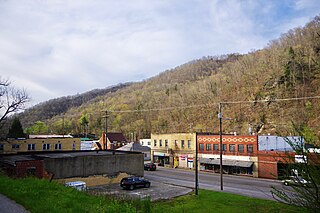
Whitesville is a town and former coal town in Boone County, West Virginia, United States, along the Big Coal River. The population was 361 at the 2020 census. Whitesville was incorporated on August 15, 1935, by the Boone County Circuit Court. The town derives its name from B. W. White, a pioneer settler. Whitesville was formerly known as Jarrold's Valley and Pritchard City.

<span class="mw-page-title-main">Barboursville, West Virginia</span> Village in West Virginia, United States

Barboursville is a village in Cabell County, West Virginia, United States. The population was 4,456 at the 2020 census. It is part of the Huntington–Ashland metropolitan area.

<span class="mw-page-title-main">Clendenin, West Virginia</span> Town in West Virginia, United States

Clendenin is a town in Kanawha County, West Virginia, United States, situated along the Elk River. The population was 850 at the 2020 census.

<span class="mw-page-title-main">Jane Lew, West Virginia</span> Town in West Virginia, United States

Jane Lew is a town in Lewis County, West Virginia, United States. The population was 409 at the time of the 2020 census.

<span class="mw-page-title-main">Alum Creek, West Virginia</span> Census-designated place in West Virginia, United States

Alum Creek is a census-designated place (CDP) in Kanawha and Lincoln counties along the Coal River in the U.S. state of West Virginia. It includes the unincorporated communities of Alum Creek, Forks of Coal, and Priestley. The CDP had a population of 1,749 at the 2010 census, down from 1,839 at the 2000 census.

<span class="mw-page-title-main">Farmington, West Virginia</span> Town in West Virginia, United States

Farmington is a town in Marion County, West Virginia, United States. The population was 389 at the 2020 census. The small town is situated on Buffalo Creek and the Allegheny Mountains about 6 miles west of Fairmont, Marion County's county seat. It is best known for being the site of the 1968 Farmington Mine disaster.

<span class="mw-page-title-main">Keystone, West Virginia</span> City in West Virginia, United States

Keystone is a city in McDowell County, West Virginia, United States. Per the 2020 census, the population was 176. Keystone is one of the few municipalities in West Virginia with an African-American majority, with 65 percent of the residents being black.

<span class="mw-page-title-main">Elk Garden, West Virginia</span> Town in West Virginia, United States

Elk Garden is a town in Mineral County, West Virginia, United States. It is part of the 'Cumberland, MD-WV Metropolitan Statistical Area'. The population was 211 at the 2020 census. Elk Garden High School was consolidated into Keyser High School in 1997. However the Primary School is still in session, offering classes from Pre-Kindergarten through the fifth grade. The school mascot is the Elk Garden Stags. Elk Garden was incorporated in 1890 by the Mineral County Circuit Court. It is named for an elk lick near the original town site.

<span class="mw-page-title-main">Teays Valley, West Virginia</span> Census-designated place in West Virginia, United States

Teays Valley is a census-designated place in Putnam County, West Virginia, United States. The population was 14,350 at the 2020 census. Located about 20 miles (32 km) west of Charleston and 30 miles (48 km) east of Huntington, it is part of the Huntington–Ashland metropolitan area.

<span class="mw-page-title-main">Williamstown, West Virginia</span> City in West Virginia, United States

Williamstown is a city in Wood County, West Virginia, United States, along the Ohio River. It is part of the Parkersburg–Vienna metropolitan area. The population was 2,997 at the 2020 census. The now closed Fenton Art Glass Company was located in the city.

References

  1. 1 2 "State & County QuickFacts". United States Census Bureau. Retrieved October 19, 2022.
  2. "Find a County". National Association of Counties. Archived from the original on May 31, 2011. Retrieved June 7, 2011.
  3. "Archived copy". Archived from the original on September 23, 2001. Retrieved July 23, 2013.{{cite web}}: CS1 maint: archived copy as title (link)
  4. Otis K. Rice & Stephen W. Brown, West Virginia: A History, 2nd ed., University Press of Kentucky, Lexington (1993), p. 240.
  5. United States Census Bureau, U.S. Decennial Census, Tables of Minor Civil Divisions in West Virginia, 1870–2010.
  6. 1 2 Boone County WV Google Maps (accessed April 15, 2019)
  7. ""Find an Altitude/Boone County WV" Google Maps (accessed April 15, 2019)". Archived from the original on May 21, 2019. Retrieved April 16, 2019.
  8. "2010 Census Gazetteer Files". US Census Bureau. August 22, 2012. Retrieved July 23, 2015.
  9. "Annual Estimates of the Resident Population for Counties: April 1, 2020 to July 1, 2021" . Retrieved October 19, 2022.
  10. "US Decennial Census". US Census Bureau. Retrieved January 9, 2014.
  11. "Historical Census Browser". University of Virginia Library. Retrieved January 9, 2014.
  12. "Population of Counties by Decennial Census: 1900 to 1990". US Census Bureau. Retrieved January 9, 2014.
  13. "Census 2000 PHC-T-4. Ranking Tables for Counties: 1990 and 2000" (PDF). United States Census Bureau. Archived (PDF) from the original on October 9, 2022. Retrieved January 9, 2014.
  14. 1 2 3 "Profile of General Population and Housing Characteristics: 2010 Demographic Profile Data". US Census Bureau. Archived from the original on February 13, 2020. Retrieved April 3, 2016.
  15. "Population, Housing Units, Area, and Density: 2010 - County". US Census Bureau. Archived from the original on February 13, 2020. Retrieved April 3, 2016.
  16. "Selected Social Characteristics in the US – 2006-2010 American Community Survey 5-Year Estimates". US Census Bureau. Archived from the original on February 13, 2020. Retrieved April 3, 2016.
  17. "Selected Economic Characteristics – 2006-2010 American Community Survey 5-Year Estimates". US Census Bureau. Archived from the original on February 13, 2020. Retrieved April 3, 2016.
  18. "Boone County WV - Ancestry & family history". www.epodunk.com. Archived from the original on October 24, 2012. Retrieved March 27, 2018.
  19. Leip, David. "Atlas of US Presidential Elections". uselectionatlas.org. Retrieved March 27, 2018.

38°01′N81°43′W / 38.02°N 81.72°W / 38.02; -81.72