
Nenagh is the county town of County Tipperary in Ireland. Nenagh used to be a market town, and the site of the East Munster Ormond Fair.
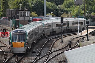
Rail transport in Ireland is provided by Iarnród Éireann in the Republic of Ireland and by Northern Ireland Railways in Northern Ireland.

Iarnród Éireann, or Irish Rail, is the operator of the national railway network of Ireland. Established on 2 February 1987, it is a subsidiary of Córas Iompair Éireann (CIÉ). It operates all internal InterCity, Commuter, DART and freight railway services in the Republic of Ireland, and, jointly with Northern Ireland Railways, the Enterprise service between Dublin and Belfast. In 2019, IÉ carried a record peak of 50 million passengers, up from 48 million in 2018.

Roscrea is a market town in County Tipperary, Ireland, which in 2016 had a population of 5,446. Roscrea is one of the oldest towns in Ireland, having developed around the 7th century monastery of Saint Crónán of Roscrea, parts of which remain preserved today.
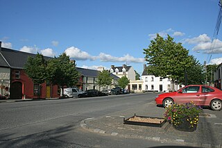
Cloughjordan, officially Cloghjordan, is a town in County Tipperary in Ireland. It is in the barony of Ormond Lower, and it is also a parish in the Roman Catholic Diocese of Killaloe.

Ballybrophy is a railway station in the village of Ballybrophy, County Laois, Ireland, halfway between Borris-in-Ossory and Rathdowney in the Barony of Clandonagh.

Limerick railway station also known as Colbert Station or Limerick Colbert serves the city of Limerick in County Limerick, Ireland. It is on Parnell Street and is the main station on the Limerick Suburban Rail network. It has approximately 2,500 rail passengers a day travelling on four rail routes. The Bus Éireann bus station on site services approximately one million passengers a year, with 125 buses departing each day.
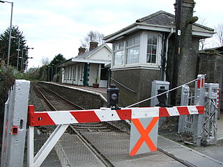
Castleconnell railway station, opened on 8 August 1858 on the Great Southern and Western Railway line, serves the town of Castleconnell in County Limerick, Ireland.

Nenagh railway station serves the town of Nenagh and surrounding area in County Tipperary, in the Mid-West Region of Ireland.

Cloughjordan railway station serves the town and surrounding area of Cloughjordan, County Tipperary in the Midwest of Ireland. The station is located 1 km south west of the town centre on the Templemore Road.

Roscrea railway station serves the town of Roscrea, County Tipperary, in Ireland.

Commuter is a brand of suburban rail services operated by Iarnród Éireann in the Republic of Ireland, serving the cities of Dublin, Cork, Limerick and Galway. This brand is distinct from the longer distance InterCity brand, and Dublin's higher frequency DART brand. Most Commuter services share a track with InterCity services. During the first decade of the new millennium, Iarnród Éireann put a significant amount of effort into upgrading its network, with new tracks, signalling, station upgrades and trains. Commuter services are operated by diesel multiple unit train sets.
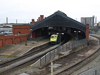
The Dublin–Cork Main Line is the main InterCity railway route in Ireland between Dublin Heuston and Cork Kent. In 2018, 3.46 million passengers travelled on the line, a 10% increase from 2017 figures.
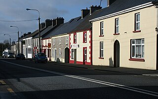
Moneygall is a village on the border of counties Offaly and Tipperary, in Ireland. It is situated on the R445 road between Dublin and Limerick. There were 313 people living in the village as of the 2016 census. Moneygall has a Catholic church, motorway service station, a car sales and repair centre, a national school, a Garda station and two pubs. The nearest Church of Ireland church, Borrisnafarney, is 2 km from the village beside the former Loughton Demesne.

Birdhill is a village in County Tipperary, Ireland. It is in the barony of Owney and Arra and is part of the parish of Newport, Birdhill and Toor in the Roman Catholic Archdiocese of Cashel and Emly. Its Irish name was historically anglicised as Knockan or Knockaneeneen.
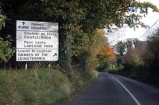
The R494 road is a regional road in Ireland which runs southwest-northeast from Junction 27 of the M7 at Birdhill, County Tipperary to the N52 at Nenagh - all in County Tipperary. It leaves the M7 and loops around the Arra Mountains between the hills and Lough Derg returning to what was the N7 in Nenagh.

Limerick Suburban Rail are a group of Iarnród Éireann commuter train services from Limerick Colbert to various other destinations on three different lines.

The Waterford, Limerick and Western Railway (WL&WR), formerly the Waterford and Limerick Railway up to 1896, was at the time it was amalgamated with the Great Southern and Western Railway in 1901 the fourth largest railway in Ireland, with a main line stretching from Limerick to Waterford and branches to Sligo and Tralee.

The Limerick–Ballybrophy line is a 52.5 miles (84.5 km) railway line connecting the city of Limerick with Ballybrophy in County Laois. The line diverges from the Limerick to Limerick Junction railway line at Killonan Junction and continues in a north east direction with five intermediate stops at Castleconnell, Birdhill, Nenagh, Cloughjordan and Roscrea. The line ends at Ballybrophy where it joins the Dublin-Cork Main Line.
Lisbunny is a townland and a civil parish in the historical Barony of Ormond Lower, County Tipperary, Ireland. Its location is to the east of Nenagh. The only signage indicating the townland is for Lisbunny Industrial Estate on the north side of the R445 road just after crossing the bridge over the Limerick–Ballybrophy railway line.


