Barasat Junction railway station

Last updated

Barasat Junction
Indian Railways Suburban Railway Logo.svg Kolkata Suburban Railway junction station
Barasat Railway Station.jpg
Barasat Junction railway station
General information
Location Barasat, North 24 Parganas, West Bengal
India
Coordinates 22°43′26″N88°29′01″E / 22.723940°N 88.483665°E / 22.723940; 88.483665
Elevation12 metres (39 ft)
Owned by Indian Railways
Operated by Eastern Railway
Platforms5
Tracks6
Construction
Structure typeAt Grade
ParkingNot available
Other information
StatusActive
Station codeBT
Zone(s) Eastern Railway
Division(s) Sealdah
History
Opened1906;119 years ago (1906)
Electrified1972;53 years ago (1972)
Services
Preceding station Kolkata Suburban Railway Following station
Hridaypur
towards Sealdah
Eastern Line Bamangachhi
Kazipara
towards Hasnabad
Location
West Bengal location map.svg
Red pog.svg
Barasat Junction
Location in West Bengal
India location map.svg
Red pog.svg
Barasat Junction
Location in India

Barasat Junction is a Kolkata Suburban Railway station in Barasat. [1] It is one of the major suburban railway stations in North 24 Parganas district, West Bengal, India. Generally, people commuting daily use this station for travelling to Kolkata's Central Business District or other towns, with the busiest times at the station being the morning and evening peak periods. This station provides the facility of separate rest rooms for both male & female passengers. Barasat Junction Railway station consists of 6 permanent platforms (Platform no: 1–6).

Contents

Station complex

A reservation counter for booking long-distance railway tickets in the early morning and regular non-reservation tickets booking are all time available. Tickets can be collected from the main ticket counter at the junction of platform no. 1. Two smart card booths are operational for ticket purchasing through the use computerised smart cards.

A railway car shade forms a part of the station's overall structure, having been designed to cover two trains for rail engine and car maintenance.

Barasat Basirhat Railway

Barasat Basirhat Railway (BBR) was a 2 ft 6 in (762 mm) gauge railway line started by Martin & Co. in 1914 as part of their wide network of narrow gauge operations under the name of Martin's Light Railways. The line connected the two towns of Barasat and Basirhat near Calcutta (now Kolkata), in West Bengal, India. The line was closed in 1955, after Indian independence (in 1947), when all privately run lines were taken over by the government or were closed. BBR got a fresh lease of life when Indian Railways placed the line under its Eastern Railways zone, Sealdah division and converted the route partly to broad gauge in 1962. Later on, this route was fully restored to 5 ft 6 in (1,676 mm) (Indian gauge) and local trains started using the route.

Metro Railway Kolkata expansion plan

Recently, the government-owned Indian Railways corporation approved a proposal for an underground metro railway station connecting Barasat Junction to Noapara metro station. The construction of the project has started in October 2011.

Extension plan from Noapara to Barasat: [2] The proposed Kolkata Metro Yellow Line extension alignment pass through Dum Dum Cantonment and Jessore Road up to Biman Bandar station. From there, the line would run under Jessore Road until New Barrackpore before reaching the surface at Madhyamgram station. From Madhyamgram to Barasat, the alignment would be elevated. However, for crossing the existing road overbridge at Madhyamgram and Barasat, the alignment would descend gradually to ground level and rise again on viaduct. This is supposed to be beneficial for the people of North 24 Parganas district and will bring them closer to Kolkata's Business district. This would reduce the heavy pressure on Sealdah–Barasat section of Eastern Railways. The Madhyamgram Metro railway station is to be constructed in the Madhyamgram-Barasat section. [3] [4]

Work for the NoaparaBarasat (via NSC Bose Airport) metro extension came to a halt in 2013 as construction giant L&T has pulled out of the 20 km metro corridor project. L&T was unable to get on with the work due to huge encroachment problems on railway land.

L&T has moved out all major equipment from the project site at Barasat and has closed down two of the three site offices. The lone site office is under locked. [5]

After almost 7 years with the ongoing land acquisition problems, Barasat metro was in the brink of getting cancelled. The development of New Barrackpore to Barasat (phase 3 of Yellow Line) was supposed to go elevated to cut down the expenses, but the stretch was in doubt due to huge encroachment problem. But in February 2021, Prime Minister Narendra Modi gave his nod to construct this stretch underground, giving respite to thousands of families who were supposed to be evicted for the development of the elevated stretch. [6] [7]

Yellow Line has now been divided into 3 phases :

See also

Related Research Articles

<span class="mw-page-title-main">Sealdah railway station</span> Railway station in Kolkata, West Bengal, India

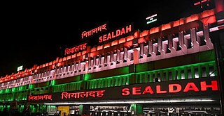
Sealdah railway station is one of India's major railway terminals serving the city of Kolkata. It is the second largest railway station in India and West Bengal in terms of platforms, tracks and overall daily passenger holding capacity. It is one of the five large railway stations serving the Kolkata metropolitan area, the others being Howrah, Shalimar, Kolkata and Santragachi. Over 1.5 million passengers use the station on a daily basis. It is an important suburban rail terminal of Kolkata Suburban Railway. Passengers can use the Sealdah metro station to transfer to the Green Line of Kolkata Metro.

<span class="mw-page-title-main">Kolkata Metro</span> Rapid transit system in Kolkata, India

The Kolkata Metro is a rapid transit system serving the city of Kolkata and the Kolkata Metropolitan Region in West Bengal, India. Opened in 1984, it was the first operational rapid transit system in India. Currently it is the second busiest and fifth longest rapid transit system in India. As of now, it has one fully operational, and three partly operational lines for a total of 59.38 km (36.90 mi). Two other lines are in various phases of construction and planning. The system has a mix of underground, at-grade, and elevated stations using both broad-gauge and standard-gauge tracks. It operates on a 750 V DC Third rail system. Trains operate between 06:50 and 22:40 IST and the fares range from ₹5 to ₹50.

<span class="mw-page-title-main">Madhyamgram</span> City in West Bengal, India

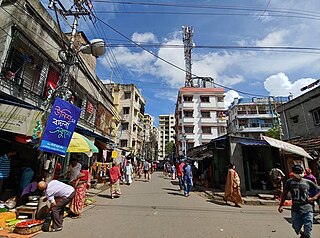
Madhyamgram is a city and a municipality of North 24 Parganas district in the Indian state of West Bengal. It is a part of the area covered by Kolkata Metropolitan Development Authority (KMDA).

<span class="mw-page-title-main">North 24 Parganas district</span> District in West Bengal, India

North 24 Parganas (abv. 24 PGS (N)) or sometimes North Twenty Four Parganas is a district in southern West Bengal, of eastern India. North 24 Parganas extends in the tropical zone from latitude 22° 11′ 6″ north to 23° 15′ 2″ north and from longitude 88º20' east to 89º5' east. Barasat is the district headquarters of North 24 Parganas. North 24 Parganas is West Bengal's most populous district and also (since 2014) the most populated district in the whole of India. It is the tenth-largest district in the State by area.

<span class="mw-page-title-main">Transport in Kolkata</span>

Kolkata the Capital of the Indian state of West Bengal has a good transportation system. Kolkata's transport system is diverse, with a mix of modern and traditional modes of transport catering to the city's large population.

<span class="mw-page-title-main">Belgharia</span> Neighbourhood in Presidency, West Bengal, India

Belgharia is a neighbourhood in Kamarhati of North 24 Parganas district in the Indian state of West Bengal. It is a part of the area covered by Kolkata Metropolitan Development Authority (KMDA).

Ghola is a neighbourhood in Panihati of North 24 Parganas district in the Indian state of West Bengal. It is a part of the area covered by Kolkata Metropolitan Development Authority (KMDA).

<span class="mw-page-title-main">Dum Dum metro station</span> Metro station in Kolkata, India

Dum Dum is an elevated metro station on the North-South corridor of the Blue Line of Kolkata Metro in Kolkata, West Bengal, India. The metro station adjoins the platforms of the Dum Dum Junction railway station where connections can be made with Indian Railways services.

<span class="mw-page-title-main">Hridaypur railway station</span> Railway station in West Bengal, India

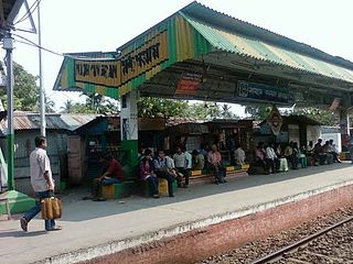
Hridaypur is a Kolkata Suburban Railway station in Hridaypur. It serves the Barasat's areas of Dakbunglow, Rathtala, Purbachal, Shishirkunja, Udayrajpur and Chandigarh in the North 24 Parganas district, West Bengal, India. It is under the jurisdiction of Eastern Railway.

<span class="mw-page-title-main">Madhyamgram railway station</span> Railway station in West Bengal, India

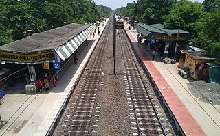
Madhyamgram railway station is a Kolkata Suburban Railway station in the town of Madhyamgram. It serves the local areas of Madhyamgram, Badu and Sajirhat in the North 24 Parganas district, West Bengal, India.

<span class="mw-page-title-main">Sealdah railway division</span> Railway division in West Bengal, India

Sealdah railway division is one of the four railway divisions under the jurisdiction of Eastern Railway zone of the Indian Railways. Its headquarters is located in Kaiser Street in Kolkata, West Bengal near the Sealdah railway station. Geographically the division covers the railway tracks and services in the areas between the Hooghly river on the west, Bangladesh on the north and east and the Sundarbans in the south. The Railway network under Sealdah Division was part of the Eastern Bengal Railway. The Eastern Bengal Railway was formed on 1 July 1884. On 1 January 1942, Assam Bengal Railway and Eastern Bengal Railway were amalgamated to form Bengal Assam Railway. Sealdah Division became a part of East Indian Railway on 15 August 1947, after the Partition of India and Partition of Bengal. The East Indian Railway was formed on 1 June 1845. On 14 April 1952, East Indian Railway was renamed as Eastern Railway.

<span class="mw-page-title-main">Yellow Line (Kolkata Metro)</span> Transit line in Kolkata, India

Yellow Line is a rapid transit metro line of the Kolkata Metro in Kolkata, West Bengal, India. It is a 16.876 km (10.486 mi) long line from Noapara to Barasat in North 24 Parganas, which is under construction. It is being built by RVNL, Senbo & ITD. It will run mostly on underground tunnels, the track will be elevated until Jessore Road from Noapara and then go underground towards Barasat metro station. It will have an interchange at the Kolkata Airport with Orange Line.

<span class="mw-page-title-main">Jai Hind metro station</span> Kolkata Metro station

Jai Hind is a metro station of Kolkata Metro. It will serve the city of Kolkata's main airport, the Netaji Subhas Chandra Bose International Airport. As of October 2024 the station is planned to be open for service during March 2025.

<span class="mw-page-title-main">Dum Dum Cantonment railway station</span> Railway station in West Bengal, India

Dum Dum Cantonment is a Kolkata Suburban Railway station in Dum Dum. Its code is DDC. The Dum Dum Cantonment metro station is adjacent to Dum Dum Cantonment railway station. It was named by the Cantonment area near Dum Dum. It serves Subhas Nagar, Gorabazar, Natun Bazar and surrounding Dum Dum Cantonment areas.

<span class="mw-page-title-main">Birati railway station</span> Railway station in West Bengal, India

Birati railway station is a Kolkata Suburban Railway station in Birati. It serves Birati and Nimta areas in North Dumdum, West Bengal, India. It lies between the Durganagar railway station and Bisharpara Kodaliya railway station. Madhusudan Banerjee Road connects the Barrackpore Trunk Road and Jessore Road through Birati.

<span class="mw-page-title-main">Nimta</span> Census town in West Bengal, India

Nimta is a census town in North Dum Dum municipality in Barrackpore II CD Block of Barrackpore subdivision of North 24 Parganas district in the state of West Bengal.

<span class="mw-page-title-main">Sealdah–Bangaon line</span> Railway Route in West Bengal, India

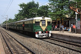
The Sealdah–Bangaon line is a 78 km (48 mi) long broad gauge railway line that connects the Sealdah railway station of Kolkata with Bangaon of North 24 Parganas in the Indian state of West Bengal. Once a part of the old Calcutta–Jessore–Khulna line, today it is a busy suburban section of the Kolkata Suburban Railway. It is under the jurisdiction of the Sealdah railway division of the Eastern Railway zone of Indian Railways.

<span class="mw-page-title-main">Jessore Road metro station</span> Metro station in Kolkata, India

Jessore Road is an at grade level metro station of Yellow Line of Kolkata Metro. It is situated just beside Jessore Road near 1 no. gate of Kolkata airport. This station was proposed in Yellow Line, in the budget of 2010–11. It was a part of the integration of old line of Circular Railway from Dum Dum Cantonment to Biman Bandar.

<span class="mw-page-title-main">Dum Dum Park</span> Neighbourhood in Presidency, West Bengal, India

Dum Dum Park is a locality in South Dumdum of North 24 Parganas district in the Indian state of West Bengal. It is a part of the area covered by Kolkata Metropolitan Development Authority (KMDA).

<span class="mw-page-title-main">Sealdah Main and North section</span> Railway Route in West Bengal, India

The Sealdah Main and North section refer to a set of rail lines which connect the city of Kolkata with its northern suburbs and with the North 24 Parganas, Nadia and Murshidabad districts of West Bengal, India along the eastern bank of the Hooghly river. It is a part of the Kolkata Suburban Railway and is under the jurisdiction of the Sealdah railway division of the Eastern Railway zone of Indian Railways.

References

  1. "About Barasat Tourism" (Web page). Holiday IQ – Discover Intelligent Holiday Planning. Leisure & Lifestyle Information Services Pvt. Ltd. December 2005. Retrieved 5 April 2012.
  2. "Dum Dum–Barasat metro extension Plan" (Web page). MRK. Metro Railway Kolkata, Web site publish. 2012. Retrieved 16 October 2012.
  3. "Kolkata Metro Official Map".
  4. "Barasat Metro Progressing".
  5. "End of the road for Dum Dum–Barasat metro extension" (Web page). The Times of India . 2012. Archived from the original on 11 April 2013. Retrieved 25 December 2012.
  6. "PM nod for underground Metro averts eviction". www.telegraphindia.com. Retrieved 12 April 2023.
  7. "Senbo & ITD Win Kolkata Metro Barasat Line's Underground Work". The Metro Rail Guy. 20 March 2022. Retrieved 12 April 2023.