Powys is a county and preserved county in Wales. It borders Gwynedd, Denbighshire, and Wrexham to the north; the English ceremonial counties of Shropshire and Herefordshire to the east; Monmouthshire, Blaenau Gwent, Merthyr Tydfil, Caerphilly, Rhondda Cynon Taf, and Neath Port Talbot to the south; and Carmarthenshire and Ceredigion to the west. The largest settlement is Newtown, and the administrative centre is Llandrindod Wells.
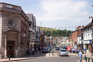
Newtown is a town in Powys, Wales. It lies on the River Severn in the community of Newtown and Llanllwchaiarn, within the historic boundaries of Montgomeryshire. It was designated a new town in 1967 and saw population growth as firms settled, changing its market town character. Its 2001 population of 10,780 rose to 11,357 in the 2011 census, and rose again to 11,362 in the 2021 census.

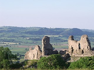
Knighton is a market town and community on the River Teme, straddling the border between Powys, Wales and Shropshire, England. It lies in the traditional county of Radnorshire. Originally an Anglo-Saxon settlement, Knighton is located on Offa's Dyke, the ancient earthwork that divided the two countries. It later became a Norman defensive border town.

Meifod, formerly also written Meivod, is a small village, community and electoral ward seven miles (11 km) north-west of Welshpool in Montgomeryshire, Powys, Wales, on the A495 road and located in the valley of the River Vyrnwy. The River Banwy has a confluence with the Vyrnwy approximately two miles (3.2 km) to the west of the village. The village itself had a population of 317. The community includes the village of Bwlch-y-cibau and the hamlet of Allt-y-Main.

Dolwyddelan is a village and community in Conwy County Borough, Wales. The community occupies most of the valley of the Afon Lledr, and contains the settlements of Dolwyddelan, Pentre Bont, Blaenau Dolwyddelan, and Pont-y-Pant. It lies within Snowdonia, and the surrounding hills are part of the Moelwynion range. The population of the community was recorded as 454 in the 2021 census, and in the 2011 census the proportion of Welsh speakers was recorded as 50.8%.

Talybont-on-Usk is a village and community in Powys, Wales, in the historic county of Brecknockshire. It lies on both the Caerfanell river and the Monmouthshire and Brecon Canal, about 1 mile (1.6 km) from the River Usk. In 2001, it had a population of 743, reducing to 719 at the 2011 census. The community includes the settlements of Llansantffraed, Scethrog, Aber Village, and Pencelli.

Dinas Powys is a town and community in the Vale of Glamorgan, South Wales. Its name means "fort of the provincial place" and refers to the Iron Age hillfort which overlooks the village. Dinas Powys is 5.6 miles (9.0 km) south-west of the centre of Cardiff and is situated on the A4055 road from Cardiff to Barry, making it a popular dormitory village for city commuters. It neighbours the larger town of Penarth.

Hope is a small village and community in Flintshire, north-east Wales. The village is located approximately 3 miles / 4.5 km from the Wales-England border, on the course of the River Alyn, and less than 5 miles from Wrexham.
Trewern is a small village, community and electoral ward in Montgomeryshire, Powys, Wales. The community includes the villages of Buttington and Middletown, situated 4.5 miles (7.2 km) northeast of Welshpool, 14.5 miles (23.3 km) west of Shrewsbury and 1 mile (1.6 km) west of the Wales-England border.

Llangadfan is a small village in Powys, Wales, based in the community of Banwy. The village lies on the A458 between Foel and Llanerfyl, 12 kilometres (7.5 mi) from Llanwddyn. Dyfnant Forest is located nearby. The village is said to be known for its country dances.

Llandyssil is a village in the community of Abermule with Llandyssil, in Powys, Wales, in the traditional county of Montgomeryshire. It is about two miles from the town of Montgomery.

Castle Caereinion is a small village and community in Montgomeryshire, Powys, Wales, upon the River Banwy, around 8 miles west of Welshpool, and 4 miles east of Llanfair Caereinion.

Bausley with Criggion is a community in Montgomeryshire, Powys, Wales, 87 miles (140 km) from Cardiff and 148 miles (238 km) from London.

The Vale of Grwyney is a community in Powys, Wales. It follows most of the border between Powys and Monmouthshire. It takes its name from the river Grwyney which flows through it into the River Usk. The river Grwyney has two sources, called the Grwyne Fechan and the Grywne Fawr, which both rise in the Black Mountains and converge into one river near Llanbedr before meeting the Usk.

Glyn Tarell is a valley and a community in the county of Powys, Wales, and the historic county of Brecknockshire. It is in the Brecon Beacons National Park and at the northern edge of the Brecon Beacons mountains.

Llanbadarn Fynydd is a village and community in Radnorshire, Powys, Wales, and is 63 miles (101 km) from Cardiff and 149 miles (240 km) from London.

Nantmel is a village and a community in Radnorshire, Powys, Wales, and is 76.5 miles (123.1 km) from Cardiff and 150.5 miles (242.2 km) from London. In 2011 the population of Nantmel was 621 with 11.8% of them able to speak Welsh. The population of the community was 637 as of the 2011 UK Census.

The River Banwy is a river about 19 miles (31 km) long in Powys, Wales. It is a tributary of the River Vyrnwy.

Abermule with Llandyssil, formerly just Llandyssil, is a community in Powys, Wales, including the villages of Abermule and Llandyssil, and had a population of 1527 as of the 2011 UK Census. It also includes settlements of Llanmerewig and Green Lane.
Newtown and Llanllwchaiarn is a local government community in mid Powys, Wales. It includes the town of Newtown and the small neighbouring village of Llanllwchaiarn. At the time of the 2011 census the population of the community was 11,357. The community council is called Newtown and Llanllwchaiarn Town Council, often abbreviated to Newtown Town Council.


