BLITS

Last updated
BLITS
BLITS 300c target.gif
An artist's impression of BLITS
Mission typeTechnology
Operator Roskosmos
ILRS network
COSPAR ID 2009-049G OOjs UI icon edit-ltr-progressive.svg
SATCAT no. 35871
Mission durationAchieved: 3.5 years
Planned: 5 years
Spacecraft properties
Manufacturer FSUE-IPIE
Launch mass7.53 kilograms (16.6 lb)
Start of mission
Launch date17 September 2009, 15:55:07 (2009-09-17UTC15:55:07Z) UTC [1]
Rocket Soyuz-2-1b/Fregat
Launch site Baikonur Site 31/6
End of mission
Last contactMarch–April 2013
Orbital parameters
Reference system Geocentric
Regime Low Earth
Semi-major axis 7,197.67 kilometres (4,472.42 mi)
Eccentricity 0.0004373
Perigee altitude 823 kilometres (511 mi)
Apogee altitude 829 kilometres (515 mi)
Inclination 98.55 degrees
Period 101.28 minutes
RAAN 105.39 degrees
Argument of perigee 71.58 degrees
Epoch 25 February 2014, 08:51:29 UTC [2]

BLITS (Ball Lens In The Space) is a Russian satellite launched on September 17, 2009, as a secondary payload on a Soyuz-2.1b/Fregat, from the Baikonur Cosmodrome in Kazakhstan. The satellite is totally passive and spherical, and is tracked using satellite laser ranging (SLR) by the International Laser Ranging Service. [3] The design of BLITS is based on the optical Luneburg lens concept. The retroreflector is a multilayer glass sphere; it provides uniform reflection characteristics when viewed within a very wide range of angles, and can provide a cross-section sufficient for observations at low to medium orbit heights. A similar design was already tested on a smaller laser reflector carried on board of the METEOR-3M spacecraft launched on December 10, 2001. [4]

Contents

The purpose of the mission was to validate the spherical glass retroreflector satellite concept and obtain SLR (Satellite Laser Ranging) data for solution of scientific problems in geophysics, geodynamics, and relativity. The BLITS allows millimeter and submillimeter accuracy SLR measurements, as its "target error" (uncertainty of reflection center relative to its center of mass) is less than 0.1 mm. An additional advantage is that the Earth's magnetic field does not affect the satellite orbit and spin parameters, unlike retroreflectors incorporated into active satellites. The BLITS allows the most accurate measurements of any SLR satellites, with the same accuracy level as a ground target. [5]

The satellite was inserted into an 832 km (517 mi) Sun-synchronous orbit, with an inclination of 98.85º. [6] The satellite was spinning at a spin period of 5.6 seconds around the axis normal to its orbit plane, allowing laser light to be reflected in short bursts because only half of the satellite is covered in a reflective coating. As the satellite is made of glass, minimal in-flight spin slowdown was expected since there were no conducting parts where currents interacting with the Earth magnetic field can be induced. [7] The expected operative life was at least five years, but the mission was interrupted in 2013 after a collision with space debris. [7] [8]

Structure

A scheme illustrating how the BLITS retroreflector works. BLITS Satellite scheme.gif
A scheme illustrating how the BLITS retroreflector works.

The satellite consists of two outer hemispheres (radius 85.16 mm or 3.353 in) made of a low-refraction-index glass (n = 1.47) and an inner ball lens (radius 53.52 mm or 2.107 in) made of a high-refraction-index glass (n = 1.76); the two outer hemispheres and the inner ball are glued together, and one of the outer hemispheres is externally coated with a reflective aluminum coating, covered with a protective varnish. The total mass is 7.53 kg (16.6 lb). [1] [7]

The satellite was designed for ranging with a green (532 nm) laser. When used for ranging, the phase center is 85.16 mm (3.353 in) behind the sphere center, with a range correction of +196.94 mm (7.754 in) taking into account the indices of refraction. [9] A smaller spherical retroreflector of the same type but 6 cm in diameter was fastened to the Meteor-3M spacecraft and tested during its space flight of 2001–2006.

Collision

In early 2013, the satellite was found to have a new orbit 120 m (390 ft) lower, a faster spin period of 2.1 seconds, and a different spin axis. [8] The change was traced back to an event that occurred 22 Jan 2013 at 07:57 UTC; data from the United States's Space Surveillance Network showed that within 10 seconds of that time BLITS was close to the predicted path of a fragment of the former Chinese Fengyun-1C satellite, with a relative velocity of 9.6 km/s (6.0 mi/s) between them. The Chinese government destroyed the Fengyun-1C, at an altitude of 865 km (537 mi), on 11 Jan 2007 as a test of an anti-satellite missile, leaving 2,300 to 15,000 pieces of debris.

On January 28, 2013, the International Laser Ranging Service announced that a collision happened between BLITS and a space debris fragment. As a result, an abrupt change occurred of the BLITS orbit parameters (a decrease of the orbiting period), and the spin period changed from 5.6 s before collision to 2.1 s after collision. On April 19, 2013, BLITS mission contacts from the Scientific Research Institute for Precision Instrument Engineering in Moscow asked the ILRS to end tracking on the satellite, [10] because its laser reflector cross section has significantly decreased after the collision, preventing its further use. [11] According to the simulation by the Center for Space Standards & Innovation (CSSI), a research arm of Analytical Graphics, Inc. (AGI), BLITS could have been hit by a piece of debris originated by the 2007 Chinese anti-satellite missile test. [12]

Last science data was returned from the satellite on 5 March 2013. [13]

New version

An improved version of the reflector, named BLITS-M, launched 26 December 2019 with a Gonets-M mission on a Rokot rocket. [14] BLITS-M failed to separate from the upper stage; thus the mission was a failure. [14]

Related Research Articles

<span class="mw-page-title-main">Geodesy</span> Science of planetary measurement

Geodesy or geodetics is the science of measuring and representing the geometry, gravity, and spatial orientation of the Earth in temporally varying 3D. It is called planetary geodesy when studying other astronomical bodies, such as planets or circumplanetary systems. Geodesy is an earth science as well as a discipline of applied mathematics, and many consider the study of Earth's shape and gravity to be central to the science.
<span class="mw-page-title-main">Retroreflector</span> Device to reflect radiation back to its source

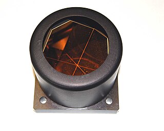
A retroreflector is a device or surface that reflects radiation back to its source with minimum scattering. This works at a wide range of angle of incidence, unlike a planar mirror, which does this only if the mirror is exactly perpendicular to the wave front, having a zero angle of incidence. Being directed, the retroflector's reflection is brighter than that of a diffuse reflector. Corner reflectors and cat's eye reflectors are the most used kinds.

<span class="mw-page-title-main">Lunar Laser Ranging experiments</span> Measuring the distance between the Earth and the Moon with laser light

Lunar Laser Ranging (LLR) is the practice of measuring the distance between the surfaces of the Earth and the Moon using laser ranging. The distance can be calculated from the round-trip time of laser light pulses travelling at the speed of light, which are reflected back to Earth by the Moon's surface or by one of several retroreflectors installed on the Moon. Three were placed by the United States' Apollo program, two by the Soviet Lunokhod 1 and 2 missions, and one by India's Chandrayaan-3 mission.

<span class="mw-page-title-main">History of the telescope</span>

The history of the telescope can be traced to before the invention of the earliest known telescope, which appeared in 1608 in the Netherlands, when a patent was submitted by Hans Lippershey, an eyeglass maker. Although Lippershey did not receive his patent, news of the invention soon spread across Europe. The design of these early refracting telescopes consisted of a convex objective lens and a concave eyepiece. Galileo improved on this design the following year and applied it to astronomy. In 1611, Johannes Kepler described how a far more useful telescope could be made with a convex objective lens and a convex eyepiece lens. By 1655, astronomers such as Christiaan Huygens were building powerful but unwieldy Keplerian telescopes with compound eyepieces.

<span class="mw-page-title-main">LAGEOS</span> Scientific research satellites

LAGEOS, Laser Geodynamics Satellite or Laser Geometric Environmental Observation Survey, are a series of two scientific research satellites designed to provide an orbiting laser ranging benchmark for geodynamical studies of the Earth. Each satellite is a high-density passive laser reflector in a very stable medium Earth orbit (MEO).
<span class="mw-page-title-main">Satellite laser ranging</span>

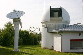
In satellite laser ranging (SLR) a global network of observation stations measures the round trip time of flight of ultrashort pulses of light to satellites equipped with retroreflectors. This provides instantaneous range measurements of millimeter level precision which can be accumulated to provide accurate measurement of orbits and a host of important scientific data. The laser pulse can also be reflected by the surface of a satellite without a retroreflector, which is used for tracking space debris.

<span class="mw-page-title-main">Apache Point Observatory Lunar Laser-ranging Operation</span>

The Apache Point Observatory Lunar Laser-ranging Operation, or APOLLO, is a project at the Apache Point Observatory in New Mexico. It is an extension and advancement of previous Lunar Laser Ranging experiments, which use retroreflectors on the Moon to track changes in lunar orbital distance and motion.

<span class="mw-page-title-main">Satellite geodesy</span> Measurement of the Earth using satellites

Satellite geodesy is geodesy by means of artificial satellites—the measurement of the form and dimensions of Earth, the location of objects on its surface and the figure of the Earth's gravity field by means of artificial satellite techniques. It belongs to the broader field of space geodesy. Traditional astronomical geodesy is not commonly considered a part of satellite geodesy, although there is considerable overlap between the techniques.

<span class="mw-page-title-main">Meteor (satellite)</span> Series of weather observation satellites launched by Russia

The Meteor spacecraft are weather observation satellites launched by the Soviet Union and Russia. The Meteor satellite series was initially developed during the 1960s. The Meteor satellites were designed to monitor atmospheric and sea-surface temperatures, humidity, radiation, sea ice conditions, snow-cover, and clouds. Between 1964 and 1969, a total of eleven Soviet Union Meteor satellites were launched.

<span class="mw-page-title-main">Fengyun</span> Chinese weather satellites

Fēngyún are China's meteorological satellites. Launched since 1988 into polar Sun-synchronous and geosynchronous orbit, each three-axis stabilized Fengyun satellite is built by the Shanghai Academy of Spaceflight Technology (SAST) and operated by the China Meteorological Administration (CMA). To date, China has launched twenty-one Fengyun satellites in four classes. Fengyun 1 and Fengyun 3 satellites are in polar, Sun-synchronous orbit and Low Earth orbit while Fengyun 2 and 4 are geosynchronous orbit.

<span class="mw-page-title-main">STARSHINE (satellite)</span> Series of satellites

The STARSHINE series of three artificial satellites were student participatory missions sponsored by the United States Naval Research Laboratory.

<span class="mw-page-title-main">Jason-3</span> International Earth observation satellite mission

Jason-3 is a satellite altimeter created by a partnership of the European Organisation for the Exploitation of Meteorological Satellites (EUMETSAT) and National Aeronautic and Space Administration (NASA), and is an international cooperative mission in which National Oceanic and Atmospheric Administration (NOAA) is partnering with the Centre National d'Études Spatiales. The satellite's mission is to supply data for scientific, commercial, and practical applications to sea level rise, sea surface temperature, ocean temperature circulation, and climate change.
<span class="mw-page-title-main">LARES (satellite)</span>

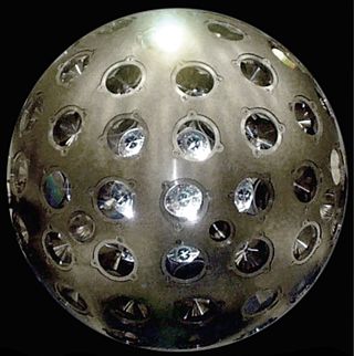
LARES is a passive satellite system of the Italian Space Agency.
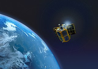
<span class="mw-page-title-main">STSat-2C</span> South Korean satellite

STSat-2C, or Science and Technology Satellite-2C, or Naro Science Satellite (ko:나로과학위성) was a South Korean satellite which was launched in 2013. It was operated by the Korea Aerospace Research Institute (KARI), and was intended to demonstrate technology for future spacecraft. The satellite had a mass of 100 kg (220 lb), and was expected to operate for less than a year.
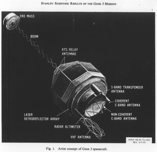
<span class="mw-page-title-main">GEOS-3</span> Satellite

GEOS-3, or Geodynamics Experimental Ocean Satellite 3, or GEOS-C, was the third and final satellite as part of NASA's Geodetic Earth Orbiting Satellite/Geodynamics Experimental Ocean Satellite program (NGSP) to better understand and test satellite tracking systems. For GEOS 1 and GEOS 2, the acronym stands for Geodetic Earth Orbiting Satellite; this was changed for GEOS-3.
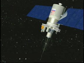
<span class="mw-page-title-main">Meteor-3M No.1</span>

Meteor-3M No.1 was the first and only of the Meteor-3M series polar-orbiting weather satellites. It was launched on 10 December 2001 at 17:18:57 UTC from the Baikonur Cosmodrome in Kazakhstan. The satellite is in a Sun-synchronous orbit with an ascending node time of about 9AM.

MoonLIGHT is a laser retroreflector developed as a collaboration primarily between the University of Maryland in the United States, and the Italian National Institute for Nuclear Physics - National Laboratories of Frascati (INFN-LNF) to complement and expand on the Lunar Laser Ranging experiment started with the Apollo Program in 1969. MoonLIGHT was planned to be launched in July 2020 as a secondary payload on the MX-1E lunar lander built by the private company Moon Express. However, as of February 2020, the launch of the MX-1E has been canceled. In 2018 INFN proposed to the European Space Agency (ESA) the MoonLIGHT Pointing Actuators (MPAc) project and was contracted by ESA to deliver it. MPAc is an INFN development for ESA, with auxiliary support by the Italian Space Agency (ASI) for prototyping work. In 2021, ESA agreed with NASA to launch MPAc with a Commercial Lunar Payload Services (CLPS) mission. Nova-C, the lander on which MPAc will be integrated, is designed by Intuitive Machines and the landing site is Reiner Gamma. The expected launch date of the Nova-C mission carrying the instrument, IM-3, is in 2025.

Starlette and Stella are nearly identical French geodetic and geophysical satellites. Starlette was launched on 6 February 1975 and Stella on 26 September 1993. Starlette was the first passive laser satellite developed.

References

  1. 1 2 "BLITS". International Laser Ranging Service. Archived from the original on 2013-10-17. Retrieved 2014-02-25.
  2. "BLITS Satellite details 2009-049G NORAD 35871". N2YO. 25 February 2014. Retrieved 26 February 2014.
  3. Pearlman, M.; Arnold, D.; Davis, M.; Barlier, F.; Biancale, R.; Vasiliev, V.; Ciufolini, I.; Paolozzi, A.; Pavlis, E. C.; Sośnica, K.; Bloßfeld, M. (November 2019). "Laser geodetic satellites: a high-accuracy scientific tool". Journal of Geodesy. 93 (11): 2181–2194. Bibcode:2019JGeod..93.2181P. doi:10.1007/s00190-019-01228-y. S2CID   127408940.
  4. "Spherical Retroreflector with an Extremely Small Target Error: International Experiment in Space" (PDF). 13th International Workshop on Laser Ranging. Toward Millimeter Accuracy. NASA.
  5. "BLITS: spin parameters and its optical response measured by the Graz 2kHz SLR system" (PDF).
  6. Sośnica, Krzysztof; Jäggi, Adrian; Meyer, Ulrich; Thaller, Daniela; Beutler, Gerhard; Arnold, Daniel; Dach, Rolf (October 2015). "Time variable Earth's gravity field from SLR satellites". Journal of Geodesy. 89 (10): 945–960. Bibcode:2015JGeod..89..945S. doi: 10.1007/s00190-015-0825-1 .
  7. 1 2 3 "BLITS (Ball Lens In The Space)". ESA, Earth Observation portal.
  8. 1 2 "Russian BLITS Satellite hit by Space Debris". Spaceflight101: Space News and Beyond. 9 March 2013. Archived from the original on 2016-10-05. Retrieved 16 April 2020.{{cite web}}: CS1 maint: unfit URL (link)
  9. "BLITS LRS Mission Support Status". Archived from the original on 2016-10-16. Retrieved 2019-03-06.
  10. "BLITS satellite tracking ends - ILRS News". International Laser Ranging Service. April 19, 2013. Archived from the original on June 12, 2024.
  11. Parkhomenko, Natalia; Shargorodsky, Victor; Vasiliev, Vladimir; Yurasov, Vasily (2013). Accident in orbit (PDF). 18th International Workshop on Laser Ranging. Art. 13-Po03. Fujiyoshida, Japan.
  12. Kelso, T.S. (March 8, 2013). "Chinese space debris may have hit Russian satellite". AGI Blog. AGI – Analytical Graphics, Inc. Archived from the original on March 11, 2013. Retrieved February 25, 2014.
  13. "International Laser Ranging Service". Ilrs.cddis.eosdis.nasa.gov. Retrieved 2022-08-20.
  14. 1 2 Krebs, Gunter Dirk. "BLITS-M 1, 2, 3". Gunter's Space Page. Retrieved 7 July 2024.