This article needs additional citations for verification .(October 2013) |

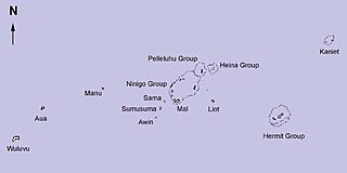
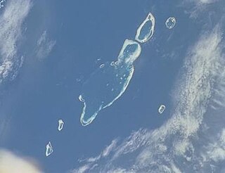
Aua is an island in the Bismarck Archipelago. It is part of the Western Islands within Manus Province of northern Papua New Guinea.
This article needs additional citations for verification .(October 2013) |

Aua is an island in the Bismarck Archipelago. It is part of the Western Islands within Manus Province of northern Papua New Guinea.
The first sighting by Europeans of Aua island was by the Spanish navigator Iñigo Órtiz de Retes on 27 July 1545 when on board of the carrack San Juan tried to return from Tidore to New Spain. He charted this island together with the nearby islands, Wuvulu and Manu, as La Barbada (the bearded island in Spanish). [1] [2]
The genetic makeup of the island is especially diverse when contrasted against the surrounding islands in the Bismark Archipelago, the inhabitants descend from various stocks of Papuan, Melanesian, Polynesian, and Micronesian peoples. [3]

The Admiralty Islands are an archipelago group of 40 islands in the Bismarck Archipelago, to the north of New Guinea in the South Pacific Ocean. These are also sometimes called the Manus Islands, after the largest island.

The Bismarck Archipelago is a group of islands off the northeastern coast of New Guinea in the western Pacific Ocean and is part of the Islands Region of Papua New Guinea. Its area is about 50,000 square kilometres (19,000 sq mi).

German New Guinea consisted of the northeastern part of the island of New Guinea and several nearby island groups and was the first part of the German colonial empire. The mainland part of the territory, called Kaiser-Wilhelmsland, became a German protectorate in 1884. Other island groups were added subsequently. The Bismarck Archipelago, and the North Solomon Islands were declared a German protectorate in 1885. The Caroline Islands, Palau, and the Mariana Islands were bought from Spain in 1899. German New Guinea annexed the formerly separate German Protectorate of Marshall Islands, which also included Nauru, in 1906. German Samoa, though part of the German colonial empire, was not part of German New Guinea.

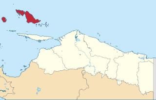
The Biak Islands are an island group of Papua province, eastern Indonesia in the Cenderawasih Bay 50 km off the north-western coast of the island of New Guinea. The group consists of the main islands of Biak, Supiori and Numfor, and numerous smaller islands, mostly covered in rain forest. The population of the archipelago is about 130,000.

The Bismarck Sea lies in the south-western Pacific Ocean within the Papua New Guinean exclusive economic zone. It is located north-east of the island of New Guinea and south of the Bismarck Archipelago. It has coastlines in districts of the Islands Region, Momase Region, and Papua Region.

Homalanthus is a genus of plants in the family Euphorbiaceae, first described in 1824. It is the only genus in the subtribe Carumbiinae. It is native to mainland Southeast Asia, Malesia, Papuasia, northern and eastern Australia, and various islands in the Pacific.

Rambutyo Island is one of the Admiralty Islands in the Bismarck Archipelago. Administratively, Rambutyo Island is part of Manus Province, Papua New Guinea. The population (unknown) is concentrated on the west coast. Villages include Mouklen and Lengkau.

Blup Blup Island is a small forested island off the northern coast of Papua New Guinea about 30 km (19 mi) offshore from Cape Girgir and is considered part of the Schouten Islands. It is located at latitude S 3°30'46" and longitude E 144°35'16". The island has a small population and is theoretically part of the Papuan province of East Sepik, although officially it is still a protectorate.

Wuvulu Island is part of the Western Islands of the Bismarck Archipelago in the western Pacific Ocean, part of Manus Province, Papua New Guinea. It is the westernmost island of the thirteen island groups that make up island chain in the archipelago. It is an island of volcanic origin encircled by a coral reef with a maximum height of three meters above sea level.
The Wuvulu-Aua language is an Austronesian language which is spoken on the Wuvulu and Aua Islands and in the Manus Province of Papua New Guinea.

The Western Islands are a group of islands in the Bismarck Archipelago, and within Manus Province of the Islands Region, in northern Papua New Guinea.

The New Guinea Islands Region is one of four regions of Papua New Guinea (PNG), comprising the Bismarck Archipelago and north-western Solomon Islands Archipelago, located north-east of New Guinea island.

The Solomon Islands (archipelago) is an island group in the western South Pacific Ocean, north-east of Australia. The archipelago is in the Melanesian subregion and bioregion of Oceania and forms the eastern boundary of the Solomon Sea. The many islands of the archipelago are distributed across the sovereign states of Papua New Guinea and Solomon Islands. The largest island in the archipelago is Bougainville Island, which is a part of the Autonomous Region of Bougainville along with Buka Island, the Nukumanu Islands, and a number of smaller nearby islands. Much of the remainder falls within the territory of Solomon Islands and include the atolls of Ontong Java, Sikaiana, the raised coral atolls of Bellona and Rennell, and the volcanic islands of Choiseul, Guadalcanal, Makira, Malaita, New Georgia, the Nggelas, Santa Isabel, and the Shortlands. The Santa Cruz Islands are not a part of the archipelago.
Kadovar is a volcanic island in Papua New Guinea northeast of the much larger island of New Guinea. The volcano erupted in January 2018 and the eruption is ongoing as of 2023, although the activity level is generally considered to be low. There were some heightened thermal phenomena in 1976.

The Ninigo Islands are a group of 31 islands within the Western Islands of the Bismarck Archipelago, Papua New Guinea. Their coordinates are 1°16′S144°15′E.

The Hermit Islands are a group of 17 islands within the Western Islands of the Bismarck Archipelago, Papua New Guinea. Their coordinates are 1°30′S145°4′E.

The Kaniet Islands are the easternmost group islands within the Western Islands of the Bismarck Archipelago, Papua New Guinea. It consists four islands and one islet. Their coordinates are 0°54′S145°32′E, located north-east of the Hermit Islands. Sae Island is a nearby island often subsumed under the Kaniet(-Sae) Islands, albeit the two are distinct. Another name for the Kaniet(-Sae) Islands is "Anchorite Islands".

Sae Island is the northernmost island within the Western Islands of the Bismarck Archipelago, Papua New Guinea. It is located just north-west of the Kaniet Islands, under which it is often subsumed, although the two are distinct. Another name for the Kaniet(-Sae) Islands is "Anchorite Islands".

The West Melanesian Trench is an oceanic trench in the Bismarck Sea north of Papua New Guinea delineating the plate tectonic boundary between the Caroline and North Bismarck plates.
The Pam Islands are an island group of the Admiralty Islands archipelago in the Bismarck Sea, within Papua New Guinea.