Aravalli West Thorn Scrub Forests

Last updated

Aravalli West Thorn Scrub Forests
Wheat Fields in Sialkot.jpg
Crop fields in Sialkot, Punjab, Pakistan
Ecoregion IM1303.svg
Map of the Northwestern thorn scrub forests ecoregion
Ecology
Realm Indomalayan
Biome deserts and xeric shrublands
Borders
Geography
Area486,906 km2 (187,995 sq mi)
Countries
states of India & provinces of Pakistan
Conservation
Conservation status critical/endangered
Protected20,150 km2 (4%) [1]

The Aravalli West Thorn Scrub Forests, formerly known as Northwestern thorn scrub forests, is a xeric shrubland ecoregion of Pakistan and Northern India, stretching along the border lowlands and hills between the two countries. Once covered in deciduous forest, this ecoregion has been degraded through agriculture and the extraction of timber so that it currently has a scanty covering of thorny scrub dominated by such trees as Acacia senegal , Acacia leucophloea and Prosopis cineraria . Where the soils are particularly saline, there are patches of semi-desert. A number of mammals are found in this habitat, including about four hundred species of bird. Some small areas are protected but the collection of firewood and the conversion of the land to subsistence farming continues. [2] [3]

Contents

Location and description

The ecoregion encircles the Thar Desert and Indus Valley Desert ecoregions. It stretches along the border lowlands and hills between India and Pakistan and includes: the western half of Gujarat (excluding the mountain of Girnar), and extending through Rajasthan, where it is bounded on the southeast by the Aravalli Range; most of Haryana and Punjab states of India as well as the Jammu region of Jammu and Kashmir, extending to the foothills of the Himalayas; in Pakistan, most of Punjab province, extending into easternmost Northwest Frontier and Baluchistan provinces and western Sindh.

This ecoregion, together with the Thar Desert and Indus Valley Desert ecoregions, form Miklos Udvardy's "Thar Desert" Biogeographic province. [4]

Climate

The climate of the ecoregion consists of Hot semi-arid (Köppen climate classification (BSh)) and Arid (Köppen climate classification (BWh)) climates. This climate is characteristic of steppes, grasslands, and forests. The temperature includes, hot summers and cool or dry winters. Precipitation averages 500–600 mm/year with heavy rainfalls and evening thunderstorms with the possibility of cloudbursts and flash floods in the monsoon season, late July–August. This being said, it only receives enough rainfall to support scrub. It does not receive enough rainfall to feature in the humid subtropical climate.

Flora

The thorn scrub forests are thought to be tropical dry forests that have been degraded through intensive agriculture and grazing into stunted and open thorn scrub, dominated by trees such as Acacia senegal and Acacia leucophloea , as well as Prosopis cineraria , Capparis zeylanica , Cinnamomum cassia , Durio zibethinus , Garcinia mangostana , Artocarpus heterophyllus , Ficus benghalensis , Gnetum gnemon , Mangifera indica , Toona sinensis , Cocos nucifera , Tetrameles nudiflora , Ginkgo biloba , Shorea robusta , Prunus serrulata , Camphora officinarum , Quercus acutissima , Tsuga dumosa , Ulmus lanceifolia , Terminalia tomentosa , Terminalia belerica , Tetrameles nudiflora , Tectona grandis , and species of Salvadora , Gymnosporia , Grewia, and Gardenia . However the region also contains patches of semi-desert where the soil is particularly saline. [5] [6]

Fauna

Despite the large scale forest clearance large mammals still remain in the ecoregion including leopard and their prey such as chinkara (Gazella bennettii) and the threatened species chousingha (Tetracerus quadricornis), and blackbuck (Antilope cervicapra). The scrubland is also home to another large cat, the caracal, which preys on mice, birds, and reptiles. There are two endemic mammals, both bats: Triaenops persicus and the small mouse-tailed bat (Rhinopoma muscatellum).

There are more than 400 species of birds in the region including the endemic rufous-vented grass babbler (Laticilla burnesii), the near-endemic white-winged tit (Parus nuchalis) and the threatened great Indian bustard (Ardeotis nigriceps) and lesser florican (Eupodotis indica).

Threats and preservation

Over 90% of the ecoregion has been converted to human use, and the remaining habitat is highly fragmented. There are many protected areas but they are very small and unconnected and even these are liable to invasion for firewood collecting and clearance for planting. However the traditions of the Bishnoi community based in this region extend protection to some wildlife, especially the blackbuck and the tree.[ citation needed ]

See also

Related Research Articles

<span class="mw-page-title-main">Thar Desert</span> Large arid region in India and Pakistan

The Thar Desert, also known as the Great Indian Desert, is an arid region in the north-western part of the Indian subcontinent that covers an area of 200,000 km2 (77,000 sq mi) in India and Pakistan. It is the world's 18th-largest desert, and the world's 9th-largest hot subtropical desert.

<span class="mw-page-title-main">Malabar Coast moist forests</span> Ecoregion in India

The Malabar Coast moist forests are a tropical moist broadleaf forest ecoregion of southwestern India.

<span class="mw-page-title-main">South Western Ghats moist deciduous forests</span> Ecoregion in India

The South Western Ghats moist deciduous forests is an ecoregion in the Western Ghats of southern India with tropical and subtropical moist broadleaf forests. This biome covers the Nilgiri Hills between elevation of 250 and 1,000 m in Kerala, Karnataka and Tamil Nadu states.

<span class="mw-page-title-main">South Deccan Plateau dry deciduous forests</span> Ecoregion in India

The South Deccan Plateau dry deciduous forests is a tropical dry forest ecoregion in southern India. The ecoregion lies in the southernmost portion of the Deccan Plateau, and includes the southernmost portion of the Eastern Ghats.

<span class="mw-page-title-main">Khathiar–Gir dry deciduous forests</span> Ecoregion in India

The Khathiar–Gir dry deciduous forests is a mostly arid ecoregion in northwestern India that stretches over 103,100 sq mi (267,000 km2) across Gujarat, Rajasthan and Madhya Pradesh. The dry deciduous forests in the region are dominated by teak, and thorny trees and scrub in drier areas.

<span class="mw-page-title-main">Upper Gangetic Plains moist deciduous forests</span> Ecoregion in northern India

The Upper Gangetic Plains moist deciduous forests is a tropical and subtropical moist broadleaf forests ecoregion of northern India.

The Indus Valley Desert is an almost uninhabited desert ecoregion of northern Pakistan.

<span class="mw-page-title-main">Northern dry deciduous forests</span> Ecoregion of India

The Northern dry deciduous forests, presently known as the North Deccan dry deciduous forests, is a tropical dry broadleaf forest ecoregion of east-central India.

<span class="mw-page-title-main">Narmada Valley dry deciduous forests</span> Ecoregion in India

The Narmada Valley dry deciduous forests are a tropical dry forest ecoregion of central India. The ecoregion lies mostly in Madhya Pradesh state, but extends into portions of Chhattisgarh, Maharashtra, Karnataka and Uttar Pradesh states.
<span class="mw-page-title-main">Deccan thorn scrub forests</span> Ecoregion of India and Sri Lanka

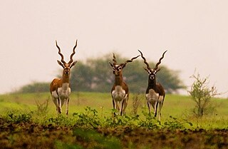
The Deccan thorn scrub forests are a xeric shrubland ecoregion of south India and northern Sri Lanka. Historically this area was covered by tropical dry deciduous forest, but this only remains in isolated fragments. The vegetation now consists of mainly of southern tropical thorn scrub type forests. These consist of open woodland with thorny trees with short trunks and low, branching crowns; spiny and xerophytic shrubs; and dry grassland. This is the habitat of the great Indian bustard and blackbuck, though these and other animals are declining in numbers; this area was at one time home to large numbers of elephants and tigers. Almost 350 species of bird have been recorded here. The remaining natural habitat is threatened by overgrazing and invasive weeds, but there are a number of small protected areas which provide a haven for the wildlife. Trees in these forests have adapted to not require much water.

<span class="mw-page-title-main">Sri Lanka dry-zone dry evergreen forests</span> Ecoregion in Sri Lanka

The Sri Lanka dry-zone dry evergreen forests are a tropical dry broadleaf forest ecoregion of the island of Sri Lanka.

<span class="mw-page-title-main">Northern Indochina subtropical forests</span> Ecoregion in Southeast Asia

The Northern Indochina subtropical forests are a subtropical moist broadleaf forest ecoregion of northern Indochina, covering portions of Vietnam, Laos, Thailand, Myanmar, and China's Yunnan Province.

<span class="mw-page-title-main">Central Deccan Plateau dry deciduous forests</span>

The Central Deccan Plateau dry deciduous forests in Western and Southern India, containing large protected areas of natural tiger habitat.

<span class="mw-page-title-main">Mizoram–Manipur–Kachin rain forests</span> Ecoregion in Indochina

The Mizoram–Manipur–Kachin rain forests is a subtropical moist broadleaf forest ecoregion which occupies the lower hillsides of the mountainous border region joining Bangladesh, China's Yunnan Province, India, and Myanmar. The ecoregion covers an area of 135,600 square kilometres (52,400 sq mi). Located where the biotas of the Indian Subcontinent and the Indochinese Peninsula meet, and in the transition between subtropical and tropical regions of Asia, the Mizoram–Manipur–Kachin rain forests are home to great biodiversity. The WWF rates the ecoregion as "Globally Outstanding" in biological distinctiveness.

<span class="mw-page-title-main">Rann of Kutch</span> Large area of salt desert in India and Pakistan

The Rann of Kutch is a large area of salt marshes that span the border between India and Pakistan. It is located mostly in the Kutch district of the Indian state of Gujarat, with a minor portion extending into the Sindh province of Pakistan. It is divided into the Great Rann and Little Rann. It used to be a part of the Arabian Sea, but it then dried up, leaving behind the salt, which formed the Rann of Kutch. The Luni flowed into the Rann of Kutch, but when the Rann dried up, the Luni was left behind, which explains why the Luni does not flow into the Arabian Sea today.

<span class="mw-page-title-main">Timor and Wetar deciduous forests</span> Ecoregion in Indonesia and East Timor

The Timor and Wetar deciduous forests is a tropical dry forest ecoregion in Indonesia and East Timor. The ecoregion includes the islands of Timor, Wetar, Rote, Savu, and adjacent smaller islands.

<span class="mw-page-title-main">Sonoran–Sinaloan transition subtropical dry forest</span> Ecoregion in Sonora and Sinaloa, Mexico

The Sonoran–Sinaloan transition subtropical dry forest is a tropical dry broadleaf forest ecoregion in northwestern Mexico.
<span class="mw-page-title-main">Tenasserim–South Thailand semi-evergreen rain forests</span> Ecoregion on Mainland Southeast Asia

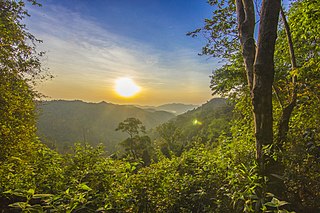
The Tenasserim–South Thailand semi-evergreen rain forests is a tropical moist broadleaf forest ecoregion on Mainland Southeast Asia. The ecoregion extends north–south along the Kra Isthmus. It includes lowland forests along the coasts, and montane forests on the Tenasserim Hills and Bilauktaung range, which form the mountainous spine of the isthmus.

<span class="mw-page-title-main">Irrawaddy moist deciduous forests</span> Ecoregion in Myanmar

The Irrawaddy moist deciduous forests is a tropical moist broadleaf forest ecoregion in central Myanmar. The ecoregion occupies the central basin of the Irrawaddy River and the lower basin of the Salween River. The ecoregion is characterized by forests of tall trees which drop their leaves in the dry season. Most of the ecoregion's forests have been converted to agriculture.
<span class="mw-page-title-main">Myanmar coastal rain forests</span> Ecoregion on Mainland Southeast Asia

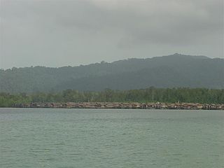
The Myanmar coastal rain forests is a tropical moist broadleaf forest ecoregion on Mainland Southeast Asia. The ecoregion occupies Myanmar's coastal lowlands along the Andaman Sea and the Bay of Bengal.

References

  1. Eric Dinerstein, David Olson, et al. (2017). An Ecoregion-Based Approach to Protecting Half the Terrestrial Realm, BioScience, Volume 67, Issue 6, June 2017, Pages 534–545; Supplemental material 2 table S1b.
  2. Dinerstein, Eric; Olson, David; Joshi, Anup; Vynne, Carly; Burgess, Neil D.; Wikramanayake, Eric; Hahn, Nathan; Palminteri, Suzanne; Hedao, Prashant; Noss, Reed; Hansen, Matt (June 2017). "An Ecoregion-Based Approach to Protecting Half the Terrestrial Realm". BioScience. 67 (6): 534–545. doi:10.1093/biosci/bix014. ISSN   0006-3568. PMC   5451287 . PMID   28608869.
  3. Wikramanayake, Eric. "Aravalli West Thorn Scrub Forests". oneearth.org. Retrieved 11 October 2024.
  4. "Northwestern thorn scrub forests". Terrestrial Ecoregions. World Wildlife Fund.
  5. Champion, H. G., and S. K. Seth. 1968. A revised survey of the forest types of India. Government of India Press
  6. Puri, G.S., Gupta, R.K., and Meher-Homji, V.M.P.S. 1989. Forest Ecology Volume 2. New Delhi, India: Oxford & IBH Publishing Company