
Thornhill is a village on the southern outskirts of Dewsbury in Kirklees, West Yorkshire, England. Historically part of the West Riding of Yorkshire, Thornhill was absorbed into Dewsbury County Borough in 1910. The village is located on a ridge on the south side of the River Calder. Dewsbury, Ossett and Wakefield are close by. Its parish church houses a collection of Anglo-Saxon crosses.
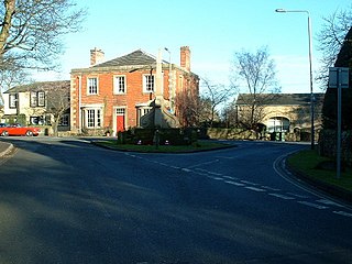
West Bretton is a village and civil parish in the Wakefield, West Yorkshire, England. It lies close to junction 38 of the M1 motorway at Haigh. It has a population of 546, reducing to 459 at the 2011 Census.

Wakefield is a cathedral city in West Yorkshire, England located on the River Calder. The city had a population of 109,766 in the 2021 census, up from 99,251 in the 2011 census. The city is the administrative centre of the wider Metropolitan Borough of Wakefield, which had a 2022 population of 357,729, the 26th most populous district in England. It is part of the West Yorkshire Built-up Area and the Yorkshire and The Humber region.

The West Riding of Yorkshire was one of three historic subdivisions of Yorkshire, England. From 1889 to 1974 the riding was an administrative county named County of York, West Riding. The lieutenancy at that time included the city of York and as such was named "West Riding of the County of York and the County of the City of York". The riding ceased to be used for administrative purposes in 1974, when England's local government was reformed.
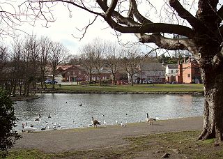
Askern is a town and civil parish within the City of Doncaster, in South Yorkshire, England. It is on the A19 road between Doncaster and Selby. Historically part of the West Riding of Yorkshire, it had a population of 5,570 at the 2011 Census. Askern was also known in for its Greyhound Stadium, which closed in 2022.

Darton is a large village in the Metropolitan Borough of Barnsley, on the border with West Yorkshire, England. At the time of the 2001 UK census, it had a population of 14,927, increasing to 21,345 for both Darton Wards at the 2011 Census.

Hemsworth is a town and civil parish in the City of Wakefield, West Yorkshire, England. Historically within the West Riding of Yorkshire and had a population of 13,311 at the 2001 census, with it increasing to 13,533 at the 2011 Census.
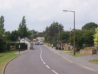
Kexbrough is a village in the Barnsley district, in the county of South Yorkshire, England, on the border with West Yorkshire. The village falls within the Darton West ward of Barnsley MBC. It is located west of the M1 motorway, just south of Junction 38 at an elevation of around 351 feet (107 m) above sea level. Historically the village was known as Kexborough, and includes the hamlets of Haigh and Swithin. Until 1974 it was in the West Riding of Yorkshire.
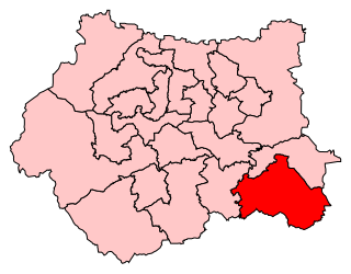
Hemsworth was a constituency in West Yorkshire represented in the House of Commons since 1996 by Jon Trickett of the Labour Party.

Skellow is a village in the Doncaster district, in the county of South Yorkshire, England. Historically part of the West Riding of Yorkshire, the village is roughly 5 miles (8 km) north-west of Doncaster. The village falls in the Askern Spa Ward of Doncaster MBC. To the north and south is mixed farmland, the A1 runs immediately along the western edge of the village, and to the east Skellow merges with the adjacent village of Carcroft along the B1220 road.

Sandal and Agbrigg railway station serves the Wakefield suburbs of Sandal and Agbrigg in West Yorkshire, England. It lies on the Wakefield Line and is operated by Northern.

Netherton is a village in the City of Wakefield metropolitan borough of West Yorkshire, England. It lies about 4 miles south-west of Wakefield, 3 miles south of Ossett and 1 mile south of Horbury. The village is in the Wakefield Rural ward of Wakefield Metropolitan District Council. The village name is shown on map "Dvcatvs Eboracensis pars occidentalis" from 1646.
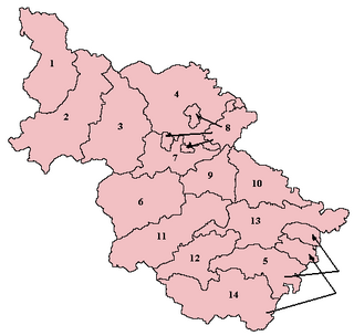
Staincross was a Wapentake, which is an administrative division, in the historic county of the West Riding of Yorkshire. It consisted of seven parishes, and included the towns of Barnsley and Penistone

Agbrigg and Morley was a wapentake of the West Riding of Yorkshire, England. The main purpose of the wapentake was the administration of justice by a local court. At the time of the Domesday survey in 1086, Agbrigg and Morley were separate wapentakes. For example, Methley was in Agbrigg, while Rothwell was in Morley.

Shepley is a village in the civil parish of Kirkburton, in Kirklees, West Yorkshire, England. It lies 8 miles (13 km) south south east of Huddersfield and 6 miles (9.7 km) north west of Penistone.
Southern West Riding of Yorkshire was a parliamentary constituency covering part of the historic West Riding of Yorkshire. It returned two Members of Parliament (MPs) to the House of Commons of the Parliament of the United Kingdom, elected by the bloc vote system.

Sandal Magna or Sandal is a suburb of Wakefield, West Yorkshire, England with a population in 2001 of 5,432. An ancient settlement, it is the site of Sandal Castle and is mentioned in the Domesday Book. It is 2 mi (3.2 km) south from Wakefield, 8 mi (13 km) north of Barnsley. The Battle of Wakefield was fought here in the 15th century during the Wars of the Roses.

Alverthorpe is a suburb of, and former village in Wakefield, West Yorkshire, England.
Wakefield City Police was the police force for the city of Wakefield in the West Riding of Yorkshire, England between the years of 1848 and 1968.


