
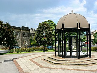
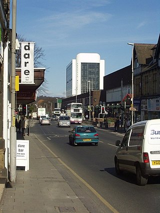
Harrogate is a spa town in the district and county of North Yorkshire, England. Historically in the West Riding of Yorkshire, the town is a tourist destination and its visitor attractions include its spa waters and RHS Harlow Carr gardens. 13 miles (21 km) away from the town centre is the Yorkshire Dales National Park and the Nidderdale AONB.
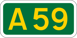
The A59 is a major road in England which is around 109 miles (175 km) long and runs from Wallasey, Merseyside to York, North Yorkshire. The alignment formed part of the Trunk Roads Act 1936, being then designated as the A59. It is a key route connecting Merseyside at the M53 motorway to Yorkshire, passing through three counties and connecting to various major motorways. The road is a combination of historical routes combined with contemporary roads and a mixture of dual and single carriageway. Some sections of the A59 in Yorkshire closely follow the routes of Roman roads, some dating back to the Middle Ages as salt roads, whilst much of the A59 in Merseyside follows Victorian routes which are largely unchanged to the present day.
The Borough of Harrogate was a local government district with borough status in North Yorkshire, England, from 1974 to 2023. Its council was based in the town of Harrogate, but it also included surrounding settlements, including the cathedral city of Ripon, and almost all of the Nidderdale Area of Outstanding Natural Beauty. At the 2011 Census, the borough had a population of 157,869.
The Harrogate line is a passenger rail line through parts of North Yorkshire and the West Yorkshire area of northern England connecting Leeds to York by way of Harrogate and Knaresborough. Service on the line is operated by Northern, with a few additional workings by London North Eastern Railway starting and terminating at Harrogate. West Yorkshire Metro's bus and rail MetroCard ticket is available for journeys between Leeds and Harrogate.

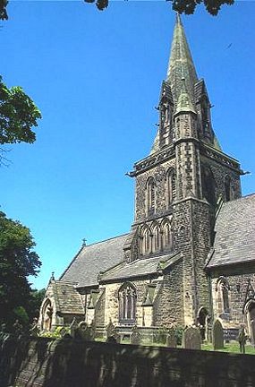
The Diocese of Ripon was a former Church of England diocese, part of the Province of York. Immediately prior to its dissolution, it covered an area in western and northern Yorkshire as well as the south Teesdale area administered by County Durham which is traditionally part of Yorkshire. The cities of Ripon and Leeds were within its boundaries as were the towns of Harrogate, Richmond, Knaresborough, Hawes and Bedale and the surrounding countryside; its northern boundary was the River Tees.
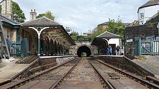
Knaresborough railway station is a Grade II listed station serving the town of Knaresborough in North Yorkshire, England. It is located on the Harrogate Line 16.75 miles (27 km) west of York and is operated by Northern Trains, who provide all passenger train services.
Weeton is a village and civil parish in the Harrogate district of North Yorkshire, England.

The A630 is an A road in the United Kingdom. It runs between Sheffield city centre (53.3762°N 1.3998°W) and junction 4 of the M18 motorway (53.5400°N 1.0229°W), passing through Rotherham and Doncaster on the way. The road is entirely in South Yorkshire.
The A660 is a major road in the Leeds and Bradford districts of West Yorkshire, England that runs from Leeds city centre to Burley-in-Wharfedale where it meets the A65. The A660 is approximately 10 miles (16 km) long, and crosses the watershed from Airedale to lower Wharfedale. For most of its length the road is in the metropolitan district of the City of Leeds; the last 0.4 miles (0.6 km) is in City of Bradford district.
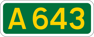
The A643 is a main road between Leeds and Huddersfield in West Yorkshire, England. Its eastern end is at the Armley Gyratory roundabout on the western edge of Leeds City Centre. The road then goes through:

The A657 is an A road in West Yorkshire, England that begins in Bramley and ends in Saltaire near Shipley. The road is approximately 8 miles (13 km) long.

Greengates is a small suburban area in the north-east of the city of Bradford, West Yorkshire, in England. The area is bordered by Idle and Thackley to the north-west, whilst Thorpe Edge is to the west. To the south of Greengates is Ravenscliffe with the village of Eccleshill beyond that. Apperley Bridge is to the north. East bound of Greengates in the Leeds Metropolitan District is the village of Calverley.

Leeds City bus station serves the city of Leeds, England. Owned and managed by West Yorkshire Metro, it is situated between the Quarry Hill and Leeds Kirkgate Markets areas of Leeds city centre. The National Express Dyer Street Coach Station adjoins the bus station.

Carlton is a civil parish in the City of Leeds in West Yorkshire, England. It consists of the villages of East Carlton and West Carlton, and in 2001 had a population of 169.

Ravenscliffe is a housing estate in the Eccleshill ward of the city of Bradford District, in the English county of West Yorkshire. Ravenscliffe is located to the west of Fagley Beck and to the east of the A658 Harrogate Road. The buildings that were Ravenscliff farmhouse are situated off to the south in Fagley while Ravenscliffe Woods are in Pudsey to the south east.
The Way of the Roses is a coast-to-coast long-distance cycle route of Great Britain and is based on minor roads, disused railway lines and specially constructed cycle paths. It lies entirely within the counties of Lancashire and Yorkshire, crossing the Yorkshire Dales and the Yorkshire Wolds in the North of England, passing through the historic cities of Lancaster, Ripon and York and scenic towns and villages including Settle and Pateley Bridge
Leeds/Bradford Airport Parkway station is a proposed railway station near Horsforth, Leeds, in West Yorkshire. It would have around 300 parking spaces serving Leeds Bradford Airport along with adjoining areas including Cookridge, Bramhope and Yeadon and would be situated on the existing Leeds-Harrogate-York route north of the existing Horsforth station. The proposal uses both the existing dedicated airport car park bus services and the existing main line railway infrastructure with the new station thus enabling frequent direct access to Leeds, Harrogate, Knaresborough and York along with many other rail journeys using interchange at Leeds or York stations.

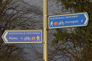
The Nidderdale Greenway is a 4-mile (6.4 km) path that runs between Harrogate and Ripley in North Yorkshire, England. It uses a former railway line that ran between Harrogate and Pateley Bridge as its course. The route connects to other cycle paths including the Way of the Roses.

National Cycle Network (NCN) Route 636 is a Sustrans Route that runs from Harrogate to Knaresborough. The route is 4 miles (6.4 km) in length and is fully open and signed in both directions.
National Cycle Network (NCN) Route 67 is a Sustrans National Route that runs from Long Whatton to Northallerton. The route is 124 miles (200 km) in length and is open but with sections missing.

