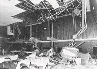
The Chūetsu earthquakes occurred in Niigata Prefecture, Japan, at 17:56 local time on Saturday, October 23, 2004. The Japan Meteorological Agency (JMA) named it the "Heisei 16 Niigata Prefecture Chuetsu Earthquake". Niigata Prefecture is located in the Hokuriku region of Honshu, the largest island of Japan. The initial earthquake had a magnitude of 6.6 and caused noticeable shaking across almost half of Honshu, including parts of the Tōhoku, Hokuriku, Chūbu, and Kantō regions.

On 14 June, the 2008 Iwate earthquake struck the Tōhoku region of northeastern Honshū in Japan. Japan Meteorological Agency (JMA) officially named this earthquake the Iwate–Miyagi Nairiku earthquake in 2008. This earthquake occurred in the south of the inland of Iwate Prefecture at 8:43 JST on June 14. The JMA magnitude was estimated at MJMA 7.2, and the moment magnitude by USGS was at 6.9. The epicenter was located at 39°01.7′N140°52.8′E, about 85 kilometres (55 mi) north of Sendai and about 385 kilometres (240 mi) north-northeast of Tokyo.

The 2016 Kumamoto earthquakes were a series of earthquakes, including a magnitude 7.0 mainshock which struck at 01:25 JST on April 16, 2016 beneath Kumamoto City of Kumamoto Prefecture in Kyushu Region, Japan, at a depth of about 10 kilometres, and a foreshock earthquake with a magnitude 6.2 at 21:26 JST (12:26 UTC) on April 14, 2016, at a depth of about 11 kilometres.

On March 20, 2021, at 18:09 JST. The magnitude 6.9 or 7.0 earthquake struck offshore east of Tōhoku, Japan at a depth of 54.0 kilometers (33.6 mi) to 60 kilometers (37 mi). It had a maximum JMA intensity of Shindo 5+ while on the Mercalli intensity scale, it earned a rating of VII. Power outages and some slight damage in Miyagi was reported.

The 1894 Shōnai earthquake is an earthquake occurred on October 22, 1894 at Sakata, Yamagata Prefecture in Japan. It was caused by the movement of the Shonai Plain Eastern Margin Fault Zone (庄内平野東縁断層帯).

The 1925 North Tajima earthquake occurred on May 23, 1925 at Toyooka, Hyōgo in Japan.

The 2011 Nagano earthquake was an earthquake that occurred near the border between Niigata and Nagano prefectures at 3:59 JST on March 12, 2011. The depth of the hypocenter was 8 km and magnitude of the earthquake was 6.7.
The 1978 Izu Ōshima earthquake is an earthquake that occurred on January 14, 1978, at 12:24 local time. The earthquake had a magnitude of 7.0, and the epicenter was located in offshore Izu Ōshima, Japan.
The 1896 Rikuu earthquake is an inland earthquake that occurred on August 31, 1896, near the border between Akita and Iwate prefectures, Japan. Magnitude was 7.2. The earthquake left 209 people dead and 779 people injured. Senya Fault is a fault which was responsible for 1896 Rikuu earthquake, along with surface rupture.
The 1961 Kita Mino earthquake is an earthquake that occurred on August 19, 1961, near the border between Ishikawa, Fukui and Gifu Prefectures in Japan. The magnitude was 7.0. The earthquake left 8 people dead and 43 people injured.
The 1968 Ebino earthquake is an earthquake that occurred on February 21, 1968, near the border between Miyazaki, Kumamoto and Kagoshima Prefectures in Japan. Moment magnitude was 6.2. The earthquake left three people dead and 42 people injured.
The 1939 Oga earthquake struck Akita Prefecture, Japan on May 1, 1939. This event was a doublet earthquake, in which the mainshock occurred at 14:58 (JST), 6.8, and an aftershock at 15:00 (JST), MJMA 6.7. The earthquake left 27 people dead and 52 people injured, and 479 homes were destroyed.

The July 2008 Iwate earthquake was an earthquake that occurred in Iwate Prefecture, Japan on July 23, 2008. The earthquake's moment magnitude was 6.8 and it occurred at a depth of 115 km. Since this earthquake was an intermediate-focus earthquake, the shaking of the earthquake was observed over a wide range. It had a maximum JMA intensity of Shindo 6− .
The 2016 Tottori earthquake is an earthquake that occurred in central Tottori Prefecture in Japan on October 21, 2016. It measured 6.2 on the moment magnitude scale. The earthquake left 32 people injured.

The 1982 Urakawa earthquake was a 6.9 earthquake that struck off the coast of Urakawa, Japan, on 11:32 (JST), March 21, 1982. The epicenter was 42.1°N 142.6°E. The earthquake was the largest earthquake in the history of the region. The earthquake caused 167 injuries and damage in Tomakomai and Sapporo.

The 2011 Shizuoka earthquake occurred approximately 42 km (26 mi) north-northeast of Shizuoka City at 22:31 JST, 15 March 2011. The magnitude was Mw 6.0 or MJMA 6.4, and the depth was 9 km (5.6 mi). The hypocenter of this earthquake is thought to have been near the presumed location of the magma chamber of Mount Fuji. It may have been a triggered earthquake caused by the Tohoku earthquake, which occurred four days earlier, on 11 March 2011. It was sinistral strike-slip fault earthquake. It had a maximum JMA intensity of Shindo 6+ (Fujinomiya) or VIII (Severe) on the Mercalli intensity scale. The earthquake left 80 people injured, and caused some power outages.

On March 16, 2022, at 23:36 JST, a strong earthquake struck off the coast of Fukushima, Japan. The earthquake had a magnitude of 7.4 according to the Japanese Meteorological Agency (JMA), while the United States Geological Survey (USGS) gave an estimate of 7.3. Immediately after the event a 30‑cm tsunami was reported. The event is known in Japanese as Fukushima-ken Oki Jishin. As a result of this natural disaster, four people died and 247 were injured.
The 1922 Shimabara earthquake occurred in Kyushu, Japan on December 8, 1922. The mainshock (M6.9) was followed by a large aftershock (M6.5) 9 hours later.


