Segmentation and analysis of hemispherical images to estimate leaf area index (LAI) and further parameters
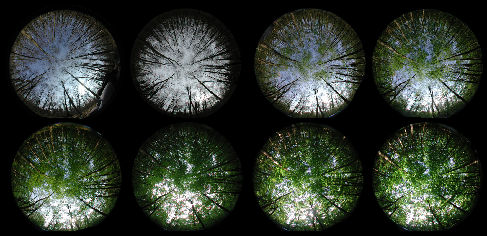
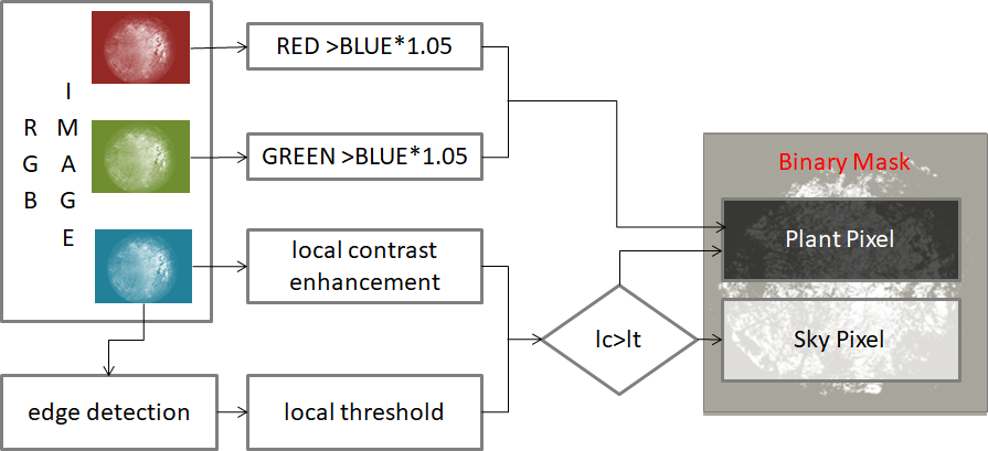
These tools are designed to calculate Leaf Area Index (LAI) and further canopy parameters, such as transmission and gap fraction, for batches of hemispherical images. The first step is a segmentation of the image into plant/sky pixels. The segmentation method used here is a novel approach based on local contrast enhancement and allows also to process images that were taken in not ideal conditions.
The image is then split into a number of concentrical circles and angular segment, and the transmission for each segment is calculated.
Different functions to calculate LAI were implemented, according to following publications:
- Norman, J.M., Campbell, G.S., 1989. Canopy structure. In: Pearcy, R.W., Ehleringer, J.R., Mooney, H.A., Rundel, P.W. (Eds.), Plant Physiological Ecology: Field Methods and Instrumentation. Chapman and Hall, London, New York, pp. 301–325.
- Miller, J.B., 1967. A Formula for Average Foliage Density. Australian Journal of Botany, 15(1), pp. 141-&.
- Lang (1987) Simplified estimate of leaf area index from transmittance of the sun's beam. _Agricultural and Forest Meteorology, 41 (1987) 17~186
- LI-COR, 1992. LAI-2000 Plant Canopy Analyser. Instruction manual. LICOR, Lincoln, NE, USA.
In addition, the code also includes some variations of these methods.
The tools provided with this script are:
- ImageSetup.py: a GUI tool in order to set mark the rotation (set North) and mask certain areas of the image to be ignored (sun) or analyzed separately (requires [https://glade.gnome.org/] (glade) ).
- NorthCorrected.py: Rotate Images so that North is on top. This script uses the parameters in the *.par file (as created my ImageSetup.py) to determine the rotation angle.
- Overview.py: Stack images together to create a nice overview (Servers a template only, needs to be edited according to the number of images)
Just copy the files into a filder of your choice. Run the script by
CGA.py [imagepath] [outpath]
e.g.
./cga/CGA.py ../tests ../out
the output directory will be created if not yet existant.
For each Image, a parameter file is created. The file contains 2 lines, a header and a data line (columns separated by semicolons):
SITE;OBS;LAT;LON;ALT;TIME;CENTER;RADIUS;NORTH;WOOD
F1_001;O1;47.70488;7.470766;244;24.03.2011 10:13:47;[1000, 800];750;280.400983435;Test1.jpg
The Fields are defined as follows:
- SITE: Site identifier
- OBS: Observation identifier
- LAT: Geographical latitude
- LON: Geographical longitude
- ALT: Elevation
- TIME: Date and time when the image was taken
- CENTER: [x,y] coordinates of the center pixel
- RADIUS: Radius of the Image
- NORTH: Rotation angle indicating the direction to North
- WOOD: the path to the reference image that does not have leaves (to accurately estimate LAI)
This code was first written 2011, I'm currently testing if it still works as intended. There are still many hard-coded parameters that can be should be made accessible as command line arguments Update Oct. 2020: The main code CGA.py is now Python3 compatible. Tools still need to be tested

