Neidio i'r cynnwys

Delwedd:Byzantine Constantinople-en.png

Ni chefnogir cynnwys y dudalen mewn ieithoedd eraill.
Oddi ar Wicipedia

Maint llawn ((3,200 × 2,888 picsel, maint y ffeil: 2.35 MB, ffurf MIME: image/png))

Daw'r ffeil hon o Comin Wikimedia a gellir ei defnyddio gan brosiectau eraill. Dangosir isod y disgrifiad sydd ar dudalen ddisgrifio'r ffeil yno.

Wicipedia

 This is a featured picture on the Saesneg language Wikipedia (Featured pictures) and is considered one of the finest images.

If you think this file should be featured on Wikimedia Commons as well, feel free to nominate it.
If you have an image of similar quality that can be published under a suitable copyright license, be sure to upload it, tag it, and nominate it.

Crynodeb

Disgrifiad
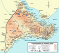
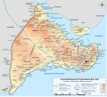
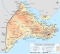
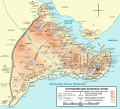
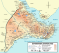
English: Topographical map of Constantinople during the Byzantine period.
Български: Топографска карта на Константинопол (Цариград) през византийския период. Източник: R. Janin, Constantinople Byzantine. Developpement urbain et repertoire topographique. Пътната мрежа и някои други детайли се основават на Dumbarton Oaks Papers 54 и други публикувани източници.
Deutsch: Topografische Karte Konstantinopels während des byzantinischen Zeitraums. Quelle: R. Janin, Constantinople Byzantine. Developpement urbain et repertoire topographique. Straßennetz und andere Einzelheiten basiert auf Dumbarton Oaks Papers 54. Kirchen, insb. nicht identifizierte und ausgegrabene Bauten sind aus dem The Byzantine Churches of Istanbul entnommen. Andere herausgegebenen Quellen wurden behilfsmäßig gebraucht.
Ελληνικά: Τοπογραφικός χάρτης Κωνσταντινουπόλεως κατά τη Βυζαντινή περίοδο. Βασική πηγή χάρτη: R. Janin, Constantinople Byzantine. Developpement urbain et repertoire topographique. Το οδικό δίκτυο και διάφορες άλλες λεπτομέρειες με βάση το Dumbarton Oaks Papers 54. Πληροφορίες για τις εκκλησίες, ιδιαίτερα τις μη ταυτοποιημένες, από την ιστοσελίδα The Byzantine Churches of Istanbul του Πανεπιστημίου της Νέας Υόρκης.
Although I've striven to make this map as complete and correct as possible, there may be some errors or omissions. Any corrections & suggestions are welcome.
Dyddiad
Ffynhonnell

Own work using:

Crëwr
Caniatâd
(Ailddefnyddio'r ffeil hon)
Yr wyf fi, deiliad yr hawlfraint ar y gwaith hwn, yn ei gyhoeddi yn ôl termau'r trwyddedau a ganlyn:
w:en:Creative Commons
cydnabyddiaeth rhannu ar dermau tebyg
Trwyddedir y ffeil hon yn ôl termau'r drwydded Creative Commons Attribution-Share Alike 3.0 Unported.
Mae'n rhydd i chi:
  • rhannu – gallwch gopïo, dosbarthu a throsglwyddo'r gwaith
  • ailwampio – gallwch addasu'r gwaith
Ar yr amodau canlynol:
  • cydnabyddiaeth – Mae'n rhaid i chi nodi manylion y gwaith hwn, rhoi dolen i'r drwydded, a nodi os y bu golygu arni, yn y modd a benwyd gan yr awdur neu'r trwyddedwr (ond heb awgrymu o gwbl eu bod yn eich cymeradwyo chi na'ch defnydd o'r gwaith).
  • rhannu ar dermau tebyg – Os byddwch yn addasu'r gwaith hwn, neu yn ei drawsnewid, neu yn adeiladu arno, mae'n rhaid i chi ddosbarthu'r gwaith dan drwydded sy'n union yr un fath same a'r gwreiddiol.
GNU head Caniateir copïo, dosbarthu a/neu golygu'r ddogfen hon yn ôl telerau'r Drwydded Ddogfennaeth Rydd GNU, Fersiwn 1.2 neu unrhyw fersiwn diweddarach a gyhoeddwyd gan y Free Software Foundation; yn cynnwys dim Adrannau Di-syfl, dim Testunau Clawr Blaen, a dim Testunau Clawr Cefn. Cynhwysir copi o'r drwydded hon yn yr adran Trwydded Ddogfennaeth Rydd GNU".
Gallwch ddewis y drwydded y mynnwch.
 Geotemporal data
Bounding box
N: 41.0422904°N
W: 28.9138096°E E: 28.993665°E
S: 40.9875892°N
Georeferencing View the georeferenced map in the Wikimaps Warper
Diwygiadau eraill

[golygu]

Full maps

SVG:

PNG:

Numeric versions

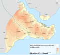
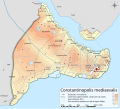
Regions

Roads

Open this image as an overlay in Google Earth (Google Maps, Bing) (Help|Source)

Captions

Add a one-line explanation of what this file represents
Constantinople during the Byzantine period

Items portrayed in this file

yn portreadu

28 Hydref 2008

media type Saesneg

image/png

checksum Saesneg

b4b5347456038e42cfa57b6c9763eaefb8d38a55

data size Saesneg

2,462,235 byte

2,888 pixel

3,200 pixel

Hanes y ffeil

Cliciwch ar ddyddiad / amser i weld y ffeil fel ag yr oedd bryd hynny.

Dyddiad / AmserBawdlunHyd a lledDefnyddiwrSylw
cyfredol17:42, 25 Ebrill 2010Bawdlun y fersiwn am 17:42, 25 Ebrill 20103,200 × 2,888 (2.35 MB)MahahahaneapneapCompressed
12:56, 15 Rhagfyr 2009Bawdlun y fersiwn am 12:56, 15 Rhagfyr 20093,200 × 2,888 (3.42 MB)Cplakidaslarger & more detailed version, various corrections, Galata included
23:08, 30 Mehefin 2009Bawdlun y fersiwn am 23:08, 30 Mehefin 20092,134 × 2,000 (1.62 MB)FalcorianLossless compression with pngout.
22:47, 8 Ionawr 2009Bawdlun y fersiwn am 22:47, 8 Ionawr 20092,134 × 2,000 (1.84 MB)Cplakidasmore info, minor tweaks & corrections
11:48, 28 Hydref 2008Bawdlun y fersiwn am 11:48, 28 Hydref 20082,134 × 2,000 (1.76 MB)Cplakidas{{Information |Description={{en|1=Topographical map of Constantinople during the Byzantine period. Map source: R. Janin, ''Constantinople Byzantine. Developpement urbain et repertoire topographique''. Road network and some other d

Mae'r 1 tudalennau a ddefnyddir isod yn cysylltu i'r ddelwedd hon:

Defnydd cydwici y ffeil

Mae'r wicis eraill hyn yn defnyddio'r ffeil hon:

Gweld rhagor o'r defnydd cydwici o'r ffeil hon.

Metadata