Category:Valid SVG created with Batik:Maps
Jump to navigation
Jump to search
Media in category "Valid SVG created with Batik:Maps"
The following 14 files are in this category, out of 14 total.
-
Auslandseinsätze der Bundeswehr.2013-03-07.svg 1,245 × 979; 2.84 MB
-
Berlin location map.svg 1,400 × 1,151; 441 KB
-
Dominican Republic location map.svg 1,400 × 1,139; 182 KB
-
Hilfe Geotools Beispiel 2.svg 454 × 230; 105 KB
-
Hilfe Geotools Beispiel 3.svg 388 × 500; 112 KB
-
Map Corded Ware culture-de.svg 1,015 × 598; 662 KB
-
Map Corded Ware culture-en.svg 1,015 × 598; 660 KB
-
Maslow tr.svg 815 × 815; 33 KB
-
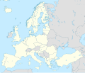
NATO Europe location map.svg 1,401 × 1,198; 1.42 MB
-
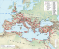
Roman Empire 125 general map (Red roads).svg 2,186 × 1,817; 5.06 MB
-
USA Idaho location map.svg 915 × 1,200; 611 KB
-
USA Montana location map.svg 1,201 × 893; 636 KB
-
USA Virginia location map.svg 1,500 × 964; 941 KB
-
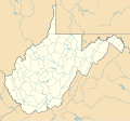
USA West Virginia location map.svg 1,201 × 1,118; 523 KB


