Category:Maps of fisheries
Jump to navigation
Jump to search
Subcategories
This category has only the following subcategory.
M
Media in category "Maps of fisheries"
The following 11 files are in this category, out of 11 total.
-
EU Trawlers.png 819 × 956; 767 KB
-
FAO Major Fishing Areas.svg 1,352 × 677; 574 KB
-
Fish Bath.png 1,056 × 906; 1.71 MB
-
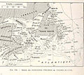
FMIB 37352 Region des Grandes Peches de Terre-Neuve.jpeg 925 × 827; 242 KB
-
FMIB 49080 Sketch of waters that should be closed to commercial fishereis.jpeg 1,297 × 1,254; 166 KB
-
Important Regional Fishery Organizations in the North Atlantic.jpg 552 × 363; 44 KB
-
Lange diercke sachsen deutschland fischsonderzugverkehr.jpg 1,258 × 1,221; 757 KB
-
Map RK-A 01.jpg 179 × 179; 38 KB
-
Primary production to sustain global marine fisheries.png 1,953 × 2,353; 3.39 MB
-
World catches 1950 2005.png 800 × 545; 15 KB


