Category:Maps of Delaware
Jump to navigation
Jump to search
States of the United States: Alabama · Alaska · Arizona · Arkansas · California · Colorado · Connecticut · Delaware · Florida · Georgia · Hawaii · Idaho · Illinois · Indiana · Iowa · Kansas · Kentucky · Louisiana · Maine · Maryland · Massachusetts · Michigan · Minnesota · Mississippi · Missouri · Montana · Nebraska · Nevada · New Hampshire · New Jersey · New Mexico · New York · North Carolina · North Dakota · Ohio · Oklahoma · Oregon · Pennsylvania · Rhode Island · South Carolina · South Dakota · Tennessee · Texas · Utah · Vermont · Virginia · Washington · West Virginia · Wisconsin · Wyoming – Washington, D.C.
insular area of the United States: American Samoa · Guam · Northern Mariana Islands · Puerto Rico · United States Virgin Islands – United States Minor Outlying Islands: Baker Island · Howland Island · Jarvis Island · Johnston Atoll · Kingman Reef · Midway Atoll · Navassa Island · Palmyra Atoll · Wake Island
insular area of the United States: American Samoa · Guam · Northern Mariana Islands · Puerto Rico · United States Virgin Islands – United States Minor Outlying Islands: Baker Island · Howland Island · Jarvis Island · Johnston Atoll · Kingman Reef · Midway Atoll · Navassa Island · Palmyra Atoll · Wake Island
Wikimedia category | |||||
| Upload media | |||||
| Instance of | |||||
|---|---|---|---|---|---|
| Category combines topics | |||||
| Delaware | |||||
state of the United States of America | |||||
| Pronunciation audio | |||||
| Instance of |
| ||||
| Part of |
| ||||
| Named after |
| ||||
| Location |
| ||||
| Located in or next to body of water | |||||
| Capital | |||||
| Legislative body | |||||
| Executive body | |||||
| Highest judicial authority | |||||
| Anthem |
| ||||
| Head of government |
| ||||
| Inception |
| ||||
| Coastline |
| ||||
| Highest point | |||||
| Population |
| ||||
| Area |
| ||||
| Elevation above sea level |
| ||||
| Replaces | |||||
| Different from | |||||
| Maximum temperature record |
| ||||
| Minimum temperature record |
| ||||
| official website | |||||
 | |||||

Subcategories
This category has the following 30 subcategories, out of 30 total.
Media in category "Maps of Delaware"
The following 43 files are in this category, out of 43 total.
-
AmDiscoveryMap.jpg 300 × 211; 32 KB
-
B&O Royal Blue map.png 1,091 × 729; 1.29 MB
-
Breakwater.jpeg 700 × 480; 67 KB
-
Brookline.png 800 × 739; 1.39 MB
-
Datamil de map.jpg 258 × 273; 13 KB
-
DC-DE-MD-PA-VA-WV Level IV ecoregions.pdf 5,100 × 6,300; 2.34 MB
-
DE - State Police Troops.png 506 × 1,096; 36 KB
-
DE try3.svg 744 × 1,052; 134 KB
-
Delaware - Cross Section of Gun Decks - NARA - 68865544.jpg 5,696 × 4,513; 1.76 MB
-
Delaware - Dover - NARA - 140696324.jpg 7,136 × 7,078; 6.28 MB
-
Delaware - New Castle County - NARA - 140696329.jpg 7,872 × 12,914; 14.39 MB
-
Delaware - Sussex County - NARA - 140696326 (page 1).jpg 6,208 × 11,745; 11.58 MB
-
Delaware - Sussex County - NARA - 140696326 (page 2).jpg 6,272 × 11,749; 12.29 MB
-
Delaware 90.jpg 376 × 479; 82 KB
-
Delaware earthquake, Nov 30.jpg 612 × 719; 118 KB
-
Delaware Köppen.png 6,300 × 10,200; 389 KB
-
Delaware POI.png 220 × 530; 11 KB
-
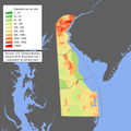
Delaware population map.png 600 × 600; 136 KB
-
Delaware wind resource map 50m 800.jpg 850 × 1,100; 346 KB
-
Delaware-aaf-map.jpg 356 × 322; 19 KB
-
Delaware-wedge-pl.png 710 × 813; 7 KB
-
Delaware01.png 1,182 × 1,387; 473 KB
-
Delaware2012ZoneMap.png 1,131 × 1,601; 96 KB
-
Delmarva-Peninsula-MarylandES.png 398 × 599; 85 KB
-
Delmarva-Peninsula-VirginiaES.png 398 × 599; 85 KB
-
Delmarva.png 514 × 774; 15 KB
-
DnH-gravity.pa.track.jpg 1,000 × 400; 221 KB
-
Ellendalemap1906.jpg 936 × 724; 110 KB
-
Ellendaleusgs.jpg 640 × 400; 30 KB
-
In Canc' John Penn, Thomas Penn, and Richard Penn, Esqrs Fleuron T130315-2.png 3,362 × 3,382; 308 KB
-
PA-Delaware-wedge.png 659 × 1,002; 470 KB
-
Population density of Delaware counties (2020).jpg 2,653 × 3,558; 218 KB
-
Redbird Reef 01.JPG 376 × 479; 73 KB
-
Tangent line.jpg 235 × 174; 18 KB
-
The DuPont Corridor.jpg 817 × 630; 54 KB
-
The wedge delaware.JPG 636 × 463; 29 KB
-
The Wedge.png 640 × 463; 128 KB
-
Transpen-line.gif 696 × 502; 16 KB
-
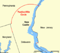
Twelve-mile-circle.gif 539 × 475; 7 KB
-
US Southeastern Plains Map.jpg 3,300 × 2,550; 6.8 MB
-
Защита животных в Делавэре.jpg 1,230 × 765; 128 KB


